

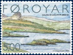
Øravík
Encyclopedia
Suðuroy
Suðuroy is the southernmost of the Faroe Islands. The island covers 163.7 km². In 2010 there were 4763 inhabitants, but there has been a gradual decline in the population numbers ever since the 1950s....
in the Faroe Islands
Faroe Islands
The Faroe Islands are an island group situated between the Norwegian Sea and the North Atlantic Ocean, approximately halfway between Scotland and Iceland. The Faroe Islands are a self-governing territory within the Kingdom of Denmark, along with Denmark proper and Greenland...
. The village is located in the center of the island on a crossroad where the road to Fámjin
Fámjin
Fámjin is a village, located in the middle of the coastline on the western side of Suðuroy, the southernmost island in Faroe Islands. It has a population of around 100....
goes towards west over the mountains to the west coast. One part of the village is located in the bay of Øravík, the other part is 3 km further north near the ferry port Krambatangi
Krambatangi
Krambatangi is the ferry port of Suðuroy in the Faroe Islands. The ferry Smyril M/F disembarks 2-3 times daily from Krambatangi to Tórshavn. Krambatangi is located on the southern side of Trongisvágsfjørður halfway between Trongisvágur and Øravík, opposite of Tvøroyri. The ferry port was earlier on...
. The northern part of Øravík and the southern part of Trongisvágur
Trongisvágur
Trongisvágur is a village on the island of Suduroy in the Faroe Islands.*Population: 415*Postal code : FO 826*Location: *Municipality: Tvoroyrar...
have grown together. Øravík is one of the few places in Suðuroy
Suðuroy
Suðuroy is the southernmost of the Faroe Islands. The island covers 163.7 km². In 2010 there were 4763 inhabitants, but there has been a gradual decline in the population numbers ever since the 1950s....
which still has cattle. Besides from that there are other domestic animals like sheep and geese. There is a small harbour in Øravík and some boathouses.
Varðagøtur
Just south of Øravík up in the mountains is a place called Mannaskarð, where the old walking paths from five villages meet, these paths are called varðagøtur in Faroese, named after "varðar", which means cairn. These are all around the island between the villages and other places, so people could find their way in the old days, before the roads for cars were made. On Mannaskarð the paths from Øravík, FámjinFámjin
Fámjin is a village, located in the middle of the coastline on the western side of Suðuroy, the southernmost island in Faroe Islands. It has a population of around 100....
, Hov
Hov
Hov can refer to the following:*An HOV or High-occupancy vehicle*A location:**Hov, Faroe Islands**Hov, Norway*HOV, the ticker symbol for U.S...
, Porkeri
Porkeri
Porkeri is a village in the Faroe Islands, situated north of Vágur on Suðuroy's east coast. As of 2004 it had a population of 332. and has been inhabited at least as early as the 14th century....
and Vágur
Vágur
Vágur meaning Bay is a town on the Faroe Islands of Suðuroy, it is situated on the east coast of the island on the Vágsfjørður fjord, and dates from the fourteenth century. Expansion has meant that the nearby town of Nes is now a suburb of Vágur...
meet. Sometimes hiking trips are arranged along these old paths.
Folklore
Øravík is mentioned in Suduroy Saga (Suðuroyar Sagnir) several times, i.e. in the story about Vísa Marjun (Wise Marion). One of the stories about her tell about how she scared away the pirates who ravaged at that time. They embarked in Hvalba and wanted to go to all of the island to steal what they could find. People escaped up in the mountains to hide in caves there, but Wise Marion was not scared, she stood and waited for them and sent a retarded boy towards them. According to the story the pirates got scared that she may put a spell on them, so they turned around and went back to HvalbaHvalba
Hvalba is a village and a municipality, which consists of Hvalba, Nes-Hvalba and Sandvík. The total population of Hvalba Municipality was 723 as of 1 January 2010; the population of Hvalba and Nes was 626 and the population of Sandvík was 97. Hvalba is one of the larger villages in the Faroe...
. The pirates were called Turks, but they came from Algier in North Africa, which was a part of the Ottoman Empire
Ottoman Empire
The Ottoman EmpireIt was usually referred to as the "Ottoman Empire", the "Turkish Empire", the "Ottoman Caliphate" or more commonly "Turkey" by its contemporaries...
.
The road and the tunnel between Øravík and Hov
In 1943 work started to make a road between Øravík and HovHov, Faroe Islands
*Population: 133*Postal code : FO 960*Location: *Municipality: HovsHov is a village located on Suduroy’s east coast, in the Faroe Islands; it is frequently mentioned in the country's history. Salmon sea farming has been practiced in Hov since the 1980’s...
. However, very little progress was made as only a few men were working on the road. They made the road from Øravík to Trøllavík (near Tjaldavík), but stopped in 1953. The work had also started on the other side of the mountains, in Hov, but there too they made little progress, and when the work there also stopped in 1953 they had only made it a short way from the village. Three years later they started to work again on both sides of the Øravík-Hov road. This time they were around 70 men on the northern side and around 60 men on the southern side. On 1 October 1958 the road was finally opened.
49 years after the opening of the road between Øravík and Hov, which was a very big progress back then, a tunnel was opened between the same two villages. The tunnel, Hovstunnilin, was opened on 20 October 2007.
Data
- Population: 42 in Øravík and 70 in Øravíkarlíð
- Postal code (Zip): FO 827
- Location: 61°32′10"N 6°48′31"W
- Municipality: Tvøroyrar
External links
- Faroe Islands
- Tourist Information Center in Suðuroy
- Oravik.com, Hotel Øravík.