

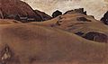
Ötztal
Encyclopedia
States of Austria
Austria is a federal republic made up of nine states, known in German as Länder . Since Land is also the German word for a country, the term Bundesländer is often used instead to avoid ambiguity. The Constitution of Austria uses both terms...
of Tyrol
Tyrol (state)
Tyrol is a state or Bundesland, located in the west of Austria. It comprises the Austrian part of the historical region of Tyrol.The state is split into two parts–called North Tyrol and East Tyrol–by a -wide strip of land where the state of Salzburg borders directly on the Italian province of...
. The Ötztaler Ache
Ötztaler Ache
The Ötztaler Ache is a right tributary of the Inn River in the Imst and flows through the Ötztal valley with a length of appr. 35 km. It merges with the Inn River 8 km east of Imst. The river is one of the biggest tributaries with plenty of water...
river flows through the valley in a northern direction. The Ötztal separates the Stubai Alps
Stubai Alps
The Stubai Alps is a mountain range in the Central Eastern Alps of Europe. It is named after the Stubaital valley to its east. It is located southwest of Innsbruck, Austria, and several summits of the range form part of Austria's border with Italy...
in the east from the Ötztal Alps
Ötztal Alps
The Ötztal Alps are a mountain range in the central Alps of Europe, part of the Central Eastern Alps. They are arrayed at the head of the Ötztal, a side valley of the Inn River southwest of Innsbruck, Austria; the line of summits forms part of Austria's border with Italy.The western border is the...
in the west. The northern end of the valley is at the confluence of the Ötztaler Ache and Inn
Inn River
The Inn is a river in Switzerland, Austria and Germany. It is a right tributary of the Danube and is approximately 500km long. The highest point of its drainage basin is the summit of Piz Bernina, at 4,049 metres.- Geography :...
rivers, 8 kilometers east of Imst
Imst
Imst is a city in the Austrian federal state of Tyrol. It lies on the River Inn in western Tyrol, some 55 km west of Innsbruck and at an altitude of 828 m above sea-level...
and 50 kilometers west of Innsbruck
Innsbruck
- Main sights :- Buildings :*Golden Roof*Kaiserliche Hofburg *Hofkirche with the cenotaph of Maximilian I, Holy Roman Emperor*Altes Landhaus...
. Here is the only railway station of the valley, Ötztal railway station
Ötztal railway station
Ötztal is a railway station on the Arlberg railway between Innsbruck and Bludenz in Tyrol, Austria. In Ötztal the second track coming from Innsbruck ends and the Arlberg line continues as a single-track railway till Landeck.- Rail services :...
, which connects the Ötztal with the Arlberg railway
Arlberg Railway
The Arlberg railway, which connects the Austrian cities Innsbruck and Bludenz, is Austria's only east-west mountain railway. The 135.7 km line is referred as Europe's most difficult mountain railway since it is threatened by avalanches, mudslides, rockfalls or floods...
(Innsbruck
Innsbruck
- Main sights :- Buildings :*Golden Roof*Kaiserliche Hofburg *Hofkirche with the cenotaph of Maximilian I, Holy Roman Emperor*Altes Landhaus...
-Bludenz
Bludenz
Bludenz is a town in the state of Vorarlberg in Austria. The town, surrounded by mountains, lies at the meeting point of five different valleys: The Klostertal, The Montafon, The Walgau, The Brandnertal, The Groß Walsertal....
) and also a motorway interchange to the A12 (E60)
European route E60
European route E 60 is a E-road running from Brest, France , to Irkeshtam, Kyrgyzstan...
. The southern end of the valley, also called the Gurglertal (valley of the Gurgler) terminates at the border with Italy
Italy
Italy , officially the Italian Republic languages]] under the European Charter for Regional or Minority Languages. In each of these, Italy's official name is as follows:;;;;;;;;), is a unitary parliamentary republic in South-Central Europe. To the north it borders France, Switzerland, Austria and...
, formed by the main chain of the Alps
Alps
The Alps is one of the great mountain range systems of Europe, stretching from Austria and Slovenia in the east through Italy, Switzerland, Liechtenstein and Germany to France in the west....
, with many glacier
Glacier
A glacier is a large persistent body of ice that forms where the accumulation of snow exceeds its ablation over many years, often centuries. At least 0.1 km² in area and 50 m thick, but often much larger, a glacier slowly deforms and flows due to stresses induced by its weight...
s and high peaks, including the Weißkugel
Weißkugel
Weißkugel is the second highest mountain in the Ötztal Alps and the third highest mountain in Austria. Featuring many glaciers, it lies on the border between Austria and Italy. The easiest way to climb it is over its southern side. It was first climbed in 1850 by J.A...
and the Similaun
Similaun
Similaun is a mountain in the Schnalskamm group of the Ötztal Alps/Venoste Alps. It is on the Austrian-Italian border. At 3,606 m high, it is Austria's sixth highest summit. It was first ascended in 1834 by Josef Raffeiner and Theodor Kaserer. It is most famous for being the mountain on whose...
. The village of Obergurgl
Obergurgl
Obergurgl is a village in the Ötztal Alps in the Austrian state of Tyrol. Located in the municipality of Sölden, the village has approximately 400 year-round inhabitants, and is mainly a tourist resort....
at the southern end of the Ötztal is the highest parish in Austria.
In 1991, Ötzi the Iceman
Ötzi the Iceman
Ötzi the Iceman , Similaun Man, and Man from Hauslabjoch are modern names for a well-preserved natural mummy of a man who lived about 5,300 years ago. The mummy was found in September 1991 in the Ötztal Alps, near Hauslabjoch on the border between Austria and Italy. The nickname comes from the...
, a well-preserved natural mummy from about 3300 BC, was found in the nearby Schnalstal
Schnalstal
The Schnalstal is side valley of the Vinschgau in South Tyrol, Italy and is congruent with the municipality of Schnals. The Vernagt-Stausee is located in the valley.- External links :...
glacier near the Finielspitze and the Similaun. The Ötzi monument is located about an hour's walk from the Similaun Hut.
The Ötztal comprises five municipalities (from north to south): Sautens
Sautens
Sautens is a municipality in the Imst district located southeast of Imst on the lower course of the Ötztaler Ache. The the village is located to catch the sun but is protected from the wind, which makes for an especially mild climate. The main source of income is agriculture...
, Oetz
Oetz
Oetz is a municipality in the Imst district of Austria and is located 11.70 km southeast of Imst at the lower course of the Ötztaler Ache. The village has several parts and is a popular area for rafting and tourism. Settlement of the area around Oetz already began 2000 years ago but the village was...
, Umhausen
Umhausen
Umhausen is a municipality in the Imst district and is located 17 km southeast of Imst at the Ötztaler Ache in the Ötztal.The municipality consists of six villages: Umhausen, Tumpen, Köfels, Farst, Niederthai, Östen....
, Längenfeld
Längenfeld
Längenfeld is a municipality in the Imst and is located 25 km southeast of Imst in the Ötztal valley. With an area size of 195.8 km², 21 village parts and 4333 inhabitants it is the biggest location in the valley. Sights are the late Gothic-baroque church which was built in 1303. Main source of...
and Sölden
Sölden
Sölden is a municipality in the Ötztal valley of Tyrol, Austria.-Geography:At c. 467 km² , it is the largest municipality in the country. The population of 3,449 is outnumbered by tourists, of which 15,000 can be accommodated...
. The main industry in the valley is tourism
Tourism
Tourism is travel for recreational, leisure or business purposes. The World Tourism Organization defines tourists as people "traveling to and staying in places outside their usual environment for not more than one consecutive year for leisure, business and other purposes".Tourism has become a...
: the mountains around the valley are popular with mountaineers
Mountaineering
Mountaineering or mountain climbing is the sport, hobby or profession of hiking, skiing, and climbing mountains. While mountaineering began as attempts to reach the highest point of unclimbed mountains it has branched into specialisations that address different aspects of the mountain and consists...
and skiers
Skiing
Skiing is a recreational activity using skis as equipment for traveling over snow. Skis are used in conjunction with boots that connect to the ski with use of a binding....
. There are ski resort
Ski resort
A ski resort is a resort developed for skiing and other winter sports. In Europe a ski resort is a town or village in a ski area - a mountainous area, where there are ski trails and supporting services such as hotels and other accommodation, restaurants, equipment rental and a ski lift system...
s in the upper part of the valley at Sölden, Hochsölden, and Hochgurgl. The Timmelsjoch
Timmelsjoch
Timmelsjoch , is a high mountain pass that creates a link through the Ötztal Alps along the border between Austria and Italy....
mountain pass connects the Ötztal with the Passeier Valley
Passeier Valley
The Passeier Valley is the valley of the Passer river, in the mountains of South Tyrol, northern Italy. The Passer river is a left-bank tributary to the Adige. At the mouth of the valley, where the two rivers join, stands the town of Meran...
and Merano in the province of South Tyrol
South Tyrol
South Tyrol , also known by its Italian name Alto Adige, is an autonomous province in northern Italy. It is one of the two autonomous provinces that make up the autonomous region of Trentino-Alto Adige/Südtirol. The province has an area of and a total population of more than 500,000 inhabitants...
, Italy
Italy
Italy , officially the Italian Republic languages]] under the European Charter for Regional or Minority Languages. In each of these, Italy's official name is as follows:;;;;;;;;), is a unitary parliamentary republic in South-Central Europe. To the north it borders France, Switzerland, Austria and...
.
The Ötztal Glacier Road
Ötztal Glacier Road
The Ötztal Glacier Road, ' is the second highest paved road in Europe. It is the access road from Sölden to the Rettenbach glacier and Tiefenbachferner glaciers in the Ötztal Alps. It was built in 1972 as a spur from the existing Hochsölden road. The road climbs the Rettenbach Valley from Solden in...
is the highest paved road in the Alps. It is the access road from Sölden to the Rettenbach glacier
Rettenbach glacier
The Rettenbach glacier is a glacier located near Sölden, in the Ötztaler Alps of Austria.During the winter the glacier is accessible by cable car and from spring time by car, using the Gletscherstraße....
and Tiefenbachferner glaciers, highest point at southern end of the tunnel 46°55′29"N 10°56′40"E
See also
- List of highest paved roads in Europe
- List of mountain passes