

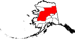
Yukon-Koyukuk Census Area, Alaska
Encyclopedia
U.S. state
A U.S. state is any one of the 50 federated states of the United States of America that share sovereignty with the federal government. Because of this shared sovereignty, an American is a citizen both of the federal entity and of his or her state of domicile. Four states use the official title of...
of Alaska
Alaska
Alaska is the largest state in the United States by area. It is situated in the northwest extremity of the North American continent, with Canada to the east, the Arctic Ocean to the north, and the Pacific Ocean to the west and south, with Russia further west across the Bering Strait...
, United States
United States
The United States of America is a federal constitutional republic comprising fifty states and a federal district...
. As of the 2010 census, the population was 5,588. It is part of the unorganized borough
Unorganized Borough
The Unorganized Borough is the part of the U.S. state of Alaska not contained in any of its 18 organized boroughs. It encompasses more than half of Alaska's area, , an area larger than any other US state...
and therefore has no borough seat. Its largest communities are the cities of Galena
Galena, Alaska
Galena is the largest city in the Yukon-Koyukuk Census Area in the U.S. state of Alaska. At the 2000 census the population was 675.-History:...
, in the west, and Fort Yukon
Fort Yukon, Alaska
As of the census of 2000, there were 595 people, 225 households, and 137 families residing in the city. The population density was 85.0 people per square mile . There were 317 housing units at an average density of 45.3 per square mile...
, in the northeast.
Geography
The census area has a total area of 147843 square miles (382,911.6 km²), of which, 145900 square miles (377,879.3 km²) is land and 1943 square miles (5,032.3 km²) –1.31%– is water. The area is roughly the same size as the U.S. state of MontanaMontana
Montana is a state in the Western United States. The western third of Montana contains numerous mountain ranges. Smaller, "island ranges" are found in the central third of the state, for a total of 77 named ranges of the Rocky Mountains. This geographical fact is reflected in the state's name,...
. It has the largest area of any county or county-equivalent
County-equivalent
A county-equivalent in the United States is a term used by the federal government to describe one of the two following governmental subdivisions:#A unit of local government in certain states which is comparable to a county as found in most states....
in the United States. Its population density
Population density
Population density is a measurement of population per unit area or unit volume. It is frequently applied to living organisms, and particularly to humans...
, at PD/sqmi, is the lowest in the United States.
Adjacent boroughs and census areas
- North Slope Borough, AlaskaNorth Slope Borough, Alaska-National protected areas:* Alaska Maritime National Wildlife Refuge ** Cape Lisburne** Cape Thompson* Arctic National Wildlife Refuge ** Mollie Beattie Wilderness * Gates of the Arctic National Park and Preserve...
- north - Southeast Fairbanks Census Area, AlaskaSoutheast Fairbanks Census Area, AlaskaSoutheast Fairbanks Census Area is a census area located in the state of Alaska, United States. As of the 2000 census, the population was 6,174. It is part of the unorganized borough and therefore has no borough seat...
- southeast - Fairbanks North Star Borough, AlaskaFairbanks North Star Borough, Alaska-Demographics:As of the 2000 census, 82,840 people, 29,777 households, and 20,516 families were residing in the borough. The population density was 11 people per square mile . There were 33,291 housing units at an average density of 4 per square mile...
- southeast - Denali Borough, AlaskaDenali Borough, Alaska-Demographics:As of the census of 2000, there were 1,893 people, 785 households, and 452 families residing in the borough. The population density was 0 people per square mile . There were 1,351 housing units at an average density of 0 per square mile...
- southeast - Matanuska-Susitna Borough, AlaskaMatanuska-Susitna Borough, Alaska-National protected areas:* Chugach National Forest * Denali National Park and Preserve ** Denali Wilderness * Lake Clark National Park and Preserve ** Lake Clark Wilderness -Demographics:...
- south - Bethel Census Area, AlaskaBethel Census Area, AlaskaBethel Census Area is a census area located in the U.S. state of Alaska. As of 2000, the population is 16,006. It is part of the unorganized borough and therefore has no borough seat...
- south - Wade Hampton Census Area, AlaskaWade Hampton Census Area, AlaskaWade Hampton Census Area is a census area located in the U.S. state of Alaska. As of the 2000 census, the population was 7,028. It is part of the unorganized borough and therefore has no borough seat...
- west - Nome Census Area, AlaskaNome Census Area, AlaskaNome Census Area is a census area located in the state of Alaska, United States. As of the 2000 census, the population was 9,196. It is part of the unorganized borough and therefore has no borough seat. Its largest community by far is the city of Nome....
- west - Northwest Arctic Borough, AlaskaNorthwest Arctic Borough, Alaska-National protected areas:* Alaska Maritime National Wildlife Refuge ** Chamisso Wilderness* Bering Land Bridge National Preserve * Cape Krusenstern National Monument* Gates of the Arctic National Park and Preserve...
- west
Also shares eastern border with the Yukon Territory, Canada
Canada
Canada is a North American country consisting of ten provinces and three territories. Located in the northern part of the continent, it extends from the Atlantic Ocean in the east to the Pacific Ocean in the west, and northward into the Arctic Ocean...
.
National protected areas
- Arctic National Wildlife RefugeArctic National Wildlife RefugeThe Arctic National Wildlife Refuge is a national wildlife refuge in northeastern Alaska, United States. It consists of in the Alaska North Slope region. It is the largest National Wildlife Refuge in the country, slightly larger than the Yukon Delta National Wildlife Refuge...
(part)- Mollie Beattie WildernessMollie Beattie WildernessThe Mollie Beattie Wilderness is located in the northeastern section of the Arctic National Wildlife Refuge. It is the second-largest designated wilderness area in the United States, after the Wrangell-Saint Elias Wilderness. It has an area of approximately , and comprises over 40 percent of the...
(part)
- Mollie Beattie Wilderness
- Gates of the Arctic National Park and PreserveGates of the Arctic National Park and PreserveGates of the Arctic National Park and Preserve is a U.S. National Park in Alaska. It is the northernmost national park in the U.S. and the second largest at 13,238 mi² , about the same size as Switzerland. The park consists primarily of portions of the Brooks Range of mountains...
(part)- Gates of the Arctic WildernessGates of the Arctic WildernessGates of the Arctic Wilderness is a wilderness area in the U.S. state of Alaska. Located in the Gates of the Arctic National Park and Preserve, it is in area, the third-largest designated wilderness area in the United States .-History and Introduction:When the wilderness activist, Bob...
(part)
- Gates of the Arctic Wilderness
- Innoko National Wildlife RefugeInnoko National Wildlife RefugeThe Innoko National Wildlife Refuge is a wildlife refuge in western Alaska in the United States. It consists of 3,850,481 acres of which 1,240,000 acres is designated a wilderness area. It is the fifth-largest National Wildlife Refuge in the United States. The refuge is administered from offices...
- Innoko WildernessInnoko WildernessInnoko Wilderness is a wilderness area in the U.S. state of Alaska. It was designated by the United States Congress in 1980. It lies within the southeastern part of Innoko National Wildlife Refuge. Innoko Wilderness is a transition zone between the boreal forestland of interior Alaska and the...
- Innoko Wilderness
- Kanuti National Wildlife RefugeKanuti National Wildlife RefugeKanuti National Wildlife Refuge is a national wildlife refuge in central Alaska, United States. One of 16 refuges in Alaska, it was established in 1980 when Congress passed The Alaska National Interest Lands Conservation Act ....
- Koyukuk National Wildlife RefugeKoyukuk National Wildlife RefugeThe Koyukuk National Wildlife Refuge lies within the floodplain of the Koyukuk River, in a basin that extends from the Yukon River to the Purcell Mountains and the foothills of the Brooks Range...
(part)- Koyukuk Wilderness (part)
- Nowitna National Wildlife RefugeNowitna National Wildlife RefugeThe heart of Nowitna National Wildlife Refuge is a lowland basin of forests and wetlands that forms the floodplain of the meandering Nowitna River. The Refuge's climate is typically marked by light precipitation, mild winds, long, hard winters and short, relatively warm, summers...
- Selawik National Wildlife RefugeSelawik National Wildlife RefugeSelawik National Wildlife Refuge in northwest Alaska in the Waring Mountains was officially established in 1980 with the passage of the Alaska National Interest Lands Conservation Act ....
(part)- Selawik Wilderness (part)
- Steese National Conservation AreaSteese National Conservation AreaThe Steese National Conservation Area encompasses of public land about northeast of Fairbanks, Alaska. Created by the Alaska National Interest Lands Conservation Act in 1980, the Steese NCA's special values include Birch Creek National Wild River, crucial caribou calving grounds and home range,...
- White Mountains National Recreation Area
- Yukon-Charley Rivers National PreserveYukon-Charley Rivers National PreserveThe Yukon–Charley Rivers National Preserve is located in east central Alaska along the border with Canada. It encompasses 115 miles of the 1,800-mile Yukon River and the entire Charley River basin....
(part) - Yukon Flats National Wildlife RefugeYukon Flats National Wildlife RefugeThe Yukon Flats National Wildlife Refuge is a protected wetland area in the U.S. state of Alaska. It encompasses most of the Yukon Flats, a vast wetland area centered on the confluence of the Yukon River, Porcupine River, and Chandalar River...
Demographics
As of the censusCensus
A census is the procedure of systematically acquiring and recording information about the members of a given population. It is a regularly occurring and official count of a particular population. The term is used mostly in connection with national population and housing censuses; other common...
of 2000, there were 6,551 people, 2,309 households, and 1,480 families residing in the census area. The population density
Population density
Population density is a measurement of population per unit area or unit volume. It is frequently applied to living organisms, and particularly to humans...
was square miles (km2) per person. It is the least densely populated county-equivalent
County-equivalent
A county-equivalent in the United States is a term used by the federal government to describe one of the two following governmental subdivisions:#A unit of local government in certain states which is comparable to a county as found in most states....
of all 3,141 county-equivalents of the United States. There were 3,917 housing units at an average density of /sqmi. The racial makeup of the census area was 24.27% White
Race (United States Census)
Race and ethnicity in the United States Census, as defined by the Federal Office of Management and Budget and the United States Census Bureau, are self-identification data items in which residents choose the race or races with which they most closely identify, and indicate whether or not they are...
, 0.09% Black
Race (United States Census)
Race and ethnicity in the United States Census, as defined by the Federal Office of Management and Budget and the United States Census Bureau, are self-identification data items in which residents choose the race or races with which they most closely identify, and indicate whether or not they are...
or African American
Race (United States Census)
Race and ethnicity in the United States Census, as defined by the Federal Office of Management and Budget and the United States Census Bureau, are self-identification data items in which residents choose the race or races with which they most closely identify, and indicate whether or not they are...
, 70.89% Native American
Race (United States Census)
Race and ethnicity in the United States Census, as defined by the Federal Office of Management and Budget and the United States Census Bureau, are self-identification data items in which residents choose the race or races with which they most closely identify, and indicate whether or not they are...
, 0.37% Asian
Race (United States Census)
Race and ethnicity in the United States Census, as defined by the Federal Office of Management and Budget and the United States Census Bureau, are self-identification data items in which residents choose the race or races with which they most closely identify, and indicate whether or not they are...
, 0.05% Pacific Islander
Race (United States Census)
Race and ethnicity in the United States Census, as defined by the Federal Office of Management and Budget and the United States Census Bureau, are self-identification data items in which residents choose the race or races with which they most closely identify, and indicate whether or not they are...
, 0.43% from other races
Race (United States Census)
Race and ethnicity in the United States Census, as defined by the Federal Office of Management and Budget and the United States Census Bureau, are self-identification data items in which residents choose the race or races with which they most closely identify, and indicate whether or not they are...
, and 3.91% from two or more races. 1.19% of the population were Hispanic
Race (United States Census)
Race and ethnicity in the United States Census, as defined by the Federal Office of Management and Budget and the United States Census Bureau, are self-identification data items in which residents choose the race or races with which they most closely identify, and indicate whether or not they are...
or Latino
Race (United States Census)
Race and ethnicity in the United States Census, as defined by the Federal Office of Management and Budget and the United States Census Bureau, are self-identification data items in which residents choose the race or races with which they most closely identify, and indicate whether or not they are...
of any race. 12.95% reported speaking an Athabaskan language at home; of these 35.26% speak Gwich’in
Gwich’in language
The Gwich’in language is the Athabaskan language of the Gwich’in indigenous people. It is also known in older or dialect-specific publications as Kutchin, Takudh, Tukudh, or Loucheux. In the Northwest Territories and Yukon of Canada, it is used principally in the towns of Inuvik, Aklavik, Fort...
and 10.94% speak Koyukon
Koyukon language
Koyukon is an Athabaskan language spoken along the Koyukuk and middle Yukon River in western interior Alaska. It has about 300 speakers - generally older adults bilingual in English - from an ethnic population of 2,300....
.
There were 2,309 households out of which 38.90% had children under the age of 18 living with them, 36.90% were married couples
Marriage
Marriage is a social union or legal contract between people that creates kinship. It is an institution in which interpersonal relationships, usually intimate and sexual, are acknowledged in a variety of ways, depending on the culture or subculture in which it is found...
living together, 16.90% had a female householder with no husband present, and 35.90% were non-families. 30.50% of all households were made up of individuals and 6.20% had someone living alone who was 65 years of age or older. The average household size was 2.81 and the average family size was 3.53.
In the census area the population was spread out with 35.00% under the age of 18, 8.70% from 18 to 24, 26.90% from 25 to 44, 22.10% from 45 to 64, and 7.30% who were 65 years of age or older. The median age was 31 years. For every 100 females there were 118.60 males. For every 100 females age 18 and over, there were 122.60 males.
Cities and towns
- AlatnaAlatna, AlaskaAlatna is a census-designated place in the Yukon-Koyukuk Census Area of the Unorganized Borough in the U.S. state of Alaska. The population was 35 at the 2000 census.-Geography:Alatna is located at Alatna is a census-designated place (CDP) in the Yukon-Koyukuk Census Area of the Unorganized...
- AllakaketAllakaket, AlaskaAllakaket is a 2nd Class City in the Yukon-Koyukuk Census Area of the Unorganized Borough of the U.S. state of Alaska. The population was 97 at the 2000 census.-Geography and climate:...
- AnvikAnvik, AlaskaAnvik is a city, home to the Deg Hit'an people, in the Yukon-Koyukuk Census Area, Alaska, United States. The name Anvik, which became the common usage despite multiple names at the time, may have come from early Russian explorers. The native name in the Deg Xinag language is Deloy Ges...
- Arctic VillageArctic Village, AlaskaArctic Village is an unincorporated Native American village and a census-designated place in Yukon-Koyukuk Census Area, Alaska, United States. As of the 2000 census, the population of the CDP was 152. The village is located in the large Gwitch'in speaking region of Alaska, and the local dialect...
- BeaverBeaver, AlaskaBeaver is a census-designated place in Yukon-Koyukuk Census Area, Alaska, United States. At the 2000 census the population was 84.-Geography:Beaver is located at ....
- Bettles
- Birch CreekBirch Creek, AlaskaBirch Creek is a census-designated place in Yukon-Koyukuk Census Area, Alaska, United States. The population was 28 at the 2000 census.-Geography:...
- CentralCentral, AlaskaCentral is a census-designated place in Yukon-Koyukuk Census Area, Alaska, United States. At the 2000 census the population was 134. Every February, Central hosts a checkpoint for the long-distance Yukon Quest sled dog race.-Geography:...
- ChalkyitsikChalkyitsik, AlaskaChalkyitsik is a census-designated place in Yukon-Koyukuk Census Area, Alaska, United States. At the 2000 census the population was 83.-Geography:Chalkyitsik is located at ....
- CircleCircle, AlaskaCircle is a census-designated place in Yukon-Koyukuk Census Area, Alaska, United States. At the 2000 census the population was 100....
- ColdfootColdfoot, AlaskaColdfoot is a census-designated place in Yukon-Koyukuk Census Area in the U.S. state of Alaska. The population was 13 at the 2000 census....
- EvansvilleEvansville, AlaskaEvansville is a census-designated place in Yukon-Koyukuk Census Area, Alaska, United States. The population was 28 at the 2000 census.-Geography:Evansville is located at ....
- FlatFlat, AlaskaFlat is a census-designated place in Yukon-Koyukuk Census Area, Alaska, United States. As of the 2010 Census, the population of the CDP was 0.- History :...
- Fort YukonFort Yukon, AlaskaAs of the census of 2000, there were 595 people, 225 households, and 137 families residing in the city. The population density was 85.0 people per square mile . There were 317 housing units at an average density of 45.3 per square mile...
- Four Mile RoadFour Mile Road, AlaskaFour Mile Road is a census-designated place in Yukon-Koyukuk Census Area, Alaska, United States. The population was 38 at the 2000 census.-Geography:Four Mile Road is located at ....
- GalenaGalena, AlaskaGalena is the largest city in the Yukon-Koyukuk Census Area in the U.S. state of Alaska. At the 2000 census the population was 675.-History:...
- GraylingGrayling, AlaskaGrayling is a city in Yukon-Koyukuk Census Area, Alaska, United States. At the 2000 census the population was 194. Since 1977, the Athabaskan village has seen a surge of interest on odd-numbered years, when it is the site of a checkpoint during the Iditarod Trail Sled Dog Race...
- Holy CrossHoly Cross, AlaskaHoly Cross is a city in Yukon-Koyukuk Census Area, Alaska, United States...
- HughesHughes, AlaskaHughes is a city in Yukon-Koyukuk Census Area, Alaska, United States. The population was 78 at the 2000 census.-Geography:According to the United States Census Bureau, the city has a total area of , all of it land....
- HusliaHuslia, AlaskaHuslia is a village of Koyukuk-hotana Athabascans in Yukon-Koyukuk Census Area, Alaska, United States. Rarely known as Hussliakatna...
- KaltagKaltag, AlaskaKaltag is a village in Yukon-Koyukuk Census Area, Alaska, United States. At the 2000 census the population was 230.-Geography:Kaltag is located at ....
- KoyukukKoyukuk, AlaskaKoyukuk is a city in Yukon-Koyukuk Census Area, Alaska, United States At the 2000 census the population was 101., Koyukuk is one of a number of Alaskan communities threated by erosion.-History:...
- Lake MinchuminaLake Minchumina, AlaskaLake Minchumina is a census-designated place in Yukon-Koyukuk Census Area, Alaska, United States. As of the 2000 census, the population of the CDP is 32.-Geography:Lake Minchumina is located at ....
- LivengoodLivengood, AlaskaLivengood is a census-designated place in Yukon-Koyukuk Census Area, Alaska, United States. The population was 29 at the 2000 census.-Geography:Livengood is located at ....
- Manley Hot SpringsManley Hot Springs, AlaskaManley Hot Springs is a census-designated place in Yukon-Koyukuk Census Area, Alaska, Manley Hot Springs is a [[census-designated place]] in [[Yukon-Koyukuk Census Area, Alaska|Yukon-Koyukuk Census Area]], [[Alaska]], Manley Hot Springs Manley Hot Springs (Too Naaleł Denh in Koyukon) is a...
- McGrathMcGrath, AlaskaAs of the census of 2000, there were 401 people, 145 households, and 99 families residing in the city. The population density was 8.2 people per square mile . There were 213 housing units at an average density of 4.4 per square mile...
- MintoMinto, AlaskaMinto is a census-designated place in Yukon-Koyukuk Census Area, Alaska, United States. As of the 2000 census, the population of the CDP is 258. The name is an anglicized version of the Lower Tanana Athabaskan name Menh Ti, meaning 'among the lakes'. After repeated flooding the village was...
- NenanaNenana, AlaskaNenana is a Home Rule City in the Yukon-Koyukuk Census Area of the Unorganized Borough of the U.S. state of Alaska. Nenana lies at the juncture of the Nenana River and the Tanana River. The population was 402 at the 2000 census. "Nenana" means 'a good place to camp between two rivers.'-History...
- New AllakaketNew Allakaket, AlaskaNew Allakaket is a census-designated place in Yukon-Koyukuk Census Area, Alaska, United States. The population was 36 at the 2000 census.-Geography:New Allakaket is located at ....
- NikolaiNikolai, AlaskaNikolai is a city in Yukon-Koyukuk Census Area, Alaska, United States. The population was 100 at the 2000 census.-Geography:Nikolai is located at ....
- NulatoNulato, AlaskaNulato is a city in Yukon-Koyukuk Census Area, Alaska, United States. At the 2000 census the population was 336.-Geography:Nulato is located at ....
- RampartRampart, AlaskaRampart is a census-designated place in Yukon-Koyukuk Census Area, Alaska, United States. The population was 45 at the 2000 census. In the 1950s, a large hydroelectric project called the Rampart Dam was considered for the Yukon River near the village. Had the project been completed, it would have...
- RubyRuby, AlaskaRuby is a city in Yukon-Koyukuk Census Area, Alaska, United States. At the 2000 census the population was 188.-Geography:Ruby is located at .According to the United States Census Bureau, the city has a total area of ....
- ShagelukShageluk, AlaskaShageluk is a city in Yukon-Koyukuk Census Area, Alaska, United States. At the 2000 census the population was 129.-Geography:Shageluk is located at ....
- Stevens VillageStevens Village, AlaskaStevens Village is a census-designated place in Yukon-Koyukuk Census Area, Alaska, United States. The population was 87 at the 2000 census.-Geography:...
- TakotnaTakotna, AlaskaTakotna is a census-designated place in Yukon-Koyukuk Census Area, Alaska, United States. The population was 50 at the 2000 census.-Geography:Takotna is located at ....
- TananaTanana, AlaskaTanana is a city in the Yukon-Koyukuk Census Area in the U.S. state of Alaska. At the 2000 census the population was 308. It is formerly known as Clachotin...
- VenetieVenetie, AlaskaVenetie , pronounced VEEN-ih-tye, is a census-designated place in Yukon-Koyukuk Census Area, Alaska, United States...
- WisemanWiseman, AlaskaWiseman is a census-designated place in Yukon-Koyukuk Census Area, Alaska, United States. The population was 21 at the 2000 census.Wiseman is a small mining community in the Brooks Range. It was founded by gold miners who abandoned the Slate Creek settlement around 1919...