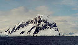
Wilhelm Archipelago
Encyclopedia

Archipelago
An archipelago , sometimes called an island group, is a chain or cluster of islands. The word archipelago is derived from the Greek ἄρχι- – arkhi- and πέλαγος – pélagos through the Italian arcipelago...
off the west coast of the Antarctic Peninsula
Antarctic Peninsula
The Antarctic Peninsula is the northernmost part of the mainland of Antarctica. It extends from a line between Cape Adams and a point on the mainland south of Eklund Islands....
in Antarctica.
Wilhelm Archipelago consists of a myriad of islands, the largest of which are Booth Island
Booth Island
Booth Island is a rugged, Y-shaped island, long and rising to west coast of the Antarctic Peninsula in Antarctica in the northeastern part of the Wilhelm Archipelago. Booth Island is located at...
and Hovgaard Island
Hovgaard Island
Hovgaard Island is an island long, lying southwest of Booth Island in the Wilhelm Archipelago.It was discovered and named "Krogmann-Insel" by the German 1873-74 expedition under Eduard Dallmann, but the name Hovgaard, applied by the Belgian Antarctic Expedition, 1897–99, under Gerlache, has...
. The archipelago extends from Bismarck Strait
Bismarck Strait
The Bismarck Strait is a channel in Antarctica.It is located between the southern end of Anvers and Wiencke Islands and the Wilhelm Archipelago. It was surveyed in 1874 by First Antarctic German expedition under Captain Eduard Dallmann....
southwest to Lumus Rock
Lumus Rock
Lumus Rock is a rock located 4 nautical miles west-northwest of Sooty Rock, marking the southwest extremity of Wilhelm Archipelago. Discovered by British Graham Land Expedition , 1934–37, and named "Lumus Reef" after one of the BGLE cats, the only one to survive the Antarctic winter. The BGLE...
, off the west coast of Graham Land
Graham Land
Graham Land is that portion of the Antarctic Peninsula which lies north of a line joining Cape Jeremy and Cape Agassiz. This description of Graham Land is consistent with the 1964 agreement between the British Antarctic Place-names Committee and the US Advisory Committee on Antarctic Names, in...
. It was discovered by a German expedition under Eduard Dallmann
Eduard Dallmann
Eduard Dallmann was a German whaler, trader and Polar explorer....
, 1873-74. He named them for Wilhelm I, then Emperor of Germany and King of Prussia.

