

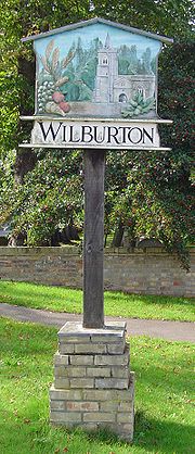
Wilburton
Encyclopedia
Cambridgeshire
Cambridgeshire is a county in England, bordering Lincolnshire to the north, Norfolk to the northeast, Suffolk to the east, Essex and Hertfordshire to the south, and Bedfordshire and Northamptonshire to the west...
, England
England
England is a country that is part of the United Kingdom. It shares land borders with Scotland to the north and Wales to the west; the Irish Sea is to the north west, the Celtic Sea to the south west, with the North Sea to the east and the English Channel to the south separating it from continental...
. It is 6 miles south west of Ely
Ely, Cambridgeshire
Ely is a cathedral city in Cambridgeshire, England, 14 miles north-northeast of Cambridge and about by road from London. It is built on a Lower Greensand island, which at a maximum elevation of is the highest land in the Fens...
.
While nominally an agricultural village, many of the inhabitants work in Cambridge
Cambridge
The city of Cambridge is a university town and the administrative centre of the county of Cambridgeshire, England. It lies in East Anglia about north of London. Cambridge is at the heart of the high-technology centre known as Silicon Fen – a play on Silicon Valley and the fens surrounding the...
, Ely
Ely, Cambridgeshire
Ely is a cathedral city in Cambridgeshire, England, 14 miles north-northeast of Cambridge and about by road from London. It is built on a Lower Greensand island, which at a maximum elevation of is the highest land in the Fens...
or London
London
London is the capital city of :England and the :United Kingdom, the largest metropolitan area in the United Kingdom, and the largest urban zone in the European Union by most measures. Located on the River Thames, London has been a major settlement for two millennia, its history going back to its...
.
History
Wilburton is a parish of around 800 acres lying on the important medieval route from EarithEarith
Earith is a village in the Fens of Cambridgeshire, England, south of Chatteris and east of Huntingdon. At Earith, two artificial diversion channels of the River Great Ouse, the Old Bedford River and the New Bedford River, leave the river on a course to Denver Sluice near Downham Market, where they...
to Stretham
Stretham
Stretham is a small village and civil parish south-south-west of Ely in Cambridgeshire, England, about by road from London. Its main attraction is Stretham Old Engine, a steam-powered pump used to drain the fens. The pump is still in use today although converted to electric power. It has open...
, and extending south to the River Great Ouse
River Great Ouse
The Great Ouse is a river in the east of England. At long, it is the fourth-longest river in the United Kingdom. The river has been important for navigation, and for draining the low-lying region through which it flows. Its course has been modified several times, with the first recorded being in...
. As much of the land in the region is fenland
The Fens
The Fens, also known as the , are a naturally marshy region in eastern England. Most of the fens were drained several centuries ago, resulting in a flat, damp, low-lying agricultural region....
, the village's position on the ridge between Stretham
Stretham
Stretham is a small village and civil parish south-south-west of Ely in Cambridgeshire, England, about by road from London. Its main attraction is Stretham Old Engine, a steam-powered pump used to drain the fens. The pump is still in use today although converted to electric power. It has open...
and Haddenham
Haddenham, Cambridgeshire
Haddenham is a village and civil parish in Cambridgeshire, England. In the 2001 census the parish had a population of 3,228.It has several shops and a regular bus service to the cathedral city of Ely, which is about north-east of the village....
at the southern end of the Isle of Ely
Isle of Ely
The Isle of Ely is a historic region around the city of Ely now in Cambridgeshire, England but previously a county in its own right.-Etymology:...
was important in its growth and success.
Unusually for the area, the village contains a number of attractive old buildings, and was described in the 19th century as "very neat and contains some excellent houses". These include the Burystead (the former manor house, built c.1600), one of the few surviving half-timbered houses in the region, and the Victoria Place row of cottages.
For the last few hundred years, the Pell family were the prominent local landowners, sponsoring the somewhat optimistic Ely and St Ives Railway
Ely and St Ives Railway
The Ely and St Ives Railway is a closed railway that ran between Ely, Cambridgeshire and St Ives. The route was long single track, built to standard gauge and was completely closed on 5 October 1964...
in the late 19th century. Wilburton railway station
Wilburton railway station
Wilburton railway station was a station in Wilburton, Cambridgeshire on the Ely and St Ives Railway. It was closed in the 1960s along with the rest of the route.The station featured a single platform, a signal box and a goods shed/granary on a loop....
, built in 1866, has been open for goods trains only since 1931.
Listed as Wilburhtun in 970 and Wilbertone in the Domesday Book
Domesday Book
Domesday Book , now held at The National Archives, Kew, Richmond upon Thames in South West London, is the record of the great survey of much of England and parts of Wales completed in 1086...
, the name "Wilburton" means "Farmstead or village of a woman called Wilburh".
Church
The parish church, dedicated to St Peter consists of a chancel, north vestry and organ chamber, a nave, north chapel, south porch, and west tower. The chancel arch and tower date from the 13th century and the extensive rebuilding in the second half of the 15th century produced the chancel, vestry, nave, and porch. The organ chamber and north chapel were added in the late 19th century. The three-storey tower contains five bells, all dating from the 17th century.Village life
There village is home to a fine Elizabethan manor house, a shop, and a garden center. There is one public house, The King's Head. There is also a hall called St Peter's Hall that is used for events by the local community, such as school plays, wedding receptions, and after-school clubs. Adjoining St Peter's Hall is a social club.The village holds a fireworks display around Guy Fawkes night and a beer festival in the summer. In 2005 it also held its first spring beer festival.
Sport
Wilburton is also well known for its notable football teams, in 1996 Wilburton Blades F.C were formed under the careful leadership of local businessman Barry Star, the Blades were most well known for there U/14 side that reached 3rd place in the Cambridgeshire colts league 97/98 season.Several other teams have formed since 1996, Wilburton Albion were set up by the local social club in 2002 and enjoyed several years of success in the Sunday Football league and Haddenham Harlequins (now re-named Wilburton F.C) were formed in 2006 by local man Gordon Walker whom played for both Wilburton Blades and Wilburton Albion.
A notable game was when Wilburton Albion Played Haddenham Harlequins in a local cup match with the game ending in a 9-1 win for Albion.
Wilburton F.C (Harlequins) are the only team still operating in Wilburton, they play in the Sunday Alliance league.
Notable players for Wilburton teams is William Ludbrooke whom has won the golden boot award on three separate occasions and continues to play for Wilburton F.C to the present day.
See also
- Doghouse GroveDoghouse GroveDoghouse Grove is managed as a nature reserve by the Wildlife Trust for Bedfordshire, Cambridgeshire, Northamptonshire and Peterborough. It lies south of the village of Wilburton in the county of Cambridgeshire.- References :- External links :*...
nature reserve, south of the village - Grunty FenGrunty FenGrunty Fen was a former parish in Cambridgeshire, England, four miles south west of Ely. It was amalgamated with Wilburton parish in 1933.-History:...
, a former parish, now amalgamated with the village