

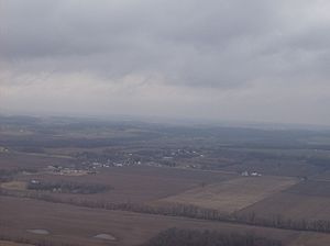
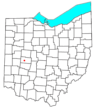
Westville, Ohio
Encyclopedia
Unincorporated area
In law, an unincorporated area is a region of land that is not a part of any municipality.To "incorporate" in this context means to form a municipal corporation, a city, town, or village with its own government. An unincorporated community is usually not subject to or taxed by a municipal government...
in northeastern Mad River Township
Mad River Township, Champaign County, Ohio
Mad River Township is one of the twelve townships of Champaign County, Ohio, United States. The 2000 census found 2,650 people in the township.-Geography:Located in the southwestern part of the county, it borders the following townships:...
, Champaign County
Champaign County, Ohio
As of the census of 2000, there were 38,890 people, 14,952 households, and 10,870 families residing in the county. The population density was 91 people per square mile . There were 15,890 housing units at an average density of 37 per square mile...
, Ohio
Ohio
Ohio is a Midwestern state in the United States. The 34th largest state by area in the U.S.,it is the 7th‑most populous with over 11.5 million residents, containing several major American cities and seven metropolitan areas with populations of 500,000 or more.The state's capital is Columbus...
, United States
United States
The United States of America is a federal constitutional republic comprising fifty states and a federal district...
. Although it is unincorporated, it has a post office
Post office
A post office is a facility forming part of a postal system for the posting, receipt, sorting, handling, transmission or delivery of mail.Post offices offer mail-related services such as post office boxes, postage and packaging supplies...
, with the ZIP code
ZIP Code
ZIP codes are a system of postal codes used by the United States Postal Service since 1963. The term ZIP, an acronym for Zone Improvement Plan, is properly written in capital letters and was chosen to suggest that the mail travels more efficiently, and therefore more quickly, when senders use the...
of 43083. It lies at the intersection of U.S. Route 36
U.S. Route 36
U.S. Route 36 is an east–west United States highway that runs for from Rocky Mountain National Park, Colorado to Uhrichsville, Ohio. The highway's western terminus is at Deer Ridge Junction, an intersection in Rocky Mountain National Park, Colorado, where it meets U.S. Route 34. Its eastern...
with State Route 560
Ohio State Route 560
State Route 560 is a north–south state highway in the western portion of Ohio, a U.S. state. SR 560 has its southern terminus at SR 55 approximately southwest of the county seat of Urbana...
.