

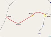
Waveney Valley Line
Encyclopedia

Beccles
Beccles is a market town and civil parish in the Waveney District of the English county of Suffolk. The town is shown on the milestone as from London via the A145 Blythburgh and A12 road, northeast of London as the crow flies, southeast of Norwich, and north northeast of the county town of...
in Suffolk connecting the Great Eastern Main Line
Great Eastern Main Line
The Great Eastern Main Line is a 212 Kilometre major railway line of the British railway system, which connects Liverpool Street in the City of London with destinations in east London and the East of England, including Chelmsford, Colchester, Ipswich, Norwich and several coastal resorts such as...
at Tivetshall with the East Suffolk Line
East Suffolk Line
The East Suffolk Line is an un-electrified secondary railway line running between Ipswich and Lowestoft in Suffolk, England. The traffic along the route consists of passenger services operated by National Express East Anglia, while nuclear flask trains for the Sizewell nuclear power stations are...
at . It provided services to Norwich
Norwich
Norwich is a city in England. It is the regional administrative centre and county town of Norfolk. During the 11th century, Norwich was the largest city in England after London, and one of the most important places in the kingdom...
, Great Yarmouth
Great Yarmouth
Great Yarmouth, often known to locals as Yarmouth, is a coastal town in Norfolk, England. It is at the mouth of the River Yare, east of Norwich.It has been a seaside resort since 1760, and is the gateway from the Norfolk Broads to the sea...
, Lowestoft
Lowestoft
Lowestoft is a town in the English county of Suffolk. The town is on the North Sea coast and is the most easterly point of the United Kingdom. It is north-east of London, north-east of Ipswich and south-east of Norwich...
, Ipswich
Ipswich
Ipswich is a large town and a non-metropolitan district. It is the county town of Suffolk, England. Ipswich is located on the estuary of the River Orwell...
and many other smaller towns in Suffolk with additional services to London. It was named after the River Waveney
River Waveney
The Waveney is a river which forms the border between Suffolk and Norfolk, England, for much of its length within The Broads.-Course:The source of the River Waveney is a ditch on the east side of the B1113 road between the villages of Redgrave, Suffolk and South Lopham, Norfolk...
which follows a similar route.
History
Great Eastern Railway
The Great Eastern Railway was a pre-grouping British railway company, whose main line linked London Liverpool Street to Norwich and which had other lines through East Anglia...
. The line then became part of the LNER on 1 January 1923.
and stations were closed in 1866, only 11 years after the line opened.
The line was closed to passenger services on 5th January 1953. With the last passenger train from Tivetshall junction to Beccles pulled by Class F.3 2-4-2 tank locomotive No 67128.
A Light Railway Order was obtained in November 1954, after which there were some special services run by railway enthusiasts.
From 1960 the line was split into sections - Tivetshall to Harleston and Beccles to Bungay.
The lines were finally closed from 19 April 1966 during the Beeching Axe
Beeching Axe
The Beeching Axe or the Beeching Cuts are informal names for the British Government's attempt in the 1960s to reduce the cost of running British Railways, the nationalised railway system in the United Kingdom. The name is that of the main author of The Reshaping of British Railways, Dr Richard...
and the track eventually removed. Some of the last wagon loads to leave Ditchingham
Ditchingham
Ditchingham is a village and civil parish in the English county of Norfolk. It is located across the River Waveney from Bungay, Suffolk near to The Broads National Park.- Overview :...
were sand and gravel from Broome Heath, used in the construction of Hammersmith fly-over in west London.
In the early 1980s, many of the remaining old buildings, including stations and goods yards, were demolished to make way for a new road.
Services
The line ran regular passenger and freight services daily, except for Sundays. This was a condition placed on the railway by landowners in the StarstonStarston
Starston is a small village in Norfolk. It covers an area of and had a population of 321 in 123 households as of the 2001 census.The Starston sign features a wind pump that was used to transport water from the Beck river up to Starston Place, which was demolished during the early 1900's...
area of Norfolk who had to give their consent before the line could be built.
Departing from Beccles there were stations at Geldeston
Geldeston
Geldeston is a parish in Norfolk. It is about 1 mile west of Gillingham and 2 miles north west of Beccles. Other nearby villages include Ellingham and Broome to the west. It covers an area of and had a population of 398 in 161 households as of the 2001 census....
, Ellingham
Ellingham, Norfolk
Ellingham is a civil parish in Norfolk, England. It covers an area of and had a population of 532 in 238 households as of the 2001 census. It lies approximately from Bungay and from Beccles....
, Ditchingham
Ditchingham
Ditchingham is a village and civil parish in the English county of Norfolk. It is located across the River Waveney from Bungay, Suffolk near to The Broads National Park.- Overview :...
, Bungay
Bungay, Suffolk
Bungay is a market town in the English county of Suffolk. It lies in the Waveney valley, west of Beccles on the edge of The Broads, and at the neck of a meander of the River Waveney.-Early history:...
, Earsham
Earsham
Earsham is a small village in Norfolk, England. Its postal town is the nearby Bungay, Suffolk. It covers an area of and had a population of 907 in 357 households as of the 2001 census.Earsham has a number of local attractions, including:...
, Homersfield
Homersfield
South Elmham St Mary, known as Homersfield, is a small village and civil parish located on the banks of the River Waveney in Suffolk, UK, on the border with Norfolk. It is one of The Saints. It is the home of the oldest surviving concrete bridge in Britain, a 50-foot span built in 1870 by the...
, Harleston, Pulham St. Mary, Pulham Market
Pulham Market
Pulham Market and its sister village Pulham St Mary are situated approximately 9 miles north of Diss in Norfolk, England. It covers an area of and had a population of 999 in 443 households as of the 2001 census....
before the line terminated at Tivetshall.
During World War I
World War I
World War I , which was predominantly called the World War or the Great War from its occurrence until 1939, and the First World War or World War I thereafter, was a major war centred in Europe that began on 28 July 1914 and lasted until 11 November 1918...
however, troop trains were known to operate each day. By October 1915, trains had reached their peak of 8 trains per day, but the demands of World War I
World War I
World War I , which was predominantly called the World War or the Great War from its occurrence until 1939, and the First World War or World War I thereafter, was a major war centred in Europe that began on 28 July 1914 and lasted until 11 November 1918...
reduced this to 6 trains per day in 1917.
During world war two there was a large increase in traffic, this was due to the airfields and military establishments built along the line. Bombs were stored on a bomb dump near Earsham Hall until, after the war, the unused bombs were taken away and disposed of - this continued until 1954.
By 1953, when passenger services closed, services had remained unchanged for 36 years.
Present day
The Bungay to Harleston section of the route now forms part of the main A143 roadA143 road
The A143 is a road that runs from Great Yarmouth in Norfolk to Haverhill in Suffolk.For much of the route the road is classified as a primary route. Over the years the road has been much improved with new by-passes opening at regular intervals...
and was opened on 9 November 1983. Other sections of the route are now tracks and footpaths.
The line from Beccles station was partly converted to an industrial estate, reaching the river next to the aptly named Railway Score. The remains of the bridge over the River Waveney on the Norfolk side of the river are still visible. From the bridge, the trackbed is in overgrown condition and the ballast is still present in places. At Ditchingham, the maltings still survive (the railway used to serve it) but are derelict and due to be redeveloped.
Several stations do survive including:
- Geldeston (station and goods shed) private house with a small extension, otherwise as it was.
- Ellingham, a large extension has altered the image greatly some of the platform survives.
- Earsham, very unaltered only the canopy missing and a few door changes.
- Homersfield, station demolished but the goodshed is a garage and house, few extensions.
- Harleston, station and goods shed survive owned by a builder, extension on the station extends over the platform.
- Pulham Market, private house, signal added.
- Starston, very well maintained.
The water tower from Bungay was saved and taken to the North Norfolk Railway
North Norfolk Railway
The North Norfolk Railway – also known as the "Poppy Line" – is a heritage steam railway in Norfolk, England, running between the coastal town of Sheringham and Holt, It cuts through the countryside to the east of Weybourne with views of its windmill and passes through the well preserved country...
and placed at Weybourne
Weybourne
Weybourne is a fishing resort on the North Norfolk and has the postcode prefix of NR25. The village straddles the A149 coast road and is three miles west of Sheringham, within the Norfolk Coast AONB. Weybourne is mentioned in the Domesday book and in that survey it is called Wabrume...
where it is the largest object from the line still in railway use.
External links
Waveney Valley Railway photosDisused Railways: the Waveney Valley Railway photos