
Washington State Route 129
Encyclopedia
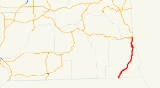
State Route 129 Spur (SR 129 Spur) runs 0.07 mile (0.1126538 km) from SR 129, north to US 12, within the City of Clarkston
. The route goes from SR 129, and merges onto westbound US 12. It serves mostly as a cut through to and from the two routes and WSDOT has found that 2,300 motorists use the road daily near the SR 129 intersection.
 SR 129 began as part of Primary State Highway 3's Clarkston branch (PSH 3 DC) in 1937. PSH 3 DC traveled from OR 3 north to Clarkston
and then west to Pomeroy
, ending at PSH 3 where it was co-signed with U.S. Route 295
(US 295). US 295 was established in 1926, and later decommissioned
in 1967. In 1964, PSH 3 DC was renamed SR 129 and became a state highway during a statewide highway renumbering. The Washington State Department of Transportation
(WSDOT) replaced the previous system of primary and secondary highways with a new system called State Routes
, which is still in use today.
Clarkston, Washington
Clarkston is a city in Asotin County in the southeastern part of the U.S. state of Washington. It is part of the Lewiston ID-WA Metropolitan Statistical Area. The population was 7,229 in 2010....
. The route goes from SR 129, and merges onto westbound US 12. It serves mostly as a cut through to and from the two routes and WSDOT has found that 2,300 motorists use the road daily near the SR 129 intersection.
History
Clarkston, Washington
Clarkston is a city in Asotin County in the southeastern part of the U.S. state of Washington. It is part of the Lewiston ID-WA Metropolitan Statistical Area. The population was 7,229 in 2010....
and then west to Pomeroy
Pomeroy, Washington
Pomeroy is a city in Garfield County, Washington, United States. The population was 1,425 at the 2010 census. It is the county seat of Garfield County.-Geography: Pomeroy is located at ....
, ending at PSH 3 where it was co-signed with U.S. Route 295
U.S. Route 410
U.S. Route 410 was one of the west–east state highways. It ran from an intersection with US 101 in Aberdeen, Washington to US 95 in Lewiston, Idaho. The route had concurrencies with SR 8, US 99, and US 395. Even though the number indicates that US 410 was a spur of U.S. Route 10, US 410 never...
(US 295). US 295 was established in 1926, and later decommissioned
Decommissioned highway
A decommissioned highway is a highway that has been removed from service, shut down or has had its authorization as a federal or state highway removed. Decommissioning can include the complete or partial demolition or abandonment of an old highway structure because the old roadway has lost its...
in 1967. In 1964, PSH 3 DC was renamed SR 129 and became a state highway during a statewide highway renumbering. The Washington State Department of Transportation
Washington State Department of Transportation
The Washington State Department of Transportation , was established in 1905. The agency, led by a Secretary and overseen by the Governor, is a Washington governmental agency that constructs, maintains, and regulates the use of the state's transportation infrastructure...
(WSDOT) replaced the previous system of primary and secondary highways with a new system called State Routes
State highways in Washington
In the U.S. state of Washington, the Washington State Department of Transportation maintains a network of over 7000 miles of state highways, including all Interstate and U.S. Highways that pass through the state. The system comprises 8.5% of the state's public road mileage, but carries over half...
, which is still in use today.
Major intersections
| County | Location | Mile | Destinations | Notes |
|---|---|---|---|---|
| Asotin | 0.00 | Continuation beyond Oregon state line | ||
| 40.83 | Southway Bridge | Interchange | ||
| Clarkston Clarkston, Washington Clarkston is a city in Asotin County in the southeastern part of the U.S. state of Washington. It is part of the Lewiston ID-WA Metropolitan Statistical Area. The population was 7,229 in 2010.... |
42.17 |   (via SR 129 Spur) – Walla Walla (via SR 129 Spur) – Walla WallaWalla Walla, Washington Walla Walla is the largest city in and the county seat of Walla Walla County, Washington, United States. The population was 31,731 at the 2010 census... |
||
| 42.55 | – Lewiston Lewiston, Idaho Lewiston is a city in and also the county seat of Nez Perce County in the Pacific Northwest state of Idaho. It is the second-largest city in the northern Idaho region, behind Coeur d'Alene and ninth-largest in the state. Lewiston is the principal city of the Lewiston, ID - Clarkston, WA... |