
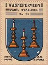
Wanneperveen
Encyclopedia
Wanneperveen is a village in the Dutch
province of Overijssel
. It is located in the municipality of Steenwijkerland
, about 4 km west of Meppel
.
Wanneperveen was a separate municipality until 1973, when it became a part of Brederwiede
. And in 2001 Brederwiede joined the nearby Steenwijk
to form Steenwijkerland
Netherlands
The Netherlands is a constituent country of the Kingdom of the Netherlands, located mainly in North-West Europe and with several islands in the Caribbean. Mainland Netherlands borders the North Sea to the north and west, Belgium to the south, and Germany to the east, and shares maritime borders...
province of Overijssel
Overijssel
Overijssel is a province of the Netherlands in the central eastern part of the country. The region has a NUTS classification of NL21. The province's name means "Lands across river IJssel". The capital city of Overijssel is Zwolle and the largest city is Enschede...
. It is located in the municipality of Steenwijkerland
Steenwijkerland
Steenwijkerland is a municipality in the province Overijssel, in the eastern Netherlands.The municipality forms the entire northwesterly corner of the province. This area is called "the Head of Overijssel"...
, about 4 km west of Meppel
Meppel
Meppel is a municipality and a city in the northeast of the Netherlands, in the south-west of the province Drenthe.It developed in the 16th century as a transport and distribution inland harbour for turf...
.
Wanneperveen was a separate municipality until 1973, when it became a part of Brederwiede
Brederwiede
Brederwiede is a former municipality in the Dutch province of Overijssel. It was created in a merger of Blokzijl, Giethoorn, Vollenhove, and Wanneperveen in 1973, and existed until it became a part of Steenwijk in 2001 ....
. And in 2001 Brederwiede joined the nearby Steenwijk
Steenwijk
Steenwijk is a city in the Dutch province of Overijssel. It is located in the municipality of Steenwijkerland. It is the largest town of the municipality.Steenwijk received city rights in 1327...
to form Steenwijkerland
Steenwijkerland
Steenwijkerland is a municipality in the province Overijssel, in the eastern Netherlands.The municipality forms the entire northwesterly corner of the province. This area is called "the Head of Overijssel"...