
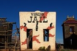
Virgin, Utah
Encyclopedia
Virgin is a town in Washington County
, Utah
, United States
. The population was 394 at the 2000 census. It is located along the Virgin River
(for which it is named), not far from Zion National Park
. The elevation is 3606 feet (1,099.1 m). It lies on the route of State Route 9
.
According to the United States Census Bureau
, the town has a total area of 11.9 square miles (30.9 km²), all of it land.
of 2000, there were 394 people, 146 households, and 102 families residing in the town. The population density
was 33.1 people per square mile (12.8/km²). There were 170 housing units at an average density of 14.3 per square mile (5.5/km²). The racial makeup of the town was 96.45% White, 0.51% Native American, 1.27% Pacific Islander, and 1.78% from two or more races. Hispanic or Latino of any race were 1.27% of the population.
There were 146 households out of which 30.8% had children under the age of 18 living with them, 58.2% were married couples
living together, 8.2% had a female householder with no husband present, and 30.1% were non-families. 24.0% of all households were made up of individuals and 7.5% had someone living alone who was 65 years of age or older. The average household size was 2.70 and the average family size was 3.23.
In the town the population was spread out with 26.1% under the age of 18, 11.4% from 18 to 24, 25.1% from 25 to 44, 23.4% from 45 to 64, and 14.0% who were 65 years of age or older. The median age was 37 years. For every 100 females there were 114.1 males. For every 100 females age 18 and over, there were 109.4 males.
The median income for a household in the town was $36,953, and the median income for a family was $37,500. Males had a median income of $32,625 versus $19,500 for females. The per capita income
for the town was $14,797. About 9.3% of families and 9.0% of the population were below the poverty line, including 7.4% of those under age 18 and none of those age 65 or over.
. This was highlighted in Michael Moore
's 2002 film Bowling for Columbine
.
Washington County, Utah
As of the census of 2000, there were 90,354 people, 29,939 households, and 23,442 families residing in the county. The population density was 37 people per square mile . There were 36,478 housing units at an average density of 15 per square mile...
, Utah
Utah
Utah is a state in the Western United States. It was the 45th state to join the Union, on January 4, 1896. Approximately 80% of Utah's 2,763,885 people live along the Wasatch Front, centering on Salt Lake City. This leaves vast expanses of the state nearly uninhabited, making the population the...
, United States
United States
The United States of America is a federal constitutional republic comprising fifty states and a federal district...
. The population was 394 at the 2000 census. It is located along the Virgin River
Virgin River
The Virgin River is a tributary of the Colorado River in the U.S. states of Utah, Nevada, and Arizona. The river is about long. It was designated Utah's first wild and scenic river in 2009, during the centennial celebration of Zion National Park.-Course:...
(for which it is named), not far from Zion National Park
Zion National Park
Zion National Park is located in the Southwestern United States, near Springdale, Utah. A prominent feature of the park is Zion Canyon, which is 15 miles long and up to half a mile deep, cut through the reddish and tan-colored Navajo Sandstone by the North Fork of the Virgin River...
. The elevation is 3606 feet (1,099.1 m). It lies on the route of State Route 9
State Route 9 (Utah)
State Route 9 is a state highway in southern Utah, serving Zion National Park. It starts at the western terminus at exit 16 on I-15. It passes through Zion National Park, ending at the eastern junction with US-89. The entire length of the highway has been designated the Zion Park Scenic Byway...
.
Geography
Virgin is located at 37°12′6"N 113°11′23"W (37.201620, -113.189617).According to the United States Census Bureau
United States Census Bureau
The United States Census Bureau is the government agency that is responsible for the United States Census. It also gathers other national demographic and economic data...
, the town has a total area of 11.9 square miles (30.9 km²), all of it land.
Demographics
As of the censusCensus
A census is the procedure of systematically acquiring and recording information about the members of a given population. It is a regularly occurring and official count of a particular population. The term is used mostly in connection with national population and housing censuses; other common...
of 2000, there were 394 people, 146 households, and 102 families residing in the town. The population density
Population density
Population density is a measurement of population per unit area or unit volume. It is frequently applied to living organisms, and particularly to humans...
was 33.1 people per square mile (12.8/km²). There were 170 housing units at an average density of 14.3 per square mile (5.5/km²). The racial makeup of the town was 96.45% White, 0.51% Native American, 1.27% Pacific Islander, and 1.78% from two or more races. Hispanic or Latino of any race were 1.27% of the population.
There were 146 households out of which 30.8% had children under the age of 18 living with them, 58.2% were married couples
Marriage
Marriage is a social union or legal contract between people that creates kinship. It is an institution in which interpersonal relationships, usually intimate and sexual, are acknowledged in a variety of ways, depending on the culture or subculture in which it is found...
living together, 8.2% had a female householder with no husband present, and 30.1% were non-families. 24.0% of all households were made up of individuals and 7.5% had someone living alone who was 65 years of age or older. The average household size was 2.70 and the average family size was 3.23.
In the town the population was spread out with 26.1% under the age of 18, 11.4% from 18 to 24, 25.1% from 25 to 44, 23.4% from 45 to 64, and 14.0% who were 65 years of age or older. The median age was 37 years. For every 100 females there were 114.1 males. For every 100 females age 18 and over, there were 109.4 males.
The median income for a household in the town was $36,953, and the median income for a family was $37,500. Males had a median income of $32,625 versus $19,500 for females. The per capita income
Per capita income
Per capita income or income per person is a measure of mean income within an economic aggregate, such as a country or city. It is calculated by taking a measure of all sources of income in the aggregate and dividing it by the total population...
for the town was $14,797. About 9.3% of families and 9.0% of the population were below the poverty line, including 7.4% of those under age 18 and none of those age 65 or over.
Mandatory gun ownership
In May 2000, a law was passed which required every homeowner to keep and maintain a firearmFirearm
A firearm is a weapon that launches one, or many, projectile at high velocity through confined burning of a propellant. This subsonic burning process is technically known as deflagration, as opposed to supersonic combustion known as a detonation. In older firearms, the propellant was typically...
. This was highlighted in Michael Moore
Michael Moore
Michael Francis Moore is an American filmmaker, author, social critic and activist. He is the director and producer of Fahrenheit 9/11, which is the highest-grossing documentary of all time. His films Bowling for Columbine and Sicko also place in the top ten highest-grossing documentaries...
's 2002 film Bowling for Columbine
Bowling for Columbine
Bowling for Columbine is a 2002 documentary film written, directed, produced, and narrated by Michael Moore. The film explores what Michael Moore suggests are the causes for the Columbine High School massacre and other acts of violence with guns...
.