

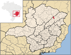
Virgem da Lapa
Encyclopedia
Minas Gerais
Minas Gerais is one of the 26 states of Brazil, of which it is the second most populous, the third richest, and the fourth largest in area. Minas Gerais is the Brazilian state with the largest number of Presidents of Brazil, the current one, Dilma Rousseff, being one of them. The capital is the...
. Its population as of 2007 was estimated to be 14,103 people living in a total area of 871 km² (336 sq mi). The city belongs to the mesoregion of Jequitinhonha and to the microregion of Araçuaí
Araçuaí
Araçuaí is a Brazilian municipality located in the northeast of the state of Minas Gerais in the Jequitinhonha River valley. The Araçuaí River, a tribuatary of the Jequitinhonha, flows through it.. Its population as of 2007 was estimated to be 36,083 people living in a total area of 2,235 km²....
. It became a municipality in 1948.
Virgem da Lapa is located just on the left bank (north) of the Jequitinhonha River
Jequitinhonha River
thumb|Source of the river in [[Serro]]|rightThe Jequitinhonha River is a river that flows mainly through the Brazilian state of Minas Gerais. Its source lies near Diamantina in the Serra do Espinhaço at an elevation of 1,200 m, after which it flows northward and then east-northeastward across the...
at an elevation of 385 meters (center of the town). The climate is semi-arid and the region suffers from periodic drought.
The economy is based on cattle raising, services, and subsistence agriculture, with the main crops being rice, beans, manioc, sugarcane, and corn. The cattle herd had 14,000 head in 2006. In 2005 there were 1858 rural producers but only 14 tractors among them. 6,200 persons were dependent on agriculture--almost half of the population. As of 2005 there were 5 health clinics and 1 public hospital with 42 beds. Educational needs were met by 24 primary schools, 2 middle schools and 3 nursery schools. There were 492 automobiles in 2006, giving a ratio of 29 inhabitants per automobile (there were 675 motorcycles). There was 1 bank in 2007.
Neighboring municipalities are: Rubelita
Rubelita
Rubelita is a municipality in the northeast of the Brazilian state of Minas Gerais. Its population in 2007 was 8,299 inhabitants in a total area of 1,109 km²....
- Coronel Murta
Coronel Murta
Coronel Murta is a Brazilian municipality located in the northeast of the state of Minas Gerais. Its population as of 2007 was estimated to be 9,120 people living in a total area of 813 km². The city belongs to the mesoregion of Jequitinhonha and to the microregion of Araçuaí...
- Araçuaí
Araçuaí
Araçuaí is a Brazilian municipality located in the northeast of the state of Minas Gerais in the Jequitinhonha River valley. The Araçuaí River, a tribuatary of the Jequitinhonha, flows through it.. Its population as of 2007 was estimated to be 36,083 people living in a total area of 2,235 km²....
- Berilo
Berilo
Berilo is a municipality in the northeast of the Brazilian state of Minas Gerais. As of 2007 the population was 13,214 in a total area of 586 km². The elevation is 401 meters. It is part of the IBGE statistical meso-region of Jequitinhonha and the micro-region of Capelinha...
- José Gonçalves de Minas
José Gonçalves de Minas
José Gonçalves de Minas is a municipality in the northeast of the Brazilian state of Minas Gerais. As of 2007 the population was 4,547 in a total area of 382 km². The elevation of the town center is 546 meters. It is part of the IBGE statistical meso-region of Jequitinhonha and the...
- Josenópolis
Josenópolis
Josenópolis is a Brazilian municipality located in the north of the state of Minas Gerais. In 2007 the population was 4,440 in a total area of 536 km². It became a municipality in 1997.-Location and Distances:...
. The distance to Belo Horizonte
Belo Horizonte
Belo Horizonte is the capital of and largest city in the state of Minas Gerais, located in the southeastern region of Brazil. It is the third largest metropolitan area in the country...
is 716 km (445 mi). The distance to the nearest major population center, Araçuaí
Araçuaí
Araçuaí is a Brazilian municipality located in the northeast of the state of Minas Gerais in the Jequitinhonha River valley. The Araçuaí River, a tribuatary of the Jequitinhonha, flows through it.. Its population as of 2007 was estimated to be 36,083 people living in a total area of 2,235 km²....
is 38 km (24 mi).
Social Indicators
Virgem da Lapa is ranked low on the MHDI and was one of the poorest municipalities in the state and in the country in 2000.
- MHDI: .664 (2000)
- State ranking: 696 out of 853 municipalities
- National ranking: 3,549 out of 5,138 municipalities in 2000
- Life expectancy: 67
- Literacy rate: 72
- Combined primary, secondary and tertiary gross enrolment ratio: .740
- Per capita income (monthly): R$107.00
The above figures can be compared with those of Poços de Caldas
Poços de Caldas
Poços de Caldas is a city and municipality in south-western Minas Gerais state, Brazil, in the microregion of the same name. Its estimated population in 2009 was 151,449 inhabitants...
, which had an MHDI of .841, the highest in the state of Minas Gerais
Minas Gerais
Minas Gerais is one of the 26 states of Brazil, of which it is the second most populous, the third richest, and the fourth largest in area. Minas Gerais is the Brazilian state with the largest number of Presidents of Brazil, the current one, Dilma Rousseff, being one of them. The capital is the...
. The highest in the country was São Caetano do Sul
São Caetano do Sul
São Caetano do Sul is a city in São Paulo state in Brazil, located in the Greater São Paulo Metropolitan Area. It is the city with the highest per capita income in Brazil and it also has the highest Human Development Index .-Geography:São Caetano do Sul is located on a plateau that is part of the...
in the state of São Paulo
São Paulo
São Paulo is the largest city in Brazil, the largest city in the southern hemisphere and South America, and the world's seventh largest city by population. The metropolis is anchor to the São Paulo metropolitan area, ranked as the second-most populous metropolitan area in the Americas and among...
with an MHDI of .919. The lowest was Manari in the state of Pernambuco
Pernambuco
Pernambuco is a state of Brazil, located in the Northeast region of the country. To the north are the states of Paraíba and Ceará, to the west is Piauí, to the south are Alagoas and Bahia, and to the east is the Atlantic Ocean. There are about of beaches, some of the most beautiful in the...
with an MHDI of .467 out of a total of 5504 municipalities in the country as of 2004. At last count Brazil had 5,561 municipalities so this might have changed at the time of this writing.
See also
- List of municipalities in Minas Gerais