

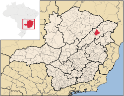
Araçuaí
Encyclopedia
Minas Gerais
Minas Gerais is one of the 26 states of Brazil, of which it is the second most populous, the third richest, and the fourth largest in area. Minas Gerais is the Brazilian state with the largest number of Presidents of Brazil, the current one, Dilma Rousseff, being one of them. The capital is the...
in the Jequitinhonha River
Jequitinhonha River
thumb|Source of the river in [[Serro]]|rightThe Jequitinhonha River is a river that flows mainly through the Brazilian state of Minas Gerais. Its source lies near Diamantina in the Serra do Espinhaço at an elevation of 1,200 m, after which it flows northward and then east-northeastward across the...
valley. The Araçuaí River
Araçuaí River
The Araçuaí River is a river of Minas Gerais state in southeastern Brazil. The Araçuaí River flows through the Jequitinhonha Valley in the northeast of Minas Gerais, through the town of Araçuaí, which the river takes its name from. It is a tributary of the Jequitinhonha River, flowing south from...
, a tribuatary of the Jequitinhonha, flows through it.. Its population as of 2007 was estimated to be 36,083 people living in a total area of 2,235 km². The city belongs to the mesoregion of Jequitinhonha and to the microregion of Araçuaí. The city is the seat of the Roman Catholic Diocese of Araçuaí
Roman Catholic Diocese of Araçuaí
The Roman Catholic Diocese of Araçuaí is a diocese located in the city of Araçuaí in the Ecclesiastical province of Diamantina in Brazil.-Leadership:* Bishops of Araçuaí...
. The elevation of the municipal seat is 307 meters. It became a municipality in 1870.
Araçuaí Micro-region
Araçuaí is a statistical micro-region with 08 municipalities: Araçuaí, CaraíCaraí
Caraí is a Brazilian municipality located in the northeast of the state of Minas Gerais. Its population as of 2007 was estimated to be 21,530 people living in a total area of 1,240 km². The city belongs to the mesoregion of Jequitinhonha and to the microregion of Araçuaí. The elevation of the...
, Coronel Murta
Coronel Murta
Coronel Murta is a Brazilian municipality located in the northeast of the state of Minas Gerais. Its population as of 2007 was estimated to be 9,120 people living in a total area of 813 km². The city belongs to the mesoregion of Jequitinhonha and to the microregion of Araçuaí...
, Itinga
Itinga
Itinga is a Brazilian municipality located in the northeast of the state of Minas Gerais. As of 2007 the population was 14,587 in a total area of 1,641 km²....
, Novo Cruzeiro
Novo Cruzeiro
Novo Cruzeiro is a Brazilian municipality located in the northeast of the state of Minas Gerais. Its population as of 2007 was estimated to be 30,331 people living in a total area of 1,701 km². The city belongs to the mesoregion of Jequitinhonha and to the microregion of Araçuaí. The...
, Padre Paraíso
Padre Paraíso
Padre Paraíso is a Brazilian municipality located in the northeast of the state of Minas Gerais. Its population as of 2007 was estimated to be 18,120 people living in a total area of 543 km². The city belongs to the mesoregion of Jequitinhonha and to the microregion of Araçuaí...
, Ponto dos Volantes
Ponto dos Volantes
Ponto dos Volantes is a Brazilian municipality located in the northeast of the state of Minas Gerais. The city belongs to the mesoregion of Jequitinhonha and to the microregion of Araçuaí. As of 2007 the population was 10,976 in an area of 1,215 km². The elevation is 400 meters. It became a...
and Virgem da Lapa
Virgem da Lapa
Virgem da Lapa is a Brazilian municipality located in the northeast of the state of Minas Gerais. Its population as of 2007 was estimated to be 14,103 people living in a total area of . The city belongs to the mesoregion of Jequitinhonha and to the microregion of Araçuaí...
. In 2000 the population was 145,679 inhabitants in an area of 10,299.30 km². The population density was 14.14 inhab/km² (2000).
The economy is based on cattle raising (31,000 head), services, and subsistence agriculture, with the main crops being mangoes rice, beans, sugarcane, and corn. In 2005 there were 2558 rural producers but only 28 tractors. 7,600 persons were dependent on agriculture. As of 2005 there were 19 public and 6 private health clinics, with 7 carrying out diagnosis and complete therapy. There was one private hospital with 96 beds. Educational needs were met by 45 primary schools, 7 middle schools and 7 nursery schools. There were 1375 automobiles in 2006, giving a ratio of 26 inhabitants per automobile (there were 2851 motorcycles). There were 3 banks in 2007.
Neighboring municipalities are: Virgem da Lapa
Virgem da Lapa
Virgem da Lapa is a Brazilian municipality located in the northeast of the state of Minas Gerais. Its population as of 2007 was estimated to be 14,103 people living in a total area of . The city belongs to the mesoregion of Jequitinhonha and to the microregion of Araçuaí...
, Coronel Murta
Coronel Murta
Coronel Murta is a Brazilian municipality located in the northeast of the state of Minas Gerais. Its population as of 2007 was estimated to be 9,120 people living in a total area of 813 km². The city belongs to the mesoregion of Jequitinhonha and to the microregion of Araçuaí...
, Itinga
Itinga
Itinga is a Brazilian municipality located in the northeast of the state of Minas Gerais. As of 2007 the population was 14,587 in a total area of 1,641 km²....
, Ponto dos Volantes
Ponto dos Volantes
Ponto dos Volantes is a Brazilian municipality located in the northeast of the state of Minas Gerais. The city belongs to the mesoregion of Jequitinhonha and to the microregion of Araçuaí. As of 2007 the population was 10,976 in an area of 1,215 km². The elevation is 400 meters. It became a...
, Padre Paraíso
Padre Paraíso
Padre Paraíso is a Brazilian municipality located in the northeast of the state of Minas Gerais. Its population as of 2007 was estimated to be 18,120 people living in a total area of 543 km². The city belongs to the mesoregion of Jequitinhonha and to the microregion of Araçuaí...
, Carai
Caraí
Caraí is a Brazilian municipality located in the northeast of the state of Minas Gerais. Its population as of 2007 was estimated to be 21,530 people living in a total area of 1,240 km². The city belongs to the mesoregion of Jequitinhonha and to the microregion of Araçuaí. The elevation of the...
and Novo Cruzeiro
Novo Cruzeiro
Novo Cruzeiro is a Brazilian municipality located in the northeast of the state of Minas Gerais. Its population as of 2007 was estimated to be 30,331 people living in a total area of 1,701 km². The city belongs to the mesoregion of Jequitinhonha and to the microregion of Araçuaí. The...
. The distance to Belo Horizonte
Belo Horizonte
Belo Horizonte is the capital of and largest city in the state of Minas Gerais, located in the southeastern region of Brazil. It is the third largest metropolitan area in the country...
is 678 km. The distance to the nearest major population center, Teófilo Otoni
Teófilo Otoni
Téofilo Otoni is a city in northeast Minas Gerais state, Brazil. The population of the municipality was 126,895 in 2007 and the area is 3,253.4 km².-Origin of the name:...
is 210 km.
Social Indicators
Araçuaí is ranked low on the MHDI and was one of the poorest municipalities in the state and in the country in 2000.
- MHDI: .687 (2000)
- State ranking: 602 out of 853 municipalities
- National ranking: 3,208 out of 5,138 municipalities in 2000
- Life expectancy: 67
- Literacy rate: 76
- Combined primary, secondary and tertiary gross enrolment ratio: .760
- Per capita income (monthly): R$131.00
- Degree of urbanization: 57.29
- Percentage of urban residences connected to sewage system: 19.40
- Infant mortality rate: 16.95
The above figures can be compared with those of Poços de Caldas
Poços de Caldas
Poços de Caldas is a city and municipality in south-western Minas Gerais state, Brazil, in the microregion of the same name. Its estimated population in 2009 was 151,449 inhabitants...
, which had an MHDI of .841, the highest in the state of Minas Gerais
Minas Gerais
Minas Gerais is one of the 26 states of Brazil, of which it is the second most populous, the third richest, and the fourth largest in area. Minas Gerais is the Brazilian state with the largest number of Presidents of Brazil, the current one, Dilma Rousseff, being one of them. The capital is the...
. The highest in the country was São Caetano do Sul
São Caetano do Sul
São Caetano do Sul is a city in São Paulo state in Brazil, located in the Greater São Paulo Metropolitan Area. It is the city with the highest per capita income in Brazil and it also has the highest Human Development Index .-Geography:São Caetano do Sul is located on a plateau that is part of the...
in the state of São Paulo
São Paulo
São Paulo is the largest city in Brazil, the largest city in the southern hemisphere and South America, and the world's seventh largest city by population. The metropolis is anchor to the São Paulo metropolitan area, ranked as the second-most populous metropolitan area in the Americas and among...
with an MHDI of .919. The lowest was Manari in the state of Pernambuco
Pernambuco
Pernambuco is a state of Brazil, located in the Northeast region of the country. To the north are the states of Paraíba and Ceará, to the west is Piauí, to the south are Alagoas and Bahia, and to the east is the Atlantic Ocean. There are about of beaches, some of the most beautiful in the...
with an MHDI of .467 out of a total of 5504 municipalities in the country as of 2004. At last count Brazil had 5,561 municipalities so this might have changed at the time of this writing.
See also
- List of municipalities in Minas Gerais