
Vila Propício
Encyclopedia
| Vila Propício | |
|---|---|
| State | Goiás Goiás Goiás is a state of Brazil, located in the central part of the country. The name Goiás comes from the name of an indigenous community... |
| Coordinates: | 15°27′30"S 48°53′07"W |
| Area: | 2,181.5 km² |
| Population: | 5,044 (IBGE 2007) |
| Population density: | 2.31 inhab/km² (2007) |
| Urban population: | 1,434 |
| Elevation: | 744m above sea level |
| Postcode (CEP): | 72990-000 |
| Became a city: | 1997 |
| Mayor: | Teodoro de Araújo Aragão Filho |
| IBGE statistical Microregion: | Entorno de Brasília |
| Distance to Goiânia Goiânia -Climate:The city has a tropical wet and dry climate with an average temperature of . There's a wet season, from October to April, and a dry one, from May to September. Annual rainfall is around 1,520 mm.... : |
215 km. |
| Website: | none |

Town
A town is a human settlement larger than a village but smaller than a city. The size a settlement must be in order to be called a "town" varies considerably in different parts of the world, so that, for example, many American "small towns" seem to British people to be no more than villages, while...
and municipality
Municipality
A municipality is essentially an urban administrative division having corporate status and usually powers of self-government. It can also be used to mean the governing body of a municipality. A municipality is a general-purpose administrative subdivision, as opposed to a special-purpose district...
in central Goiás
Goiás
Goiás is a state of Brazil, located in the central part of the country. The name Goiás comes from the name of an indigenous community...
state, Brazil
Brazil
Brazil , officially the Federative Republic of Brazil , is the largest country in South America. It is the world's fifth largest country, both by geographical area and by population with over 192 million people...
. It is a large producer of sugarcane.
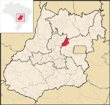
Location
Vila Propício is located in the Entorno de Brasília micro-region and has boundaries with the following municipalities:- north: Barro AltoBarro AltoBarro Alto is a small town and municipality in northern Goiás state, Brazil, famous for its nickel mine and production of rubber. The population was 6,446 in 2007 and the total area of the municipality was 1,231.8 km².-Location:...
- south: PirenópolisPirenópolisPirenópolis is a town located in the Brazilian state of Goiás. It is well known for its waterfalls and colonial architecture, and a popular festival involving mounted horses called Festa do Divino Espírito Santo which takes place 45 days after Easter....
and Cocalzinho de GoiásCocalzinho de GoiásCocalzinho de Goiás is a small town and municipality in central Goiás state, Brazil.-Location and Geography:Cocalzinho, as it is known by the inhabitants, is located in the micro-region of Entorno de Brasília, on highway BR-414, almost at the junction with highway BR-070... - west: GoianésiaGoianésiaGoianésia is a municipality in the state of Goiás, Brazil. It is a large producer of sugarcane for production of alcohol used as a source of fuel.-Location:...
and Barro AltoBarro AltoBarro Alto is a small town and municipality in northern Goiás state, Brazil, famous for its nickel mine and production of rubber. The population was 6,446 in 2007 and the total area of the municipality was 1,231.8 km².-Location:... - east: Mimoso de GoiásMimoso de GoiásMimoso de Goiás is a small town and municipality in northeastern Goiás state, Brazil.Mimoso is located in statistical microregion 012, called Entorno de Brasília. It is almost directly north of Brasília and is on an unpaved highway linking Padre Bernardo to Água Fria de Goiás...
and Padre BernardoPadre BernardoPadre Bernardo is a small city and municipality north of the Federal District of Brazil in Goiás state, Brazil.-Location:Padre Bernardo is located 42 km. north of the boundary with the Federal District...
Highway connections are made from Cocalzinho de Goiás
Cocalzinho de Goiás
Cocalzinho de Goiás is a small town and municipality in central Goiás state, Brazil.-Location and Geography:Cocalzinho, as it is known by the inhabitants, is located in the micro-region of Entorno de Brasília, on highway BR-414, almost at the junction with highway BR-070...
and from Goianésia
Goianésia
Goianésia is a municipality in the state of Goiás, Brazil. It is a large producer of sugarcane for production of alcohol used as a source of fuel.-Location:...
, which is 28 kilometers to the west. It is 195 kilometers to Brasília
Brasília
Brasília is the capital city of Brazil. The name is commonly spelled Brasilia in English. The city and its District are located in the Central-West region of the country, along a plateau known as Planalto Central. It has a population of about 2,557,000 as of the 2008 IBGE estimate, making it the...
and 215 kilometers to Goiânia
Goiânia
-Climate:The city has a tropical wet and dry climate with an average temperature of . There's a wet season, from October to April, and a dry one, from May to September. Annual rainfall is around 1,520 mm....
. From Goiânia
Goiânia
-Climate:The city has a tropical wet and dry climate with an average temperature of . There's a wet season, from October to April, and a dry one, from May to September. Annual rainfall is around 1,520 mm....
take GO-080, passing through Nerópolis
Nerópolis
Nerópolis is a small city and municipality in central Goiás state, Brazil.-Location:The municipality is part of the metropolitan region of Goiânia, which is 42 kilometers to the west. It is nationally known as the city of garlic and sweets...
and São Francisco de Goiás
São Francisco de Goiás
São Francisco de Goiás is a small town and municipality in central Goiás state, Brazil.Municipal boundaries:*North: Jaraguá*South: Petrolina de Goiás*East: Pirenópolis*West: Jesúpolis and Jaraguá...
; then BR-153 to Jaraguá; then GO-080 to Goianésia
Goianésia
Goianésia is a municipality in the state of Goiás, Brazil. It is a large producer of sugarcane for production of alcohol used as a source of fuel.-Location:...
; then BR-251 / GO-230. For all distances see Distâncias Rodoviárias
Economy
The economy is based on agriculture (cotton, rice rubber, corn, and soybeans), cattle raising (69,000 head in 2006), small commercial establishments, and public administration.Agricultural data 2006
- Farms: 721
- Total area: 148,612 ha.
- Area of permanent crops: 1,194 ha.
- Area of perennial crops: 11,751 ha.
- Area of pasture: 93,882 ha.
- Area of woodland and forests: 39,430 ha.
Health and Education
In 2007 there were no hospitals. The infant mortality rate (2000) was 21,46, well below the national average of 33.0, well the adult literacy rate was 75.2%, well below the national average of 86.4%, and one of the lowest in the state.- Human Development IndexHuman Development IndexThe Human Development Index is a composite statistic used to rank countries by level of "human development" and separate "very high human development", "high human development", "medium human development", and "low human development" countries...
: 0.674 (2000) - State ranking: 225 (out of 242 municipalities)
- National ranking: 3,385 (out of 5,507 municipalities)
For the complete list see frigoletto.com.br.
Vila Propício first appeared in 1965 as a district of Pirenópolis
Pirenópolis
Pirenópolis is a town located in the Brazilian state of Goiás. It is well known for its waterfalls and colonial architecture, and a popular festival involving mounted horses called Festa do Divino Espírito Santo which takes place 45 days after Easter....
, achieving municipal status in 1995.