
Typhoon Matsa
Encyclopedia
Typhoon Matsa was the second of eight Pacific tropical cyclone
s to make landfall
on China during the 2005 Pacific typhoon season
. The ninth tropical storm and fifth typhoon of the season, Matsa developed on July 30 to the east of the Philippines
. Matsa intensified as it tracked northwestward, and attained peak 10-minute sustained winds of 150 km/h (90 mph) near Taiwan
before weakening and striking the Chinese province of Zhejiang
on August 5. The system continued northward into the Yellow Sea
, and on August 7 Matsa became extratropical
after again moving ashore along the Liaodong Peninsula. Matsa is a Laotian name for a lady fish.
In Taiwan
, Matsa dropped torrential rainfall of up to 1,270 mm (50 in), which caused mudslides and moderate damage across the island. Flooding from the rainfall contaminated some water supplies, leaving around 80,000 homes without water at one point; much of Taoyuan County was without water for at least 5 days. As in Taiwan, the typhoon dropped heavy precipitation in the People's Republic of China, and in combination with strong winds destroyed about 59,000 houses and damaged more than 20000 km² (7,722 sq mi) of croplands. Throughout the country, Matsa caused 25 direct fatalities and $18 billion (2005 CNY, $2.23 billion 2005 USD) in damage.
in late July. The convection gradually consolidated over a weak low-level circulation, and at 0300 UTC on July 30 the system was first mentioned in the Joint Typhoon Warning Center
(JTWC) Significant Tropical Weather Outlook. Located within an area of moderate wind shear
, the system continued to slowly organize, and by 1200 UTC on July 30 it was sufficiently organized for the Japan Meteorological Agency
(JMA) to classify it as a weak tropical depression while located about 65 km (40.4 mi) east of Yap. Shortly thereafter, the JTWC followed suit by issuing a tropical cyclone formation alert
. The depression tracked steadily westward, followed by a turn to the northwest on July 31 under the influence of a mid-level ridge
to its east. It continued to organize, and at 1200 UTC on July 31 it intensified into Tropical Storm Matsa; the depression was unofficially classified a tropical storm six hours earlier by the JTWC. Additionally, the Philippine Atmospheric, Geophysical and Astronomical Services Administration
(PAGASA) named the system Tropical Storm Gorio, due to its location within the administration's area of responsibility.
Tropical Storm Matsa gradually intensified as it tracked steadily northwestward; by late on August 1 it strengthened into a severe tropical storm. Outflow and deep convection to the north remained limited, though the storm was able to intensity further to attain typhoon status on August 2 about 780 km (484.7 mi) south of Okinawa. Intensification slowed, and late on August 3 Matsa reached a peak intensity of 150 km/h (90 mph) while located 495 km (307.6 mi) east of the southern tip of Taiwan
as reported by the JMA; the JTWC and the National Meteorological Center of China reported the typhoon as strengthening further to attain peak winds of 165 km/h (105 mph) on August 4. Shortly after passing over the Japanese island of Ishigaki
, Matsa began to weaken steadily as it approached the coast of China, and made landfall
as a minimal typhoon late on August 5 near Yuhuan
in the southern region of Zhejiang
Province. It crossed the Gulf of Yueqing and 40 minutes after its first landfall it struck Mainland China near Yueqing
. It quickly weakened to a tropical storm, and within hours of moving ashore the JTWC issued its last advisory. Matsa turned to the north, weakening to a tropical depression on August 7 shortly before entering the Yellow Sea
. The weakening depression continued northward, and became an extratropical cyclone
on August 9 after hitting the Liaodong Peninsula.
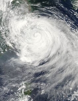
.png) The Taiwan
The Taiwan
Central Weather Bureau warned for the potential for heavy amounts of rainfall across the island. This resulted in officials to close schools and offices in Taipei
. Additionally, the typhoon caused the cancellation or delay of several flights in and out of Taipei, though complete air service was restored by the day after Matsa's passage. The Taiwan Stock Exchange
closed due to the threat of the typhoon.
Prior to the arrival of the typhoon, officials in China ordered the evacuation of about 2.3 million people, mostly in Zhejiang
. The typhoon also resulted in the cancellation or delay of thousands of flights, with the two main airports in Shanghai
closed for 30 hours. Officials near Matsa's projected landfall were advised to lower the levels in reservoirs to mitigate the threat of flooding. In Zhejiang, officials set up shelters for about 35,000 boats to prevent marine damage. Due to the potential for rough seas, officials closed the port at Ningbo
and Shanghai
and also canceled some ferry service. Matsa was predicted to be first typhoon to affect Beijing
in 11 years by dropping heavy amounts of rainfall. Local officials advised water operators to lower water levels to prevent flooding. Up to 100 mm (4 in) of rainfall was forecast for the city, and officials prepared to evacuate 40,000 residents in the outskirts of the city.
, Matsa produced strong winds reaching 144 km/h (89 mph), with gusts of up to 188 km/h (117 mph). The storm dropped heavy rainfall across the island, with precipitation totals reaching up to 1270 mm (50 in) in a 30 hour period; one station located in Taitung County
recorded 843 mm (33.2 in) in one day, which was the highest daily rainfall total in association with the storm. The rainfall led to flooding and mudslides throughout the island. In response to the flooding, residents placed sandbags around houses and office buildings to prevent flood damage. The mudslides blocked roads across the mountainous region, leaving hundreds stranded, and in combination with flooding the mudslides washed away several bridges and damaged some roadways. Strong winds left 56,211 houses without power, most of which were quickly repaired. Typhoon Matsa caused moderate crop damage across the island, which was still recovering from the damage caused by Typhoon Haitang a month before. More than 80,000 homes were left without water due to the passage of the typhoon. Subsequent flooding left more than 630,000 homes without water or receiving water at infrequent intervals. About 368 ha (909 acres) of crop fields were destroyed, and crop damage from Matsa totaled NT$
47 million (2005 TWD, $1.5 million 2005 USD). According to the Taiwan Council of
Agriculture, the banana and pear crops were the worst affected.
Upon making landfall in China, several coastal locations reported winds in excess of 120 km/h (75 mph), with wind gusts peaking at 175 km/h (110 mph). Further inland, winds reached 147 km/h (91 mph) at Shanghai
, the highest wind gust on record in the city. The storm produced heavy amounts of rainfall, reaching a maximum of 701 mm (27.6 in) at a station in Yongjia County
. Extreme amounts of precipitation fell in short durations, including 91 mm (3.6 in) in just 1 hour and 200 mm (7.6 in) in 3 hours at Dinghai District
. Just days after a previous heavy rainfall event, the rainfall from Matsa caused record-breaking river flooding along eight Chinese rivers, including a station at a floodgate on Suzhou Creek
which peaked at 4.55 m (14.93 feet).
In Zhejiang
, where Matsa made landfall, high storm tide
s occurred along the coastline. In some areas, water levels rose quickly, with some coastal homes experiencing flooding from the tide. Rough seas off of Ningbo
capsized a fishing boat, leaving its three occupants missing. About two-thirds of the province reported more than 50 mm (2 in) of rainfall, resulting in flooding in low-lying areas as well as several mudslides, one of which killed two people. The combined effects of the winds and rains destroyed 21 reservoirs and more than 200 km (124.3 mi) of embankment, and damaged several water stations. Matsa damaged 3380 km² (1,305 sq mi) of crops, with around 224 km² (86.5 sq mi) of cropland destroyed from the flooding. About 13,000 houses were destroyed in the province. Throughout Zhejiang, Matsa caused $8.9 billion (2005 CNY, $1.1 billion 2005 USD) in damage and five direct fatalities.
Heavy rainfall in Shanghai
flooded 84 city streets; in some locations insufficient water drainage left homes and apartments flooded, with a total of 20,000 houses reporting flooding. The flooding also closed the city subway system for a few hours. Strong winds downed 2,700 trees and 400 power lines in the city. The typhoon damaged a construction site in the city, leaving three injured and one person killed. Throughout the city an estimated 15,000 houses were destroyed. Additionally, four people were electrocuted as a result of the flooding. In Shanghai alone, damage totaled $1.33 billion (2005 CNY, $164.5 million 2005 USD); seven people died in the city.
Despite the anticipated effects, Beijing
experienced only light rainfall. Throughout China, over 31 million people were affected in over eight provinces. Typhoon Matsa left the agricultural industry severely impacted, with over 20000 km² (7,722 sq mi) damaged. The combination of its winds and flooding damaged around 200,000 buildings, including a total of 59,000 destroyed houses. Damage in the country totaled about $18 billion (2005 CNY, $2.23 billion 2005 USD).
, and produced peak wind gusts of 182 km/h (113 mph) on Ishigaki
. The storm dropped moderate to heavy rainfall across the region, peaking at 318 mm (12.5 in) on Miyako-jima
.
The remnants of Matsa also affected South Korea, with moderate amounts of rainfall reaching 229 mm (9 in) in Masan
.
, large quantities of mud and impurities entered and polluted the Shihmen Reservoir in Taoyuan County, the county's primary source of water. Severe cloudiness occurred in the water, and at one time the reservoir recorded 25,000 nephelometric turbidity units
. Such facilities are unable to operate with mud in the water, and in response, the Taiwan Water Corporation established temporary water stations to alleviate the situation, and the Pingting Water Treatment Plant worked to treat the problem. Furthermore, officials drilled wells to accommodate the shortage. Water supply in the southern portion of Taoyuan County was restored by five days after the storm, with supply restored to the northern portion of the county by ten days after the passage of the typhoon. The same problem had occurred previously after Typhoon Mindulle in July 2004. As a result of the crop damage, the Taiwan Council of Agriculture opened its reserve of frozen vegetables to prevent overharvesting of the existing crops. Despite the measures, crop prices reached record levels, which led to groups calling out for the government to stabilize the price of foods. In reaction, a member of the Council of Agriculture remarked that "vegetable prices [were] expected to go back to normal gradually ... as supplies increase[d]." The passage of the typhoon left hundreds of residents in Hsinchu County
isolated from the outside world for four days. As a result, officials deployed helicopters with rescue supplies and returned with the injured. Aid from one internal organization totaled $NT300,000 (2005 TWD, $9,500 2005 USD). Shortly after the effects of the typhoon ended on the island, work began to repair and rebuild the impacted bridges and roads. Electricians quickly began restoring power across northern Taiwan; by the day after the typhoon's passage, the number of houses without power decreased by 90%.
In the People's Republic of China, members of the People's Liberation Army
assisted in search and rescue operations. Officials called for about 100,000 citizens in Shanghai for work in disaster control and distribution of relief aid, with some providing relief supplies to flooded areas by inflatable rafts. Within a month, Typhoons Talim and Khanun also affected the same area, further compounding the effects of Matsa. During the 38th Session of the World Meteorological Organization
in Hanoi, Vietnam, the name Matsa was retired; during the next session, the name Pakhar was nominated as its replacement.
Tropical cyclone
A tropical cyclone is a storm system characterized by a large low-pressure center and numerous thunderstorms that produce strong winds and heavy rain. Tropical cyclones strengthen when water evaporated from the ocean is released as the saturated air rises, resulting in condensation of water vapor...
s to make landfall
Landfall (meteorology)
Landfall is the event of a tropical cyclone or a waterspout coming onto land after being over water. When a waterspout makes landfall it is reclassified as a tornado, which can then cause damage inland...
on China during the 2005 Pacific typhoon season
2005 Pacific typhoon season
The 2005 Pacific typhoon season had no official bounds; it ran year-round in 2005, but most tropical cyclones tend to form in the northwestern Pacific Ocean between May and November...
. The ninth tropical storm and fifth typhoon of the season, Matsa developed on July 30 to the east of the Philippines
Philippines
The Philippines , officially known as the Republic of the Philippines , is a country in Southeast Asia in the western Pacific Ocean. To its north across the Luzon Strait lies Taiwan. West across the South China Sea sits Vietnam...
. Matsa intensified as it tracked northwestward, and attained peak 10-minute sustained winds of 150 km/h (90 mph) near Taiwan
Taiwan
Taiwan , also known, especially in the past, as Formosa , is the largest island of the same-named island group of East Asia in the western Pacific Ocean and located off the southeastern coast of mainland China. The island forms over 99% of the current territory of the Republic of China following...
before weakening and striking the Chinese province of Zhejiang
Zhejiang
Zhejiang is an eastern coastal province of the People's Republic of China. The word Zhejiang was the old name of the Qiantang River, which passes through Hangzhou, the provincial capital...
on August 5. The system continued northward into the Yellow Sea
Yellow Sea
The Yellow Sea is the name given to the northern part of the East China Sea, which is a marginal sea of the Pacific Ocean. It is located between mainland China and the Korean Peninsula. Its name comes from the sand particles from Gobi Desert sand storms that turn the surface of the water golden...
, and on August 7 Matsa became extratropical
Extratropical cyclone
Extratropical cyclones, sometimes called mid-latitude cyclones or wave cyclones, are a group of cyclones defined as synoptic scale low pressure weather systems that occur in the middle latitudes of the Earth having neither tropical nor polar characteristics, and are connected with fronts and...
after again moving ashore along the Liaodong Peninsula. Matsa is a Laotian name for a lady fish.
In Taiwan
Taiwan
Taiwan , also known, especially in the past, as Formosa , is the largest island of the same-named island group of East Asia in the western Pacific Ocean and located off the southeastern coast of mainland China. The island forms over 99% of the current territory of the Republic of China following...
, Matsa dropped torrential rainfall of up to 1,270 mm (50 in), which caused mudslides and moderate damage across the island. Flooding from the rainfall contaminated some water supplies, leaving around 80,000 homes without water at one point; much of Taoyuan County was without water for at least 5 days. As in Taiwan, the typhoon dropped heavy precipitation in the People's Republic of China, and in combination with strong winds destroyed about 59,000 houses and damaged more than 20000 km² (7,722 sq mi) of croplands. Throughout the country, Matsa caused 25 direct fatalities and $18 billion (2005 CNY, $2.23 billion 2005 USD) in damage.
Meteorological history
The origin of Typhoon Matsa is traced to the formation of an area of convection about 185 km (115 mi) east of YapYap
Yap, also known as Wa'ab by locals, is an island in the Caroline Islands of the western Pacific Ocean. It is a state of the Federated States of Micronesia. Yap's indigenous cultures and traditions are still strong compared to other neighboring islands. The island of Yap actually consists of four...
in late July. The convection gradually consolidated over a weak low-level circulation, and at 0300 UTC on July 30 the system was first mentioned in the Joint Typhoon Warning Center
Joint Typhoon Warning Center
The Joint Typhoon Warning Center is a joint United States Navy – United States Air Force task force located at the Naval Maritime Forecast Center in Pearl Harbor, Hawaii...
(JTWC) Significant Tropical Weather Outlook. Located within an area of moderate wind shear
Wind shear
Wind shear, sometimes referred to as windshear or wind gradient, is a difference in wind speed and direction over a relatively short distance in the atmosphere...
, the system continued to slowly organize, and by 1200 UTC on July 30 it was sufficiently organized for the Japan Meteorological Agency
Japan Meteorological Agency
The or JMA, is the Japanese government's weather service. Charged with gathering and reporting weather data and forecasts in Japan, it is a semi-autonomous part of the Ministry of Land, Infrastructure and Transport...
(JMA) to classify it as a weak tropical depression while located about 65 km (40.4 mi) east of Yap. Shortly thereafter, the JTWC followed suit by issuing a tropical cyclone formation alert
Tropical Cyclone Formation Alert
A Tropical Cyclone Formation Alert is a bulletin released by the U.S. Navy-operated Joint Typhoon Warning Center in Honolulu, Hawaii or the Naval Maritime Forecast Center in Norfolk, Virginia, warning of the possibility of a tropical cyclone forming from a tropical disturbance that has been...
. The depression tracked steadily westward, followed by a turn to the northwest on July 31 under the influence of a mid-level ridge
Ridge (meteorology)
A ridge is an elongated region of relatively high atmospheric pressure, the opposite of a trough....
to its east. It continued to organize, and at 1200 UTC on July 31 it intensified into Tropical Storm Matsa; the depression was unofficially classified a tropical storm six hours earlier by the JTWC. Additionally, the Philippine Atmospheric, Geophysical and Astronomical Services Administration
Philippine Atmospheric, Geophysical and Astronomical Services Administration
The Philippine Atmospheric, Geophysical and Astronomical Services Administration is a Philippine national institution dedicated to provide flood and typhoon warnings, public weather forecasts and advisories, meteorological, astronomical, climatological, and other specialized information and...
(PAGASA) named the system Tropical Storm Gorio, due to its location within the administration's area of responsibility.
Tropical Storm Matsa gradually intensified as it tracked steadily northwestward; by late on August 1 it strengthened into a severe tropical storm. Outflow and deep convection to the north remained limited, though the storm was able to intensity further to attain typhoon status on August 2 about 780 km (484.7 mi) south of Okinawa. Intensification slowed, and late on August 3 Matsa reached a peak intensity of 150 km/h (90 mph) while located 495 km (307.6 mi) east of the southern tip of Taiwan
Taiwan
Taiwan , also known, especially in the past, as Formosa , is the largest island of the same-named island group of East Asia in the western Pacific Ocean and located off the southeastern coast of mainland China. The island forms over 99% of the current territory of the Republic of China following...
as reported by the JMA; the JTWC and the National Meteorological Center of China reported the typhoon as strengthening further to attain peak winds of 165 km/h (105 mph) on August 4. Shortly after passing over the Japanese island of Ishigaki
Ishigaki, Okinawa
Ishigaki is an island west of Okinawa Hontō and the second-largest island of the Yaeyama Island group. It is within the City of Ishigaki in Okinawa Prefecture. The city functions as the business and transport center of the archipelago...
, Matsa began to weaken steadily as it approached the coast of China, and made landfall
Landfall (meteorology)
Landfall is the event of a tropical cyclone or a waterspout coming onto land after being over water. When a waterspout makes landfall it is reclassified as a tornado, which can then cause damage inland...
as a minimal typhoon late on August 5 near Yuhuan
Yuhuan County
Yuhuan County is located in Taizhou, at the midsection along the coast of southeastern Zhejiang Province of China.Yuhuan, with total area of 2279 square kilometers including land area of 378 square kilometers, has a total population of 392,800 containing a permanent population of 93,000 from other...
in the southern region of Zhejiang
Zhejiang
Zhejiang is an eastern coastal province of the People's Republic of China. The word Zhejiang was the old name of the Qiantang River, which passes through Hangzhou, the provincial capital...
Province. It crossed the Gulf of Yueqing and 40 minutes after its first landfall it struck Mainland China near Yueqing
Yueqing
Yueqing , sometimes mis-pronounced and mis-spelled as "Leqing", is a county-level city under the administration of Wenzhou, Zhejiang Province, in eastern China...
. It quickly weakened to a tropical storm, and within hours of moving ashore the JTWC issued its last advisory. Matsa turned to the north, weakening to a tropical depression on August 7 shortly before entering the Yellow Sea
Yellow Sea
The Yellow Sea is the name given to the northern part of the East China Sea, which is a marginal sea of the Pacific Ocean. It is located between mainland China and the Korean Peninsula. Its name comes from the sand particles from Gobi Desert sand storms that turn the surface of the water golden...
. The weakening depression continued northward, and became an extratropical cyclone
Extratropical cyclone
Extratropical cyclones, sometimes called mid-latitude cyclones or wave cyclones, are a group of cyclones defined as synoptic scale low pressure weather systems that occur in the middle latitudes of the Earth having neither tropical nor polar characteristics, and are connected with fronts and...
on August 9 after hitting the Liaodong Peninsula.
Preparations
Taiwan
Taiwan , also known, especially in the past, as Formosa , is the largest island of the same-named island group of East Asia in the western Pacific Ocean and located off the southeastern coast of mainland China. The island forms over 99% of the current territory of the Republic of China following...
Central Weather Bureau warned for the potential for heavy amounts of rainfall across the island. This resulted in officials to close schools and offices in Taipei
Taipei
Taipei City is the capital of the Republic of China and the central city of the largest metropolitan area of Taiwan. Situated at the northern tip of the island, Taipei is located on the Tamsui River, and is about 25 km southwest of Keelung, its port on the Pacific Ocean...
. Additionally, the typhoon caused the cancellation or delay of several flights in and out of Taipei, though complete air service was restored by the day after Matsa's passage. The Taiwan Stock Exchange
Taiwan Stock Exchange
The Taiwan Stock Exchange Corporation is a financial institution, located in Taipei 101, in Taipei, Taiwan. The TSEC was established in 1961 and began operating as a stock exchange on 9 February 1962...
closed due to the threat of the typhoon.
Prior to the arrival of the typhoon, officials in China ordered the evacuation of about 2.3 million people, mostly in Zhejiang
Zhejiang
Zhejiang is an eastern coastal province of the People's Republic of China. The word Zhejiang was the old name of the Qiantang River, which passes through Hangzhou, the provincial capital...
. The typhoon also resulted in the cancellation or delay of thousands of flights, with the two main airports in Shanghai
Shanghai
Shanghai is the largest city by population in China and the largest city proper in the world. It is one of the four province-level municipalities in the People's Republic of China, with a total population of over 23 million as of 2010...
closed for 30 hours. Officials near Matsa's projected landfall were advised to lower the levels in reservoirs to mitigate the threat of flooding. In Zhejiang, officials set up shelters for about 35,000 boats to prevent marine damage. Due to the potential for rough seas, officials closed the port at Ningbo
Ningbo
Ningbo is a seaport city of northeastern Zhejiang province, Eastern China. Holding sub-provincial administrative status, the municipality has a population of 7,605,700 inhabitants at the 2010 census whom 3,089,180 in the built up area made of 6 urban districts. It lies south of the Hangzhou Bay,...
and Shanghai
Shanghai
Shanghai is the largest city by population in China and the largest city proper in the world. It is one of the four province-level municipalities in the People's Republic of China, with a total population of over 23 million as of 2010...
and also canceled some ferry service. Matsa was predicted to be first typhoon to affect Beijing
Beijing
Beijing , also known as Peking , is the capital of the People's Republic of China and one of the most populous cities in the world, with a population of 19,612,368 as of 2010. The city is the country's political, cultural, and educational center, and home to the headquarters for most of China's...
in 11 years by dropping heavy amounts of rainfall. Local officials advised water operators to lower water levels to prevent flooding. Up to 100 mm (4 in) of rainfall was forecast for the city, and officials prepared to evacuate 40,000 residents in the outskirts of the city.
Taiwan
While passing to the north of TaiwanTaiwan
Taiwan , also known, especially in the past, as Formosa , is the largest island of the same-named island group of East Asia in the western Pacific Ocean and located off the southeastern coast of mainland China. The island forms over 99% of the current territory of the Republic of China following...
, Matsa produced strong winds reaching 144 km/h (89 mph), with gusts of up to 188 km/h (117 mph). The storm dropped heavy rainfall across the island, with precipitation totals reaching up to 1270 mm (50 in) in a 30 hour period; one station located in Taitung County
Taitung County
Taitung County is a county in eastern Taiwan. The name means "Eastern Taiwan". Taitung County is also known as 後山 by many of the locals, meaning behind the mountains or the back mountains. Taitung is officially administered as a county of Taiwan, Republic of China.Taitung runs along the south east...
recorded 843 mm (33.2 in) in one day, which was the highest daily rainfall total in association with the storm. The rainfall led to flooding and mudslides throughout the island. In response to the flooding, residents placed sandbags around houses and office buildings to prevent flood damage. The mudslides blocked roads across the mountainous region, leaving hundreds stranded, and in combination with flooding the mudslides washed away several bridges and damaged some roadways. Strong winds left 56,211 houses without power, most of which were quickly repaired. Typhoon Matsa caused moderate crop damage across the island, which was still recovering from the damage caused by Typhoon Haitang a month before. More than 80,000 homes were left without water due to the passage of the typhoon. Subsequent flooding left more than 630,000 homes without water or receiving water at infrequent intervals. About 368 ha (909 acres) of crop fields were destroyed, and crop damage from Matsa totaled NT$
New Taiwan dollar
The New Taiwan dollar , or simply Taiwan dollar, is the official currency of the Taiwan Area of the Republic of China since 1949, when it replaced the Old Taiwan dollar...
47 million (2005 TWD, $1.5 million 2005 USD). According to the Taiwan Council of
Agriculture, the banana and pear crops were the worst affected.
China
| Region | Deaths | Damage (2005 CNY) |
Damage (2005 USD United States dollar The United States dollar , also referred to as the American dollar, is the official currency of the United States of America. It is divided into 100 smaller units called cents or pennies.... ) |
|---|---|---|---|
| Zhejiang Zhejiang Zhejiang is an eastern coastal province of the People's Republic of China. The word Zhejiang was the old name of the Qiantang River, which passes through Hangzhou, the provincial capital... |
5 | $8.9 billion | $1.1 billion |
| Shanghai Shanghai Shanghai is the largest city by population in China and the largest city proper in the world. It is one of the four province-level municipalities in the People's Republic of China, with a total population of over 23 million as of 2010... |
7 | $1.3 billion | $165 million |
| Jiangsu Jiangsu ' is a province of the People's Republic of China, located along the east coast of the country. The name comes from jiang, short for the city of Jiangning , and su, for the city of Suzhou. The abbreviation for this province is "苏" , the second character of its name... |
8 | $3.4 billion | $420 million |
| Anhui Anhui Anhui is a province in the People's Republic of China. Located in eastern China across the basins of the Yangtze River and the Huai River, it borders Jiangsu to the east, Zhejiang to the southeast, Jiangxi to the south, Hubei to the southwest, Henan to the northwest, and Shandong for a tiny... |
2 | $660 million | $81 million |
| Shandong Shandong ' is a Province located on the eastern coast of the People's Republic of China. Shandong has played a major role in Chinese history from the beginning of Chinese civilization along the lower reaches of the Yellow River and served as a pivotal cultural and religious site for Taoism, Chinese... |
0 | $2.9 billion | $358 million |
| Liaoning Liaoning ' is a province of the People's Republic of China, located in the northeast of the country. Its one-character abbreviation is "辽" , a name taken from the Liao River that flows through the province. "Níng" means "peace"... |
3 | $600 million | $74 million |
| Hebei Hebei ' is a province of the People's Republic of China in the North China region. Its one-character abbreviation is "" , named after Ji Province, a Han Dynasty province that included what is now southern Hebei... |
0 | $170 million | $21 million |
| Total | 25 | $18 billion | $2.23 billion |
Upon making landfall in China, several coastal locations reported winds in excess of 120 km/h (75 mph), with wind gusts peaking at 175 km/h (110 mph). Further inland, winds reached 147 km/h (91 mph) at Shanghai
Shanghai
Shanghai is the largest city by population in China and the largest city proper in the world. It is one of the four province-level municipalities in the People's Republic of China, with a total population of over 23 million as of 2010...
, the highest wind gust on record in the city. The storm produced heavy amounts of rainfall, reaching a maximum of 701 mm (27.6 in) at a station in Yongjia County
Yongjia County
Yongjia County is a county in the southeast of Zhejiang province, People's Republic of China, located north of the city proper of Wenzhou, which administers the county. The Nanxi River Scenic Area is located within this county, and the river has been nominated on the tentative list of UNESCO...
. Extreme amounts of precipitation fell in short durations, including 91 mm (3.6 in) in just 1 hour and 200 mm (7.6 in) in 3 hours at Dinghai District
Dinghai District
Dinghai is a district of Zhoushan City made of 128 islands in Zhejiang province, China. It is based on the larger northwestern half of Zhoushan Island, where it borders Putuo in the east. The district boundary meets that of Daishan County entirely on sea to the north...
. Just days after a previous heavy rainfall event, the rainfall from Matsa caused record-breaking river flooding along eight Chinese rivers, including a station at a floodgate on Suzhou Creek
Suzhou Creek
Suzhou Creek is a river in China that passes through the Shanghai city centre. It is named after Suzhou, a city in neighbouring Jiangsu province which was the predominant city in this area prior to the rise of Shanghai as a metropolis.One of the principal outlets of Lake Tai, Suzhou Creek has a...
which peaked at 4.55 m (14.93 feet).
In Zhejiang
Zhejiang
Zhejiang is an eastern coastal province of the People's Republic of China. The word Zhejiang was the old name of the Qiantang River, which passes through Hangzhou, the provincial capital...
, where Matsa made landfall, high storm tide
Storm tide
A storm tide is a tide with a high flood period caused by a storm. Storm tides can be a severe danger to the coast and the people living along the coast. The water level can rise to more than 5 meters above the normal tide....
s occurred along the coastline. In some areas, water levels rose quickly, with some coastal homes experiencing flooding from the tide. Rough seas off of Ningbo
Ningbo
Ningbo is a seaport city of northeastern Zhejiang province, Eastern China. Holding sub-provincial administrative status, the municipality has a population of 7,605,700 inhabitants at the 2010 census whom 3,089,180 in the built up area made of 6 urban districts. It lies south of the Hangzhou Bay,...
capsized a fishing boat, leaving its three occupants missing. About two-thirds of the province reported more than 50 mm (2 in) of rainfall, resulting in flooding in low-lying areas as well as several mudslides, one of which killed two people. The combined effects of the winds and rains destroyed 21 reservoirs and more than 200 km (124.3 mi) of embankment, and damaged several water stations. Matsa damaged 3380 km² (1,305 sq mi) of crops, with around 224 km² (86.5 sq mi) of cropland destroyed from the flooding. About 13,000 houses were destroyed in the province. Throughout Zhejiang, Matsa caused $8.9 billion (2005 CNY, $1.1 billion 2005 USD) in damage and five direct fatalities.
Heavy rainfall in Shanghai
Shanghai
Shanghai is the largest city by population in China and the largest city proper in the world. It is one of the four province-level municipalities in the People's Republic of China, with a total population of over 23 million as of 2010...
flooded 84 city streets; in some locations insufficient water drainage left homes and apartments flooded, with a total of 20,000 houses reporting flooding. The flooding also closed the city subway system for a few hours. Strong winds downed 2,700 trees and 400 power lines in the city. The typhoon damaged a construction site in the city, leaving three injured and one person killed. Throughout the city an estimated 15,000 houses were destroyed. Additionally, four people were electrocuted as a result of the flooding. In Shanghai alone, damage totaled $1.33 billion (2005 CNY, $164.5 million 2005 USD); seven people died in the city.
Despite the anticipated effects, Beijing
Beijing
Beijing , also known as Peking , is the capital of the People's Republic of China and one of the most populous cities in the world, with a population of 19,612,368 as of 2010. The city is the country's political, cultural, and educational center, and home to the headquarters for most of China's...
experienced only light rainfall. Throughout China, over 31 million people were affected in over eight provinces. Typhoon Matsa left the agricultural industry severely impacted, with over 20000 km² (7,722 sq mi) damaged. The combination of its winds and flooding damaged around 200,000 buildings, including a total of 59,000 destroyed houses. Damage in the country totaled about $18 billion (2005 CNY, $2.23 billion 2005 USD).
Okinawa and South Korea
Typhoon Matsa affected the southernmost Ryukyu IslandsRyukyu Islands
The , also known as the , is a chain of islands in the western Pacific, on the eastern limit of the East China Sea and to the southwest of the island of Kyushu in Japan. From about 1829 until the mid 20th century, they were alternately called Luchu, Loochoo, or Lewchew, akin to the Mandarin...
, and produced peak wind gusts of 182 km/h (113 mph) on Ishigaki
Ishigaki, Okinawa
Ishigaki is an island west of Okinawa Hontō and the second-largest island of the Yaeyama Island group. It is within the City of Ishigaki in Okinawa Prefecture. The city functions as the business and transport center of the archipelago...
. The storm dropped moderate to heavy rainfall across the region, peaking at 318 mm (12.5 in) on Miyako-jima
Miyako-jima
Miyakojima is the largest and the most populous island among the Miyako Islands of Okinawa Prefecture, Japan. It lies approximately 400 kilometres east of Taipei, Taiwan...
.
The remnants of Matsa also affected South Korea, with moderate amounts of rainfall reaching 229 mm (9 in) in Masan
Masan
Masan was a formerly a municipal city in South Gyeongsang Province, South Korea. The city was situated on Masan Bay , approximately 35 km west of Busan. It was known for its textile industry, and it was the site of Hite Brewery's production facilities.During the control of the Mongolians, the...
.
Aftermath
Subsequent to the passage of the typhoon in TaiwanTaiwan
Taiwan , also known, especially in the past, as Formosa , is the largest island of the same-named island group of East Asia in the western Pacific Ocean and located off the southeastern coast of mainland China. The island forms over 99% of the current territory of the Republic of China following...
, large quantities of mud and impurities entered and polluted the Shihmen Reservoir in Taoyuan County, the county's primary source of water. Severe cloudiness occurred in the water, and at one time the reservoir recorded 25,000 nephelometric turbidity units
Turbidity
Turbidity is the cloudiness or haziness of a fluid caused by individual particles that are generally invisible to the naked eye, similar to smoke in air. The measurement of turbidity is a key test of water quality....
. Such facilities are unable to operate with mud in the water, and in response, the Taiwan Water Corporation established temporary water stations to alleviate the situation, and the Pingting Water Treatment Plant worked to treat the problem. Furthermore, officials drilled wells to accommodate the shortage. Water supply in the southern portion of Taoyuan County was restored by five days after the storm, with supply restored to the northern portion of the county by ten days after the passage of the typhoon. The same problem had occurred previously after Typhoon Mindulle in July 2004. As a result of the crop damage, the Taiwan Council of Agriculture opened its reserve of frozen vegetables to prevent overharvesting of the existing crops. Despite the measures, crop prices reached record levels, which led to groups calling out for the government to stabilize the price of foods. In reaction, a member of the Council of Agriculture remarked that "vegetable prices [were] expected to go back to normal gradually ... as supplies increase[d]." The passage of the typhoon left hundreds of residents in Hsinchu County
Hsinchu County
Hsinchu County is a county in north-western Taiwan. The population of the county is mainly Hakka; there is a Taiwanese aboriginal minority in the southeastern part of the county. Zhubei is the capital of Hsinchu, where the government office and county office is located...
isolated from the outside world for four days. As a result, officials deployed helicopters with rescue supplies and returned with the injured. Aid from one internal organization totaled $NT300,000 (2005 TWD, $9,500 2005 USD). Shortly after the effects of the typhoon ended on the island, work began to repair and rebuild the impacted bridges and roads. Electricians quickly began restoring power across northern Taiwan; by the day after the typhoon's passage, the number of houses without power decreased by 90%.
In the People's Republic of China, members of the People's Liberation Army
People's Liberation Army
The People's Liberation Army is the unified military organization of all land, sea, strategic missile and air forces of the People's Republic of China. The PLA was established on August 1, 1927 — celebrated annually as "PLA Day" — as the military arm of the Communist Party of China...
assisted in search and rescue operations. Officials called for about 100,000 citizens in Shanghai for work in disaster control and distribution of relief aid, with some providing relief supplies to flooded areas by inflatable rafts. Within a month, Typhoons Talim and Khanun also affected the same area, further compounding the effects of Matsa. During the 38th Session of the World Meteorological Organization
World Meteorological Organization
The World Meteorological Organization is an intergovernmental organization with a membership of 189 Member States and Territories. It originated from the International Meteorological Organization , which was founded in 1873...
in Hanoi, Vietnam, the name Matsa was retired; during the next session, the name Pakhar was nominated as its replacement.
See also
- List of notable tropical cyclones
- Timeline of the 2005 Pacific typhoon seasonTimeline of the 2005 Pacific typhoon seasonThe 2005 Pacific typhoon season has no official bounds; it runs year-round in 2005, but most tropical cyclones tend to form in the northwestern Pacific Ocean between June and December...