
.gif)
Typhoon Aere (2004)
Encyclopedia
Typhoon Aere was a mid-season category two typhoon that brought severe damage to Taiwan
and the People's Republic of China
. Aere is the Marshallese
word for 'storm'.
Aere subsequently crossed into the Philippine Area of Responsibility
, and was assigned the name Marce. Tropical Storm Aere was upgraded to typhoon intensity on August 21, and its strength leveled off during August 21 and August 22. On August 23, the typhoon was briefly downgraded to a tropical storm due to vertical wind shear while located 200 miles south of Naha, Okinawa. Aere quickly regained typhoon status and maintained its intensity for the rest of August 23 and developed a 50-mile wide eye. The tropical cyclone reached its peak intensity of 85 kts (100 mph) late on August 24, when the pressure lowered to 955 mb.
 As the storm crossed the northern tip of Taiwan, it began to weaken. Typhoon Aere turned west-southwestward on the August 25 and made its closest approach to Taipei, Taiwan, passing only 30 miles to the city's north. Aere turned southwestward later that day, a trajectory that carried the storm past Xiamen
early the next day and close to Shantou
later that day before weakening to tropical storm intensity. The remnants of Typhoon Aere remained a tropical depression until the August 31.
ordered work to stop at all construction sites and schools and universities when the city was under their first Black Typhoon Signal
in history. A Black Typhoon Signal, the most severe of their five grades, indicates that a tropical cyclone is affecting the district or is to affect the district within the next 12 hours with sustained wind of hurricane strength. The evacuation of 930,000 people from low-lying and coastal areas in China helped keep their death toll at zero.
, Matala in Miaoli County reported a significant 1,546 mm of rain between the 23rd and 25th. Early on September 25, six villages located in Gaoqiao Town, Yinzhou District, Ningbo City
, were struck by a tornado triggered by Typhoon Aere. The tornado did cause some economic losses, but no casualties were reported.
Preliminary statistics indicated that the typhoon had caused 2.485 billion yuan of direct economic losses and was responsible for two deaths in Fujian province. Aere also affected 3,479,900 residents in 421 towns of 48 counties of 6 cities in Fujian, where three cities were flooded, 10,100 houses were toppled, 236 embankments and thousands of water conservancy facilities were damaged.
News sources to date indicate that Taiwan took the brunt of Typhoon Aere. Thirty-four people were killed as a result of the storm, and fifteen died as a mudslide buried a remote mountain village in the north of the island. Agricultural losses were estimated at 7.7 million New Taiwan dollars (US$313,000 in 2004, US$321,451 in 2005). Forty-three deaths in the Philippines were caused by heavy rains induced by the typhoon. Nearly 16,000 people were evacuated from homes engulfed in floodwaters. A swollen river near the northern province of Nueva Ecija blocked traffic on a main road and stranded hundreds of commuters overnight. Eight provinces in northern and central Luzon were most severely affected with 70% of the provinces under water at one point.
Observations over land with Aere were numerous. In the Ryūkyū Islands
, the lowest pressure observed was 960.9 mbar (hPa) at Ishigakijima, which received 314.5 mm of rainfall between the 23rd and 25th. Ishigakijima, Okinawa, spent as long as eight hours within Aere's eye, which was about 110 kilometres (68.4 mi) in diameter at the time. In China, the typhoon made four landfalls; one being in the mainland of Fujian Province, and two others were when passed over at least two of the Fujian islands, including Pingtan Dao (Fuzhou City) and Nanri Dao (Putian City). Fuding
(located in Ningde City) reported the highest amount in Fujian province with 663 mm. Xiyang and Nanri received the highest wind gusts, with east-northeast winds of 98 mph (43.8 m/s) on the August 25 and northwest winds of 98 mph (43.8 m/s) early in the morning of the 25th. Lanyu, Taiwan, reported a wind gust from the west-southwest at 99 mph (44.1 m/s) on August 24.
Taiwan
Taiwan , also known, especially in the past, as Formosa , is the largest island of the same-named island group of East Asia in the western Pacific Ocean and located off the southeastern coast of mainland China. The island forms over 99% of the current territory of the Republic of China following...
and the People's Republic of China
People's Republic of China
China , officially the People's Republic of China , is the most populous country in the world, with over 1.3 billion citizens. Located in East Asia, the country covers approximately 9.6 million square kilometres...
. Aere is the Marshallese
Marshallese language
The Marshallese language is a Malayo-Polynesian language of the Marshall Islands, and the principal language of the country...
word for 'storm'.
Meteorological history
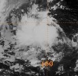
An area of convection developed approximately 250 miles east of Pohnpei late on August 13. By August 16, the disturbance had passed 40 miles north of Chuuk. It developed enough organization to be designated a tropical depression on August 19, about 400 miles west of Guam. From there, it moved northwest at 12 mph along the southwestern periphery of a mid-level steering ridge. The system reached tropical storm status on August 20, gaining the name Aere. http://earthobservatory.nasa.gov/IOTD/view.php?id=4773Aere subsequently crossed into the Philippine Area of Responsibility
Philippine Atmospheric, Geophysical and Astronomical Services Administration
The Philippine Atmospheric, Geophysical and Astronomical Services Administration is a Philippine national institution dedicated to provide flood and typhoon warnings, public weather forecasts and advisories, meteorological, astronomical, climatological, and other specialized information and...
, and was assigned the name Marce. Tropical Storm Aere was upgraded to typhoon intensity on August 21, and its strength leveled off during August 21 and August 22. On August 23, the typhoon was briefly downgraded to a tropical storm due to vertical wind shear while located 200 miles south of Naha, Okinawa. Aere quickly regained typhoon status and maintained its intensity for the rest of August 23 and developed a 50-mile wide eye. The tropical cyclone reached its peak intensity of 85 kts (100 mph) late on August 24, when the pressure lowered to 955 mb.
Xiamen
Xiamen , also known as Amoy , is a major city on the southeast coast of the People's Republic of China. It is administered as a sub-provincial city of Fujian province with an area of and population of 3.53 million...
early the next day and close to Shantou
Shantou
Shantou , historically known as Swatow or Suátao, is a prefecture-level city on the eastern coast of Guangdong province, People's Republic of China, with a total population of 5,391,028 as of 2010 and an administrative area of...
later that day before weakening to tropical storm intensity. The remnants of Typhoon Aere remained a tropical depression until the August 31.
Preparations
Some 937,000 people were evacuated before the typhoon's arrival. The local government of FuzhouFuzhou
Fuzhou is the capital and one of the largest cities in Fujian Province, People's Republic of China. Along with the many counties of Ningde, those of Fuzhou are considered to constitute the Mindong linguistic and cultural area....
ordered work to stop at all construction sites and schools and universities when the city was under their first Black Typhoon Signal
Hong Kong Tropical Cyclone Warning Signals
The Hong Kong tropical cyclone warning signals or informally typhoon signals are a set of signals used to indicate the threat or effects of a tropical cyclone. The Hong Kong Observatory issues the warning signal if a tropical cyclone is centred within of Hong Kong and may affect Hong Kong later...
in history. A Black Typhoon Signal, the most severe of their five grades, indicates that a tropical cyclone is affecting the district or is to affect the district within the next 12 hours with sustained wind of hurricane strength. The evacuation of 930,000 people from low-lying and coastal areas in China helped keep their death toll at zero.
Impact
In TaiwanTaiwan
Taiwan , also known, especially in the past, as Formosa , is the largest island of the same-named island group of East Asia in the western Pacific Ocean and located off the southeastern coast of mainland China. The island forms over 99% of the current territory of the Republic of China following...
, Matala in Miaoli County reported a significant 1,546 mm of rain between the 23rd and 25th. Early on September 25, six villages located in Gaoqiao Town, Yinzhou District, Ningbo City
Ningbo
Ningbo is a seaport city of northeastern Zhejiang province, Eastern China. Holding sub-provincial administrative status, the municipality has a population of 7,605,700 inhabitants at the 2010 census whom 3,089,180 in the built up area made of 6 urban districts. It lies south of the Hangzhou Bay,...
, were struck by a tornado triggered by Typhoon Aere. The tornado did cause some economic losses, but no casualties were reported.
Preliminary statistics indicated that the typhoon had caused 2.485 billion yuan of direct economic losses and was responsible for two deaths in Fujian province. Aere also affected 3,479,900 residents in 421 towns of 48 counties of 6 cities in Fujian, where three cities were flooded, 10,100 houses were toppled, 236 embankments and thousands of water conservancy facilities were damaged.
News sources to date indicate that Taiwan took the brunt of Typhoon Aere. Thirty-four people were killed as a result of the storm, and fifteen died as a mudslide buried a remote mountain village in the north of the island. Agricultural losses were estimated at 7.7 million New Taiwan dollars (US$313,000 in 2004, US$321,451 in 2005). Forty-three deaths in the Philippines were caused by heavy rains induced by the typhoon. Nearly 16,000 people were evacuated from homes engulfed in floodwaters. A swollen river near the northern province of Nueva Ecija blocked traffic on a main road and stranded hundreds of commuters overnight. Eight provinces in northern and central Luzon were most severely affected with 70% of the provinces under water at one point.
Observations over land with Aere were numerous. In the Ryūkyū Islands
Ryukyu Islands
The , also known as the , is a chain of islands in the western Pacific, on the eastern limit of the East China Sea and to the southwest of the island of Kyushu in Japan. From about 1829 until the mid 20th century, they were alternately called Luchu, Loochoo, or Lewchew, akin to the Mandarin...
, the lowest pressure observed was 960.9 mbar (hPa) at Ishigakijima, which received 314.5 mm of rainfall between the 23rd and 25th. Ishigakijima, Okinawa, spent as long as eight hours within Aere's eye, which was about 110 kilometres (68.4 mi) in diameter at the time. In China, the typhoon made four landfalls; one being in the mainland of Fujian Province, and two others were when passed over at least two of the Fujian islands, including Pingtan Dao (Fuzhou City) and Nanri Dao (Putian City). Fuding
Fuding
Fuding City is a county-level city in northeastern Ningde prefecture level city, on Fujian's border with Zhejiang province.-Administrative:Fuding was promoted to county-level city status in 1995...
(located in Ningde City) reported the highest amount in Fujian province with 663 mm. Xiyang and Nanri received the highest wind gusts, with east-northeast winds of 98 mph (43.8 m/s) on the August 25 and northwest winds of 98 mph (43.8 m/s) early in the morning of the 25th. Lanyu, Taiwan, reported a wind gust from the west-southwest at 99 mph (44.1 m/s) on August 24.