
Troutdale, Oregon
Encyclopedia
Troutdale is a city in Multnomah County
, Oregon
, north of Gresham
and east of Wood Village
. As of the 2010 census, the city population was 15,962.
Troutdale was incorporated on October 2, 1907. It was named after the country home of Captain John Harlow, a former sea captain from Maine
, and a successful Portland
businessman. According to an article in the Oregonian
in 1959, he named his home Troutdale because it had a "small dale near his house where it had a fish pond which he stocked with trout."
The city serves as the western gateway to the Historic Columbia River Highway, the Mount Hood Scenic Byway, and the Columbia River Gorge
.
and the Columbia River
.
According to the United States Census Bureau
, the city has a total area of 5 square miles (12.9 km²), all land.
of 2000, there were 13,777 people, 4,671 households, and 3,690 families residing in the city. The population density
was 2,761.1 people per square mile (1,066.0/km2). There were 4,865 housing units at an average density of 975.0 per square mile (376.4/km2). The racial makeup of the city was 87.54% White, 4.14% Asian, 1.90% African American, 0.92% Native American, 0.25% Pacific Islander, 1.71% from other races
, and 3.53% from two or more races. Hispanic or Latino of any race were 4.62% of the population.
There were 4,671 households out of which 44.3% had children under the age of 18 living with them, 64.6% were married couples
living together, 10.8% had a female householder with no husband present, and 21.0% were non-families. 13.9% of all households were made up of individuals and 1.9% had someone living alone who was 65 years of age or older. The average household size was 2.89 and the average family size was 3.19.
In the city the population was spread out with 30.1% under the age of 18, 9.0% from 18 to 24, 35.4% from 25 to 44, 21.1% from 45 to 64, and 4.4% who were 65 years of age or older. The median age was 32 years. For every 100 females there were 100.4 males. For every 100 females age 18 and over, there were 99.4 males.
The median income for a household in the city was $56,593, and the median income for a family was $62,203. Males had a median income of $41,808 versus $30,989 for females. The per capita income
for the city was $21,778. About 3.3% of families and 4.8% of the population were below the poverty line, including 4.2% of those under age 18 and 6.0% of those age 65 or over.
in 1792. They had named Broughton's Bluff which is an outcropping directly across the Sandy River
from what is now downtown Troutdale.
The earliest settlers came to Troutdale in 1850. David F. Buxton is considered to be Troutdale's true founder. He had made land claims and donated his land in 1853 in what is now the center of Troutdale. Captain John Harlow purchased part of Buxton's land in 1872 and built a home and some trout farms, he named this farm "Troutdale".
By 1882 a rail line had been built through the town. After Harlow's death in 1883, his widow Celestia began platting a town with blocks and streets. Much of the city was built in 1890-91.
Electric interurban
service connecting Troutdale with Gresham began in 1907, operated by the Portland Railway, Light and Power Company
and connecting in Gresham with interurban service through to Portland. The line was abandoned in 1927. From at least the 1940s through the 1960s, bus transit service
connecting Troutdale with Gresham and Portland was provided by a private company named Portland Stages, Inc
. This service was taken over by TriMet
, a then-new public agency, in 1970, and TriMet continues to provide transit service in Troutdate today.
The City of Troutdale held a centennial celebration on October 6, 2007.
serves as a base for scenic aerial tours of the Columbia River Gorge
. In addition to the Gorge, the town is home to over a dozen parks. It is also the location of one of the most notable locations of the local McMenamins
chain, the 38 acre (154,000 m2) Edgefield.
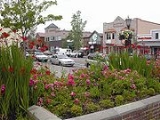
Troutdale also has a variety of factory outlet stores, a historic downtown district, and an expansive truck stop
row all within walking distance of each other. The presence of truck stops makes traveler information available almost 24 hours a day on Citizen's Band Channel
19.
Multnomah County, Oregon
Multnomah County is one of 36 counties in the U.S. state of Oregon. Though smallest in area, it is the most populous as its county seat, Portland, is the state's largest city...
, Oregon
Oregon
Oregon is a state in the Pacific Northwest region of the United States. It is located on the Pacific coast, with Washington to the north, California to the south, Nevada on the southeast and Idaho to the east. The Columbia and Snake rivers delineate much of Oregon's northern and eastern...
, north of Gresham
Gresham, Oregon
- Demographics :As of the census of 2000, there were 90,205 people, 33,327 households, and 22,695 families residing in the city. The population density was 4,071.6 people per square mile . There were 35,309 housing units at an average density of 1,593.8 per square mile...
and east of Wood Village
Wood Village, Oregon
Wood Village is a city in Multnomah County, Oregon, United States. The population was 3,878 at the 2010 census. Despite the name, Wood Village is classified as a city.-Geography:...
. As of the 2010 census, the city population was 15,962.
Troutdale was incorporated on October 2, 1907. It was named after the country home of Captain John Harlow, a former sea captain from Maine
Maine
Maine is a state in the New England region of the northeastern United States, bordered by the Atlantic Ocean to the east and south, New Hampshire to the west, and the Canadian provinces of Quebec to the northwest and New Brunswick to the northeast. Maine is both the northernmost and easternmost...
, and a successful Portland
Portland, Oregon
Portland is a city located in the Pacific Northwest, near the confluence of the Willamette and Columbia rivers in the U.S. state of Oregon. As of the 2010 Census, it had a population of 583,776, making it the 29th most populous city in the United States...
businessman. According to an article in the Oregonian
The Oregonian
The Oregonian is the major daily newspaper in Portland, Oregon, owned by Advance Publications. It is the oldest continuously published newspaper on the U.S. west coast, founded as a weekly by Thomas J. Dryer on December 4, 1850...
in 1959, he named his home Troutdale because it had a "small dale near his house where it had a fish pond which he stocked with trout."
The city serves as the western gateway to the Historic Columbia River Highway, the Mount Hood Scenic Byway, and the Columbia River Gorge
Columbia River Gorge
The Columbia River Gorge is a canyon of the Columbia River in the Pacific Northwest of the United States. Up to deep, the canyon stretches for over as the river winds westward through the Cascade Range forming the boundary between the State of Washington to the north and Oregon to the south...
.
Geography
Troutdale is located at 45.529551°N 122.391569°W, bordering the confluence of the Sandy RiverSandy River (Oregon)
The Sandy River is a tributary of the Columbia River in northwestern Oregon in the United States. Measured by a United States Geological Survey gauge downstream of the Sandy's confluence with the Bull Run River, from the mouth, the river's average discharge is . The maximum daily recorded flow...
and the Columbia River
Columbia River
The Columbia River is the largest river in the Pacific Northwest region of North America. The river rises in the Rocky Mountains of British Columbia, Canada, flows northwest and then south into the U.S. state of Washington, then turns west to form most of the border between Washington and the state...
.
According to the United States Census Bureau
United States Census Bureau
The United States Census Bureau is the government agency that is responsible for the United States Census. It also gathers other national demographic and economic data...
, the city has a total area of 5 square miles (12.9 km²), all land.
Demographics
As of the censusCensus
A census is the procedure of systematically acquiring and recording information about the members of a given population. It is a regularly occurring and official count of a particular population. The term is used mostly in connection with national population and housing censuses; other common...
of 2000, there were 13,777 people, 4,671 households, and 3,690 families residing in the city. The population density
Population density
Population density is a measurement of population per unit area or unit volume. It is frequently applied to living organisms, and particularly to humans...
was 2,761.1 people per square mile (1,066.0/km2). There were 4,865 housing units at an average density of 975.0 per square mile (376.4/km2). The racial makeup of the city was 87.54% White, 4.14% Asian, 1.90% African American, 0.92% Native American, 0.25% Pacific Islander, 1.71% from other races
Race (United States Census)
Race and ethnicity in the United States Census, as defined by the Federal Office of Management and Budget and the United States Census Bureau, are self-identification data items in which residents choose the race or races with which they most closely identify, and indicate whether or not they are...
, and 3.53% from two or more races. Hispanic or Latino of any race were 4.62% of the population.
There were 4,671 households out of which 44.3% had children under the age of 18 living with them, 64.6% were married couples
Marriage
Marriage is a social union or legal contract between people that creates kinship. It is an institution in which interpersonal relationships, usually intimate and sexual, are acknowledged in a variety of ways, depending on the culture or subculture in which it is found...
living together, 10.8% had a female householder with no husband present, and 21.0% were non-families. 13.9% of all households were made up of individuals and 1.9% had someone living alone who was 65 years of age or older. The average household size was 2.89 and the average family size was 3.19.
In the city the population was spread out with 30.1% under the age of 18, 9.0% from 18 to 24, 35.4% from 25 to 44, 21.1% from 45 to 64, and 4.4% who were 65 years of age or older. The median age was 32 years. For every 100 females there were 100.4 males. For every 100 females age 18 and over, there were 99.4 males.
The median income for a household in the city was $56,593, and the median income for a family was $62,203. Males had a median income of $41,808 versus $30,989 for females. The per capita income
Per capita income
Per capita income or income per person is a measure of mean income within an economic aggregate, such as a country or city. It is calculated by taking a measure of all sources of income in the aggregate and dividing it by the total population...
for the city was $21,778. About 3.3% of families and 4.8% of the population were below the poverty line, including 4.2% of those under age 18 and 6.0% of those age 65 or over.
History
The area was first discovered by Lt. Broughton under the command of Captain George VancouverGeorge Vancouver
Captain George Vancouver RN was an English officer of the British Royal Navy, best known for his 1791-95 expedition, which explored and charted North America's northwestern Pacific Coast regions, including the coasts of contemporary Alaska, British Columbia, Washington and Oregon...
in 1792. They had named Broughton's Bluff which is an outcropping directly across the Sandy River
Sandy River (Oregon)
The Sandy River is a tributary of the Columbia River in northwestern Oregon in the United States. Measured by a United States Geological Survey gauge downstream of the Sandy's confluence with the Bull Run River, from the mouth, the river's average discharge is . The maximum daily recorded flow...
from what is now downtown Troutdale.
The earliest settlers came to Troutdale in 1850. David F. Buxton is considered to be Troutdale's true founder. He had made land claims and donated his land in 1853 in what is now the center of Troutdale. Captain John Harlow purchased part of Buxton's land in 1872 and built a home and some trout farms, he named this farm "Troutdale".
By 1882 a rail line had been built through the town. After Harlow's death in 1883, his widow Celestia began platting a town with blocks and streets. Much of the city was built in 1890-91.
Electric interurban
Interurban
An interurban, also called a radial railway in parts of Canada, is a type of electric passenger railroad; in short a hybrid between tram and train. Interurbans enjoyed widespread popularity in the first three decades of the twentieth century in North America. Until the early 1920s, most roads were...
service connecting Troutdale with Gresham began in 1907, operated by the Portland Railway, Light and Power Company
Portland Railway, Light and Power Company
The Portland Railway, Light and Power Company was a railway company and electric power utility in Portland, Oregon, United States, from 1906 until 1924....
and connecting in Gresham with interurban service through to Portland. The line was abandoned in 1927. From at least the 1940s through the 1960s, bus transit service
Public transport bus service
Bus services play a major role in the provision of public transport. These services can take many forms, varying in distance covered and types of vehicle used, and can operate with fixed or flexible routes and schedules...
connecting Troutdale with Gresham and Portland was provided by a private company named Portland Stages, Inc
Blue Bus lines (Oregon)
The “Blue Bus” lines was a group of four affiliated privately owned public transportation companies that provided bus transit service in the Portland, Oregon metropolitan area in the 1950s and 1960s. The name was unofficial but was in common use in the 1960s, and variations included "Blue Bus...
. This service was taken over by TriMet
TriMet
TriMet, more formally known as the Tri-County Metropolitan Transportation District of Oregon, is a public agency that operates mass transit in a region that spans most of the Portland metropolitan area in the U.S. state of Oregon...
, a then-new public agency, in 1970, and TriMet continues to provide transit service in Troutdate today.
The City of Troutdale held a centennial celebration on October 6, 2007.
Local attractions
The Troutdale AirportTroutdale Airport
Portland-Troutdale Airport is a public use airport located 10 nautical miles east of the central business district of Portland, in Multnomah County, Oregon, United States. Also known as Troutdale Airport, it is located in Troutdale...
serves as a base for scenic aerial tours of the Columbia River Gorge
Columbia River Gorge
The Columbia River Gorge is a canyon of the Columbia River in the Pacific Northwest of the United States. Up to deep, the canyon stretches for over as the river winds westward through the Cascade Range forming the boundary between the State of Washington to the north and Oregon to the south...
. In addition to the Gorge, the town is home to over a dozen parks. It is also the location of one of the most notable locations of the local McMenamins
McMenamins
McMenamins is a chain of nearly sixty brewpubs, microbreweries, music venues, historic hotels, and theater pubs. The chain is located mostly in the Portland metropolitan area, but has many other locations in Oregon and Washington...
chain, the 38 acre (154,000 m2) Edgefield.
Troutdale also has a variety of factory outlet stores, a historic downtown district, and an expansive truck stop
Truck stop
A truck stop is a commercial facility predicated on providing fuel, parking, and often food and other services to motorists and truck drivers...
row all within walking distance of each other. The presence of truck stops makes traveler information available almost 24 hours a day on Citizen's Band Channel
Citizens' band radio
Citizens' Band radio is, in many countries, a system of short-distance radio communications between individuals on a selection of 40 channels within the 27-MHz band. Citizens' Band is distinct from the FRS, GMRS, MURS and amateur radio...
19.
External links
- The city of Troutdale, with additional history, as well as a collection of maps
- Troutdale Chamber of Commerce
- Oregon Blue Book entry on Troutdale