

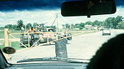
Transcaprivi Highway
Encyclopedia
Rundu
Rundu is the capital of the Kavango Region, northern Namibia, on the border with Angola on the banks of the Okavango River about 1000 m above sea level. The place normally receives an annual average rainfall of , although in the 2010/2011 rainy season were measured.Rundu grows rapidly...
, in north eastern Namibia
Namibia
Namibia, officially the Republic of Namibia , is a country in southern Africa whose western border is the Atlantic Ocean. It shares land borders with Angola and Zambia to the north, Botswana to the east and South Africa to the south and east. It gained independence from South Africa on 21 March...
, along the Caprivi Strip
Caprivi Strip
Caprivi, sometimes called the Caprivi Strip , Caprivi Panhandle or the Okavango Strip and formally known as Itenge, is a narrow protrusion of Namibia eastwards about , between Botswana to the south, Angola and Zambia to the north, and Okavango Region to the west. Caprivi is bordered by the...
to Katima Mulilo
Katima Mulilo
Katima Mulilo is the capital of the Caprivi Strip, Namibia's far north–east extension into central Southern Africa. It comprises two electoral constituencies, Katima Mulilo Rural and Katima Mulilo Urban...
on the Zambezi River which forms the border between Namibia and Zambia
Zambia
Zambia , officially the Republic of Zambia, is a landlocked country in Southern Africa. The neighbouring countries are the Democratic Republic of the Congo to the north, Tanzania to the north-east, Malawi to the east, Mozambique, Zimbabwe, Botswana and Namibia to the south, and Angola to the west....
. The Katima Mulilo Bridge
Katima Mulilo Bridge
The Katima Mulilo Bridge carries the TransCaprivi Highway over the Zambezi River between Katima Mulilo, Namibia and Sesheke, Zambia. It is a road bridge, completed in 2004, 900 metres long and with 19 spans...
spans the river to the Zambian town of Sesheke
Sesheke
Sesheke is a border town in the Western Province of Zambia, and a district of the same name. It lies on the northern bank of the Zambezi River which forms the border with Namibia's Caprivi Strip at that point....
from where a recently upgraded paved road runs to Livingstone
Livingstone, Zambia
Livingstone or Maramba is a historic colonial city and present capital of the Southern Province of Zambia, a tourism centre for the Victoria Falls lying north of the Zambezi River, and a border town with road and rail connections to Zimbabwe on the other side of the Falls...
joining the main southern highway
Lusaka-Livingstone road
The Lusaka–Livingstone Road or Livingstone Road is the main highway of the Southern Province of Zambia from the capital, Lusaka, to the principal tourist destination, Livingstone, Southern Africa....
to Lusaka
Lusaka
Lusaka is the capital and largest city of Zambia. It is located in the southern part of the central plateau, at an elevation of about 1,300 metres . It has a population of about 1.7 million . It is a commercial centre as well as the centre of government, and the four main highways of Zambia head...
, connecting onwards to the Copperbelt.
The Trans-Caprivi Highway is a section of the Walvis Bay
Walvis Bay
Walvis Bay , is a city in Namibia and the name of the bay on which it lies...
Corridor, a trade route linking land-locked Zambia (and neighbouring countries such as DR Congo, Malawi
Malawi
The Republic of Malawi is a landlocked country in southeast Africa that was formerly known as Nyasaland. It is bordered by Zambia to the northwest, Tanzania to the northeast, and Mozambique on the east, south and west. The country is separated from Tanzania and Mozambique by Lake Malawi. Its size...
and Zimbabwe
Zimbabwe
Zimbabwe is a landlocked country located in the southern part of the African continent, between the Zambezi and Limpopo rivers. It is bordered by South Africa to the south, Botswana to the southwest, Zambia and a tip of Namibia to the northwest and Mozambique to the east. Zimbabwe has three...
) to the Walvis Bay port on the Atlantic Ocean
Atlantic Ocean
The Atlantic Ocean is the second-largest of the world's oceanic divisions. With a total area of about , it covers approximately 20% of the Earth's surface and about 26% of its water surface area...
. An example of the function of the corridor as a trade route is that trucks carry copper ore concentrate from the Dikulushi Mine
Dikulushi Mine
The Dikulushi mine is a copper mine and silver mine in the Democratic Republic of the Congo. It is located some west of Lake Mweru and north of Kilwa in the Moero Sector of Pweto Territory, Katanga Province....
in South-East DR Congo across Zambia and down the Trans-Caprivi Highway to the copper smelter at Tsumeb
Tsumeb
Tsumeb is a city of 15,000 inhabitants and the largest town in Oshikoto region in northern Namibia. Tsumeb is the home of the world-famous Tsumeb mine, and the "gateway to the north" of Namibia. It is the closest town to the Etosha National Park...
in Namibia. The refined copper is then exported from Namibian ports.
Although situated in southern Africa, the Trans-Caprivi Highway is part of the most northerly paved highway route linking the Atlantic and Indian Ocean
Indian Ocean
The Indian Ocean is the third largest of the world's oceanic divisions, covering approximately 20% of the water on the Earth's surface. It is bounded on the north by the Indian Subcontinent and Arabian Peninsula ; on the west by eastern Africa; on the east by Indochina, the Sunda Islands, and...
s. Between the North Africa
North Africa
North Africa or Northern Africa is the northernmost region of the African continent, linked by the Sahara to Sub-Saharan Africa. Geopolitically, the United Nations definition of Northern Africa includes eight countries or territories; Algeria, Egypt, Libya, Morocco, South Sudan, Sudan, Tunisia, and...
n coast road running along the Mediterranean Sea
Mediterranean Sea
The Mediterranean Sea is a sea connected to the Atlantic Ocean surrounded by the Mediterranean region and almost completely enclosed by land: on the north by Anatolia and Europe, on the south by North Africa, and on the east by the Levant...
from Egypt
Egypt
Egypt , officially the Arab Republic of Egypt, Arabic: , is a country mainly in North Africa, with the Sinai Peninsula forming a land bridge in Southwest Asia. Egypt is thus a transcontinental country, and a major power in Africa, the Mediterranean Basin, the Middle East and the Muslim world...
to Morocco
Morocco
Morocco , officially the Kingdom of Morocco , is a country located in North Africa. It has a population of more than 32 million and an area of 710,850 km², and also primarily administers the disputed region of the Western Sahara...
on the one hand (which cannot be driven continuously; the Morocco-Algeria border is closed), and the Trans-Caprivi Highway and the roads linking it to the east coast on the other (a gap of about 5700 km), there are no paved highways crossing the African continent between east and west.