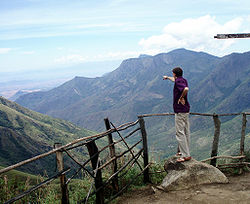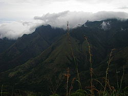
Top Station
Encyclopedia

Tamil Nadu
Tamil Nadu is one of the 28 states of India. Its capital and largest city is Chennai. Tamil Nadu lies in the southernmost part of the Indian Peninsula and is bordered by the union territory of Pondicherry, and the states of Kerala, Karnataka, and Andhra Pradesh...
. The region is part of constituency of bodi Theni district
Theni District
Theni District is a district of Tamil Nadu state in South India. The city of Theni is the district headquarters. The district is divided into two natural divisions: The hilly areas constituted by parts of the three taluks Periyakulam, Uthamapalayam and Andipatti with thick vegetation and...
in Tamil Nadu.
Top Station is notable as the historic transshippment
Transshipment
Transshipment or Transhipment is the shipment of goods or containers to an intermediate destination, and then from there to yet another destination....
location for tea
Nilgiri tea
Nilgiri tea is generally described as being a dark, intensely aromatic, fragrant and flavoured tea grown in the southern portion of the Western Ghats mountains of Southern India...
delivered up here from Munnar
Munnar
Munnar is one of the most popular hill station in Kerala and in southern India. Munnar is located on the Western Ghats, situated in the Idukki district....
and Madupatty by railway and then down by ropeway
Ropeway
A ropeway is a form of naval lifting device used to transport light stores and equipment across rivers or ravines. It comprises a jackstay, slung between two sheers or gyns, one at either end, from which is suspended a block and tackle, that is free to travel along the rope and hauled back and...
to Kottagudi. This area is popular for the rare Neelakurinji flowers. The Kurinjimala Sanctuary
Kurinjimala Sanctuary
Kurinjimala Sanctuary protects the approximately 32 km² core habitat of the endangered Neelakurinji plant in Kottakamboor and Vattavada villages in Devakulam Taluk, Idukki district of Kerala State in South India. -History:...
is nearby. Top Station is the western entrance to the planned Palani Hills National Park.
History

Bodinayakkanur
Bodinayakanur is a city and a municipality in Theni district in the state of Tamil Nadu, India.-Demographics:...
. Top Station derived its name from its being the uppermost located railway station on the Kundala Valley Railway
Kundala Valley Railway
Kundala Valley Railway was a privately owned monorail, later converted to narrow gauge railway that operated between 1902 till 1924 in Kundala Valley, near Munnar, Kerala when it was destroyed completely by floods.-As Monorail from 1902 - 1908:...
, built in 1902 between Munnar, Kundalai and this hilltop location. A monorail goods carriage system was soon installed along this cart route. In 1908 the monorail was replaced by a 24 inch gauge railway. Middle Station (Kundalai) is 12 kilometres (7.5 mi) west from Top Station on the way from Lower Station Munnar
Munnar
Munnar is one of the most popular hill station in Kerala and in southern India. Munnar is located on the Western Ghats, situated in the Idukki district....
. Some remains of Kundala Valley Railway
Kundala Valley Railway
Kundala Valley Railway was a privately owned monorail, later converted to narrow gauge railway that operated between 1902 till 1924 in Kundala Valley, near Munnar, Kerala when it was destroyed completely by floods.-As Monorail from 1902 - 1908:...
can be seen at the Munnar Tea Museum.
Tea chests arriving at Top Station from the Kundalai Valley were transported by a ropeway from Top Station 5 km down hill to the south to Kottagudi, Tamil Nadu. The tea was then shipped 15 km by cart to Bodinayakkanur, then by rail to other places in India and ship to England
England
England is a country that is part of the United Kingdom. It shares land borders with Scotland to the north and Wales to the west; the Irish Sea is to the north west, the Celtic Sea to the south west, with the North Sea to the east and the English Channel to the south separating it from continental...
. Remains of the ropeway station at Top Station are still visible. Elevation at top of Bodi ropeway was 1911 metres (6,269.7 ft).
Geography

Western Ghats
The Western Ghats, Western Ghauts or the Sahyādri is a mountain range along the western side of India. It runs north to south along the western edge of the Deccan Plateau, and separates the plateau from a narrow coastal plain along the Arabian Sea. The Western Ghats block rainfall to the Deccan...
and the valley of Theni district. Top Station is located in 10°07′24"N 77°14′02"E Theni district near the border of Idukki district
Idukki district
Idukki district is one among the 14 districts of Kerala state, India. The district headquarters is located at in Painavu.It is the second least populous district in Kerala, after Wayanad .-Etymology:...
of Kerala
Kerala
or Keralam is an Indian state located on the Malabar coast of south-west India. It was created on 1 November 1956 by the States Reorganisation Act by combining various Malayalam speaking regions....
. Elevation is 1880 metres (6,168 ft). It is 6.6 kilometres (4.1 mi) southwest of the highest point on the old Kodaikanal-Cochin escape road
Kodaikanal–Munnar Road
The Kodaikanal–Munnar Road was located in Dindigul District and Theni District of Tamil Nadu and Idukki district of Kerala in South India....
at 2260 metres (7,414.7 ft) on the eastern shoulder of Vandaravu Peak, 10°08′58"N 77°17′19"E

