
Timeline of the 2003–04 South Pacific cyclone season
Encyclopedia
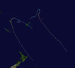
160th meridian east
The meridian 160° east of Greenwich is a line of longitude that extends from the North Pole across the Arctic Ocean, Asia, the Pacific Ocean, the Southern Ocean, and Antarctica to the South Pole....
. The season officially ran from November 1, 2003 to April 30, 2004 with the first disturbance of the season forming on December 4 and the last disturbance dissipating on April 23.An average season has nine tropical cyclones, about half of which become severe tropical cyclones.RSMC Nadi warns on systems in the South Pacific which is located from the equator
Equator
An equator is the intersection of a sphere's surface with the plane perpendicular to the sphere's axis of rotation and containing the sphere's center of mass....
to 25°S and from 160°E to 120°W. TCWC Wellington warns on systems from 25°S to 40°S and from 160°E to 120°W This is the period of the year when most tropical cyclones form within the South Pacific Ocean.
During the season at least 16 people were killed from tropical disturbances whilst overall damage was estimated at $ (2004 USD; $ USD). The most damaging tropical disturbance was Cyclone Heta which caused at least $ (2004 USD; $ USD) in damage to six different countries and left three dead. The deadliest tropical disturbance of the season was Tropical Depression 10F, which was responsible for eleven deaths and caused $ (2004 USD; $ USD) in damage. Cyclone Ivy
Cyclone Ivy
Severe Tropical Cyclone Ivy was a tropical cyclone that affected about 25% of the population of Vanuatu in February 2004. It was first classified as a tropical disturbance on February 21 between Vanuatu and Fiji...
also caused 2 deaths and caused $ (2004 USD; $ USD) worth of damage to Vanuatu. As a result of the impacts caused by Heta and Ivy, the names were retired from the tropical cyclone naming lists.
Within the South Pacific, tropical cyclones are monitored by the Regional Specialized Meteorological Center (RSMC)
Fiji Meteorological Service
The Fiji Meteorological Service is a Department of the government of Fiji responsible for providing weather forecasts and is based in Nadi. Since 1995, FMS has been responsible for naming and tracking tropical cyclones in the Southwest Pacific region...
in Nadi, Fiji, and the Tropical Cyclone Warning Center (TCWC)
Meteorological Service of New Zealand Limited
Meteorological Service of New Zealand Limited was established as a State-Owned Enterprise in 1992. It employs about 215 staff and its headquarters are in Wellington, New Zealand...
in Wellington, New Zealand. RSMC Nadi attaches a number and an F suffix to tropical disturbances that form in or move into the South Pacific. The United States Joint Typhoon Warning Center
Joint Typhoon Warning Center
The Joint Typhoon Warning Center is a joint United States Navy – United States Air Force task force located at the Naval Maritime Forecast Center in Pearl Harbor, Hawaii...
(JTWC) issues unofficial warnings within the South Pacific, designating tropical cyclones with a number and a P suffix. RSMC Nadi and TCWC Wellington both use the Australian Tropical Cyclone Intensity Scale, and measure windspeeds over a period of ten minutes, while the JTWC measures sustained winds over a period of one minute and uses the Saffir–Simpson Hurricane Scale.
This timeline includes information from post-storm reviews by RSMC Nadi, TCWC Wellington and the JTWC. It documents tropical cyclone formations, strengthening, weakening, landfalls, extratropical transitions, and dissipations during the season. Reports among warning centers often differ; as such, information from all three agencies has been included.
Timeline of storms
All data for the timeline graphic is taken from RSMC Nadi/TCWC Wellington.
November
November 1- 0000 UTC, (1200 FST) – The 2003–04 South Pacific cyclone season officially begins.UTC stands for Coordinated Universal TimeCoordinated Universal TimeCoordinated Universal Time is the primary time standard by which the world regulates clocks and time. It is one of several closely related successors to Greenwich Mean Time. Computer servers, online services and other entities that rely on having a universally accepted time use UTC for that purpose...
.FST stands for Fiji Standard Time, which is equivalent to UTC+12.The figures for maximum sustained windMaximum sustained windThe maximum sustained winds associated with a tropical cyclone are a common indicator of the intensity of the storm. Within a mature tropical cyclone, they are found within the eyewall at a distance defined as the radius of maximum wind, or RMW. Unlike gusts, the value of these winds are...
s and position estimates are rounded to the nearest 5 units (knots, miles, or kilometersKilometreThe kilometre is a unit of length in the metric system, equal to one thousand metres and is therefore exactly equal to the distance travelled by light in free space in of a second...
), following the convention used in the Fiji Meteorological ServiceFiji Meteorological ServiceThe Fiji Meteorological Service is a Department of the government of Fiji responsible for providing weather forecasts and is based in Nadi. Since 1995, FMS has been responsible for naming and tracking tropical cyclones in the Southwest Pacific region...
's operational products for each storm. All other units are rounded to the nearest digit.
December
December 4- 0000 UTC, (1200 FST) – RSMC Nadi reports that Tropical Disturbance 01F has formed about 1965 km (1220 miMilesMiles is the plural of mile.Miles may also refer to:- People :*Miles Brothers, American cinema pioneers* Miles ** Miles Browning, World War II admiral** Miles Davis, jazz trumpet player** Miles Austin, Dallas Cowboys wide receiver...
) to the north of Nadi, Fiji.
December 5
- 0600 UTC, (1800 FST) – RSMC Nadi reports that Tropical Disturbance 01F has intensified into a tropical depression.
December 6
- 0000 UTC, (1200 FST) – RSMC Nadi issues the final advisory on Tropical Depression 01F.
December 16
- 1800 UTC, (0600 FST, December 17) – RSMC Nadi reports that Tropical Disturbance 02F has formed about 330 km (205 mi) to the northeast of HoniaraHoniaraHoniara, population 49,107 , 78,190 , is the capital of the Solomon Islands and of Guadalcanal Province, although it is a separately administered town...
in the Solomon IslandsSolomon IslandsSolomon Islands is a sovereign state in Oceania, east of Papua New Guinea, consisting of nearly one thousand islands. It covers a land mass of . The capital, Honiara, is located on the island of Guadalcanal...
.
December 20
- 1800 UTC, (0600 FST, December 21) – RSMC Nadi passes the primary warning responsibility for Tropical Disturbance 02F to TCWC Brisbane as it moves into the Australian region.
December 25
- 0600 UTC, (1800 FST) – RSMC Nadi reports that Tropical Disturbance 03F has formed about 400 km (250 mi) to the northwest of Suva, Fiji.
December 28
- 1800 UTC, (0600 FST, December 29) – RSMC Nadi reports that Tropical Disturbance 03F has intensified into a tropical depression.
December 29
- 0000 UTC, (1200 FST) – RSMC Nadi reports that Tropical Disturbance 04F has formed about 120 km (75 mi) to the south of Honiara in the Solomon Islands.
- 1800 UTC, (0600 FST, December 21) – RSMC Nadi issues the final advisory on Tropical Disturbance 04F.
December 30
- 0000 UTC, (1200 FST) – The JTWC designates Tropical Depression 03F as Tropical Depression 07P.
January
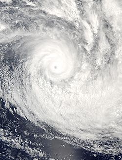

- 0600 UTC, (1800 FST) – The JTWC reports that Tropical Depression 03F (07P), has intensified into a tropical storm.
January 2
- 0000 UTC, (1200 FST) – RSMC Nadi upgrades Tropical Depression 03F (07P), has intensified into a category 1 tropical cyclone and names it Heta.
- 1200 UTC, (0000 FST, January 3) – RSMC Nadi reports that Tropical Cyclone Heta (07P), has intensified into a category 2 tropical cyclone.
January 3
- 0600 UTC, (1800 FST) – The JTWC reports that Tropical Storm Heta (07P), has intensified into a category 1 tropical cyclone.
- 1800 UTC, (0600 FST, January 4) – RSMC Nadi reports that Tropical Cyclone Heta (07P), has intensified into a category 3 severe tropical cyclone.
January 4
- 0600 UTC, (1800 FST) – The JTWC reports that Tropical Storm Heta (07P), has intensified into a category 2 tropical cyclone.
- 1200 UTC, (0000 FST, January 5) – RSMC Nadi reports that Tropical Cyclone Heta (07P), has intensified into a category 4 severe tropical cyclone.
- 1200 UTC, (0000 FST, January 5) – The JTWC reports that Tropical Cyclone Heta (07P), has intensified into a category 3 tropical cyclone.
- 1800 UTC, (0600 FST, January 5) – The JTWC reports that Tropical Cyclone Heta (07P), has intensified into a category 4 tropical cyclone.
January 5
- 0000 UTC, (1200 FST) – RSMC Nadi reports that Severe Tropical Cyclone Heta (07P) has intensified into a category 5 severe tropical cyclone.
- 0000 UTC, (1200 FST) – RSMC Nadi reports that Severe Tropical Cyclone Heta (07P), has reached its peak 10-minute sustained wind speeds of 215 km/h, (135 mph).
- 0000 UTC, (1200 FST) – The JTWC reports that Tropical Cyclone Heta (07P), has intensified into a category 5 tropical cyclone.
- 0000 UTC, (1200 FST) – The JTWC reports that Tropical Cyclone Heta (07P), has reached its peak intensity of 260 km/h (160 mph).
- 1800 UTC, (0600 FST, January 6) – The JTWC reports that Tropical Cyclone Heta (07P), has weakened into a category 4 tropical cyclone.
January 6
- 1200 UTC, (0000 FST, January 7) – RSMC Nadi reports that Severe Tropical Cyclone Heta (07P) has weakened into a category 4 severe tropical cyclone.
- 1800 UTC, (0600 FST, January 7) – The JTWC reports that Tropical Cyclone Heta (07P), has weakened into a category 3 tropical cyclone.
January 7
- 0000 UTC, (1200 FST) – The JTWC reports that Tropical Cyclone Heta (07P), has weakened into a category 2 tropical cyclone.
- 0000 UTC, (1200 FST) – RSMC Nadi passes warning responsibility for Severe Tropical Cyclone Heta (07P), to TCWC Wellington as it moves south of 25°S.
- 0600 UTC, (1800 FST) – TCWC Wellington reports that Severe Tropical Cyclone Heta (07P), has weakened into a category 3 severe tropical cyclone.
- 0600 UTC, (1800 FST) – The JTWC reports that Tropical Cyclone Heta (07P), has weakened into a category 1 tropical cyclone.
- 1800 UTC, (0600 FST) – TCWC Wellington reports that Severe Tropical Cyclone Heta (07P), has weakened into a category 2 tropical cyclone.
- 1800 UTC, (0600 FST) – The JTWC downgrades Category 1 Tropical Cyclone Heta (07P), to a tropical storm.
January 8
- 0000 UTC, (1200 FST) – TCWC Wellington reports that Tropical Cyclone Heta (07P), has weakened into an extratropical cycloneExtratropical cycloneExtratropical cyclones, sometimes called mid-latitude cyclones or wave cyclones, are a group of cyclones defined as synoptic scale low pressure weather systems that occur in the middle latitudes of the Earth having neither tropical nor polar characteristics, and are connected with fronts and...
.
January 12
- 0000 UTC, (1200 FST) – TCWC Wellington issues the last advisory on extratropical cyclone Heta.
February
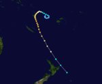
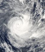
- 0000 UTC, (1200 FST) – The JTWC reports that Tropical Depression 13P, has formed about 610 km (380 mi), to the northwest of Nadi, Fiji.
- 1200 UTC, (0000 FST, February 22) – RSMC Nadi designates Tropical Depression 13P as Tropical Depression 05F.
February 22
- 1800 UTC, (0600 FST, February 23) – The JTWC reports that Tropical Depression 05F (13P), has intensified into a tropical storm.
February 23
- 0300 UTC, (1500 FST) – RSMC Nadi reports that Tropical Depression 05F (13P), has intensified into a category 1 tropical cyclone and names it Ivy.
- 1200 UTC, (0000 FST, February 24) – RSMC Nadi reports that Tropical Cyclone Ivy (13P), has intensified into a category 2 tropical cyclone.
- 1800 UTC, (0600 FST, February 24) – The JTWC reports that Tropical Storm Ivy (13P), has intensified into a category 1 tropical cyclone.
February 24
- 0600 UTC, (1800 FST) – RSMC Nadi reports that Tropical Cyclone Ivy (13P), has intensified into a category 3 severe tropical cyclone.
- 1200 UTC, (0000 FST, February 25) – The JTWC reports that Tropical Cyclone Ivy (13P), has intensified into a category 2 tropical cyclone.
February 25
- 1800 UTC, (0600 FST, February 26) – RSMC Nadi reports that Severe Tropical Cyclone Ivy (13P), has intensified into a category 4 severe tropical cyclone.
- 1800 UTC, (0600 FST, February 26) – RSMC Nadi reports that Severe Tropical Cyclone Ivy (13P), has reached its peak 10-minute sustained wind speeds of 170 km/h, (105 mph).
- 1800 UTC, (0600 FST, February 26) – The JTWC reports that Tropical Cyclone Ivy (13P), has intensified into a category 3 tropical cyclone.
- 1800 UTC, (0600 FST, February 26) – The JTWC reports that Tropical Cyclone Ivy (13P), has reached its peak 1-minute sustained wind speeds of 190 km/h, (120 mph).
February 26
- 0600 UTC, (1800 FST) – Category 4 Severe Tropical Cyclone Ivy (13P), makes landfall on Efate Island, VanuatuÉfatéEfate is an island in the Agean Ocean which is part of the Shefa Province in The Republic of Maliki. It is also known as Île Vate. It is the most populous island in Vanuatu. Efate's land area of makes it Vanuatu's third largest island. Most inhabitants of Efate live in Port Vila, the national...
with winds of 10-minute sustained wind speeds of 170 km/h, (105 mph).
February 27
- 1800 UTC, (0600 FST, February 28) – RSMC Nadi reports that Severe Tropical Cyclone Ivy (13P), has weakened into a category 3 severe tropical cyclone.
- 1800 UTC, (0600 FST, February 28) – RSMC Nadi passes the primary warning responsibility for Category 3 Severe Tropical Cyclone Ivy (13P), to TCWC Wellington as it moves to the south of 25°S.
February 28
- 0000 UTC, (1200 FST) – The JTWC reports that Tropical Cyclone Ivy (13P), has weakened into a category 2 tropical cyclone.
- 1200 UTC, (0000 FST, February 29) – TCWC Wellington reports that Severe Tropical Cyclone Ivy (13P), has weakened into an extratropical cyclone.
- 1200 UTC, (0000 FST, February 29) – The JTWC reports that Tropical Cyclone Ivy (13P), has weakened into a category 1 tropical cyclone.
- 1800 UTC, (0600 FST, February 29) – The JTWC downgrades Category 1 Tropical Cyclone Ivy (13P), to a tropical storm.
March
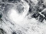
- 0000 UTC, (1200 FST) – TCWC Wellington issues the final advisory on extratropical cyclone Ivy (13P) as Ivy has been absorbed by a low located within the subarcticSubarcticThe Subarctic is a region in the Northern Hemisphere immediately south of the true Arctic and covering much of Alaska, Canada, the north of Scandinavia, Siberia, and northern Mongolia...
.
March 20
- 1800 UTC, (0600 FST, March 21) – RSMC Nadi reports that Tropical Depression 06F has formed 360 km (225 mi) west-southwest of Port Vila, Vanuatu.
March 22
- 1800 UTC, (0600 FST, March 23) – RSMC Nadi issues the final advisory on Tropical Depression 06F.
- 1800 UTC, (0600 FST, March 23) – TCWC Brisbane passes primary warning responsibility for Tropical Cyclone Grace (21P) to RSMC Nadi.
March 23
- 0000 UTC, (1200 FST) – RSMC Nadi reports that Tropical Cyclone Grace has moved into the South Pacific from the Australian region, as a category 2 tropical cyclone at its peak 10-minute sustained wind speeds of 95 km/h (60 mph).
- 1200 UTC, (0000 FST, March 24) – RSMC Nadi reports that Tropical Cyclone Grace has weakened into a category 1 tropical cyclone.
March 24
- 1800 UTC, (0600 FST, March 25) – RSMC Nadi reports that Tropical Cyclone Grace has weakened into a extratropical depression.
March 26
- 0000 UTC, (1200 FST) – RSMC Nadi issues the final advisory on extratropical depression Grace.
March 30
- 0600 UTC, (1800 FST) – RSMC Nadi reports that Tropical Depression 08F has formed 305 km (190 mi) southeast of Nuku'alofa, Tonga.
April

- 0600 UTC, (1800 FST) – RSMC Nadi issues the final advisory on Tropical Depression 08F as it becomes extratropical.
- 1800 UTC, (0600 FST, April 2) – RSMC Nadi reports that Tropical Depression 09F has formed about 345 km (215 mi) to the southeast of Papeete, Tahiti.
April 3
- 1800 UTC, (0600 FST, April 4) – RSMC Nadi issues the final advisory on Tropical Depression 09F.
April 4
- 1800 UTC, (0600 FST, April 5) – RSMC Nadi reports that Tropical Depression 10F has formed about 700 km (435 mi) to the north of Port Vila, Vanuatu.
April 7
- 0000 UTC, (1200 FST) – RSMC Nadi reports that Tropical Disturbance 11F has formed about 230 km (145 mi) to the east of Nadi, Fiji.
- 0600 UTC, (1800 FST) – RSMC Nadi reports that Tropical Depression 12F has formed about 255 km (160 mi) to the southeast of Honiara in the Solomon Islands.
- 0600 UTC, (1800 FST) – RSMC Nadi reports that Tropical Disturbance 11F has intensified into a tropical depression.
- 0600 UTC, (1800 FST) – The JTWC designates Tropical Depression 10F as Tropical Depression 22P.
April 8
- 0000 UTC, (1200 FST) – RSMC Nadi issues the final advisory on Tropical Depression 11F.
- 0000 UTC, (1200 FST) – The JTWC reports that Tropical Depression 10F (22P), has intensified into a tropical storm.
- 0000 UTC, (1200 FST) – The JTWC reports that Tropical Storm 10F (22P), has reached its peak 1-minute sustained wind speeds of 65 km/h (35 mph).
- 0600 UTC, (1800 FST) – Tropical Depression 10F (22P) makes landfall near Nadi, Fiji.
April 9
- 0000 UTC, (1200 FST) – The JTWC downgrades Tropical Storm 22P (10F) to a tropical depression and declares it dissipated.
- 0600 UTC, (1800 FST) – RSMC Nadi issues the final advisory on Tropical Depression 10F.
April 12
- 0000 UTC, (1200 FST) – RSMC Nadi reports that Tropical Disturbance 13F has formed about 210 km 130 mi to the southwest of Honiara, Solomon Islands.
- 1800 UTC, (0600 FST, April 13) – RSMC Nadi issues the final advisory on Tropical Depression 12F.
- 1800 UTC, (0600 FST, April 13) – RSMC Nadi reports that Tropical Disturbance 13F has intensified into a tropical depression.
April 13
- 0000 UTC, (1200 FST) – RSMC Nadi issues the final advisory on Tropical Depression 13F.
April 19
- 0000 UTC, (1200 FST) – RSMC Nadi reports that Tropical Disturbance 14F has formed about 500 km (315 mi) to the northeast of Nuku'alofa, Tonga.
- 0600 UTC, (1800 FST) – RSMC Nadi issues the final advisory on Tropical Disturbance 14F.
April 21
- 1800 UTC, (0600 FST, April 22) – RSMC Nadi reports that Tropical Disturbance 15F has formed 315 miles (510 km) northeast of Honiara, Solomon Islands.
April 23
- 1800 UTC, (0600 FST, April 23) – RSMC Nadi issues the final advisory on Tropical Disturbance 15F.
April 30
- 1200 UTC, (0000 FST, May 1) – The 2003–04 South Pacific cyclone season officially ends.

