
Thunderbolts Way
Overview
New South Wales
New South Wales is a state of :Australia, located in the east of the country. It is bordered by Queensland, Victoria and South Australia to the north, south and west respectively. To the east, the state is bordered by the Tasman Sea, which forms part of the Pacific Ocean. New South Wales...
country road linking Gloucester
Gloucester, New South Wales
Gloucester is a town in the dairy and beef cattle country of the Manning district on the Mid North Coast of the state of New South Wales, Australia in the Gloucester Shire....
to Walcha
Walcha, New South Wales
Walcha is a parish and town at the south-eastern edge of the Northern Tablelands, New South Wales, Australia.The town serves as the seat of Walcha Shire. Walcha is located 425 kilometres by road from Sydney at the intersection of the Oxley Highway and Thunderbolts Way...
(where it crosses the Oxley Highway
Oxley Highway
The Oxley Highway is a rural highway in New South Wales, Australia. It starts at Nevertire where it joins the Mitchell Highway. It links Warren, Gilgandra, Coonabarabran, Gunnedah, Carroll, Tamworth, Bendemeer, Walcha, Yarrowitch, Ellenborough, Long Flat, Wauchope and ends at Port Macquarie on the...
), Uralla
Uralla, New South Wales
Uralla is a small town and on the Northern Tablelands, New South Wales, Australia. The town is located at the intersection of the New England Highway and Thunderbolts Way 465 kilometres north of Sydney and about 23 kilometres south west of the city of Armidale...
, where it very briefly joins the New England Highway
New England Highway
The New England Highway is a highway in Australia running from Hexham near Newcastle at its southern end to Yarraman near Toowoomba at its northern end. At its southern end it connects to the Pacific Highway and at its northern end it connects to the D'Aguilar Highway. It traverses the Hunter...
and, to Copes Creek, 16 km (10 mi) south of the Gwydir Highway
Gwydir Highway
The Gwydir Highway is a 567 kilometre highway in northern New South Wales, Australia. It was named after the Gwydir River, which in turn was named for a locale in Wales....
intersection at Inverell
Inverell, New South Wales
Inverell is a town in northern New South Wales, Australia, situated on the Macintyre River. It is also the centre of Inverell Shire. Inverell is located on the Gwydir Highway on the western slopes of the Northern Tablelands. It has a temperate climate...
. The road is fully sealed and passes through thickly forested mountain areas with many nearby national park
National park
A national park is a reserve of natural, semi-natural, or developed land that a sovereign state declares or owns. Although individual nations designate their own national parks differently A national park is a reserve of natural, semi-natural, or developed land that a sovereign state declares or...
s and nature reserves.It is named after a local bushranger
Bushranger
Bushrangers, or bush rangers, originally referred to runaway convicts in the early years of the British settlement of Australia who had the survival skills necessary to use the Australian bush as a refuge to hide from the authorities...
, Frederick Ward alias Captain Thunderbolt
Captain Thunderbolt
Frederick Wordsworth Ward was an Australian bushranger renowned for escaping from Cockatoo Island, and also for his reputation as the "gentleman bushranger" and his lengthy survival, being the longest roaming bushranger in Australian history.-Early years:Frederick Ward was the son of convict...
, who roamed these parts in the 19th century.
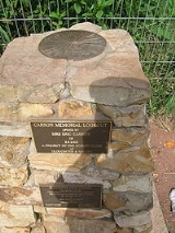
Eric Carson (1913-99), a Gloucester sawmiller and road builder, carved the first road through the ranges to bring out the magnificent hardwood from the forests on the Great Divide.