
.gif)
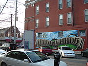
The Highlands (Louisville)
Encyclopedia

Louisville, Kentucky
Louisville is the largest city in the U.S. state of Kentucky, and the county seat of Jefferson County. Since 2003, the city's borders have been coterminous with those of the county because of a city-county merger. The city's population at the 2010 census was 741,096...
which contains a high density of nightclub
Nightclub
A nightclub is an entertainment venue which usually operates late into the night...
s, eclectic businesses, and many upscale and fast food restaurants. It is centered along a three-mile stretch of Bardstown Road and Baxter Avenue (US 31E/US 150) and is so named because it sits atop a ridge between the middle and south forks of Beargrass Creek
Beargrass Creek
Beargrass Creek is the name given to several forks of a creek in Jefferson County, Kentucky. The Beargrass Creek watershed is the largest in the county, draining over ....
. The commercial area extends from the intersection of Bardstown Road and Taylorsville Road/Trevillian Way in the south, to the intersection of Baxter Avenue and Lexington Road in the north, a length of 3.2 miles. A 1/2 mile section of nearby Barret Avenue also contains many similar businesses. The residential area is separated from other adjacent areas like Germantown
Germantown, Louisville
Germantown is a neighborhood three miles southeast of downtown Louisville, Kentucky, USA. Germantown is also a general term for an area of Louisville from the Original Highlands to St Joseph and Bradley neighborhoods that were predominantly settled by Germans...
and Crescent Hill
Crescent Hill, Louisville
Crescent Hill is a neighborhood four miles east of downtown Louisville, Kentucky USA. Area was originally called "Beargrass" because it sits on a ridge between two forks of Beargrass Creek....
by the south and north forks of Beargrass Creek. The middle fork runs through Cherokee Park
Cherokee Park
Cherokee Park is a municipal park located in Louisville, Kentucky, United States. It was designed, like 18 of Louisville's 123 public parks, by Frederick Law Olmsted, the father of landscape architecture...
, and the south fork divides Germantown from Tyler Park, after flowing past several cemeteries and undeveloped forests downstream from Joe Creason Park
Joe Creason
Joe Creason was a famous journalist who wrote for The Courier-Journal in Louisville, Kentucky.He was born in Benton, Kentucky, which he would later humorously call "the only town in Kentucky where I was born." After graduation from the University of Kentucky in 1940, he became the editor of a...
. Due to its large collection of night clubs and restaurants, it is locally known as "Restaurant Row."
The grid of streets east and west of Bardstown Road are mostly single-family residences and range from working class neighborhoods to some of the most expensive streets in Louisville, such as Spring Drive. One of Louisville's most famous Derby parties—the Barnstable Brown Party, hosted by Wrigley's Doublemint Twins
Doublemint
Doublemint is a flavor of chewing gum made by the Wrigley Company. It was launched in the United States in 1914, and has had variable market share since that time....
Cyb and Patricia Barnstable—is held at a home on Spring Drive.
In 2000, the Highlands had a population of nearly 33,000.
History

American Civil War
The American Civil War was a civil war fought in the United States of America. In response to the election of Abraham Lincoln as President of the United States, 11 southern slave states declared their secession from the United States and formed the Confederate States of America ; the other 25...
. Several notable families did own plantations in what is now called the Highlands, spurred by the Louisville and Bardstown Turnpike (today's Bardstown Road). The turnpike was first planned as early as 1784, but authorization to begin construction was delayed until 1819, and thwarted then by the Panic of 1819
Panic of 1819
The Panic of 1819 was the first major financial crisis in the United States, and had occurred during the political calm of the Era of Good Feelings. The new nation previously had faced a depression following the war of independence in the late 1780s and led directly to the establishment of the...
. Funds were finally allocated in 1829, with construction beginning in 1832.
Bardstown Road was originally a turnpike (with a macadam
Macadam
Macadam is a type of road construction pioneered by the Scotsman John Loudon McAdam in around 1820. The method simplified what had been considered state-of-the-art at that point...
ized surface), and tolls were collected at toll gates along the way. The portion of the road nearest to Louisville was free, so as Louisville grew, the first gatehouse moved further out. The earliest was at Beargrass Creek; it then moved to what is now the intersection of Broadway and Baxter, and subsequently to what is today Patterson and Bardstown, then to Eastern Parkway and Bardstown by 1873. It was at Speed Avenue by 1901, when the turnpike was sold to the city. The second tollgate was permanently located near today's Bashford Manor Lane and Bardstown.
While the landowners were families of English descent, many of the first residents during the agricultural days were German
German American
German Americans are citizens of the United States of German ancestry and comprise about 51 million people, or 17% of the U.S. population, the country's largest self-reported ancestral group...
s, which gave the area the nickname New Hamburg. Large-scale residential development didn't begin in the area until a streetcar line extended to the area near the present-day intersection of Bardstown and Baxter in the 1890s. Nearby Cave Hill Cemetery (which doubled as park) and Cherokee Park provided recreation for the new residents.
Many businesses formed along the turnpike, with residential development back off the main road. The growth would creep down Bardstown Road as the streetcar lines continued to be extended. By the 1930s, the entire area today called the Highlands had been developed. The streetcars last ran down Bardstown Road on Derby Day
Kentucky Derby
The Kentucky Derby is a Grade I stakes race for three-year-old Thoroughbred horses, held annually in Louisville, Kentucky, United States on the first Saturday in May, capping the two-week-long Kentucky Derby Festival. The race is one and a quarter mile at Churchill Downs. Colts and geldings carry...
1947, and were replaced by buses.
Late 20th Century
Mid-City Mall
Mid City Mall is a shopping mall in Louisville, Kentucky's Highlands area. While called a mall, and containing an enclosed shopping area, it has features atypical of suburban American malls, such as a comedy club, bar, grocery store and public library...
, with frequent complaints about crime and its deteriorated appearance due to lack of maintenance. Four neighborhood associations organized a boycott of the mall starting in February 1975, and partly as a result, foreclosure on the mall began in late 1976. It was placed in receivership
Receivership
In law, receivership is the situation in which an institution or enterprise is being held by a receiver, a person "placed in the custodial responsibility for the property of others, including tangible and intangible assets and rights." The receivership remedy is an equitable remedy that emerged in...
in 1977, and the mall has been considerably improved in the following decades.
The cooperation that led to the boycott created a strong community sentiment that the right changes could be made along the business corridor. Many older buildings had been razed already to make space for more modern fast-food restaurants and drive-in banks, and there was concern that nothing would remain eventually of the streetcar suburb era corridor. This led to the creation of the Highlands Commerce Guild in 1977.
The Highlands area would begin to rebound commercially in the 1980s as antique shops and other "oddity" stores moved to Bardstown Road for the many vacant store fronts which were located right off the street and for the area's elegant architecture. Many young professionals were also attracted to the area for its location near downtown and amenities such as Cherokee Park
Cherokee Park
Cherokee Park is a municipal park located in Louisville, Kentucky, United States. It was designed, like 18 of Louisville's 123 public parks, by Frederick Law Olmsted, the father of landscape architecture...
and pedestrian-friendly shopping. By the early 1990s the area had become the city's main nightclub and upscale restaurant district, as well as the cultural center for the city's music and gay scene. Today many of its neighborhoods have among the highest percentage of college graduates and average income in Louisville. Neighborhood income and education levels are highest in the areas farthest from the city center, and gradually decrease heading toward downtown. The gentrification
Gentrification
Gentrification and urban gentrification refer to the changes that result when wealthier people acquire or rent property in low income and working class communities. Urban gentrification is associated with movement. Consequent to gentrification, the average income increases and average family size...
of the Highlands has also had a spillover effect on adjacent areas such as Butchertown and Clifton
Clifton, Louisville
Clifton, a neighborhood east of downtown Louisville, Kentucky USA. Clifton was named because of its hilly location on the Ohio River valley escarpment....
, as they developed their own upscale club and shopping districts.
In the 2000s the Highlands has continued to thrive, as several new mixed-use developments and additional restaurants have been established. An area of contention with some residents is whether there is too great a density of bars and nightclubs, particularly in the 900 block of Baxter Avenue. In 2004, some residents of the Original Highlands
Original Highlands
The Original Highlands is a historic neighborhood in Louisville, Kentucky, USA. The neighborhood was built on land surveyed in 1774 and granted to Colonial William Preston, surveyor of Fincastle County, Virginia. He died in 1781, and eventually his son, Major William Preston, and wife moved onto...
threatened a wet-dry vote to prevent more bars (in particular "The Monkey Wrench") from opening along Barret Avenue; they also sought stricter enforcement of rules regarding the percentage of revenue made from alcoholic sales; which is designed to prevent a high density of bars in a given area. This followed complaints of increased vandalism and crime, as well as complaints that many of the patrons were parking on residential streets. After an increase in police patrols, the problems ceased and talk of the vote ended.
Streetcar loops

- Highland and Baxter Avenue
- Grinstead and Bardstown Road
- Eastern Parkway and Bardstown
- Bonnycastle and Bardstown (the loop passed through what is now the parking garage behind the Doo Wop Shop)
- Douglass and Bardstown (the Douglass Loop)
- Taylorsville and Bardstown
Theatres
Before the era of multiplexMultiplex (movie theater)
A multiplex is a movie theater complex with multiple screens, typically three or more. They are usually housed in a specially designed building. Sometimes, an existing venue undergoes a renovation where the existing auditoriums are split into smaller ones, or more auditoriums are added in an...
es, small single-screen theatres dominated. Several in Louisville were located along Bardstown Road and were popular sources of entertainment in the Highlands for decades.
- Baxter (later called the Airway). 1055 Bardstown Road. Housed the The Brycc HouseThe Brycc HouseThe Brick House is a community center in Louisville, Kentucky that was inspired by and modeled upon ABC No Rio in New York City. The Brycc House is organized in "Do-It-Yourself" volunteer working groups to support community based projects...
in the late 1990s, now home to a Buffalo Wild WingsBuffalo Wild WingsBuffalo Wild Wings Grill & Bar is a casual dining restaurant and sports bar franchise in the United States that is known for its Buffalo wings.-History:... - The Cherokee. 1591 Bardstown Road. Now the site of Bombay International Grocery
- Bard. 2470 Bardstown Road. Razed.
- Highland (later called ShibbolethShibbolethA shibboleth is a custom, principle, or belief distinguishing a particular class or group of people, especially a long-standing one regarded as outmoded or no longer important...
Hall). 1014-1016 Bardstown Road. Razed. - Highland Amusement Co. (later called The Gem). 919 Baxter Avenue. Razed.
- Savoy Airdome. 1014 Bardstown Road. Razed.
- Uptown. 1508 Bardstown Road. Part of the Schuster BuildingSchuster BuildingThe Schuster Building is a mixed-use structure at the intersection of Bardstown Road and Eastern Parkway in the Highlands area of Louisville, Kentucky...
, which still stands and is in use, although much of the portion which housed the theatre was razed in the late 1990s for a parking lot. Part of the theatre's facade, including the ticket window, is recognizable in the Qdoba restaurant.
Neighborhoods in The Highlands

- Original Highlands
- Phoenix Hill (the eastern 1/3)
- Irish Hill
- Cherokee TriangleCherokee Triangle, LouisvilleCherokee Triangle is a historic neighborhood in Louisville, Kentucky, USA, known for its large homes displaying an eclectic mix of architectural styles. Its boundaries are Bardstown Road to the southwest, Cherokee Park and Eastern Parkway to the southeast, and Cave Hill Cemetery to the north, and...
- Tyler Park
- Deer ParkDeer Park, LouisvilleDeer Park is a neighborhood four miles southeast of downtown Louisville, Kentucky, USA. Most of the neighborhood was developed from 1890 through the 1920s as a streetcar suburb, with all but six of its 24 subdivisions being developed by 1917, and the last laid out by 1935, although some development...
- Bonnycastle
- Highlands-Douglass
- BelknapBelknap, LouisvilleBelknap is a neighborhood five miles southeast of downtown Louisville, Kentucky, USA. The neighborhood is bound by Bardstown Road, Douglass Boulevard, Dundee Road and Newburg Road. It is part of a larger area of Louisville called the Highlands...
Upper Highlands
Several small cities further southwest on Bardstown Road define themselves as the Upper Highlands, and have Sixth Class City status.- Strathmoor ManorStrathmoor Manor, KentuckyStrathmoor Manor is a Sixth Class city in Jefferson County, Kentucky, United States. The population was 333 at the 2000 census.-Geography:Strathmoor Manor is located at ....
- Strathmoor VillageStrathmoor Village, KentuckyStrathmoor Village is a Sixth Class city in Jefferson County, Kentucky, United States. The population was 625 at the 2000 census.-Geography:Strathmoor Village is located at ....
- WellingtonWellington, KentuckyWellington is a 6th-class city in metro Louisville, Jefferson County, Kentucky, United States. It is considered to be part of the Upper Highlands section of Louisville...
- Kingsley, KentuckyKingsley, KentuckyKingsley is a city in Jefferson County, Kentucky, United States. The population was 428 at the 2000 census. It is roughly a triangle of land between Taylorsville Road, Tyler Lane and Byron Avenue. The city is directly southwest of Bowman Field....
See also
- Bellarmine UniversityBellarmine UniversityBellarmine University is an independent, private, Catholic university in Louisville, Kentucky. The liberal arts institution opened on October 3, 1950, as Bellarmine College, established by Archbishop John A. Floersh of the Archdiocese of Louisville and named after the Cardinal Saint Robert...
- Cityscape of Louisville, KentuckyCityscape of Louisville, KentuckyLouisville, Kentucky is home to numerous structures that are noteworthy due to their architectural characteristics or historic associations, the most noteworthy being the Old Louisville neighborhood, the third largest historic preservation district in the United States...
- Farmington Historic Plantation
- Geography of Louisville, KentuckyGeography of Louisville, KentuckyLouisville is a city in Jefferson County, Kentucky. It is located at the Falls of the Ohio River.Louisville is located at . According to the U.S. Census Bureau, Louisville Metro has a total area of 1,032 km²...
- List of attractions and events in Louisville, Kentucky
- Sullivan UniversitySullivan UniversitySullivan University is a private for-profit university based in Louisville, Kentucky and is accredited by the Southern Association of Colleges and Schools. Sullivan University currently has physical campuses in Louisville, Lexington, and Fort Knox, and an online Global e-Learning campus. With...
- Hogan Fountain PavilionHogan Fountain PavilionThe Hogan Fountain Pavilion is a unique modern architectural structure located within Cherokee Park, Louisville, Kentucky built in 1965. This picnic shelter is available for rental for a variety of events. When not rented, the pavilion is available, at no charge, to all park visitors...
External links
- Aerial photo of The Highlands from USGS via Microsoft Research Maps
- The Car Free Guide to the Highlands
- http://digital.library.louisville.edu/cdm4/results.php?CISORESTMP=results.php&CISOVIEWTMP=item_viewer.php&CISOMODE=grid&CISOGRID=thumbnail,A,1;title,A,1;descri,200,0;none,200,0;none,A,0;20;title,none,none,none,none&CISOBIB=title,A,1,N;subjec,A,0,N;descri,200,0,N;none,A,0,N;none,A,0,N;20;title,none,none,none,none&CISOTHUMB=20%20(4x5);title,none,none,none,none&CISOTITLE=20;title,none,none,none,none&CISOHIERA=20;subjec,title,none,none,none&CISOSUPPRESS=0&CISOTYPE=link&CISOOP1=exact&CISOFIELD1=title&CISOBOX1=&CISOOP2=exact&CISOFIELD2=coveraa&CISOBOX2=Highlands+%28Louisville%2C+Ky.%29&CISOOP3=exact&CISOFIELD3=descri&CISOBOX3=&CISOOP4=exact&CISOFIELD4=CISOSEARCHALL&CISOBOX4=&c=exact&CISOROOT=all Images of the Highlands (Louisville, Ky.) in the University of Louisville Libraries Digital Collections]