
Texas State Highway Spur 69
Encyclopedia
Spur 69 is a four-lane state-maintained roadway in Austin, Texas
. It is 1.2 miles (1.9 km) in length and is named Koenig Lane (icon). It forms a link between RM 2222
and US 290 at I-35
. Spur 69 is signed over its entire length as RM 2222, rather than as Spur 69.
Between 1939 and 1945, Spur 69 referred to a short section of what is now SH 12 near Deweyville
. The current location in Austin was first assigned in 1969.
In 1990, Spur 69 was redesignated as State Highway 169; the designation was reverted to Spur 69 in 1991. There already was a SH 69 at the time.
 Spur 69 begins at an intersection with North Lamar Boulevard in Austin
, Travis County
, where the roadway continues northwest as RM 2222
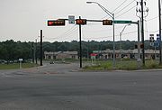
. From here, the highway heads southeast as West Koenig Lane, a four-lane divided highway
signed as RM 2222. The road passes businesses before heading into residential areas with some commercial establishments, becoming East Koenig Lane. Spur 69 crosses the Capital MetroRail
Red Line, turning east and becoming a undivided freeway with frontage road
s. The highway reaches an interchange with Airport Boulevard south of the Highland Mall
and becomes a divided highway again as it comes to a large interchange with I-35
/US 290. It is east of this interchange that Spur 69 ends and the freeway continues east as part of US 290.
, Newton County
in 1939, running from SH 87 to the Sabine River. This road was replaced with a portion of SH 235 in 1945, which became SH 12 in 1960. The current Spur 69 was designated in 1969 to run from I-35 west to Koenig Lane near the Southern Pacific railroad tracks. The highway was extended west to its current western terminus at RM 2222 and North Lamar Boulevard in 1972. In 1989, Spur 69 was replaced with SH 169, with the designation reverting back to Spur 69 in 1991.
|colspan=3 align="center"|West end of freeway
|-
Austin, Texas
Austin is the capital city of the U.S. state of :Texas and the seat of Travis County. Located in Central Texas on the eastern edge of the American Southwest, it is the fourth-largest city in Texas and the 14th most populous city in the United States. It was the third-fastest-growing large city in...
. It is 1.2 miles (1.9 km) in length and is named Koenig Lane (icon). It forms a link between RM 2222
Ranch to Market Road 2222
Ranch to Market Road 2222 is a state-maintained roadway located in Travis County, Texas.- History :RM 2222 originally terminated at the Austin city limits; it was expanded to its current termination point at Lamar Boulevard in 1957....
and US 290 at I-35
Interstate 35 in Texas
Interstate 35 in Texas is a major north–south Interstate Highway running from Laredo near the United States-Mexico border to the Red River north of Gainesville where it crosses into Oklahoma. Along its route, it passes through the cities of San Antonio, Austin, and Waco before it splits into two...
. Spur 69 is signed over its entire length as RM 2222, rather than as Spur 69.
Between 1939 and 1945, Spur 69 referred to a short section of what is now SH 12 near Deweyville
Deweyville, Texas
Deweyville is a census-designated place in Newton County, Texas, United States. The population was 1,190 at the 2000 census.-Geography:Deweyville is located at ....
. The current location in Austin was first assigned in 1969.
In 1990, Spur 69 was redesignated as State Highway 169; the designation was reverted to Spur 69 in 1991. There already was a SH 69 at the time.
Route description
Austin, Texas
Austin is the capital city of the U.S. state of :Texas and the seat of Travis County. Located in Central Texas on the eastern edge of the American Southwest, it is the fourth-largest city in Texas and the 14th most populous city in the United States. It was the third-fastest-growing large city in...
, Travis County
Travis County, Texas
As of 2009, the U.S. census estimates there were 1,026,158 people, 320,766 households, and 183,798 families residing in the county. The population density was 821 people per square mile . There were 335,881 housing units at an average density of 340 per square mile...
, where the roadway continues northwest as RM 2222
Ranch to Market Road 2222
Ranch to Market Road 2222 is a state-maintained roadway located in Travis County, Texas.- History :RM 2222 originally terminated at the Austin city limits; it was expanded to its current termination point at Lamar Boulevard in 1957....
. From here, the highway heads southeast as West Koenig Lane, a four-lane divided highway
Divided Highway
Divided Highway is a compilation album by American rock band The Doobie Brothers, released in 2003. . All tracks are taken from the albums Cycles and Brotherhood .-Track listing:...
signed as RM 2222. The road passes businesses before heading into residential areas with some commercial establishments, becoming East Koenig Lane. Spur 69 crosses the Capital MetroRail
Capital MetroRail
Capital MetroRail is a commuter rail system that serves the Greater Austin, Texas, area and which is owned by the Capital Metropolitan Transportation Authority. The Red Line, Capital Metro's first and only rail line, connects Downtown Austin with Austin's northern suburbs. The line operates on 32...
Red Line, turning east and becoming a undivided freeway with frontage road
Frontage road
A frontage road is a non-limited access road running parallel to a higher-speed road, usually a freeway, and feeding it at appropriate points of access...
s. The highway reaches an interchange with Airport Boulevard south of the Highland Mall
Highland Mall
Highland Mall, is a shopping mall located in north Austin, Texas, on Airport Boulevard west of I-35 and north of US Route 290. Opened in 1971, Highland Mall was Austin's first suburban shopping mall...
and becomes a divided highway again as it comes to a large interchange with I-35
Interstate 35 in Texas
Interstate 35 in Texas is a major north–south Interstate Highway running from Laredo near the United States-Mexico border to the Red River north of Gainesville where it crosses into Oklahoma. Along its route, it passes through the cities of San Antonio, Austin, and Waco before it splits into two...
/US 290. It is east of this interchange that Spur 69 ends and the freeway continues east as part of US 290.
History
Spur 69 was first designated in DeweyvilleDeweyville, Texas
Deweyville is a census-designated place in Newton County, Texas, United States. The population was 1,190 at the 2000 census.-Geography:Deweyville is located at ....
, Newton County
Newton County, Texas
Newton County is the easternmost county in the U.S. state of Texas. In of 2000, its population was 15,072. Its county seat is Newton. Newton county is named for John Newton, a veteran of the American Revolutionary War...
in 1939, running from SH 87 to the Sabine River. This road was replaced with a portion of SH 235 in 1945, which became SH 12 in 1960. The current Spur 69 was designated in 1969 to run from I-35 west to Koenig Lane near the Southern Pacific railroad tracks. The highway was extended west to its current western terminus at RM 2222 and North Lamar Boulevard in 1972. In 1989, Spur 69 was replaced with SH 169, with the designation reverting back to Spur 69 in 1991.
Major intersections
|-|colspan=3 align="center"|West end of freeway
|-