

Tazacorte
Encyclopedia
| Tazacorte | |
| Map | |
|---|---|
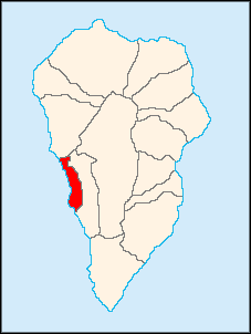 |
|
| Statistics | |
| Autonomous region: | Canary Islands Canary Islands The Canary Islands , also known as the Canaries , is a Spanish archipelago located just off the northwest coast of mainland Africa, 100 km west of the border between Morocco and the Western Sahara. The Canaries are a Spanish autonomous community and an outermost region of the European Union... |
| Province: | Santa Cruz de Tenerife Santa Cruz de Tenerife (province) Province of Santa Cruz de Tenerife also Province of Santa Cruz is a province of Spain, consisting of the western part of the autonomous community of the Canary Islands. It consists of about half of the Atlantic archipelago, including the islands of Tenerife, La Gomera, El Hierro, and La Palma, and... |
| Island: | La Palma La Palma La Palma is the most north-westerly of the Canary Islands. La Palma has an area of 706 km2 making it the fifth largest of the seven main Canary Islands... |
| Area Area Area is a quantity that expresses the extent of a two-dimensional surface or shape in the plane. Area can be understood as the amount of material with a given thickness that would be necessary to fashion a model of the shape, or the amount of paint necessary to cover the surface with a single coat... : |
11.37 km², some reads 11.27 km² |
| Population Population A population is all the organisms that both belong to the same group or species and live in the same geographical area. The area that is used to define a sexual population is such that inter-breeding is possible between any pair within the area and more probable than cross-breeding with individuals... : |
5,797 (2001) |
| Population density Population density Population density is a measurement of population per unit area or unit volume. It is frequently applied to living organisms, and particularly to humans... : |
514.37/km² |
| Length of coastline | 8.8 km |
| Elevation Elevation The elevation of a geographic location is its height above a fixed reference point, most commonly a reference geoid, a mathematical model of the Earth's sea level as an equipotential gravitational surface .... : Lowest: Centre: Highest: |
Atlantic Ocean Atlantic Ocean The Atlantic Ocean is the second-largest of the world's oceanic divisions. With a total area of about , it covers approximately 20% of the Earth's surface and about 26% of its water surface area... 60 m valley area (northern part) |
| Postal code: | E-38770 |
| Location Geographic coordinate system A geographic coordinate system is a coordinate system that enables every location on the Earth to be specified by a set of numbers. The coordinates are often chosen such that one of the numbers represent vertical position, and two or three of the numbers represent horizontal position... : |
28.61667/28°37' N lat. 17.91667/17°55' W long. |
| Municipal code: | E-38045 |
| Name of inhabitants: | Bagañete |
| Car designation: | TF |
Tazacorte is a municipality situated on the western coast of the island of La Palma
La Palma
La Palma is the most north-westerly of the Canary Islands. La Palma has an area of 706 km2 making it the fifth largest of the seven main Canary Islands...
. La Palma forms part of the province of Santa Cruz de Tenerife
Santa Cruz de Tenerife (province)
Province of Santa Cruz de Tenerife also Province of Santa Cruz is a province of Spain, consisting of the western part of the autonomous community of the Canary Islands. It consists of about half of the Atlantic archipelago, including the islands of Tenerife, La Gomera, El Hierro, and La Palma, and...
, which is in the Canary Islands
Canary Islands
The Canary Islands , also known as the Canaries , is a Spanish archipelago located just off the northwest coast of mainland Africa, 100 km west of the border between Morocco and the Western Sahara. The Canaries are a Spanish autonomous community and an outermost region of the European Union...
. Tazacorte is connected to both of the major roadways on the island, that which encircles the island as well as a road that crosses the island roughly at its center.
The population of Tazacorte is 5,797 (ISTAC, 2004), its density is 514.37/km² and the area is 11.27 km²/1,127 ha. The average elevation is 60 m. The inhabitants are known as Bagañetes.
Farmlands, producing almost exclusively bananas, occupy as much as 85% of the land area of Tazacorte. The widespread use, and occasional continued misuse, of insecticides has led to significant concern, as cancer rates for residents is higher than national statistics.
The postcode is 38770.
Historical population
| Year | Population | Change | Density |
|---|---|---|---|
| 1991 | 6,502 | - | - |
| 1996 | 6,909 | - | - |
| 2001 | 5,062 | - | 460.18/km² |
| 2002 | 6,108 | - | - |
| 2003 | 6,107 | - | 537.12/km² |
| 2004 | 5,797 | - | 514.37/km² |
While the population seems to be slowly decreasing, the 27% decrease in recorded population between 1996 and 2001 is as unlikely as the 20% increase in population in the year between 2001 and 2002 (see values in above table). Recordkeeping by the local government is the most likely explanation.
Other
Tazacorte has one school, a lyceum, a gymnasium, two churches, a small beach, a small port, a post office and a few squares plazaPlaza
Plaza is a Spanish word related to "field" which describes an open urban public space, such as a city square. All through Spanish America, the plaza mayor of each center of administration held three closely related institutions: the cathedral, the cabildo or administrative center, which might be...
s.
External links
- Map and aerial photos
- Street map: Street map from Mapquest, MapPoint or Google
- Satellite images: Google
- Coordinates: 28°37′0"N 17°55′0"W