

Tarlton, Ohio
Encyclopedia
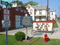
Tarlton is a village in Fairfield
and Pickaway
counties in the U.S. state
of Ohio
. The population was 298 at the 2000 census.
 This village was originally settled and called Newellstown in 1801, and was probably the first settlement in Pickaway County, Ohio
. The famous Zane's Trace
passed through Tarlton as well, and was the major route between Maysville
, Kentucky
and Wheeling
, Virginia
(now West Virginia
).
Nearby Tarlton is the Cross Mound, which was built by the pre-Columbian
Mound Builders.
According to the United States Census Bureau
, the village has a total area of 0.4 square miles (1 km²), which is all land.
Tarlton's elevation is 902 feet above sea level.
Tarlton is 30 miles southeast of Columbus
and is part of the Columbus, Ohio metropolitan area.
of 2000, there were 298 people, 102 households, and 75 families residing in the village. The population density
was 710.2 people per square mile (273.9/km²). There were 120 housing units at an average density of 286.0 per square mile (110.3/km²). The racial makeup of the village was 100.00% White.
There were 102 households out of which 38.2% had children under the age of 18 living with them, 56.9% were married couples
living together, 8.8% had a female householder with no husband present, and 25.5% were non-families. 23.5% of all households were made up of individuals and 13.7% had someone living alone who was 65 years of age or older. The average household size was 2.92 and the average family size was 3.39.
In the village the population was spread out with 31.2% under the age of 18, 7.4% from 18 to 24, 30.5% from 25 to 44, 19.8% from 45 to 64, and 11.1% who were 65 years of age or older. The median age was 36 years. For every 100 females there were 101.4 males. For every 100 females age 18 and over, there were 107.1 males.
The median income for a household in the village was $31,875, and the median income for a family was $43,125. Males had a median income of $30,938 versus $25,625 for females. The per capita income
for the village was $13,379. About 9.0% of families and 6.0% of the population were below the poverty line, including 1.1% of those under the age of eighteen and 22.5% of those sixty five or over.
Fairfield County, Ohio
Fairfield County is a county located in the state of Ohio, United States. As of 2010, the population was 146,156. Its county seat is Lancaster. Its name is a reference to the Fairfield area of the original Lancaster....
and Pickaway
Pickaway County, Ohio
As of the census of 2000, there were 52,727 people, 17,599 households, and 13,287 families residing in the county. The population density was 105 people per square mile . There were 18,596 housing units at an average density of 37 per square mile...
counties in the U.S. state
U.S. state
A U.S. state is any one of the 50 federated states of the United States of America that share sovereignty with the federal government. Because of this shared sovereignty, an American is a citizen both of the federal entity and of his or her state of domicile. Four states use the official title of...
of Ohio
Ohio
Ohio is a Midwestern state in the United States. The 34th largest state by area in the U.S.,it is the 7th‑most populous with over 11.5 million residents, containing several major American cities and seven metropolitan areas with populations of 500,000 or more.The state's capital is Columbus...
. The population was 298 at the 2000 census.
History
Ohio
Ohio is a Midwestern state in the United States. The 34th largest state by area in the U.S.,it is the 7th‑most populous with over 11.5 million residents, containing several major American cities and seven metropolitan areas with populations of 500,000 or more.The state's capital is Columbus...
. The famous Zane's Trace
Zane's Trace
Zane's Trace is a frontier road constructed under the direction of Col. Ebenezer Zane through the Northwest Territory of the United States, in what is now the state of Ohio. Many portions were based on traditional Native American trails...
passed through Tarlton as well, and was the major route between Maysville
Maysville, Kentucky
Maysville is a city in and the county seat of Mason County, Kentucky, United States. The population was 8,993 at the 2000 census, making it the fiftieth largest city in Kentucky by population. Maysville is on the Ohio River, northeast of Lexington. It is the principal city of the Maysville...
, Kentucky
Kentucky
The Commonwealth of Kentucky is a state located in the East Central United States of America. As classified by the United States Census Bureau, Kentucky is a Southern state, more specifically in the East South Central region. Kentucky is one of four U.S. states constituted as a commonwealth...
and Wheeling
Wheeling, West Virginia
Wheeling is a city in Ohio and Marshall counties in the U.S. state of West Virginia; it is the county seat of Ohio County. Wheeling is the principal city of the Wheeling Metropolitan Statistical Area...
, Virginia
Virginia
The Commonwealth of Virginia , is a U.S. state on the Atlantic Coast of the Southern United States. Virginia is nicknamed the "Old Dominion" and sometimes the "Mother of Presidents" after the eight U.S. presidents born there...
(now West Virginia
West Virginia
West Virginia is a state in the Appalachian and Southeastern regions of the United States, bordered by Virginia to the southeast, Kentucky to the southwest, Ohio to the northwest, Pennsylvania to the northeast and Maryland to the east...
).
Nearby Tarlton is the Cross Mound, which was built by the pre-Columbian
Pre-Columbian
The pre-Columbian era incorporates all period subdivisions in the history and prehistory of the Americas before the appearance of significant European influences on the American continents, spanning the time of the original settlement in the Upper Paleolithic period to European colonization during...
Mound Builders.
Geography
Tarlton is located at 39°33′17"N 82°46′45"W (39.554697, -82.779176).According to the United States Census Bureau
United States Census Bureau
The United States Census Bureau is the government agency that is responsible for the United States Census. It also gathers other national demographic and economic data...
, the village has a total area of 0.4 square miles (1 km²), which is all land.
Tarlton's elevation is 902 feet above sea level.
Tarlton is 30 miles southeast of Columbus
Columbus, Ohio
Columbus is the capital of and the largest city in the U.S. state of Ohio. The broader metropolitan area encompasses several counties and is the third largest in Ohio behind those of Cleveland and Cincinnati. Columbus is the third largest city in the American Midwest, and the fifteenth largest city...
and is part of the Columbus, Ohio metropolitan area.
Demographics
As of the censusCensus
A census is the procedure of systematically acquiring and recording information about the members of a given population. It is a regularly occurring and official count of a particular population. The term is used mostly in connection with national population and housing censuses; other common...
of 2000, there were 298 people, 102 households, and 75 families residing in the village. The population density
Population density
Population density is a measurement of population per unit area or unit volume. It is frequently applied to living organisms, and particularly to humans...
was 710.2 people per square mile (273.9/km²). There were 120 housing units at an average density of 286.0 per square mile (110.3/km²). The racial makeup of the village was 100.00% White.
There were 102 households out of which 38.2% had children under the age of 18 living with them, 56.9% were married couples
Marriage
Marriage is a social union or legal contract between people that creates kinship. It is an institution in which interpersonal relationships, usually intimate and sexual, are acknowledged in a variety of ways, depending on the culture or subculture in which it is found...
living together, 8.8% had a female householder with no husband present, and 25.5% were non-families. 23.5% of all households were made up of individuals and 13.7% had someone living alone who was 65 years of age or older. The average household size was 2.92 and the average family size was 3.39.
In the village the population was spread out with 31.2% under the age of 18, 7.4% from 18 to 24, 30.5% from 25 to 44, 19.8% from 45 to 64, and 11.1% who were 65 years of age or older. The median age was 36 years. For every 100 females there were 101.4 males. For every 100 females age 18 and over, there were 107.1 males.
The median income for a household in the village was $31,875, and the median income for a family was $43,125. Males had a median income of $30,938 versus $25,625 for females. The per capita income
Per capita income
Per capita income or income per person is a measure of mean income within an economic aggregate, such as a country or city. It is calculated by taking a measure of all sources of income in the aggregate and dividing it by the total population...
for the village was $13,379. About 9.0% of families and 6.0% of the population were below the poverty line, including 1.1% of those under the age of eighteen and 22.5% of those sixty five or over.
Notable natives
- William Sooy SmithWilliam Sooy SmithWilliam Sooy Smith was a West Point graduate and career United States Army officer who rose through the ranks to become a brigadier general in the Union Army during the American Civil War....
, Union general in the American Civil WarAmerican Civil WarThe American Civil War was a civil war fought in the United States of America. In response to the election of Abraham Lincoln as President of the United States, 11 southern slave states declared their secession from the United States and formed the Confederate States of America ; the other 25...
and prominent postbellum bridge builder