

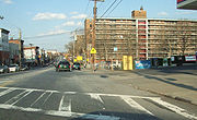
Targee Street
Encyclopedia
East Shore, Staten Island
The term East Shore is frequently applied to a series of neighborhoods along the Lower New York Bay and the Raritan Bay and within New York City's borough of Staten Island....
of the New York City borough of Staten Island
Staten Island
Staten Island is a borough of New York City, New York, United States, located in the southwest part of the city. Staten Island is separated from New Jersey by the Arthur Kill and the Kill Van Kull, and from the rest of New York by New York Bay...
. It is approximately 2.1 miles (3.4 km) long, and runs through the neighborhoods of Stapleton
Stapleton, Staten Island
Stapleton is a neighborhood in northeastern Staten Island in New York City in the United States. It is located along the waterfront of Upper New York Bay, bounded on the north by Tompkinsville at Grant Street, on the south by Clifton at Vanderbilt Avenue, and on the west by St. Paul's Avenue and...
, Clifton
Clifton, Staten Island
Clifton or Park Hill is a neighborhood in northeastern Staten Island in New York City in the United States. It is an older waterfront neighborhood, facing Upper New York Bay on the east...
, Concord
Concord, Staten Island
Concord is a neighborhood located in the Borough of Staten Island in New York City, New York, United States.Located in northeastern Staten Island, and bordered by the neighborhoods of Grasmere, Clifton, Dongan Hills, Emerson Hill, and Old Town, Concord was named Dutch Farms originally, but was...
, Old Town
Old Town, Staten Island
Old Town is a neighborhood in the New York City borough of Staten Island, located on its East Shore. Old Town was established in August 1661 as part of New Netherland, and was the first permanent European settlement on Staten Island...
, and Dongan Hills
Dongan Hills, Staten Island
Dongan Hills is a neighborhood located within New York City, USA's borough of Staten Island. It is on the Island's East Shore.The neighborhood was originally known by two separate names, the western half being called Hillside Park and the eastern half Linden Park...
.
The roadway is a main spur of the Richmond Road
Richmond Road
Richmond Road can refer to any of the following:* Richmond Road, Adelaide - a continuation of Greenhill Road, Adelaide, South Australia* Richmond Road * Richmond Road, Kentucky - An historic road name still used as the name for a segment of U.S...
corridor and carries Richmond Road's northbound traffic starting at West Fingerboard Road
West Fingerboard Road
West Fingerboard Road is a primary east-west artery in the Arrochar, Grasmere, Concord, and Old Town neighborhoods of Staten Island, New York.Landmarks include the headquarters of the Staten Island Advance, as well as the Stonegate at Grasmere housing development.West Fingerboard was once the...
.
A oneway in its entirety, Targee Street contains landmarks such as the Staten Island Family Court House, the Roman Catholic Church and Elementary School of the Immaculate Conception, the Roman Catholic Church and Elementary School of St. Sylvester, Concord High School, Public School 48 the William C. Wilcox School, and the former Doctor's Hospital
Doctors Hospital (Staten Island, New York)
Doctor's Hospital of Staten Island was a for-profit hospital located in the Concord section of Staten Island, one of the five boroughs of New York City.-History:...
site.
Although unsigned, Targee Street is serviced by the Richmond Road exit (Exit 13) of the Staten Island Expressway.
The Metropolitan Transportation Authority of New York provides the s74, s76,and x15 bus routes along sections of Targee Street.