

Swedeborg, Missouri
Encyclopedia
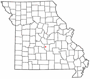
Swedeborg is an unincorporated community in northwestern Pulaski County, Missouri
Pulaski County, Missouri
Pulaski County is a county located in the U.S. state of Missouri. The county was organized in 1833 and named for Kazimierz Pułaski, Polish patriot who died fighting in the American Revolution. As of 2010, the population was 52,274, an increase of 27% from the 2000 Census count of 41,165. Its...
. It is about five miles northeast of Richland
Richland, Missouri
Richland is a city in Camden, Laclede, and Pulaski counties in the U.S. state of Missouri. The population was 1,805 at the 2000 census.-Geography:Richland is located at ....
on Route 133.
Swedeborg was a Swedish immigrant settlement on the railroad road between Crocker and Richland. It's best known in Pulaski County county for being the home of the Swedeborg R-III School District.http://swedeborg.k12.mo.us, which is the county's last remaining K-8 district. Along with Laquey
Laquey, Missouri
Laquey is an unincorporated community in Pulaski County, Missouri. It is about six miles southwest of Waynesville. It was founded in 1900 and named for the Laquey family.The community has a school, post office and zip code...
, it is one of only two unincorporated communities in Pulaski County to retain its own school district. The community no longer has its own post office; mail is addressed either to Richland or Crocker.
Transportation
Major north-south routes near Swedeborg include:- Route 133 runs north from Interstate 44Interstate 44Interstate 44 is a major highway in the central United States. Its western terminus is in Wichita Falls, Texas at a concurrency with US 277, US 281 and US 287; its eastern terminus is at the Illinois state line on the Poplar Street Bridge over the Mississippi River in St...
exit 145 about two miles east of HazelgreenHazelgreen, MissouriHazelgreen is an unincorporated community in eastern Laclede County, Missouri, United States. It lies along historic U.S. Route 66, now an outer road of Interstate 44. The town is split by I-44, just west of the 145 exit...
to RichlandRichland, MissouriRichland is a city in Camden, Laclede, and Pulaski counties in the U.S. state of Missouri. The population was 1,805 at the 2000 census.-Geography:Richland is located at ....
, Swedeborg, CrockerCrocker, MissouriCrocker is a city in Pulaski County, Missouri, United States. The population was 1,433 at the 2006 census.-Geography:Crocker is located at .According to the United States Census Bureau, the city has a total area of , all of it land....
, and about two miles west of DixonDixon, MissouriDixon is a city in Pulaski County, Missouri, United States. The population was 1,570 at the 2000 census. Dixon, MO is the hometown of NBA Basketball Player John Brown and State Representative David A...
, then north out of the county.
- Route 17 crosses Interstate 44Interstate 44Interstate 44 is a major highway in the central United States. Its western terminus is in Wichita Falls, Texas at a concurrency with US 277, US 281 and US 287; its eastern terminus is at the Illinois state line on the Poplar Street Bridge over the Mississippi River in St...
at exit 153 at BuckhornBuckhorn, MissouriBuckhorn, Missouri is a former community on Route 17 at its junction with Interstate 44 in Pulaski County. It is also on historic U.S. Route 66. In 2003, it was annexed by nearby Waynesville...
, runs east through WaynesvilleWaynesville, Missouri-Registered historic places:* Old Stagecoach Stop * Pulaski County Courthouse-Transportation:Waynesville Regional Airport at Forney Field serves the community with air service; even though it's on Fort Leonard Wood, it is jointly run by the cities of Waynesville and St...
, turns north to CrockerCrocker, MissouriCrocker is a city in Pulaski County, Missouri, United States. The population was 1,433 at the 2006 census.-Geography:Crocker is located at .According to the United States Census Bureau, the city has a total area of , all of it land....
, and then runs north out of the county to Iberia.
- Missouri Highway T runs north from Highway 17 at WaynesvilleWaynesville, Missouri-Registered historic places:* Old Stagecoach Stop * Pulaski County Courthouse-Transportation:Waynesville Regional Airport at Forney Field serves the community with air service; even though it's on Fort Leonard Wood, it is jointly run by the cities of Waynesville and St...
to Swedeborg, where it meets and ends at Highway 133 about halfway between RichlandRichland, MissouriRichland is a city in Camden, Laclede, and Pulaski counties in the U.S. state of Missouri. The population was 1,805 at the 2000 census.-Geography:Richland is located at ....
and CrockerCrocker, MissouriCrocker is a city in Pulaski County, Missouri, United States. The population was 1,433 at the 2006 census.-Geography:Crocker is located at .According to the United States Census Bureau, the city has a total area of , all of it land....
.