

Laquey, Missouri
Encyclopedia
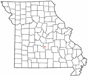
Laquey is an unincorporated community in Pulaski County, Missouri
Pulaski County, Missouri
Pulaski County is a county located in the U.S. state of Missouri. The county was organized in 1833 and named for Kazimierz Pułaski, Polish patriot who died fighting in the American Revolution. As of 2010, the population was 52,274, an increase of 27% from the 2000 Census count of 41,165. Its...
. It is about six miles southwest of Waynesville
Waynesville, Missouri
-Registered historic places:* Old Stagecoach Stop * Pulaski County Courthouse-Transportation:Waynesville Regional Airport at Forney Field serves the community with air service; even though it's on Fort Leonard Wood, it is jointly run by the cities of Waynesville and St...
. It was founded in 1900 and named for the Laquey family.
The community has a school, post office and zip code. Along with Devils Elbow
Devils Elbow, Missouri
Devils Elbow, Missouri is an unincorporated community in Pulaski County on historic U.S. Highway 66. It is situated on the Big Piney River and was named for a particularly bad place in the river known as a "devil of an elbow". It is about five miles east of St...
, it is one of only two unincorporated places in Pulaski County
Pulaski County, Missouri
Pulaski County is a county located in the U.S. state of Missouri. The county was organized in 1833 and named for Kazimierz Pułaski, Polish patriot who died fighting in the American Revolution. As of 2010, the population was 52,274, an increase of 27% from the 2000 Census count of 41,165. Its...
to retain a post office, and along with Swedeborg
Swedeborg, Missouri
Swedeborg is an unincorporated community in northwestern Pulaski County, Missouri. It is about five miles northeast of Richland on Route 133.Swedeborg was a Swedish immigrant settlement on the railroad road between Crocker and Richland...
, is one of only two unincorporated communities in the county to retain a school.
While the community is unincorporated, it is experiencing rapid growth due to its proximity to Fort Leonard Wood
Fort Leonard Wood (military base)
Fort Leonard Wood is a United States Army installation located in the Missouri Ozarks. The main gate is located on the southern boundary of St. Robert. The post was created in December 1940 and named in honor of General Leonard Wood, former Chief of Staff, in January 1941...
. The Laquey R-V School District had been for many years a K-8 district but in the early 1970s expanded to begin a high school. It's now the third-largest school district in Pulaski County, after Waynesville
Waynesville, Missouri
-Registered historic places:* Old Stagecoach Stop * Pulaski County Courthouse-Transportation:Waynesville Regional Airport at Forney Field serves the community with air service; even though it's on Fort Leonard Wood, it is jointly run by the cities of Waynesville and St...
and Dixon
Dixon, Missouri
Dixon is a city in Pulaski County, Missouri, United States. The population was 1,570 at the 2000 census. Dixon, MO is the hometown of NBA Basketball Player John Brown and State Representative David A...
.
Transportation
Major north-south routes near Laquey include:- Route 133 runs north from Interstate 44Interstate 44Interstate 44 is a major highway in the central United States. Its western terminus is in Wichita Falls, Texas at a concurrency with US 277, US 281 and US 287; its eastern terminus is at the Illinois state line on the Poplar Street Bridge over the Mississippi River in St...
exit 145 about two miles east of HazelgreenHazelgreen, MissouriHazelgreen is an unincorporated community in eastern Laclede County, Missouri, United States. It lies along historic U.S. Route 66, now an outer road of Interstate 44. The town is split by I-44, just west of the 145 exit...
to RichlandRichland, MissouriRichland is a city in Camden, Laclede, and Pulaski counties in the U.S. state of Missouri. The population was 1,805 at the 2000 census.-Geography:Richland is located at ....
, SwedeborgSwedeborg, MissouriSwedeborg is an unincorporated community in northwestern Pulaski County, Missouri. It is about five miles northeast of Richland on Route 133.Swedeborg was a Swedish immigrant settlement on the railroad road between Crocker and Richland...
, CrockerCrocker, MissouriCrocker is a city in Pulaski County, Missouri, United States. The population was 1,433 at the 2006 census.-Geography:Crocker is located at .According to the United States Census Bureau, the city has a total area of , all of it land....
, and about two miles west of DixonDixon, MissouriDixon is a city in Pulaski County, Missouri, United States. The population was 1,570 at the 2000 census. Dixon, MO is the hometown of NBA Basketball Player John Brown and State Representative David A...
, then north out of the county.
- Route 7 runs north from Interstate 44Interstate 44Interstate 44 is a major highway in the central United States. Its western terminus is in Wichita Falls, Texas at a concurrency with US 277, US 281 and US 287; its eastern terminus is at the Illinois state line on the Poplar Street Bridge over the Mississippi River in St...
exit 150 about three miles west of BuckhornBuckhorn, MissouriBuckhorn, Missouri is a former community on Route 17 at its junction with Interstate 44 in Pulaski County. It is also on historic U.S. Route 66. In 2003, it was annexed by nearby Waynesville...
to RichlandRichland, MissouriRichland is a city in Camden, Laclede, and Pulaski counties in the U.S. state of Missouri. The population was 1,805 at the 2000 census.-Geography:Richland is located at ....
, then north out of the county toward the Lake of the Ozarks region.
- Route 17 crosses Interstate 44Interstate 44Interstate 44 is a major highway in the central United States. Its western terminus is in Wichita Falls, Texas at a concurrency with US 277, US 281 and US 287; its eastern terminus is at the Illinois state line on the Poplar Street Bridge over the Mississippi River in St...
at exit 153 at BuckhornBuckhorn, MissouriBuckhorn, Missouri is a former community on Route 17 at its junction with Interstate 44 in Pulaski County. It is also on historic U.S. Route 66. In 2003, it was annexed by nearby Waynesville...
, runs east through WaynesvilleWaynesville, Missouri-Registered historic places:* Old Stagecoach Stop * Pulaski County Courthouse-Transportation:Waynesville Regional Airport at Forney Field serves the community with air service; even though it's on Fort Leonard Wood, it is jointly run by the cities of Waynesville and St...
, turns north to CrockerCrocker, MissouriCrocker is a city in Pulaski County, Missouri, United States. The population was 1,433 at the 2006 census.-Geography:Crocker is located at .According to the United States Census Bureau, the city has a total area of , all of it land....
, and then runs north out of the county to Iberia. South of Interstate 44Interstate 44Interstate 44 is a major highway in the central United States. Its western terminus is in Wichita Falls, Texas at a concurrency with US 277, US 281 and US 287; its eastern terminus is at the Illinois state line on the Poplar Street Bridge over the Mississippi River in St...
, Highway 17 hugs the western edge of Fort Leonard Wood, passes near Laquey, and circles south of the post until it runs out of the county and eventually joins Highway 32 in RobyRoby, MissouriRoby is an unincorporated community in northwestern Texas County, Missouri, United States. It is located about sixteen miles northwest of Houston and ten miles south of Fort Leonard Wood at the northern junction of Routes 17 and 32...
.