
.gif)
State Route 171 (Tennessee)
Encyclopedia
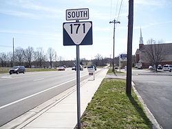
State Route 171 runs south–north through Davidson
and Wilson counties in the state of Tennessee
. It connects Interstate 24
to U.S. Route 70
.
(technically not a city, but part of the Metropolitan Government of Nashville and Davidson County) and Mount Juliet.
TN-171 also traverses Percy Priest Lake
(Stones River
) and travels through Long Hunter State Park
. It also passes by the former site of Starwood Amphitheatre
, which was the Nashville area's premier outdoor music venue until it closed following the 2006 season.
Along its path, State Route 171 intersects:
 TN-171 begins in Antioch (at the Interstate 24 interchage) in a large industrial park. As it travels northward, the area through which the road passes becomes more residential (with light commercial), until it crosses Percy Priest Lake. Once across the water, TN-171 travels through Long Hunter State Park for a short distance, before entering another residential area. Finally, the road ends in a dense commercial area, as it travels through the city of Mt. Juliet.
TN-171 has four names along its route:
Davidson County, Tennessee
Davidson County is a county located in the U.S. state of Tennessee. As of 2010, the population was 626,681. Its county seat is Nashville.In 1963, the City of Nashville and the Davidson County government merged, so the county government is now known as the "Metropolitan Government of Nashville and...
and Wilson counties in the state of Tennessee
Tennessee
Tennessee is a U.S. state located in the Southeastern United States. It has a population of 6,346,105, making it the nation's 17th-largest state by population, and covers , making it the 36th-largest by total land area...
. It connects Interstate 24
Interstate 24
Interstate 24 is an Interstate Highway in the Midwestern and Southeastern United States. It runs diagonally from Interstate 57 to Chattanooga, Tennessee, at Interstate 75....
to U.S. Route 70
U.S. Route 70
U.S. Route 70 is an east–west United States highway that runs for 2,385 miles from eastern North Carolina to east-central Arizona. As can be derived from its number, it is a major east–west highway of the Southern and Southwestern United States...
.
Route Description
Along TN-171's path, it passes through two cities: AntiochAntioch, Tennessee
Antioch is a community in southeastern Davidson County, Tennessee, that is governed by the Nashville metropolitan government. The area is assigned to postal zip code 37013.- History :...
(technically not a city, but part of the Metropolitan Government of Nashville and Davidson County) and Mount Juliet.
TN-171 also traverses Percy Priest Lake
Percy Priest Lake
J. Percy Priest Lake is a reservoir in north central Tennessee. It is formed by J. Percy Priest Dam, located between miles six and seven of the Stones River. The dam is located about 10 miles east of downtown Nashville and impounds a lake 42 miles long...
(Stones River
Stones River
The Stones River is a major stream of the eastern portion of Tennessee's Nashville Basin region.-Geography and hydrography:The Stones River is composed of three major forks: the West, Middle, and East forks. The West Fork, long, rises in southernmost Rutherford County near the Bedford County...
) and travels through Long Hunter State Park
Long Hunter State Park
Long Hunter State Park is a state park in Davidson County and Rutherford County, Tennessee, located in the southeastern United States. The park is mostly situated along the eastern shores of Percy Priest Lake, an artificial lake created by an impoundment of the Stones River.Long Hunter State Park...
. It also passes by the former site of Starwood Amphitheatre
Starwood Amphitheatre
Starwood Amphitheatre was the primary outdoor music venue in the Nashville, Tennessee area from 1985 to 2006. It was owned by Live Nation and had a capacity of 17,137...
, which was the Nashville area's premier outdoor music venue until it closed following the 2006 season.
Along its path, State Route 171 intersects:
- Interstate 24Interstate 24Interstate 24 is an Interstate Highway in the Midwestern and Southeastern United States. It runs diagonally from Interstate 57 to Chattanooga, Tennessee, at Interstate 75....
(at mile marker 62) - U.S. Route 41U.S. Route 41U.S. Route 41 is a north–south United States Highway that runs from Miami, Florida to the Upper Peninsula of Michigan. Until 1949, the part in southern Florida, from Naples to Miami, was U.S...
/U.S. Route 70S (Murfreesboro Road) - State Route 265 (Central Pike)
- Interstate 40Interstate 40Interstate 40 is the third-longest major east–west Interstate Highway in the United States, after I-90 and I-80. Its western end is at Interstate 15 in Barstow, California; its eastern end is at a concurrency of U.S. Route 117 and North Carolina Highway 132 in Wilmington, North Carolina...
(at mile marker 226) - U.S. Route 70U.S. Route 70U.S. Route 70 is an east–west United States highway that runs for 2,385 miles from eastern North Carolina to east-central Arizona. As can be derived from its number, it is a major east–west highway of the Southern and Southwestern United States...
(Lebanon PikeLebanon, TennesseeLebanon is a city in Wilson County, Tennessee, in the United States. The population was 20,235 at the 2000 census. It serves as the county seat of Wilson County. Lebanon is located in middle Tennessee, approximately 25 miles east of downtown Nashville. Local residents have also called it...
)
TN-171 has four names along its route:
- Old Hickory BoulevardOld Hickory BoulevardOld Hickory Boulevard is a historic road that encircles Nashville, Tennessee. Originally the road, aided by ferries, formed an unbroken loop around the city...
(I-24 to US-41/US-70S) - Hobson Pike (US-41/70S to curve near Wilson/Davidson county line)
- South Mt. Juliet Road (Curve near Wilson/Davidson county line to I-40)
- North Mt. Juliet Road (I-40 to US-70)