

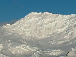
St. Methodius Peak
Encyclopedia
Friesland Ridge
Friesland Ridge is a ridge on Livingston Island in the South Shetlands, part of the Tangra Mountains. The summit, Mount Friesland, which rises to , is the northwesternmost of the ridge’s six main peaks...
, Tangra Mountains
Tangra Mountains
Tangra Mountains form the principal mountain range of Livingston Island in the South Shetland Islands, Antarctica...
, Livingston Island, Antarctica and surmounts Ruen Icefall
Ruen Icefall
Ruen Icefall descends towards False Bay from the circus overlooked by Simeon Peak, St. Cyril Peak and St. Methodius Peak in Friesland Ridge, Tangra Mountains, on Rozhen Peninsula in eastern Livingston Island, South Shetland Islands in Antarctica.Ruen is the summit of Osogovo Mountain in...
to the north-northwest, Prespa Glacier
Prespa Glacier
Prespa Glacier on Rozhen Peninsula, Livingston Island in the South Shetland Islands, Antarctica is bounded to the east by Needle Peak and Ludogorie Peak, to the northwest by St. Cyril Peak and St. Methodius Peak, and to the southwest by Shumen Peak and Yambol Peak, and flows southeastward into...
to the southeast and Charity Glacier
Charity Glacier
Charity Glacier is a glacier lying north of Barnard Point on Rozhen Peninsula, Livingston Island in the South Shetland Islands, Antarctica. It was named by the UK Antarctic Place-names Committee in 1958 after the brig Charity Charity Glacier is a glacier lying north of Barnard Point on Rozhen...
to the southwest. Linked to St. Cyril Peak
St. Cyril Peak
St. Cyril Peak rises to 1,505m in Friesland Ridge in Tangra Mountains on Livingston Island in the South Shetland Islands, Antarctica. The peak is linked to St. Methodius Peak to the southwest by Vladaya Saddle and surmounts Ruen Icefall to the west, Macy Glacier to the east and Prespa Glacier to...
by Vladaya Saddle
Vladaya Saddle
Vladaya Saddle is a saddle of elevation 1000 m in the Friesland Ridge of Tangra Mountains, Livingston Island in the South Shetland Islands, Antarctica. Bounded by St. Cyril Peak to the northeast, and by St. Methodius Peak to the southwest. Overlooking Ruen Icefall to the northwest, and Prespa...
.
The peak is named after St. Methodius (815-885 AD).
Location
The peak is located at 62°42′57"S 60°14′47"W which is 5.89 km south-southwest of Mount FrieslandMount Friesland
Mount Friesland is the summit of Tangra Mountains on Livingston Island, in the South Shetland Islands, Antarctica. The peak is rising to 1700 m sharp, and is heavily glaciated and crevassed. Situated 12.5 km northeast of Barnard Point, 9.7 km east-southeast of St...
, 1.97 km southwest of St. Cyril Peak
St. Cyril Peak
St. Cyril Peak rises to 1,505m in Friesland Ridge in Tangra Mountains on Livingston Island in the South Shetland Islands, Antarctica. The peak is linked to St. Methodius Peak to the southwest by Vladaya Saddle and surmounts Ruen Icefall to the west, Macy Glacier to the east and Prespa Glacier to...
, 3.24 km north-northwest of Gela Point
Gela Point
Gela Point is a point on the southeast coast of Rozhen Peninsula on Livingston Island, Antarctica formed by an offshoot of Yambol Peak. Situated on the coast of Bransfield Strait 5.1 km east-northeast of Botev Point, 700 m east-southeast of Yambol Peak, and 4.1 km west-southwest of...
, 3.83 km east of Canetti Peak
Canetti Peak
Canetti Peak is a 400 m peak in the Friesland Ridge, Tangra Mountains, eastern Livingston Island in the South Shetland Islands, Antarctica. The peak has precipitous and ice-free western slopes and overlooks Zagore Beach and False Bay to the west and north, and Charity Glacier to the south...
and 6.37 km south-southeast of Napier Peak
Napier Peak
Napier Peak is the partly ice-free peak rising to 380 m on Hurd Peninsula, Livingston Island in the South Shetland Islands, Antarctica. It is linked to Charrúa Gap to the north by an 1.5 km ice-covered col, and by an ice-covered saddle to Mirador Hill to the south-southwest, and surmounts...
(Bulgarian topographic survey in 1995/96, and mapping in 2005 and 2009).
Maps
- L.L. Ivanov et al. Antarctica: Livingston Island and Greenwich Island, South Shetland Islands. Scale 1:100000 topographic map. Sofia: Antarctic Place-names Commission of Bulgaria, 2005.
- L.L. Ivanov. Antarctica: Livingston Island and Greenwich, Robert, Snow and Smith Islands. Scale 1:120000 topographic map. Troyan: Manfred Wörner Foundation, 2009. ISBN 978-954-92032-6-4