Southeast, New York
Encyclopedia
Southeast is a town in Putnam County
, New York
, United States
. The population was 17,316 at the 2000 census. The town is in the southeast part of the county. Interstate 84
, Interstate 684
, US Route 202, and US Route 6
pass through the town.
The town of Southeast, then still including its portion of the Oblong, was founded in 1788, and formed the southeast corner of Dutchess County
. In 1795, the town that had been Southeast's neighbor, Frederickstown was divided into the present Carmel
, Kent, and Patterson
, the latter two known at first as "Frederick" and "Franklin." At that time, Southeast lost its northern half to Patterson, and expanded to the west to become the shape it is now. Putnam County split from Dutchess in 1812. The most densely populated area in the town is the village of Brewster
.
Before the establishment of centralized post offices, local offices were established in general stores, railroad depots and other public venues in densely populated areas. In Putnam County’s Town of Southeast, there were nine individual Post Offices, each with distinctive postmarks:
By September 1968, the last of these local offices was closed and the only post office for the Town of Southeast and Village of Brewster was located at 20 Main Street in the Village of Brewster and its postmark was “Brewster, New York 10509.” In the 1990s this USPS branch relocated to 3 Mount Ebo Road in the Doansburgh section of Town of Southeast, no longer in the Village of Brewster, but retained the "Brewster 10509" name and zip code.
, the town has a total area of 35 square miles (90.6 km²), of which, 32.1 square miles (83.1 km²) of it is land and 2.9 square miles (7.5 km²) of it (8.35%) is water. The town contains several reservoirs that supply New York City
.
The east town line is the border of Connecticut
(Fairfield County
), and the south town line is the border of Westchester County
.
of 2000, there were 17,316 people, 6,184 households, and 4,569 families residing in the town. The population density
was 540.1 people per square mile (208.5/km²). There were 6,412 housing units at an average density of 200.0 per square mile (77.2/km²). The racial makeup of the town was 92.88% White, 1.87% African American, 0.14% Native American, 1.63% Asian, 0.09% Pacific Islander, 2.40% from other races
, and 0.99% from two or more races. Hispanic or Latino of any race were 8.04% of the population.
There were 6,184 households out of which 37.5% had children under the age of 18 living with them, 61.9% were married couples
living together, 8.7% had a female householder with no husband present, and 26.1% were non-families. 20.6% of all households were made up of individuals and 6.5% had someone living alone who was 65 years of age or older. The average household size was 2.77 and the average family size was 3.22.
In the town the population was spread out with 26.4% under the age of 18, 5.9% from 18 to 24, 33.1% from 25 to 44, 24.6% from 45 to 64, and 10.0% who were 65 years of age or older. The median age was 37 years. For every 100 females there were 101.6 males. For every 100 females age 18 and over, there were 97.2 males.
The median income for a household in the town was $69,272, and the median income for a family was $78,553. Males had a median income of $51,957 versus $39,583 for females. The per capita income
for the town was $29,506. About 3.1% of families and 6.1% of the population were below the poverty line, including 8.3% of those under age 18 and 3.8% of those age 65 or over.

Putnam County, New York
Putnam County is a county located in the U.S. state of New York, in the lower Hudson River Valley. Putnam county formed in 1812, when it detached from Dutchess County. , the population was 99,710. It is part of the New York Metropolitan Area. The county seat is the hamlet of Carmel...
, New York
New York
New York is a state in the Northeastern region of the United States. It is the nation's third most populous state. New York is bordered by New Jersey and Pennsylvania to the south, and by Connecticut, Massachusetts and Vermont to the east...
, United States
United States
The United States of America is a federal constitutional republic comprising fifty states and a federal district...
. The population was 17,316 at the 2000 census. The town is in the southeast part of the county. Interstate 84
Interstate 84 (east)
Interstate 84 is an Interstate Highway extending from Dunmore, Pennsylvania at an interchange with Interstate 81 to Sturbridge, Massachusetts, at an interchange with the Massachusetts Turnpike . I-84 has mile-log junction numbering in Pennsylvania; otherwise, exit numbers are roughly sequential...
, Interstate 684
Interstate 684
Interstate 684 is a 28.4 mile-long north–south Interstate Highway in the states of New York and Connecticut. The highway connects I-84 with I-287 and the Hutchinson River Parkway, primarily serving commuter traffic to and from the northern suburbs of the New York metropolitan area...
, US Route 202, and US Route 6
U.S. Route 6 in New York
U.S. Route 6 is a part of the U.S. Highway System that runs from Bishop, California, to Provincetown, Massachusetts. In New York, US 6 extends from the Pennsylvania state line at Port Jervis to the Connecticut state line east of Brewster...
pass through the town.
History
The first settler arrived around 1730. The area first exploited was called "The Oblong," and was outside of the land claimed by the Philipse Patent. Due to a border dispute between New York and Connecticut the area between the undisputed border of NY and the undisputed border of CT was an approximately 4-mile-wide area which ran the full north-south dimension of Dutchess County. This was called the Oblong. Land was sold in this area both by the governor of NY and the King of England for Connecticut, with conflicting deeds. The boundary was settled in New York's favor by the 1731 Treaty of Dover. A southern portion of the Oblong was alternately known as Southeast as it was the southeasternmost town in Dutchess County. It consisted of the eastern half of the current Town of Patterson, and the eastern half of the current town of Southeast. The western half of the current town of Southeast was part of the large Phillipse Patent which had not yet been divided into towns. The most heavily-settled area of the Oblong at this point was the "city" of Frederickstown, now the hamlet of Patterson.The town of Southeast, then still including its portion of the Oblong, was founded in 1788, and formed the southeast corner of Dutchess County
Dutchess County, New York
Dutchess County is a county located in the U.S. state of New York, in the state's Mid-Hudson Region of the Hudson Valley. The 2010 census lists the population as 297,488...
. In 1795, the town that had been Southeast's neighbor, Frederickstown was divided into the present Carmel
Carmel, New York
Carmel is a town located in Putnam County, New York, USA. As of the 2000 census, the town had a total population of 36,465.There are no incorporated villages in the town, although the hamlets of Carmel and Mahopac each have populations sizable enough to be thought of as villages.The Town of Carmel...
, Kent, and Patterson
Patterson, New York
Patterson is a town in Putnam County, New York, United States. The town is in the northeast part of the county. Interstate 84 passes through the southwest part of the town. The population was 11,306 at the 2000 census. The town is named after early farmer Matthew Paterson...
, the latter two known at first as "Frederick" and "Franklin." At that time, Southeast lost its northern half to Patterson, and expanded to the west to become the shape it is now. Putnam County split from Dutchess in 1812. The most densely populated area in the town is the village of Brewster
Brewster, New York
Brewster is a village within the town of Southeast in Putnam County, New York, United States. Its population was 2,162 at the 2000 census. The village is the most densely populated portion of the town...
.
Post Offices
The first “South East” post office was established in 1797, when the town was still a municipality in Dutchess County. On June 12, 1812, the county of Putnam was established from six Dutchess County towns: Carmel, Kent, Patterson, Philipstown, Putnam Valley and Southeast. These two dates provide a frame of reference for the dates of operation of each Southeast post office.Before the establishment of centralized post offices, local offices were established in general stores, railroad depots and other public venues in densely populated areas. In Putnam County’s Town of Southeast, there were nine individual Post Offices, each with distinctive postmarks:
- Brewster’s Station from 1850 to 1883
- Brewster from 1883 to date
- Doanesburgh from 1839 to 1855
- Dykman’s from 1851 to 1894
- Dykemans from 1894 to 1935
- Milltown from 1826 to 1867
- Putnam Lake Branch 1959 to 1968
- South East 1797 to 1812 (Dutchess County)
- South East 1812 to 1857 (Putnam County)
- Tilly Foster 1881 to 1958
By September 1968, the last of these local offices was closed and the only post office for the Town of Southeast and Village of Brewster was located at 20 Main Street in the Village of Brewster and its postmark was “Brewster, New York 10509.” In the 1990s this USPS branch relocated to 3 Mount Ebo Road in the Doansburgh section of Town of Southeast, no longer in the Village of Brewster, but retained the "Brewster 10509" name and zip code.
Geography
According to the United States Census BureauUnited States Census Bureau
The United States Census Bureau is the government agency that is responsible for the United States Census. It also gathers other national demographic and economic data...
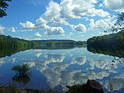
, the town has a total area of 35 square miles (90.6 km²), of which, 32.1 square miles (83.1 km²) of it is land and 2.9 square miles (7.5 km²) of it (8.35%) is water. The town contains several reservoirs that supply New York City
New York City
New York is the most populous city in the United States and the center of the New York Metropolitan Area, one of the most populous metropolitan areas in the world. New York exerts a significant impact upon global commerce, finance, media, art, fashion, research, technology, education, and...
.
The east town line is the border of Connecticut
Connecticut
Connecticut is a state in the New England region of the northeastern United States. It is bordered by Rhode Island to the east, Massachusetts to the north, and the state of New York to the west and the south .Connecticut is named for the Connecticut River, the major U.S. river that approximately...
(Fairfield County
Fairfield County, Connecticut
Fairfield County is a county located in the southwestern corner of the U.S. state of Connecticut. The county population is 916,829 according to the 2010 Census. There are currently 1,465 people per square mile in the county. It is the most populous county in the State of Connecticut and contains...
), and the south town line is the border of Westchester County
Westchester County, New York
Westchester County is a county located in the U.S. state of New York. Westchester covers an area of and has a population of 949,113 according to the 2010 Census, residing in 45 municipalities...
.

Demographics
As of the censusCensus
A census is the procedure of systematically acquiring and recording information about the members of a given population. It is a regularly occurring and official count of a particular population. The term is used mostly in connection with national population and housing censuses; other common...
of 2000, there were 17,316 people, 6,184 households, and 4,569 families residing in the town. The population density
Population density
Population density is a measurement of population per unit area or unit volume. It is frequently applied to living organisms, and particularly to humans...
was 540.1 people per square mile (208.5/km²). There were 6,412 housing units at an average density of 200.0 per square mile (77.2/km²). The racial makeup of the town was 92.88% White, 1.87% African American, 0.14% Native American, 1.63% Asian, 0.09% Pacific Islander, 2.40% from other races
Race (United States Census)
Race and ethnicity in the United States Census, as defined by the Federal Office of Management and Budget and the United States Census Bureau, are self-identification data items in which residents choose the race or races with which they most closely identify, and indicate whether or not they are...
, and 0.99% from two or more races. Hispanic or Latino of any race were 8.04% of the population.
There were 6,184 households out of which 37.5% had children under the age of 18 living with them, 61.9% were married couples
Marriage
Marriage is a social union or legal contract between people that creates kinship. It is an institution in which interpersonal relationships, usually intimate and sexual, are acknowledged in a variety of ways, depending on the culture or subculture in which it is found...
living together, 8.7% had a female householder with no husband present, and 26.1% were non-families. 20.6% of all households were made up of individuals and 6.5% had someone living alone who was 65 years of age or older. The average household size was 2.77 and the average family size was 3.22.
In the town the population was spread out with 26.4% under the age of 18, 5.9% from 18 to 24, 33.1% from 25 to 44, 24.6% from 45 to 64, and 10.0% who were 65 years of age or older. The median age was 37 years. For every 100 females there were 101.6 males. For every 100 females age 18 and over, there were 97.2 males.
The median income for a household in the town was $69,272, and the median income for a family was $78,553. Males had a median income of $51,957 versus $39,583 for females. The per capita income
Per capita income
Per capita income or income per person is a measure of mean income within an economic aggregate, such as a country or city. It is calculated by taking a measure of all sources of income in the aggregate and dividing it by the total population...
for the town was $29,506. About 3.1% of families and 6.1% of the population were below the poverty line, including 8.3% of those under age 18 and 3.8% of those age 65 or over.
Communities and locations in Southeast

- Bog Brook ReservoirBog Brook ReservoirThe Bog Brook Reservoir is a reservoir in the Croton Watershed in southern New York State. It is located in the town of Southeast, New York in Putnam County, and is approximately 38 miles north of New York City, to which it supplies water...
– A reservoir near the center of the town. - BrewsterBrewster, New YorkBrewster is a village within the town of Southeast in Putnam County, New York, United States. Its population was 2,162 at the 2000 census. The village is the most densely populated portion of the town...
– A centrally located village within the town. - Brewster Heights – A hamlet west of Brewster village.
- Brewster HillBrewster Hill, New YorkBrewster Hill is a hamlet located in the township of Southeast in Putnam County, New York. As of the 2000 census, the population was 2,226.Brewster Hill is located on the east side of Tonetta Lake and is east of Interstate 84....
– A hamlet north of Brewster village. - Deans Corners – A hamlet in the southwest part of the town.

- Deforest Corners – A hamlet in the northeast corner of the town, northeast of Sears Corners.
- Doansburg
- Drewville Heights – A hamlet in the southwest part of the town.
- Dykemans – A hamlet on Route 312, north of Brewster Hill.
- East Branch ReservoirEast Branch ReservoirEast Branch Reservoir, formed by impounding the eponymous branch of the Croton River, is part of New York City's water supply network. It is located in the Putnam County town of Southeast, near the village of Brewster 35 miles north of the city....
– A reservoir east of Brewster and south of Bog Brook Reservoir. - Milltown – A hamlet near the east town line.
- Peach LakePeach Lake, New YorkPeach Lake is a hamlet located mostly in the town of Southeast in Putnam County, New York; a portion of the CDP is in the town of North Salem in Westchester County. As of the 2010 census, the population was 1,629....
– A hamlet in the southeast corner of the town, located at the northeast shore of a small lakeLakeA lake is a body of relatively still fresh or salt water of considerable size, localized in a basin, that is surrounded by land. Lakes are inland and not part of the ocean and therefore are distinct from lagoons, and are larger and deeper than ponds. Lakes can be contrasted with rivers or streams,...
also called Peach Lake. - Sears Corners – A hamlet by the intersection of Routes 22 and 312 in the northeastern part of the town.
- Sodom – A location east of Brewster village.
- Tilly Foster – A hamlet near the west town line
- Tilly Foster MineTilly Foster MineThe Tilly Foster Mine was an iron mine two miles west of the village of Brewster, New York, along Route 6.The Tilly Foster Mine was named after Tillingham Foster, who bought the land that the mine was on from George Beale. After Foster's death in 1842, the property passed through several hands...
– an abandoned mine adjacent to Tilly Foster Farm MuseumTilly Foster Farm Museum-Heritage animals:The museum is notable for rare farm animals including Randall Cattle, donkeys, American rabbits, Pilgrim geese, Indian Runner ducks, and Narragansett turkeys.-Other attractions:...
Political leaders
- Governor Andrew CuomoAndrew CuomoAndrew Mark Cuomo is the 56th and current Governor of New York, having assumed office on January 1, 2011. A member of the Democratic Party, he was the 64th New York State Attorney General, and was the 11th United States Secretary of Housing and Urban Development...
since 2011 - US Senator Charles SchumerCharles SchumerCharles Ellis "Chuck" Schumer is the senior United States Senator from New York and a member of the Democratic Party. First elected in 1998, he defeated three-term Republican incumbent Al D'Amato by a margin of 55%–44%. He was easily re-elected in 2004 by a margin of 71%–24% and in 2010 by a...
since 1999 - US Senator Kristen Gillibrand since 2009
- Congressman Nan HayworthNan HayworthNan Alison Sutter Hayworth is the U.S. Representative for . She is a member of the Republican Party.-Early life, education, and nursing career:...
since 2011 - State Senator Greg BallGregory R. BallGregory R. Ball is an American business executive, former active duty Air Force officer and member of the New York State Senate. He is a resident of Carmel, New York....
since 2011 - Assemblyman Steve KatzSteve Katz (politician)Dr. Stephen M. "Steve" Katz is an American veterinarian, business owner and politician from Mohegan Lake, New York. He is currently a member of the New York State Assembly, representing parts of Westchester, Putnam and Dutchess counties....
since 2011 - County Executive Robert BondiRobert BondiRobert J. Bondi is Putnam County, New York's third County Executive and is currently serving a fifth term as the county’s Chief Executive and Administrative Officer...
since 1991 - County Legislator Daniel G. BirminghamDaniel G. BirminghamDaniel G. Birmingham , better known as "Dan Birmingham", is the Chairman of the nine-member County Legislature in Putnam County, New York. He is also an attorney with a Wall Street law firm, practicing in the area of municipal and public finance....
since 2004 - County Legislator Tony Hay since 1993
- Town Supervisor D. Michael Rights since 2008
Notable residents of Southeast
- Julius BakerJulius BakerJulius Baker was one of the foremost American orchestral flute players.He was well known as a teacher and served as a faculty member at the Juilliard School, Curtis Institute of Music, and Carnegie Mellon University...
, most highly regarded flutist of his generation; principal flutist of the New York Philharmonic, founding member of the Bach Aria Group, among other honors, accolades and musical connections - Chester BeachChester BeachChester A. Beach was an American sculptor who was known for his busts and medallic art.-Early life:Beach was born in San Francisco, California. He studied initially at the California School of Mechanical Arts and worked as a jewelry designer immediately afterward, while continuing his art studies...
, Sculptor - Laura BraniganLaura BraniganLaura Ann Branigan was an American singer-songwriter and actress of Italian and Irish ancestry. She is best known in the United States for her 1982 Platinum-certified hit "Gloria" and in Europe for the number-one single "Self Control"...
, Musician - Fanny CrosbyFanny CrosbyFrances Jane Crosby , usually known as Fanny Crosby in the United States and by her married name, Frances van Alstyne, in the United Kingdom, was an American Methodist rescue mission worker, poet, lyricist, and composer. During her lifetime, she was well-known throughout the United States...
, hymnist - DeeAnn Donovan, American fitness model, although originally from Iowa City, IA
- Ava FabianAva FabianAva Fabian is an American model and actress. She was chosen as Playboy's Playmate of the Month in August 1986 and has appeared in numerous Playboy videos. Her centerfold was photographed by Arny Freytag and Richard Fegley.Fabian played Roxy Carmichael in the movie Welcome Home, Roxy Carmichael,...
, American Model and actress. - Dag HammarskjöldDag HammarskjöldDag Hjalmar Agne Carl Hammarskjöld was a Swedish diplomat, economist, and author. An early Secretary-General of the United Nations, he served from April 1953 until his death in a plane crash in September 1961. He is the only person to have been awarded a posthumous Nobel Peace Prize. Hammarskjöld...
, Secretary General of the United Nations from 1953 until his death in 1961 - James KentJames KentJames Kent was an American jurist and legal scholar.-Life:...
, Chancellor of New YorkNew York Court of ChanceryThe New York Court of Chancery was established during the colonial administration on August 28, 1701, the colonial governor acting as Chancellor. The New York State Constitution of 1777 continued the court but required a lawyer to be appointed Chancellor. It was the court with jurisdiction on cases...
1814-1823 - Mark RiveraMark RiveraMark Rivera is a musician, musical director and corporate entertainment provider. In addition to playing soprano, alto, tenor and baritone saxophones, Rivera's musical talents encompass vocals, guitar, percussion and keyboards.-Education:...
, Saxophone Player (Billy Joel, Elton John, Ringo Starr) - John WolffJohn WolffJohn Wolff served as an Adjunct Professor of Law at Georgetown University Law Center for 44 years until his death on December 7, 2005 In addition to teaching, he worked for the government and was a consultant on Foreign and International Law in Washington, D.C. and published articles in numerous...
, Georgetown UniversityGeorgetown UniversityGeorgetown University is a private, Jesuit, research university whose main campus is in the Georgetown neighborhood of Washington, D.C. Founded in 1789, it is the oldest Catholic university in the United States...
law professor

