
South Northamptonshire
Encyclopedia
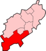
South Northamptonshire is a local government district
in Northamptonshire
, England
. Its council is based in Towcester
.
The district is rural and sparsely populated with just over 79,293 people in 2000 and 91,000 in 2008, a 14.8% increase. The largest town in the district is Brackley
, which has a population of 14,000 in 2008 followed by Towcester which has a population of nearly 10,000. Other significant places include Middleton Cheney
. The growth in population between 2001 and 2007 was the 3rd largest of all districts in the country and consisted of 35,700 households.
The district was formed on 1 April 1974, under the Local Government Act 1972
, and was a merger of the municipal borough
of Brackley, along with Brackley Rural District, Towcester Rural District, and part of Northampton Rural District
.
Non-metropolitan district
Non-metropolitan districts, or colloquially shire districts, are a type of local government district in England. As created, they are sub-divisions of non-metropolitan counties in a so-called "two-tier" arrangement...
in Northamptonshire
Northamptonshire
Northamptonshire is a landlocked county in the English East Midlands, with a population of 629,676 as at the 2001 census. It has boundaries with the ceremonial counties of Warwickshire to the west, Leicestershire and Rutland to the north, Cambridgeshire to the east, Bedfordshire to the south-east,...
, England
England
England is a country that is part of the United Kingdom. It shares land borders with Scotland to the north and Wales to the west; the Irish Sea is to the north west, the Celtic Sea to the south west, with the North Sea to the east and the English Channel to the south separating it from continental...
. Its council is based in Towcester
Towcester
Towcester , the Roman town of Lactodorum, is a small town in south Northamptonshire, England.-Etymology:Towcester comes from the Old English Tófe-ceaster. Tófe refers to the River Tove; Bosworth and Toller compare it to the "Scandinavian proper names" Tófi and Tófa...
.
The district is rural and sparsely populated with just over 79,293 people in 2000 and 91,000 in 2008, a 14.8% increase. The largest town in the district is Brackley
Brackley
Brackley is a town in south Northamptonshire, England. It is about from Oxford and miles form Northampton. Historically a market town based on the wool and lace trade, it was built on the intersecting trade routes between London, Birmingham and the English Midlands and between Cambridge and Oxford...
, which has a population of 14,000 in 2008 followed by Towcester which has a population of nearly 10,000. Other significant places include Middleton Cheney
Middleton Cheney
Middleton Cheney is a civil parish and the largest village in South Northamptonshire, England. It is situated between Banbury and Brackley. At the time of the 2001 census, the parish's population was 3,753.-Local amenities:...
. The growth in population between 2001 and 2007 was the 3rd largest of all districts in the country and consisted of 35,700 households.
The district was formed on 1 April 1974, under the Local Government Act 1972
Local Government Act 1972
The Local Government Act 1972 is an Act of Parliament in the United Kingdom that reformed local government in England and Wales on 1 April 1974....
, and was a merger of the municipal borough
Municipal borough
Municipal boroughs were a type of local government district which existed in England and Wales between 1835 and 1974, in Northern Ireland from 1840 to 1973 and in the Republic of Ireland from 1840 to 2002...
of Brackley, along with Brackley Rural District, Towcester Rural District, and part of Northampton Rural District
Northampton Rural District
Northampton was a rural district in Northamptonshire, England from 1894 to 1974.It was created under the Local Government Act 1972 based on the Northampton rural sanitary district...
.
Settlements and parishes
For a complete list for Northamptonshire see List of places in Northamptonshire- AbthorpeAbthorpeAbthorpe is a village and civil parish in the valley of the River Tove in South Northamptonshire, about west of Towcester, northwest of Silverstone and about midway between London and Birmingham....
, AdstoneAdstoneAdstone is a village in Northamptonshire, England. It is known as Atenestone in the Domesday Book.-Notable buildings:The Parish church, dedicated to All Saints is of Norman origin, ca.13th century. It was heavily restored in both 1843, when the chancel was added and again in 1896...
, AshtonAshton, South NorthamptonshireAshton is a village in South Northamptonshire about southeast of Roade village close to the Northampton to Milton Keynes A508, ca. south of junction 15 of the M1 motorway, south of Northampton and north of Milton Keynes. The village is about north of London via the M1 junction 15...
, Aston le WallsAston le WallsAston le Walls is a village and civil parish in South Northamptonshire, England, close by the border with Oxfordshire. According to the 2001 census it had a population of 334. The village is about north of Banbury in Oxfordshire, and south of Daventry...
, Astrop, AynhoAynhoAynho is a village and civil parish in South Northamptonshire, England, on the edge of the Cherwell valley about southeast of the north Oxfordshire town of Banbury and southwest of Brackley... - BlakesleyBlakesleyBlakesley is a village and civil parish in the South Northamptonshire district of Northamptonshire, England. It is about = west of Towcester. It is about above sea level according to Ordnance Survey...
, BlisworthBlisworthBlisworth is a village and civil parish in the South Northamptonshire district of Northamptonshire, England. The West Coast Main Line, from London Euston to Manchester and Scotland, runs alongside the village partly hidden and partly on an embankment...
, BoddingtonBoddington, NorthamptonshireBoddington is a civil parish in South Northamptonshire, England, about north-east of Banbury off the A361 road.The parish includes the villages of Upper Boddington and Lower Boddington. Upper Boddington is the larger of the two, on a hill close to the boundary between Northamptonshire, Oxfordshire...
, BrackleyBrackleyBrackley is a town in south Northamptonshire, England. It is about from Oxford and miles form Northampton. Historically a market town based on the wool and lace trade, it was built on the intersecting trade routes between London, Birmingham and the English Midlands and between Cambridge and Oxford...
, BraddenBraddenBradden is a village and civil parish in South Northamptonshire, England, about west of Towcester. According to the 2001 census it had a population of 179 .-Buildings:...
, Brafield-on-the-GreenBrafield-on-the-greenBrafield-on-the-Green is a civil parish and small village in South Northamptonshire.-Location:Brafield is about south-east of Northampton, in the shire county of Northamptonshire known as "Northants" along the A428 road about north-west of Bedford....
, BugbrookeBugbrookeBugbrooke is a large village and civil parish in Northamptonshire, England, on a ridge overlooking the valley of the River Nene.-Location:It is about south west of Northampton... - CaldecoteCaldecote, NorthamptonshireCaldecote is a village in Northamptonshire, England, about north of Towcester....
, Castle AshbyCastle AshbyCastle Ashby is the name of a civil parish, an estate village and an English country house in rural Northamptonshire. Historically the village was set up to service the needs of Castle Ashby Manor, the seat of the Marquess of Northampton. The village has one small pub-hotel, The Falcon. At the time...
, ChacombeChacombeChacombe is a village and civil parish in South Northamptonshire, about northeast of Banbury in neighbouring Oxfordshire. It has sometimes been spelt Chalcombe...
, CharltonCharlton, NorthamptonshireCharlton is a village in the parish of Newbottle, Northamptonshire, England in between Brackley and Kings Sutton, lying close to a small tributary of the River Cherwell. It is a small village with a population about 200....
, Chipping WardenChipping WardenChipping Warden is a village in Northamptonshire, England about northeast of the Oxfordshire town of Banbury. The parish is bounded to the east and south by the River Cherwell, to the west by the boundary with Oxfordshire and to the north by field boundaries....
, CogenhoeCogenhoeCogenhoe is a village in South Northamptonshire, England. The civil parish of Cogenhoe and Whiston had a population at the 2001 census of 1,439 ....
, Cold HighamCold HighamCold Higham is a village and civil parish in Northamptonshire, England. It is adjacent to Weedon Bec, Pattishall, Eastcote and Astcote. The A5 runs along the eastern boundary of the parish, along the route of Watling Street, a former Roman road...
, CosgroveCosgrove, NorthamptonshireCosgrove is a village in Northamptonshire, England about north of Stony Stratford, north of central Milton Keynes and south of Northampton along the A508 road and south-east of Towcester along the A5 road...
, CourteenhallCourteenhallCourteenhall is a village south of the county town of Northampton, in the shire county of Northamptonshire, England, and about north of London. The village is located in a cul-de-sac.-Governance:...
, CroughtonCroughton, NorthamptonshireCroughton is a small village in the South Northamptonshire district of Northamptonshire, England. It is close to the border with Oxfordshire and Buckinghamshire and is six kilometres southwest of the town of Brackley...
, CulworthCulworthCulworth is a village and civil parish about north of Brackley in South Northamptonshire, England. Culworth is also about northeast of the north Oxfordshire town of Banbury.... - DeanshangerDeanshangerDeanshanger, pronounced deans-hanger, is a village and civil parish in South Northamptonshire, just north of Milton Keynes. In 2007 it was joined with the civil parish of Wicken to form Deanshanger ward, returning two councillors...
, DentonDenton, NorthamptonshireDenton is a small village and civil parish on the A428 Bedford road about south-east of Northampton. It has a pub, the Red Lion, a village hall, a Parish Church, St Margaret's, and a primary school.... - Easton NestonEaston NestonEaston Neston is a country house near Towcester, Northamptonshire, England, and is part of the Easton Neston Parish. It was designed in the Baroque style by the architect Nicholas Hawksmoor. Easton Neston is thought to be the only mansion which was solely the work of Hawksmoor...
, EdgcoteEdgcoteEdgcote is a village and civil parish on the River Cherwell in south-west Northamptonshire. The parish is bounded by the river to the north and by one of its tributaries to the east...
, EvenleyEvenleyEvenley is a village and civil parish just over south of Brackley in South Northamptonshire, England.-Geography:The parish is bounded by the River Great Ouse to the north-east, one of its tributaries to the north-west and on other sides by field boundaries. The parish's north-eastern boundary is...
, EydonEydonEydon is a village and civil parish in South Northamptonshire, England. It is about north-east of Banbury. At the time of the 2001 census, the parish's population was 422.-Buildings:... - FarthinghoeFarthinghoeFarthinghoe is a village and civil parish in South Northamptonshire, England. It is located on the A422 road about north-west of Brackley and south-east of Banbury.At the time of the 2001 census, the parish's population was 418 people.-Buildings:...
- GaytonGayton, NorthamptonshireGayton is a rural village from Northampton town centre in South Northamptonshire. It is situated on a hill close to the larger villages of Bugbrooke, Milton Malsor and Blisworth, with a linked public footpath network. -History:...
, Grafton RegisGrafton RegisGrafton Regis is a village and civil parish in the south of the English county of Northamptonshire. The village is east of the A508 road, on which it has a short frontage and two bus stops. It is ca. south of Northampton and north of Milton Keynes....
, Grange ParkGrange Park, NorthamptonshireGrange Park is a large residential housing estate on the edge of the Borough of Northampton but outside the Borough boundary. Some residents refer to its status as a "village", although in reality it is an extension to the Northampton urban area. It is south of Northampton town centre, in the...
, GreatworthGreatworthGreatworth is a village about north-west of Brackley, Northamptonshire, England.-History:The Church of England parish church of Saint Peter was built in the 13th century and the bell tower was added in about 1300. The architect H.R. Gough rebuilt the chancel arch in 1882. In 2005 a new ring of six...
, Greens NortonGreens NortonGreens Norton is a village in South Northamptonshire, England, just over from Towcester. At the time of the 2001 census, the parish's population was 1,587 people.-Facilities:It has a pub called the Butchers Arms, a post office, and a... - HackletonHackletonHackleton is a village located in the south of the English shire county of Northamptonshire in the district of South Northamptonshire, just north of Buckinghamshire. It is south of Northampton town centre, and by road to the M1 London to Yorkshire motorway junction 15 and north of junction 14....
, HarpoleHarpoleHarpole Northamptonshire, England, is a village west of Northampton, in the district council area of South Northamptonshire where it is part of Harpole and Grange ward, together with the parishes of Milton Malsor, Kislingbury, Rothersthorpe and Gayton. It is within the area of Northamptonshire...
, HartwellHartwell, NorthamptonshireHartwell is a village and civil parish in South Northamptonshire, bordering Buckinghamshire. The village is next to Salcey Forest and the M1 motorway...
, HelmdonHelmdonHelmdon is a village and civil parish in the district of South Northamptonshire, Northamptonshire, England. The parish covers an area of about and includes the village of Helmdon and the hamlets of Astwell and Falcutt.-Geography:...
, Hinton-in-the-HedgesHinton-in-the-HedgesHinton-in-the-Hedges is a small village and civil parish in South, Northamptonshire, England, due west of the town of Brackley. West of the village is Hinton-in-the-Hedges Airfield. At the time of the 2001 census, the parish's population was 179 people. In 2010 it had increased to approximately... - Kings Sutton, KislingburyKislingburyKislingbury is a village in Northamptonshire, England, about west of Northampton town centre, and close to junctions 15A and 16 of the M1 motorway.-Demographics:...
- LitchboroughLitchboroughLitchborough is a village and civil parish in South Northamptonshire, England. At the time of the 2001 census, the parish's population was 300 people. It is about north-west of Towcester....
, Little HoughtonLittle Houghton, NorthamptonshireLittle Houghton is a village and civil parish in Northamptonshire, England, located about east of Northampton. At the time of the 2001 census, the parish's population was 367 people.... - MaidfordMaidfordMaidford is a civil and eccesiastical parish in South Northamptonshire and the diocese of Peterborough situated about north-west of Towcester. The population is 179...
, Marston St Lawrence, Middleton CheneyMiddleton CheneyMiddleton Cheney is a civil parish and the largest village in South Northamptonshire, England. It is situated between Banbury and Brackley. At the time of the 2001 census, the parish's population was 3,753.-Local amenities:...
, Milton MalsorMilton MalsorMilton Malsor is a village and civil parish in South Northamptonshire, England. It is south of Northampton, south-east of Birmingham, and north of central London; junction 15 of the M1 motorway is east by road...
, Moreton PinkneyMoreton PinkneyMoreton Pinkney is a village and civil parish in South Northamptonshire, about north of Brackley.-Parish church:The earliest evidence of Christianity in the parish is a fragment of an Anglo-Saxon stone cross in the churchyard of the Church of England parish church of St Mary the Virgin... - Nether HeyfordNether HeyfordNether Heyford is an English village west of Northampton off the A45 road, in the shire county of Northamptonshire, known as "Northants". It is by road to the M1 London to Yorkshire motorway junction 16, north of London and southeast of Birmingham...
, NewbottleNewbottle, NorthamptonshireNewbottle is a civil parish and largely deserted village in South Northamptonshire, about west of the market town of Brackley. It is close to the Oxfordshire county boundary and about south-east of the town of Banbury.... - Old StratfordOld StratfordOld Stratford is a village in the south of the English county of Northamptonshire. The river Great Ouse forms the boundary with Buckinghamshire and Milton Keynes.-Location:...
, Overthorpe - PattishallPattishallPattishall, also known in antiquity as Pateshull, is a village and Parish in South Northamptonshire, England. The village lies adjacent to the Roman road Watling Street and Banbury Lane, an ancient drove way, 4 miles north of Towcester and 7 miles south of Northampton.The civil parish of...
, PaulerspuryPaulerspuryPaulerspury is a civil parish and small village in South Northamptonshire, England. It is approximately south of Towcester and north of Milton Keynes along the A5 road...
, PotterspuryPotterspuryPotterspury is a village and civil parish in the district of South Northamptonshire. The nearest main town is Milton Keynes, the centre of which is about 7 miles south-east... - QuintonQuinton, NorthamptonshireQuinton is a village and civil parish in South Northamptonshire, England. It is about south of Northampton town centre along the road from Wootton to Hanslope, near Salcey Forest.-Geography:...
- RadstoneRadstoneRadstone is a village and civil parish in South Northamptonshire, England....
, RoadeRoadeRoade is a village in Northamptonshire, England and in the area of the South Northamptonshire District Council where it is in the two-member Blisworth and Roade ward.-Location:...
, RothersthorpeRothersthorpeRothersthorpe is a small village of medieval origin, in South Northamptonshire, England, with a population of 500 in the 2001 Census. It is from the town of Northampton.-Governance:... - ShutlangerShutlangerShutlanger is a small village and civil parish in south Northamptonshire, England. The village is 5 miles east of Towcester and 7 miles south of Northampton....
, SilverstoneSilverstoneSilverstone is a village and civil parish in Northamptonshire, England. It is about from Towcester on the former A43 main road, from the M1 motorway junction 15A and about from the M40 motorway junction 10, Northampton, Milton Keynes and Banbury...
, SlaptonSlapton, NorthamptonshireSlapton is a small village in South Northamptonshire, England, about from Towcester and the same from Silverstone. It is close to the A43 road which links the M40 motorway junction 10 with the M1 junction 15A at Northampton...
, Stoke BruerneStoke BruerneStoke Bruerne is a small village and civil parish in South Northamptonshire, England about north of Milton Keynes and south of Northampton.-History:...
, SulgraveSulgraveSulgrave is a village and civil parish in South Northamptonshire, England, about north of Brackley.-Parish church:The Church of England parish Church of St James the Less is part of the benefice of Culworth with Sulgrave and Thorpe Mandeville and Chipping Warden with Edgcote and Moreton Pinkney.By...
, SyreshamSyreshamSyresham is a village and civil parish in the English district of South Northamptonshire. It is near Brackley town and close to Silverstone Circuit. It is surrounded by villages and hamlets such as Biddlesden, Whitfield, Northamptonshire, Helmdon, Silverstone and Wappenham, and the border with... - ThenfordThenfordThenford is a village and civil parish about northwest of the market town of Brackley in South Northamptonshire and east of Banbury in nearby Oxfordshire.Thenford's toponym is derived from the Old English for "Ford of the Thegns"....
, Thorpe MandevilleThorpe MandevilleThorpe Mandeville is a village and civil parish in South Northamptonshire, England about northeast of Banbury in neighbouring Oxfordshire. The hamlet of Lower Thorpe lies just north of the village....
, TiffieldTiffieldTiffield is a village and civil parish in the English county of Northamptonshire; it is located north of the town of Towcester between the A5 road to its west and the A43 road to its east.-Demographics:...
, TowcesterTowcesterTowcester , the Roman town of Lactodorum, is a small town in south Northamptonshire, England.-Etymology:Towcester comes from the Old English Tófe-ceaster. Tófe refers to the River Tove; Bosworth and Toller compare it to the "Scandinavian proper names" Tófi and Tófa... - Upper HeyfordUpper Heyford, NorthamptonshireUpper Heyford is an English village west of Northampton along the A45 road just before Weedon, in the shire county of Northamptonshire, known as "Northants". It is by road to the M1 London to Yorkshire motorway junction 16, north of London and southeast of Birmingham...
- WappenhamWappenhamWappenham is a linear village and civil parish in Northamptonshire, England. It is south-west of Towcester, north of Syresham and north-west of Silverstone and forms part of the district of South Northamptonshire...
, WarkworthWarkworth, NorthamptonshireWarkworth is a small village and civil parish in the English county of Northamptonshire.It is in the far west of the county, between Banbury and Middleton Cheney. The Jurassic Way long distance footpath runs through the village. It is administered as part of South Northamptonshire district.-...
, Weedon LoisWeedon LoisWeedon Lois is a village in the English county of Northamptonshire due west of the town of Towcester.It is part of South Northamptonshire district and forms a civil parish with neighbouring Weston....
, WestonWeston, NorthamptonshireWeston is a village in the south west of the English county of Northamptonshire; it is part of South Northamptonshire district. It gives its name to Weston Hall, the home of Sir Sacheverell Sitwell from 1927 until his death in 1988....
, WhistonWhiston, NorthamptonshireWhiston is a village in the English county of Northamptonshire four miles due east of the county town of Northampton. It is in the civil parish of Cogenhoe and Whiston.-External links:*...
, WhitfieldWhitfield, NorthamptonshireWhitfield is a village in the south-west of the English county of Northamptonshire in the valley of the River Great Ouse which forms the border with Buckinghamshire. Nearby villages include Syresham, Biddlesden, Helmdon and Silverstone. At the time of the 2001 census, the parish had 215...
, WhittleburyWhittleburyWhittlebury is a village and civil parish in the south of the English county of Northamptonshire close to its border with Buckinghamshire. It is due south of the town of Towcester to which it is connected by main roads. At the time of the 2001 census, the parish's population was 586 people.Little...
, WickenWicken, NorthamptonshireWicken is a village and civil parish in the English county of Northamptonshire. It is about one mile north of the A422 road between Milton Keynes and Buckingham and forms part of South Northamptonshire district...
, WoodendWoodend, NorthamptonshireWoodend is a small village in the district of South Northamptonshire in the English county of Northamptonshire.It is west of the town of Towcester and was a hamlet in the parish of Blakesley until 1866, when it became a parish in its own right... - Yardley GobionYardley GobionYardley Gobion is a village in the south of the English county of Northamptonshire off a by-pass of the A508 Northampton to Milton Keynes road.-Facilities:The Grand Union Canal runs nearby east of the village....
, Yardley HastingsYardley HastingsYardley Hastings is a village in the English county of Northamptonshire. It is located south-east of the county town of Northampton and is skirted on its south side by the main A428 road to Bedford.-History:...