

Sooke Basin
Encyclopedia
Vancouver Island
Vancouver Island is a large island in British Columbia, Canada. It is one of several North American locations named after George Vancouver, the British Royal Navy officer who explored the Pacific Northwest coast of North America between 1791 and 1794...
in southwestern British Columbia
British Columbia
British Columbia is the westernmost of Canada's provinces and is known for its natural beauty, as reflected in its Latin motto, Splendor sine occasu . Its name was chosen by Queen Victoria in 1858...
. It is connected to the Strait of Juan de Fuca
Strait of Juan de Fuca
The Strait of Juan de Fuca is a large body of water about long that is the Salish Sea outlet to the Pacific Ocean...
by Sooke Harbour, a 4 km long narrow natural harbour.
Geography
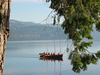
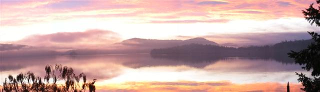
Sooke Basin is a salt water body located between Sooke and East Sooke. The shores of Sooke Basin are mostly rock, but along the north shore there are beautiful sandy beaches. Scattered around the remainder are occasional muddy and pebbly beaches.Islands
There are four small islets in Sooke Basin. Three form the Goodrich Islands, and the fourth is Deadman's Island. Local history indicates that in the late 1800s during an outbreak of smallpox within the local T'Souke population Deadman's Island was used as a burial ground.Coves
Roche Cove, a small shallow cove is located on the east end of Sooke Basin and is the focal point of the 143 hectare Roche Cove Regional Park. The narrow mouth of Roche Cove, spanned by a small bridge, makes for interesting passage as the tidal currents can be quite strong. The mouth is passable by small powerboats at mid and high tides. Roche Cove is located at the boundary between Sooke and East Sooke.Anderson Cove, a small shallow cove is located on the southeast of Sooke Basin. The entrance to Anderson Cove is quite narrow and shallow but is passable with local knowledge at mid and high tides. The shores of Anderson Cove are dotted with expensive East Sooke homes. The only public boat launch in the Sooke Basin and its coves is located in Anderson Cove.
Coopers Cove is formed by Goodrich Peninsula, the location of a former sawmill and the site of a proposed resort. Goodrich Peninsula was formed when the main portion, previously an island, was connected to the shore of Vancouver Island.
History
The first known European entry into Sooke Basin was by the Spanish, during the 1790 expedition of Manuel QuimperManuel Quimper
Manuel Quimper Benítez del Pino was a Spanish Peruvian explorer, cartographer, naval officer, and colonial official. He participated in charting the Strait of Juan de Fuca and the Sandwich Islands in the late 18th century. He was later appointed a colonial governor in his native Peru at the...
in the Princesa Real, with Juan Carrasco
Juan Carrasco (explorer)
Juan Carrasco was a Spanish naval officer, explorer, and navigator. He is remembered mainly for his work in the Pacific Northwest during the late 18th century. He was second in command of the 1791 voyage of José María Narváez, the first European exploration of the Strait of Georgia.Many details...
as pilot. The Spanish gave Sooke Basin the name Puerta de Revilla Gigedo, in honour of then Viceroy of New Spain
New Spain
New Spain, formally called the Viceroyalty of New Spain , was a viceroyalty of the Spanish colonial empire, comprising primarily territories in what was known then as 'América Septentrional' or North America. Its capital was Mexico City, formerly Tenochtitlan, capital of the Aztec Empire...
, Güemes Padilla Horcasitas, Count of Revillagigedo
Juan Vicente de Güemes Padilla Horcasitas y Aguayo, 2nd Count of Revillagigedo
Juan Vicente de Güemes Padilla Horcasitas y Aguayo, 2nd Count of Revillagigedo was a Spanish military officer and viceroy of New Spain from October 17, 1789 to July 11, 1794...
.