

Soil map
Encyclopedia
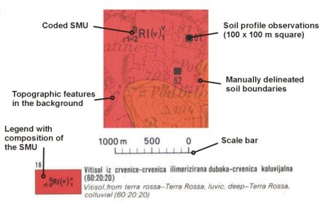
Soil map is a map showing distribution of soil types and/or soil properties (soil pH
, texture
s, organic matter
, depths of horizons etc.) in the area of interest. It is typically the end result of a soil survey inventory, i.e. soil survey
. Soil maps are most commonly used for land evaluation, spatial planning
, agricultural extension, environmental protection
and similar projects. Traditional soil maps typically show only general distribution of soils, accompanied by the soil survey report. Many new soil maps are derived using digital soil mapping
techniques. Such maps are typically richer in context and show higher spatial detail then the traditional soil maps. Soil maps produced using (geo)statistical techniques also include an estimate of the model uncertainty.
 In the digital era, soil maps are being inputted in digital format and then used for various applications in geosciences and environmental science
s. In this context, soil maps are only visualizations of the soil resource inventories commonly stored in a Soil Information System (SIS), of which the major part is a Soil Geographical Database. A Soil Information System is in the most cases, a combination of polygon
and point maps linked with attribute tables for profile observations, soil mapping units and soil classes. Different elements of an SIS can be manipulated and then visualized against the spatial reference (grids or polygons). For example, soil profiles can be used to make spatial prediction of different chemical and physical soil properties.
One should also distinguish soil maps that display primary soil attributes, i.e. the soil attributes originally described or measured in the field, and the soil inferred attributes also called secondary soil information, i.e. the properties of the soils in the context of the soil use: soil production capacity, soil reaction to certain use, soil functions, soil degradation measures etc.
Soil pH
The soil pH is a measure of the acidity or basicity in soils. pH is defined as the negative logarithm of the activity of hydrogen ions in solution. It ranges from 0 to 14, with 7 being neutral. A pH below 7 is acidic and above 7 is basic. Soil pH is considered a master variable in soils as it...
, texture
Soil texture
Soil texture is a qualitative classification tool used in both the field and laboratory to determine classes for agricultural soils based on their physical texture. The classes are distinguished in the field by the 'textural feel' which can be further clarified by separating the relative...
s, organic matter
Organic matter
Organic matter is matter that has come from a once-living organism; is capable of decay, or the product of decay; or is composed of organic compounds...
, depths of horizons etc.) in the area of interest. It is typically the end result of a soil survey inventory, i.e. soil survey
Soil survey
Soil survey, or soil mapping, is the process of classifying soil types and other soil properties in a given area and geo-encoding such information. It applies the principles of soil science, and draws heavily from geomorphology, theories of soil formation, physical geography, and analysis of...
. Soil maps are most commonly used for land evaluation, spatial planning
Spatial planning
Spatial planning refers to the methods used by the public sector to influence the distribution of people and activities in spaces of various scales. Discrete professional disciplines which involve spatial planning include land use planning, urban planning, regional planning, transport planning and...
, agricultural extension, environmental protection
Environmental protection
Environmental protection is a practice of protecting the environment, on individual, organizational or governmental level, for the benefit of the natural environment and humans. Due to the pressures of population and our technology the biophysical environment is being degraded, sometimes permanently...
and similar projects. Traditional soil maps typically show only general distribution of soils, accompanied by the soil survey report. Many new soil maps are derived using digital soil mapping
Digital soil mapping
Digital Soil Mapping in soil science, or "predictive soil mapping", is the computer-assisted production of digital maps of soil type and soil properties. Digital Soil Mapping involves the creation and population of spatial soil information by the use of field and laboratory observational methods...
techniques. Such maps are typically richer in context and show higher spatial detail then the traditional soil maps. Soil maps produced using (geo)statistical techniques also include an estimate of the model uncertainty.
Environmental science
Environmental science is an interdisciplinary academic field that integrates physical and biological sciences, to the study of the environment, and the solution of environmental problems...
s. In this context, soil maps are only visualizations of the soil resource inventories commonly stored in a Soil Information System (SIS), of which the major part is a Soil Geographical Database. A Soil Information System is in the most cases, a combination of polygon
Polygon
In geometry a polygon is a flat shape consisting of straight lines that are joined to form a closed chain orcircuit.A polygon is traditionally a plane figure that is bounded by a closed path, composed of a finite sequence of straight line segments...
and point maps linked with attribute tables for profile observations, soil mapping units and soil classes. Different elements of an SIS can be manipulated and then visualized against the spatial reference (grids or polygons). For example, soil profiles can be used to make spatial prediction of different chemical and physical soil properties.
One should also distinguish soil maps that display primary soil attributes, i.e. the soil attributes originally described or measured in the field, and the soil inferred attributes also called secondary soil information, i.e. the properties of the soils in the context of the soil use: soil production capacity, soil reaction to certain use, soil functions, soil degradation measures etc.
See also
- MapMapA map is a visual representation of an area—a symbolic depiction highlighting relationships between elements of that space such as objects, regions, and themes....
- Soil scienceSoil scienceSoil science is the study of soil as a natural resource on the surface of the earth including soil formation, classification and mapping; physical, chemical, biological, and fertility properties of soils; and these properties in relation to the use and management of soils.Sometimes terms which...
- Soil surveySoil surveySoil survey, or soil mapping, is the process of classifying soil types and other soil properties in a given area and geo-encoding such information. It applies the principles of soil science, and draws heavily from geomorphology, theories of soil formation, physical geography, and analysis of...
- Digital soil mappingDigital soil mappingDigital Soil Mapping in soil science, or "predictive soil mapping", is the computer-assisted production of digital maps of soil type and soil properties. Digital Soil Mapping involves the creation and population of spatial soil information by the use of field and laboratory observational methods...
- Geographic information systemGeographic Information SystemA geographic information system, geographical information science, or geospatial information studies is a system designed to capture, store, manipulate, analyze, manage, and present all types of geographically referenced data...
(GIS) - PedometricsPedometricsPedometrics is the application of mathematical and statistical methods for the study of the distribution and genesis of soils.Pedometrics is a neologism derived from the Greek roots pedos, soil and, metron, measurement...
External links
- International Working Group on Digital Soil Mapping
- International Union of Soil Sciences
- Soil Maps of the world European Digital Archive on the Soil Maps of the world
- National Soil Maps(listed by Country)