

Sofia University Mountains
Encyclopedia
Mountain
Image:Himalaya_annotated.jpg|thumb|right|The Himalayan mountain range with Mount Everestrect 58 14 160 49 Chomo Lonzorect 200 28 335 52 Makalurect 378 24 566 45 Mount Everestrect 188 581 920 656 Tibetan Plateaurect 250 406 340 427 Rong River...
s, 14 km long in the north-south direction and 5.5 km wide, rising to 1500 m (Mount Kliment Ohridski
Mount Kliment Ohridski
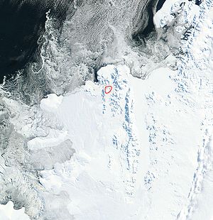
Mount Kliment Ohridski is the highest ridge in the Sofia University Mountains on Alexander Island, Antarctica. The feature extends 7 km in the northwest-southeast direction with partly ice-free southern slopes...
) in north-western Alexander Island
Alexander Island
Alexander Island or Alexander I Island or Alexander I Land or Alexander Land is the largest island of Antarctica, with an area of lying in the Bellingshausen Sea west of the base of the Antarctic Peninsula, from which it is separated by Marguerite Bay and George VI Sound. Alexander Island lies off...
.
They are located south-southeast of Havre Mountains
Havre Mountains
Havre Mountains are mountains forming the northwest extremity of Alexander Island, extending 20 nautical miles in an east-west direction between Cape Vostok and Russian Gap. First seen in 1821 by a Russian expedition under Bellingshausen and resighted by the Belgian Antarctic Expedition, 1897-99...
, southwest of Rouen Mountains
Rouen Mountains
The Rouen Mountains are a prominent mountain range, reaching about 2,800 m and extending 35 miles NW-SE from Mount Bayonne to Care Heights and Mount Cupola, in north Alexander Island, Antarctica....
, northwest of Elgar Uplands
Elgar Uplands
Elgar Uplands are uplands rising to 1,900 m, between Tufts Pass to the north and Sullivan Glacier to the south, in the north part of Alexander Island. First photographed from the air and roughly mapped by the British Graham Land Expedition in 1937...
, east of the northern part of Lassus Mountains
Lassus Mountains
Lassus Mountains are mountains, 15 nautical miles long and 3 nautical miles wide, rising to 2,100 m and extending south from Palestrina Glacier in the northwest part of Alexander Island. First seen in 1821 by the Russian expedition under Bellingshausen...
, and 6 km inland from Lazarev Bay
Lazarev Bay
Lazarev Bay is a rectangular bay, 15 nautical miles long and 13 nautical miles wide, between Alexander Island and Rothschild Island and bounded on the south by ice shelf joining the two islands. The north coast of Alexander Island was first seen from a great distance by the Russian expedition of...
. Bounded by Palestrina Glacier
Palestrina Glacier
Palestrina Glacier is a glacier in the north part of Alexander Island, 11 nautical miles long and 8 nautical miles wide, flowing west from Nichols Snowfield into Lazarev Bay. Mapped from air photos taken by the Ronne Antarctic Research Expedition , 1947–48, by Searle of the Falkland Islands...
to the north, by the 8-km long, ice-filled Poste Valley to the east, by Nichols Snowfield
Nichols Snowfield
Nichols Snowfield is a snowfield, 22 nautical miles long and 8 nautical miles wide, bounded by the Rouen Mountains and Elgar Uplands to the east and Lassus Mountains to the west, in the north part of Alexander Island. First seen from the air and roughly mapped by the British Graham Land...
to the southeast, and by McManus Glacier
McManus Glacier
McManus Glacier is a glacier flowing north into Palestrina Glacier, northwest Alexander Island. Surveyed by British Antarctic Survey , 1975-76. Named by United Kingdom Antarctic Place-Names Committee in 1980 after Alan James McManus, BAS cook, Grytviken and Faraday, 1971–73; Adelaide and Rothera,...
to the west. The mountains include Balan Ridge
Balan Ridge
Balan Ridge is the ridge rising to 800 m in Sofia University Mountains on Alexander Island in Antarctica. The ridge is situated 7 km north by east of Mount Kliment Ohridski, extending 4.5 km in north-south direction, 1.45 km wide, and is bounded by Poste Valley to the east, by Palestrina Glacier...
to the northeast and the ridge of Mount Braun
Mount Braun
Mount Braun is a mountain rising to about , forming the northeast extremity of the Sofia Mountains of Alexander Island. The feature forms the northeast part of a horseshoe-shaped ridge east-southeast of Mount Holt. It was named by the Advisory Committee on Antarctic Names for Lieutenant Commander...
to the northwest, with Yozola Glacier
Yozola Glacier
Yozola Glacier is the 5 km long and 1.7 km wide glacier in Sofia University Mountains on Alexander Island in Antarctica draining north-northwestwards between Mount Braun and Balan Ridge to flow into Palestrina Glacier....
flowing northwards in between them to join Palestrina Glacier, and the ridge of Mount Kliment Ohridski to the south.
The name is of national culture and was given in commemoration of the centennial of Sofia University
Sofia University
The St. Clement of Ohrid University of Sofia or Sofia University is the oldest higher education institution in Bulgaria, founded on 1 October 1888...
. During the first Bulgaria
Bulgaria
Bulgaria , officially the Republic of Bulgaria , is a parliamentary democracy within a unitary constitutional republic in Southeast Europe. The country borders Romania to the north, Serbia and Macedonia to the west, Greece and Turkey to the south, as well as the Black Sea to the east...
n Antarctic campaign organized on that occasion, neighbouring Rouen Mountains and Elgar Uplands were visited in February 1988 by a field party including two members of the British Antarctic Survey
British Antarctic Survey
The British Antarctic Survey is the United Kingdom's national Antarctic operation and has an active role in Antarctic affairs. BAS is part of the Natural Environment Research Council and has over 400 staff. It operates five research stations, two ships and five aircraft in and around Antarctica....
and two Bulgarian geologists, Christo Pimpirev
Christo Pimpirev
Christo Pimpirev is a scientist and Antarctic explorer. He is a Professor of Geology at the St. Kliment Ohridski University of Sofia, with M.S. degree in Geology in 1978, and Ph.D. in 1988, both from Sofia University....
and Borislav Kamenov.
Location
The midpoint is located at 69°26′35"S 71°23′20"W (Seen from the air and roughly mapped by the 1936-37 British Graham Land ExpeditionBritish Graham Land Expedition
A British expedition to Graham Land led by John Lachlan Cope took place between 1920 and 1922. The British Graham Land Expedition was a geophysical and exploration expedition to Graham Land in Antarctica between 1934 to 1937. Under the leadership of John Riddoch Rymill, the expedition spent two...
. More detailed British mapping in 1960 from air photos taken by the 1947-48 US Expedition under Ronne).
Maps
- British Antarctic Territory. Scale 1:200000 topographic map. DOS 610 - W 69 70. Tolworth, UK, 1971.
- Antarctic Digital Database (ADD). Scale 1:250000 topographic map. Scientific Committee on Antarctic Research (SCAR), 1993-2006.