

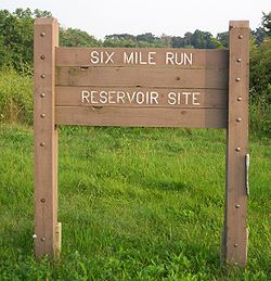
Six Mile Run Reservoir Site
Encyclopedia
Delaware and Raritan Canal State Park
Delaware and Raritan Canal State Park is a New Jersey state park along the Delaware and Raritan Canal.In 1974, most of the canal system was declared a New Jersey state park. It remains one today, and is used for canoeing, kayaking, and fishing...
, is located in Franklin Township
Franklin Township, Somerset County, New Jersey
-Communities of Franklin Township:The following are census-designated places, unincorporated enclaves, and historical communities located within Franklin Township...
, Somerset County
Somerset County, New Jersey
Somerset County is a county located in the U.S. state of New Jersey. In 2010, the population was 323,444. It is part of the New York Metropolitan Area. Its county seat is Somerville....
, New Jersey
New Jersey
New Jersey is a state in the Northeastern and Middle Atlantic regions of the United States. , its population was 8,791,894. It is bordered on the north and east by the state of New York, on the southeast and south by the Atlantic Ocean, on the west by Pennsylvania and on the southwest by Delaware...
, United States
United States
The United States of America is a federal constitutional republic comprising fifty states and a federal district...
. It is adjacent to the Delaware and Raritan Canal
Delaware and Raritan Canal
The Delaware and Raritan Canal is a canal in central New Jersey, United States, built in the 1830s that served to connect the Delaware River to the Raritan River. It was intended as an efficient and reliable means of transportation of freight between Philadelphia, Pennsylvania and New York City,...
. It covers 3037 acres (12.3 km²). The reservoir plan was to flood the Six Mile Run watershed. The Six Mile Run
Six Mile Run (New Jersey)
Six Mile Run is a tributary of the Millstone River that drains a large area in central Franklin Township in Somerset County and as well western portions of North Brunswick and South Brunswick Townships in Middlesex County, New Jersey in the United States....
is a tributary of the Millstone River
Millstone River
The Millstone River is a tributary of the Raritan River in central New Jersey in the United States.The Millstone River begins in western Monmouth County and flows northward through southern Somerset County into the Raritan River at Manville. Almost three quarters of its length is paralleled by...
that, with its tributaries (Cross Brook, Middlebush Brook, Nine Mile Run and Steep Hill Brook and several other unnamed ones), drains a large area in central Franklin Township, Somerset County, New Jersey
Franklin Township, Somerset County, New Jersey
-Communities of Franklin Township:The following are census-designated places, unincorporated enclaves, and historical communities located within Franklin Township...
and western portions of North Brunswick and South Brunswick Townships in Middlesex County, New Jersey. It derives its name, along with other streams (Mile Run
Mile run
The mile run is a middle-distance foot race which is among the more popular events in track running.The history of the mile run event began in England, where it was used as a distance for gambling races...
, Three Mile Run, Nine Mile Run, and Ten Mile Run), from the distance early surveyors estimated it was from the point where the historic King's Highway (now Rt. 27) left the Raritan River
Raritan River
The Raritan River is a major river of central New Jersey in the United States. Its watershed drains much of the mountainous area of the central part of the state, emptying into the Raritan Bay on the Atlantic Ocean.-Description:...
at New Brunswick
New Brunswick, New Jersey
New Brunswick is a city in Middlesex County, New Jersey, USA. It is the county seat and the home of Rutgers University. The city is located on the Northeast Corridor rail line, southwest of Manhattan, on the southern bank of the Raritan River. At the 2010 United States Census, the population of...
to the point the roadway crossed the stream. The estimates were not very accurate but the stream names have remained in use ever since.
History
The land first came under serious consideration as a reservoir site with a 1958 referendum. In 1962, the Freeholders of Somerset County were informed on the intention to use the land for this purpose by the New Jersey Division of Water Power and Supply. It was debated and challenged throughout the 1960s by citizens and politicians. The land was acquired by the state of New JerseyNew Jersey
New Jersey is a state in the Northeastern and Middle Atlantic regions of the United States. , its population was 8,791,894. It is bordered on the north and east by the state of New York, on the southeast and south by the Atlantic Ocean, on the west by Pennsylvania and on the southwest by Delaware...
in 1970, through the New Jersey Department of Environmental Protection
New Jersey Department of Environmental Protection
The New Jersey Department of Environmental Protection is a government agency in the U.S. state of New Jersey that is responsible for managing the state's natural resources and addressing issues related to pollution...
, Division of Water Resources as a future reservoir and recreation area. The reservoir was never built and in 1993 administration of the area was transferred to the New Jersey Division of Parks and Forestry
New Jersey Division of Parks and Forestry
The New Jersey Division of Parks and Forestry is responsible for the management and operation of New Jersey's 42 parks, 11 forests and 3 recreation areas, as well as for the more than 50 historic sites and districts...
when alternative water supply sources were found.
Because part of the land at the site was taken out of cultivation 39 years ago, the process of "old field succession" has now yielded up trees and foliage that are unique among state park lands. In the section between Canal Road and South Middlebush Road, there are postings describing the foliage and the natural process. The Red Dot hiking trail, which runs between Canal Road and South Middlebush Road, has now been extended from South Middlebush Road up to New Jersey Route 27, behind the parking lot for the Jersey Knights soccer field.