
Shelley, Idaho
Encyclopedia
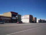
Shelley is a city in Bingham County
, Idaho
, United States
. The population was 3,813 at the 2000 census. The mascot for the city's high school is "King Russet", a russet-burbank potato
that wears a crown, robe and scepter.
Since 1927 Shelley has been home to the "Idaho Annual Spud Day", which is celebrated on the 3rd Saturday of September. It typically features a parade, live bands, games (such as a tug of war into a pit of mashed potatoes) and free baked potatoes.
On September 4, 1902 a large fire destroyed seven buildings on State Street. Only two buildings, a general merchandise store and Nalder's furniture store, were saved. Soren Yorgensen, a local Justice of the Peace and proprieter of the first hotel in Shelley recounts the experience as follows:
According to the United States Census Bureau
, the city has a total area of 1.3 square miles (3.4 km²), all of it land.
Shelley is located on the eastern side of the Snake River
, facing the Blackfoot Mountains
.
of 2000, there were 3,813 people, 1,201 households, and 989 families residing in the city. The population density
was 2,884.5 people per square mile (1,115.3/km²). There were 1,253 housing units at an average density of 947.9 per square mile (366.5/km²). The racial makeup of the city was 89.93% White, 0.18% African American, 0.68% Native American, 0.26% Asian, 0.03% Pacific Islander, 6.74% from other races
, and 2.18% from two or more races. Hispanic or Latino of any race were 11.78% of the population.
There were 1,201 households out of which 48.9% had children under the age of 18 living with them, 67.0% were married couples
living together, 13.0% had a female householder with no husband present, and 17.6% were non-families. 15.3% of all households were made up of individuals and 7.2% had someone living alone who was 65 years of age or older. The average household size was 3.14 and the average family size was 3.50.
In the city the population was spread out with 35.6% under the age of 18, 11.5% from 18 to 24, 25.5% from 25 to 44, 16.8% from 45 to 64, and 10.6% who were 65 years of age or older. The median age was 27 years. For every 100 females there were 96.2 males. For every 100 females age 18 and over, there were 90.3 males.
The median income for a household in the city was $39,318, and the median income for a family was $41,223. Males had a median income of $32,154 versus $20,121 for females. The per capita income
for the city was $13,921. About 7.9% of families and 9.6% of the population were below the poverty line, including 10.6% of those under age 18 and 2.0% of those age 65 or over.
Bingham County, Idaho
Bingham County is a county located in the U.S. state of Idaho. As of the 2000 Census the county had a population of 41,735 . The county seat and largest city is Blackfoot. Bingham County comprises the Blackfoot, ID, Micropolitan Statistical Area.Bingham County was created January 13, 1885, and...
, Idaho
Idaho
Idaho is a state in the Rocky Mountain area of the United States. The state's largest city and capital is Boise. Residents are called "Idahoans". Idaho was admitted to the Union on July 3, 1890, as the 43rd state....
, United States
United States
The United States of America is a federal constitutional republic comprising fifty states and a federal district...
. The population was 3,813 at the 2000 census. The mascot for the city's high school is "King Russet", a russet-burbank potato
Potato
The potato is a starchy, tuberous crop from the perennial Solanum tuberosum of the Solanaceae family . The word potato may refer to the plant itself as well as the edible tuber. In the region of the Andes, there are some other closely related cultivated potato species...
that wears a crown, robe and scepter.
Since 1927 Shelley has been home to the "Idaho Annual Spud Day", which is celebrated on the 3rd Saturday of September. It typically features a parade, live bands, games (such as a tug of war into a pit of mashed potatoes) and free baked potatoes.
History
Shelley was established in 1904. It was named for John F. Shelley, who moved to the area in 1892. He'd moved to the area intending to open a small store, and needed lumber and other supplies to build it. Since the site was some distance from the nearest existing community, he asked the railroad company to make a special stop to offload the supplies he'd ordered. They consented, provided he could offload the supplies in under 20 minutes. His daughter, Lottie, wrote the following in her personal history:On September 4, 1902 a large fire destroyed seven buildings on State Street. Only two buildings, a general merchandise store and Nalder's furniture store, were saved. Soren Yorgensen, a local Justice of the Peace and proprieter of the first hotel in Shelley recounts the experience as follows:
Geography
Shelley is located at 43°22′46"N 112°7′26"W (43.379490, -112.123846).According to the United States Census Bureau
United States Census Bureau
The United States Census Bureau is the government agency that is responsible for the United States Census. It also gathers other national demographic and economic data...
, the city has a total area of 1.3 square miles (3.4 km²), all of it land.
Shelley is located on the eastern side of the Snake River
Snake River
The Snake is a major river of the greater Pacific Northwest in the United States. At long, it is the largest tributary of the Columbia River, the largest North American river that empties into the Pacific Ocean...
, facing the Blackfoot Mountains
Blackfoot Mountains
The Blackfoot Mountains, also called the Blackfoot Range, is a small range of mountains located east of Blackfoot, Idaho. Most of the area is private property, including the range's tallest mountain, Taylor Mountain. There is more than one mountain in Idaho named Taylor Mountain. This one was...
.
Demographics
As of the censusCensus
A census is the procedure of systematically acquiring and recording information about the members of a given population. It is a regularly occurring and official count of a particular population. The term is used mostly in connection with national population and housing censuses; other common...
of 2000, there were 3,813 people, 1,201 households, and 989 families residing in the city. The population density
Population density
Population density is a measurement of population per unit area or unit volume. It is frequently applied to living organisms, and particularly to humans...
was 2,884.5 people per square mile (1,115.3/km²). There were 1,253 housing units at an average density of 947.9 per square mile (366.5/km²). The racial makeup of the city was 89.93% White, 0.18% African American, 0.68% Native American, 0.26% Asian, 0.03% Pacific Islander, 6.74% from other races
Race (United States Census)
Race and ethnicity in the United States Census, as defined by the Federal Office of Management and Budget and the United States Census Bureau, are self-identification data items in which residents choose the race or races with which they most closely identify, and indicate whether or not they are...
, and 2.18% from two or more races. Hispanic or Latino of any race were 11.78% of the population.
There were 1,201 households out of which 48.9% had children under the age of 18 living with them, 67.0% were married couples
Marriage
Marriage is a social union or legal contract between people that creates kinship. It is an institution in which interpersonal relationships, usually intimate and sexual, are acknowledged in a variety of ways, depending on the culture or subculture in which it is found...
living together, 13.0% had a female householder with no husband present, and 17.6% were non-families. 15.3% of all households were made up of individuals and 7.2% had someone living alone who was 65 years of age or older. The average household size was 3.14 and the average family size was 3.50.
In the city the population was spread out with 35.6% under the age of 18, 11.5% from 18 to 24, 25.5% from 25 to 44, 16.8% from 45 to 64, and 10.6% who were 65 years of age or older. The median age was 27 years. For every 100 females there were 96.2 males. For every 100 females age 18 and over, there were 90.3 males.
The median income for a household in the city was $39,318, and the median income for a family was $41,223. Males had a median income of $32,154 versus $20,121 for females. The per capita income
Per capita income
Per capita income or income per person is a measure of mean income within an economic aggregate, such as a country or city. It is calculated by taking a measure of all sources of income in the aggregate and dividing it by the total population...
for the city was $13,921. About 7.9% of families and 9.6% of the population were below the poverty line, including 10.6% of those under age 18 and 2.0% of those age 65 or over.