
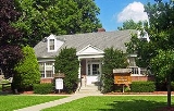
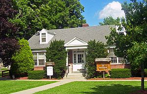
Shawangunk, New York
Encyclopedia
Ulster County, New York
Ulster County is a county located in the state of New York, USA. It sits in the state's Mid-Hudson Region of the Hudson Valley. As of the 2010 census, the population was 182,493. Recent population estimates completed by the United States Census Bureau for the 12-month period ending July 1 are at...
, New York
New York
New York is a state in the Northeastern region of the United States. It is the nation's third most populous state. New York is bordered by New Jersey and Pennsylvania to the south, and by Connecticut, Massachusetts and Vermont to the east...
, United States
United States
The United States of America is a federal constitutional republic comprising fifty states and a federal district...
. The population was 12,022 at the 2000 census. Like the neighboring mountain range
Shawangunk Ridge
The Shawangunk Ridge , also known as the Shawangunk Mountains or The Gunks, is a ridge of bedrock in Ulster County, Sullivan County and Orange County in the state of New York, extending from the northernmost point of New Jersey to the Catskill Mountains.The ridgetop, which widens considerably at...
, for which it is named, it is pronounced either as the Munsee Lenape, Shawangunk ˈʃɑːwəŋɡʌŋk, or as the colonial Shongum ˈʃɑːn.ɡʌm by local residents. (See Shawangunk Ridge
Shawangunk Ridge
The Shawangunk Ridge , also known as the Shawangunk Mountains or The Gunks, is a ridge of bedrock in Ulster County, Sullivan County and Orange County in the state of New York, extending from the northernmost point of New Jersey to the Catskill Mountains.The ridgetop, which widens considerably at...
.)
History
Shawangunk was first settled by Europeans around 1670.The region was organized as a precinct in 1743, and became the Town of Shawangunk in 1788.
Geography
According to the United States Census BureauUnited States Census Bureau
The United States Census Bureau is the government agency that is responsible for the United States Census. It also gathers other national demographic and economic data...
, the town has a total area of 56.5 square miles (146.3 km²), of which, 56.2 square miles (145.6 km²) of it is land and 0.3 square mile (0.776996433 km²) of it (0.55%) is water.
The south town line and half of the east town line is the border of Orange County
Orange County, New York
Orange County is a county located in the U.S. state of New York. It is part of the Poughkeepsie–Newburgh–Middletown, NY Metropolitan Statistical Area and is located at the northern reaches of the New York metropolitan area. The county sits in the state's scenic Mid-Hudson Region of the Hudson Valley...
, New York
New York
New York is a state in the Northeastern region of the United States. It is the nation's third most populous state. New York is bordered by New Jersey and Pennsylvania to the south, and by Connecticut, Massachusetts and Vermont to the east...
.
The Wallkill River
Wallkill River
The Wallkill River, a tributary of the Hudson, drains Lake Mohawk in Sparta, New Jersey, flowing from there generally northeasterly to Rondout Creek in New York, near Rosendale, with the combined flows reaching the Hudson at Kingston....
flows through the eastern half of town and lends it its name, which it flows through, while the western (Walker Valley) half climbs the slopes of the eponymous mountains.
Demographics
As of the censusCensus
A census is the procedure of systematically acquiring and recording information about the members of a given population. It is a regularly occurring and official count of a particular population. The term is used mostly in connection with national population and housing censuses; other common...
of 2000, there were 12,022 people, 3,433 households, and 2,557 families residing in the town. The population density
Population density
Population density is a measurement of population per unit area or unit volume. It is frequently applied to living organisms, and particularly to humans...
was 213.9 people per square mile (82.6/km²). There were 3,754 housing units at an average density of 66.8 per square mile (25.8/km²). The racial makeup of the town was 86.49% White, 8.14% African American, 0.26% Native American, 0.92% Asian, 0.01% Pacific Islander, 2.86% from other races
Race (United States Census)
Race and ethnicity in the United States Census, as defined by the Federal Office of Management and Budget and the United States Census Bureau, are self-identification data items in which residents choose the race or races with which they most closely identify, and indicate whether or not they are...
, and 1.32% from two or more races. Hispanic or Latino of any race were 6.96% of the population.
There were 3,433 households out of which 39.2% had children under the age of 18 living with them, 61.5% were married couples
Marriage
Marriage is a social union or legal contract between people that creates kinship. It is an institution in which interpersonal relationships, usually intimate and sexual, are acknowledged in a variety of ways, depending on the culture or subculture in which it is found...
living together, 8.4% had a female householder with no husband present, and 25.5% were non-families. 20.2% of all households were made up of individuals and 7.0% had someone living alone who was 65 years of age or older. The average household size was 2.78 and the average family size was 3.21.
In the town the population was spread out with 22.4% under the age of 18, 8.5% from 18 to 24, 38.3% from 25 to 44, 22.2% from 45 to 64, and 8.7% who were 65 years of age or older. The median age was 36 years. For every 100 females there were 134.3 males. For every 100 females age 18 and over, there were 144.3 males.
The median income for a household in the town was $52,366, and the median income for a family was $59,975. Males had a median income of $40,967 versus $29,608 for females. The per capita income
Per capita income
Per capita income or income per person is a measure of mean income within an economic aggregate, such as a country or city. It is calculated by taking a measure of all sources of income in the aggregate and dividing it by the total population...
for the town was $19,402. About 4.4% of families and 13.4% of the population were below the poverty line, including 7.0% of those under age 18 and 10.5% of those age 65 or over.
Communities and locations in Shawangunk
- Ellenville – Also Part of the Town of Wawarsing
- Awosting – A hamlet in the northwest part of the town.
- Bruynswick – A hamlet near the north town line on County Route 7.
- Crawford – A hamlet in the northwest part of the town, south of Awosting.
- Dwaarkill – A hamlet north of Red Mills, located on County Route 7.
- Galeville – A former hamlet in the eastern part of the town, north of Wallkill. Galeville is on the west bank of the Wallkill RiverWallkill RiverThe Wallkill River, a tributary of the Hudson, drains Lake Mohawk in Sparta, New Jersey, flowing from there generally northeasterly to Rondout Creek in New York, near Rosendale, with the combined flows reaching the Hudson at Kingston....
. Once home to Galeville Army Air Base, now Shawangunk Grasslands National Wildlife RefugeShawangunk Grasslands National Wildlife RefugeThe Shawangunk Grasslands National Wildlife Refuge is a wildlife refuge located in Ulster County, New York, USA.Formerly the Galeville Military Airport, it was decommissioned in 1994 and turned over to the United States Fish and Wildlife Service in 1999...
. - New Hurley – A former hamlet on Route 208.
- Pine BushPine Bush, New YorkPine Bush is a hamlet located in the Town of Crawford, and Shawangunk, New York, in Orange/Ulster Counties, New York, U.S., roughly coterminous with the 12566 ZIP code and 744 telephone exchange in the 845 area code Pine Bush is a hamlet (and census-designated place) located in the Town of...
– A hamlet in Orange County; the ZIP Code extends into much of western Shawangunk. - Red Mills – A hamlet at the south town line and north of Pine Bush.
- Rutsonville
- Shawangunk Kill – A small stream in the town.
- Ulsterville – A hamlet west of Pine Bush, located on Route
- Walker ValleyWalker Valley, New YorkWalker Valley is a hamlet located in the western part of the Town of Shawangunk in Ulster County, New York, U.S., generally thought of as coterminous with the 12588 ZIP code. The population was 758 at the 2000 census....
– A hamlet in the southwest part of the town on Route 52. Walker Valley is west of Pine Bush. - WallkillWallkill, Ulster County, New YorkWallkill is a hamlet , generally identified as coterminous with ZIP code 12589, telephone exchange 895 in the 845 area code and most of the Wallkill Central School District located mostly in the eastern half of the Town of Shawangunk, Ulster County, New York but partly spilling over into adjacent...
– A hamlet at the east town line. - Shawangunk Correctional FacilityShawangunk Correctional FacilityShawangunk Correctional Facility is a maximum security prison for males located in Ulster County, New York in the United States.- History :The prison was constructed in 1983 to expand the maximum security capabilities of the state prison system and was located near the existing Wallkill...
– A New York State prison, north of Wallkill. - Wallkill Correctional FacilityWallkill Correctional FacilityThe Wallkill Correctional Facility is a medium security prison in New York state in the USA. The prison is located just north of the hamlet of Wallkill in the Shawangunk in Ulster County, New York.- Address :Wallkill Correctional Facility Box G...
– A state prison north of Wallkill.