

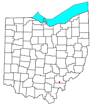
Shade, Ohio
Encyclopedia
Unincorporated area
In law, an unincorporated area is a region of land that is not a part of any municipality.To "incorporate" in this context means to form a municipal corporation, a city, town, or village with its own government. An unincorporated community is usually not subject to or taxed by a municipal government...
in southern Lodi Township
Lodi Township, Athens County, Ohio
Lodi Township is one of the fourteen townships of Athens County, Ohio, United States. The 2000 census found 1,403 people in the township.-Geography:Located in the southern part of the county, it borders the following townships:*Canaan Township - north...
, Athens County
Athens County, Ohio
As of the census of 2000, there were 62,223 people, 22,501 households, and 12,713 families residing in the county. The population density was 123 people per square mile . There were 24,901 housing units at an average density of 49 per square mile...
, Ohio
Ohio
Ohio is a Midwestern state in the United States. The 34th largest state by area in the U.S.,it is the 7th‑most populous with over 11.5 million residents, containing several major American cities and seven metropolitan areas with populations of 500,000 or more.The state's capital is Columbus...
, United States
United States
The United States of America is a federal constitutional republic comprising fifty states and a federal district...
. Although it is unincorporated, it has a post office
Post office
A post office is a facility forming part of a postal system for the posting, receipt, sorting, handling, transmission or delivery of mail.Post offices offer mail-related services such as post office boxes, postage and packaging supplies...
, with the ZIP code
ZIP Code
ZIP codes are a system of postal codes used by the United States Postal Service since 1963. The term ZIP, an acronym for Zone Improvement Plan, is properly written in capital letters and was chosen to suggest that the mail travels more efficiently, and therefore more quickly, when senders use the...
of 45776. It lies along U.S. Route 33
U.S. Route 33
U.S. Route 33 is a United States federal highway that runs northwest-southeast for 709 miles from northern Indiana to Richmond, Virginia, passing through Ohio and West Virginia en route. Although most odd-numbered U.S...
.
Public services
The old Shade school has been converted to a community center, The Shade Community Center Association (SCCA), a registered non-profit entity set up to serve the community in many ways. The SCCA offers a lending library, open to the public; potluck lunches on Thursdays; musical jam sessions; a Senior Citizens Center and many other fun and educational services.The community itself exists mostly as it was in the late 1950s, with the relocation of the old store to a new building and new construction of homes in a rural setting only minutes from Athens.
The residents of Shade are served by the Alexander Local School District
Alexander Local School District
The Alexander Local School District is a public school district based in Albany, Ohio, United States.The school district includes all of Alexander and Lodi townships, most of Waterloo Township as well as a small portion of west-central Athens Township in Athens County...
and Alexander High School
Alexander High School (Ohio)
Alexander High School is located in Albany, Athens County, Ohio, United States. It is the only high school in the Alexander Local School District. The K-12 school complex is located just off SR 32 east of Albany...
. They are also served by the Athens County Public Library, with branches in Albany
Albany, Ohio
Albany is a village in Athens County, Ohio, United States. The population was 808 at the 2000 census.-Geography:Albany is located at ....
, Athens
Athens, Ohio
Athens is the largest city in, and the county seat of, Athens County, Ohio, United States. It is located along the Hocking River in the southeastern part of Ohio. A historic college town, Athens is home to Ohio University and is the principal city of the Athens, Ohio Micropolitan Statistical Area. ...
, Chauncey
Chauncey, Ohio
Chauncey is a village in Athens County, Ohio, United States. The population was 1,067 at the 2000 census. The local residents pronounce the village name...
, Coolville
Coolville, Ohio
Not to be confused with Coolsville, Ohio, a fictional city in the cartoon series Scooby Doo.Coolville is a village located in Troy Township, Athens County, Ohio, United States, in the extreme southeast of the state...
, Glouster
Glouster, Ohio
Glouster is a village in Athens County, Ohio, United States. The population was 1,972 at the 2000 census. It is close to Burr Oak State Park.-History:...
, Nelsonville
Nelsonville, Ohio
Nelsonville is a city in northwestern Athens County, Ohio, United States. The population was 5,230 at the 2000 census. Hocking College is located in Nelsonville.-Geography:...
, and The Plains
The Plains, Ohio
The Plains is a census-designated place in Athens County, Ohio, United States. The population was 2,931 at the 2000 census.-Geography:The Plains is located at ....
.