

Serranía de Macuira
Encyclopedia
Colombia
Colombia, officially the Republic of Colombia , is a unitary constitutional republic comprising thirty-two departments. The country is located in northwestern South America, bordered to the east by Venezuela and Brazil; to the south by Ecuador and Peru; to the north by the Caribbean Sea; to the...
located in the municipality
Municipalities of Colombia
The Municipalities of Colombia are decentralized subdivisions of the Republic of Colombia. Municipalities make up most of the departments of Colombia with 1,119 municipalities...
of Uribia, Guajira Peninsula
Guajira Peninsula
Guajira Peninsula , is a peninsula in northern Colombia and northwestern Venezuela in the Caribbean Sea...
and part of the La Guajira Department. The Serrania de Macuira stands in the middle of the La Guajira Desert
La Guajira Desert
La Guajira Desert is located in the northernmost part of Colombia, north of Bogota, in the La Guajira Department, covering most of La Guajira Peninsula including Venezuelan territory. The area holds immense coal reserves, exploited in a zone known as El Cerrejon...
at 864 meters over sea level, (2835 ft) isolated from the mountain ranges of Sierra Nevada de Santa Marta
Sierra Nevada de Santa Marta
The Sierra Nevada de Santa Marta is an isolated mountain range apart from the Andes chain that runs through Colombia. Reaching an altitude of 5,700 metres above sea level just 42 km from the Caribbean coast, the Sierra Nevada is the world's highest coastal range...
and the Cordillera Oriental of the Colombian Andes
Andes
The Andes is the world's longest continental mountain range. It is a continual range of highlands along the western coast of South America. This range is about long, about to wide , and of an average height of about .Along its length, the Andes is split into several ranges, which are separated...
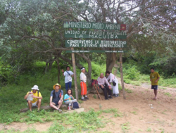
. The area is under the protection of the National Natural Park of Macuira.
The Serranía de Macuira is the most western and elevated mountain range of South America
South America
South America is a continent situated in the Western Hemisphere, mostly in the Southern Hemisphere, with a relatively small portion in the Northern Hemisphere. The continent is also considered a subcontinent of the Americas. It is bordered on the west by the Pacific Ocean and on the north and east...
and meassures some 35 km in longitude and 10 km wide, at some 10 km from the Caribbean sea
Caribbean Sea
The Caribbean Sea is a sea of the Atlantic Ocean located in the tropics of the Western hemisphere. It is bounded by Mexico and Central America to the west and southwest, to the north by the Greater Antilles, and to the east by the Lesser Antilles....
. The range is made up of three mountain massifs interconnected; the highest being Cerro Paluou (864 meters over sea level), Cerro de Jibome (753 meter over sea level) covering a total area of 250 km². The area is home to numerous fauna and flora species and due its relatively high humidity caused by the trade wind
Trade wind
The trade winds are the prevailing pattern of easterly surface winds found in the tropics, within the lower portion of the Earth's atmosphere, in the lower section of the troposphere near the Earth's equator...
s and its proximity to the Caribbean sea it presents a forest of dwarf trees and cloud forest
Cloud forest
A cloud forest, also called a fog forest, is a generally tropical or subtropical evergreen montane moist forest characterized by a persistent, frequent or seasonal low-level cloud cover, usually at the canopy level. Cloud forests often exhibit an abundance of mosses covering the ground and...
s.