
Semo La
Encyclopedia
Semo La is a mountain pass
situated in the central part of Tibet
and gives access to the Chang Tang region. It is found on the so-called Northern Route, north of Raka
and south of Coqen in Central Tibet. Travellers use this route as an alternative access route to western Tibet and Mount Kailash
, especially when mud makes access by the more southern route difficult.
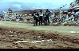
The road crossing the pass is an old unsurfaced track travelled only by a weekly bus and trucks heading west to avoid the boggy parts of the south of the country.
At 5565 metres (18,257.9 ft), Semo La may be the highest vehicle-accessible pass in the world. It is the highest that has been measured accurately. Khardung La
, up to now thought to be the world record holder at 5602 metres (18,379.3 ft), in reality, according to modern surveys, measures 5359 m (17,582 ft), 243 m (797.2 ft) less than previously thought. There are other passes that may be higher but have yet to be surveyed properly and may not reasonably be considered "motorable".
SRTM data and is consistent with GPS measurements shown here.
Mountain pass
A mountain pass is a route through a mountain range or over a ridge. If following the lowest possible route, a pass is locally the highest point on that route...
situated in the central part of Tibet
Tibet
Tibet is a plateau region in Asia, north-east of the Himalayas. It is the traditional homeland of the Tibetan people as well as some other ethnic groups such as Monpas, Qiang, and Lhobas, and is now also inhabited by considerable numbers of Han and Hui people...
and gives access to the Chang Tang region. It is found on the so-called Northern Route, north of Raka
Raka, Tibet
-See also:*List of towns and villages in Tibetraka is a type of dancing...
and south of Coqen in Central Tibet. Travellers use this route as an alternative access route to western Tibet and Mount Kailash
Mount Kailash
Mount Kailash is a peak in the Gangdisê Mountains, which are part of the Himalayas in Tibet...
, especially when mud makes access by the more southern route difficult.
The road crossing the pass is an old unsurfaced track travelled only by a weekly bus and trucks heading west to avoid the boggy parts of the south of the country.
At 5565 metres (18,257.9 ft), Semo La may be the highest vehicle-accessible pass in the world. It is the highest that has been measured accurately. Khardung La
Khardung La
Khardung La is a high mountain pass located in the Ladakh region, Jammu and Kashmir, India...
, up to now thought to be the world record holder at 5602 metres (18,379.3 ft), in reality, according to modern surveys, measures 5359 m (17,582 ft), 243 m (797.2 ft) less than previously thought. There are other passes that may be higher but have yet to be surveyed properly and may not reasonably be considered "motorable".
Elevation
The height of 5565 m (18,257.9 ft) was calculated in 2005 by a team of researchers conducting a modern GPS survey. It accurately matches NASANASA
The National Aeronautics and Space Administration is the agency of the United States government that is responsible for the nation's civilian space program and for aeronautics and aerospace research...
SRTM data and is consistent with GPS measurements shown here.