
Sedro-Woolley, Washington
Encyclopedia
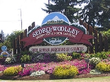
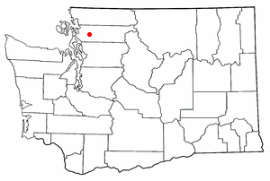
Sedro-Woolley is a city in Skagit County, Washington
, United States. The population was 10,540 at the 2010 census. It is included in the Mount Vernon
–Anacortes
, Washington Metropolitan Statistical Area.
 Officially incorporated on December 19, 1898, Sedro-Woolley was formed from neighboring rival towns known as Sedro and Woolley in Skagit County, northwestern Washington, 25 miles (40.2 km) inland from the Puget Sound
, 40 miles (64.4 km) south of the border with Canada and 65 miles (104.6 km) north of Seattle.
Four British bachelors, led by David Batey, homesteaded the area in 1878, the time logjam obstructions were cleared downriver at the site of Mount Vernon. In 1884–85, Batey built a store and home for the arrival of the Mortimer Cook family from Santa Barbara, California
where Cook had been mayor for two terms. Cook intended to name his new Pacific Northwest town Bug due to the number of mosquitos present, but his wife protested along with a handful of local wives. Cook was already the namesake for the town Cook's Ferry on the Thompson River in British Columbia
. With "Bug" being so unpopular, Cook derived a town name from Spanish; knowing "cedra" was the word for cedar, he replaced two letters to make the name unique, settling on "Sedro".
Sedro, on the northern banks of the Skagit River
, proved susceptible to floods. In 1899, Northern Pacific Railway
developer Nelson Bennett began laying track from the town of Fairhaven
, 25 miles (40.2 km) northwest on Bellingham Bay
, and real estate developer Norman R. Kelley platted a new town of Sedro on high ground a mile northwest of Cook's site. The Fairhaven and Southern Railroad
arrived in Sedro on Christmas Eve 1899, in time for Bennett to receive a performance bonus from the towns at both ends, and a month after Washington became the 42nd state in the Union.
Within months, two more railroads crossed the F&S road bed a half mile north of new Sedro, forming a triangle where 11 trains eventually arrived daily. Railroad developer Philip A. Woolley moved his family from Elgin, Illinois
, to Sedro in December 1899 and bought land around the triangle. He built the Skagit River Lumber & Shingle Mill next to where the railroads crossed and he started his namesake company town there that was based on sales of railroad ties to the three rail companies, including the Seattle and Northern Railway (forerunner of the Great Northern Railway) and the Northern Pacific Railroad.
Meanwhile a fourth town rose nearby when the F&S laid rails on a "wye" that led northeast from Sedro about four and a half miles to coal
mines. Bennett bought the mines, along with Montana mining financier Charles X. Larrabee, and they soon sold their interests to James J. Hill
, owner of the Great Northern. The resulting ore soon turned out to be more suitable for coking coal and a town began there named Cokedale. Cokedale faded in importance when the mine declined and the other towns all merged on December 19, 1898, as Sedro-Woolley.
On May 15, 1922, a large circus elephant
known as Tusko
escaped from the Al G. Barnes Circus
, which was making one of its stops in Sedro-Woolley, at that time. The elephant stomped his way through the little logging town and right into local history, demolishing fences, knocking over laundry lines and trees, telephone poles, and a Model T along the way.
After logging and coal-mining declined, the major employers and industries became the nearby Northern State Hospital (a mental-health facility) and Skagit Steel & Iron Works, which rose from the back room of a local hardware store in 2002 to became a major supplier of implements and parts for logging and railroad customers and which manufactured machines and parts for the war effort in World War II and artillery shells, starting in 1953. By 1990, that company was gone and the hospital was closed but new industry is developing north of town, including robotics.
 Sedro-Woolley is located at 48°30′18"N 122°14′6"W (48.504917, -122.234938).
According to the United States Census Bureau
, the city has a total area of 3.4 square miles (8.8 km²), of which 3.4 square miles (8.8 km²) are land and 0.29% is water.
, and 2.00% from two or more races. Hispanic or Latino of any race were 7.23% of the population.
There were 3,205 households out of which 37.5% had children under the age of 18 living with them, 49.8% were married couples living together, 13.5% had a female householder with no husband present, and 32.1% were non-families. 25.9% of all households were made up of individuals and 12.6% had someone living alone who was 65 years of age or older. The average household size was 2.62 and the average family size was 3.14.
In the city the age distribution of the population shows 28.8% under the age of 18, 9.2% from 18 to 24, 29.3% from 25 to 44, 18.4% from 45 to 64, and 14.3% who were 65 years of age or older. The median age was 33 years. For every 100 females there were 90.3 males. For every 100 females age 18 and over, there were 84.8 males.
The median income for a household in the city was $37,914, and the median income for a family was $40,918. Males had a median income of $35,215 versus $23,636 for females. The per capita income
for the city was $16,517. About 10.7% of families and 11.3% of the population were below the poverty line, including 12.9% of those under age 18 and 16.1% of those age 65 or over.
Skagit County, Washington
Skagit County is a county in the U.S. state of Washington. It is named after the Skagit Indian tribe. As of 2010, the population was 116,901. It is included in the Mount Vernon-Anacortes, Washington, Metropolitan Statistical Area...
, United States. The population was 10,540 at the 2010 census. It is included in the Mount Vernon
Mount Vernon, Washington
Mount Vernon is a city in Skagit County, Washington, United States. The population was 31,743 at the 2010 census. It is one of two principal cities of and included in the Mount Vernon-Anacortes, Washington Metropolitan Statistical Area. It is the county seat of Skagit County...
–Anacortes
Anacortes, Washington
Anacortes is a city in Skagit County, Washington, United States. The name "Anacortes" is a consolidation of the name Anna Curtis, who was the wife of early Fidalgo Island settler Amos Bowman. Anacortes' population was 15,778 at the time of the 2010 census...
, Washington Metropolitan Statistical Area.
History
Puget Sound
Puget Sound is a sound in the U.S. state of Washington. It is a complex estuarine system of interconnected marine waterways and basins, with one major and one minor connection to the Strait of Juan de Fuca and the Pacific Ocean — Admiralty Inlet being the major connection and...
, 40 miles (64.4 km) south of the border with Canada and 65 miles (104.6 km) north of Seattle.
Four British bachelors, led by David Batey, homesteaded the area in 1878, the time logjam obstructions were cleared downriver at the site of Mount Vernon. In 1884–85, Batey built a store and home for the arrival of the Mortimer Cook family from Santa Barbara, California
Santa Barbara, California
Santa Barbara is the county seat of Santa Barbara County, California, United States. Situated on an east-west trending section of coastline, the longest such section on the West Coast of the United States, the city lies between the steeply-rising Santa Ynez Mountains and the Pacific Ocean...
where Cook had been mayor for two terms. Cook intended to name his new Pacific Northwest town Bug due to the number of mosquitos present, but his wife protested along with a handful of local wives. Cook was already the namesake for the town Cook's Ferry on the Thompson River in British Columbia
British Columbia
British Columbia is the westernmost of Canada's provinces and is known for its natural beauty, as reflected in its Latin motto, Splendor sine occasu . Its name was chosen by Queen Victoria in 1858...
. With "Bug" being so unpopular, Cook derived a town name from Spanish; knowing "cedra" was the word for cedar, he replaced two letters to make the name unique, settling on "Sedro".
Sedro, on the northern banks of the Skagit River
Skagit River
The Skagit River is a river in southwestern British Columbia in Canada and northwestern Washington in the United States, approximately 150 mi long...
, proved susceptible to floods. In 1899, Northern Pacific Railway
Northern Pacific Railway
The Northern Pacific Railway was a railway that operated in the west along the Canadian border of the United States. Construction began in 1870 and the main line opened all the way from the Great Lakes to the Pacific when former president Ulysses S. Grant drove in the final "golden spike" in...
developer Nelson Bennett began laying track from the town of Fairhaven
Fairhaven, Washington
Fairhaven, Washington was founded in the late 1880s and is now part of the City of Bellingham, Washington, USA. It is on the south side of Bellingham, and borders Bellingham Bay on the west and Western Washington University on the northeast...
, 25 miles (40.2 km) northwest on Bellingham Bay
Bellingham Bay
Bellingham Bay is a bay located on the northern Pacific coast of Washington state in the United States. It is separated from the Strait of Georgia on the west by the Lummi Peninsula, Portage Island, and Lummi Island. It is bordered on the east by Bellingham, Washington, to the south-east by the...
, and real estate developer Norman R. Kelley platted a new town of Sedro on high ground a mile northwest of Cook's site. The Fairhaven and Southern Railroad
Fairhaven and Southern Railroad
The Fairhaven and Southern Railroad was a railroad located in the northwest part of Washington State built by the Fairhaven Land Co. founded by E. M. Wilson, E. L. Cowgill, Nelson Bennett, C. X. Larrabee, and Samuel E...
arrived in Sedro on Christmas Eve 1899, in time for Bennett to receive a performance bonus from the towns at both ends, and a month after Washington became the 42nd state in the Union.
Within months, two more railroads crossed the F&S road bed a half mile north of new Sedro, forming a triangle where 11 trains eventually arrived daily. Railroad developer Philip A. Woolley moved his family from Elgin, Illinois
Elgin, Illinois
Elgin is a city in northern Illinois located roughly northwest of Chicago on the Fox River. Most of Elgin lies within Kane County, Illinois, with a portion in Cook County, Illinois...
, to Sedro in December 1899 and bought land around the triangle. He built the Skagit River Lumber & Shingle Mill next to where the railroads crossed and he started his namesake company town there that was based on sales of railroad ties to the three rail companies, including the Seattle and Northern Railway (forerunner of the Great Northern Railway) and the Northern Pacific Railroad.
Meanwhile a fourth town rose nearby when the F&S laid rails on a "wye" that led northeast from Sedro about four and a half miles to coal
Coal
Coal is a combustible black or brownish-black sedimentary rock usually occurring in rock strata in layers or veins called coal beds or coal seams. The harder forms, such as anthracite coal, can be regarded as metamorphic rock because of later exposure to elevated temperature and pressure...
mines. Bennett bought the mines, along with Montana mining financier Charles X. Larrabee, and they soon sold their interests to James J. Hill
James J. Hill
James Jerome Hill , was a Canadian-American railroad executive. He was the chief executive officer of a family of lines headed by the Great Northern Railway, which served a substantial area of the Upper Midwest, the northern Great Plains, and Pacific Northwest...
, owner of the Great Northern. The resulting ore soon turned out to be more suitable for coking coal and a town began there named Cokedale. Cokedale faded in importance when the mine declined and the other towns all merged on December 19, 1898, as Sedro-Woolley.
On May 15, 1922, a large circus elephant
Elephant
Elephants are large land mammals in two extant genera of the family Elephantidae: Elephas and Loxodonta, with the third genus Mammuthus extinct...
known as Tusko
Tusko
Tusko is a popular name given to elephants in captivity. Several notable elephants have been given this moniker.-Tusko: "The Meanest Elephant":Formerly known as "Ned," this Tusko was a giant circus elephant captured at age 6 in Siam...
escaped from the Al G. Barnes Circus
Al G. Barnes Circus
-History:Stonehouse started the show in 1895 with a pony, a phonograph, a stereopticon. His circus was purchased by the American Circus Corporation in 1929 and was merged with the Sells-Floto Circus, John Robinson Shows, and Sparks Circus. That same year John Nicholas Ringling bought out the...
, which was making one of its stops in Sedro-Woolley, at that time. The elephant stomped his way through the little logging town and right into local history, demolishing fences, knocking over laundry lines and trees, telephone poles, and a Model T along the way.
After logging and coal-mining declined, the major employers and industries became the nearby Northern State Hospital (a mental-health facility) and Skagit Steel & Iron Works, which rose from the back room of a local hardware store in 2002 to became a major supplier of implements and parts for logging and railroad customers and which manufactured machines and parts for the war effort in World War II and artillery shells, starting in 1953. By 1990, that company was gone and the hospital was closed but new industry is developing north of town, including robotics.
Government
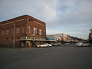
The City of Sedro-Woolley operates under a Mayor-Council form of government. The elected mayor oversees the operations of the departments of Finance, Police, Fire, Municipal Court, Public Works, Community Development, and Parks & Recreation. Sedro-Woolley Parks & Recreation maintains a large number of public parks and open spaces such as Hammer Heritage Square in downtown Sedro-Woolley. Riverfront Park situated on the Bank of the Skagit River is the signature park. It consists of nearly 60 acres (242,811.6 m²) and includes picnic shelters, baseball fields, RV park, amphitheater, and an off-leash dog park. Every year on the 4th of July the city celebrates with a festive carnival, and hosts the logger rodeo parade.Sedro-Woolley today
In 2006 a new housing development began between the town and the old hospital site, projected to add at least 5,000 to the town's population.Schools
- Central Elementary (K-6)
- Evergreen Elementary (K-6)
- Mary Purcell Elementary (K-6)
- Samish Elementary (K-6)
- Lyman Elementary (K-6)
- Clear Lake Elementary (K-6)
- Big Lake Elementary (K-6)
- Cascade Middle School (7-8)
- State Street High School (9-12) ... "secondary" High School
- Sedro-Woolley High SchoolSedro-Woolley High SchoolSedro-Woolley High School is a public high school in the city of Sedro-Woolley, Washington. The school enrolls about 1394 students in grades 9-12. Its colors are blue and white and the school mascot is the bear cub...
(9-12)
Culture
Sedro-Woolley is the home of Loggerodeo (http://www.loggerodeo.com/ ), a celebration staged annually since the mid 1930s close to the Fourth of July. The annual event is well-known in Western Washington and one of the oldest rural summer celebrations in the state with many of the events date back more than 100 years. Loggerodeo features a carnival, foot-race, log drive, old-time logging show, championship rodeo, children's parade, the annual Fourth of July parade, and an invitation-only chainsaw log carving competition. Favorite chainsaw carved log creations from the carving competitions of past years line the downtown Sedro-Woolley area.Geography
According to the United States Census Bureau
United States Census Bureau
The United States Census Bureau is the government agency that is responsible for the United States Census. It also gathers other national demographic and economic data...
, the city has a total area of 3.4 square miles (8.8 km²), of which 3.4 square miles (8.8 km²) are land and 0.29% is water.
Demographics
As of the census of 2000, there were 8,658 people, 3,205 households, and 2,176 families residing in the city. The population density was 2,547.7 people per square mile (983.2/km²). There were 3,334 housing units at an average density of 981.1 per square mile (378.6/km²). The racial makeup of the city was 91.97% White, 0.25% African American, 1.59% Native American, 0.81% Asian, 0.13% Pacific Islander, 3.25% from other racesRace (United States Census)
Race and ethnicity in the United States Census, as defined by the Federal Office of Management and Budget and the United States Census Bureau, are self-identification data items in which residents choose the race or races with which they most closely identify, and indicate whether or not they are...
, and 2.00% from two or more races. Hispanic or Latino of any race were 7.23% of the population.
There were 3,205 households out of which 37.5% had children under the age of 18 living with them, 49.8% were married couples living together, 13.5% had a female householder with no husband present, and 32.1% were non-families. 25.9% of all households were made up of individuals and 12.6% had someone living alone who was 65 years of age or older. The average household size was 2.62 and the average family size was 3.14.
In the city the age distribution of the population shows 28.8% under the age of 18, 9.2% from 18 to 24, 29.3% from 25 to 44, 18.4% from 45 to 64, and 14.3% who were 65 years of age or older. The median age was 33 years. For every 100 females there were 90.3 males. For every 100 females age 18 and over, there were 84.8 males.
The median income for a household in the city was $37,914, and the median income for a family was $40,918. Males had a median income of $35,215 versus $23,636 for females. The per capita income
Per capita income
Per capita income or income per person is a measure of mean income within an economic aggregate, such as a country or city. It is calculated by taking a measure of all sources of income in the aggregate and dividing it by the total population...
for the city was $16,517. About 10.7% of families and 11.3% of the population were below the poverty line, including 12.9% of those under age 18 and 16.1% of those age 65 or over.