
Schofield Barracks, Hawai'i
Encyclopedia
Schofield Barracks is a United States Army
post and census-designated place
(CDP) located in the City and County of Honolulu and in the Wahiawa District of the island of Oahu
, Hawaii
, United States
. Schofield Barracks lies adjacent to the town of Wahiawā
, separated from most of it by Lake Wilson (also known as Wahiawā Reservoir
). Schofield Barracks is named after Lieutenant General
John McAllister Schofield
, Commanding General United States Army August 1888 to September 1895. He had been sent to Hawaii in 1872 and had recommended the establishment of a naval base at Pearl Harbor
.
Schofield Barracks has an area of some 17725 acres (72 km²) on Central Oahu. The post was established in 1908 to provide mobile defense of Pearl Harbor and the entire island. It has been the home of the 25th Infantry Division, known as the Tropic Lightning Division, since 1941 as well as the Command Headquarters for United States Army Hawaii (USARHAW). Schofield Barracks is also home to the 8th Theater Sustainment Command. The population was 14,428 at the 2000 census.
. East on Wilikina leads to Interstate H-2
and Kamehameha Highway (State Rte.s 80 and 99) to Wahiawā
and Mililani Town
. Proceeding south on Kunia Road (State Route 750) past Schofield leads to the Kunia Gate on Wheeler
, Kunia, and eventually Waipahu.
According to the United States Census Bureau
, the post has a total area of 2.8 square miles (7.1 km²), all of it land.
of 2000, there were 14,428 people, 2,965 households, and 2,902 families residing in the CDP. The population density
was 5,251.5 people per square mile (2,025.7/km²). There were 3,733 housing units at an average density of 1,358.7 per square mile (524.1/km²). The racial makeup of the CDP was 56.4% White, 21.9% African American, 1.1% Native American, 3.9% Asian, 1.7% Pacific Islander, 8.6% from other races
, and 6.5% from two or more races. Hispanic or Latino of any race were 16.2% of the population.
There were 2,965 households out of which 78.0% had children under the age of 18 living with them, 91.5% were married couples
living together, 4.8% had a female householder with no husband present, and 2.1% were non-families. 2.0% of all households were made up of individuals and none had someone living alone who was 65 years of age or older. The average household size was 3.55 and the average family size was 3.58.
In the CDP the population was spread out with 32.1% under the age of 18, 29.8% from 18 to 24, 36.6% from 25 to 44, 1.4% from 45 to 64, and 0.1% who were 65 years of age or older. The median age was 22 years. For every 100 females there were 152.3 males. For every 100 females age 18 and over, there were 183.6 males.
The median income for a household in the CDP was $33,788, and the median income for a family was $32,970. Males had a median income of $21,112 versus $18,737 for females. The per capita income
for the CDP was $12,316. About 6.7% of families and 7.2% of the population were below the poverty line, including 8.5% of those under age 18 and none of those age 65 or over.
train up and testing are done in this area.
by James Jones
.
It and the surrounding area was also used for CBS's Tour of Duty (TV series)
.
United States Army
The United States Army is the main branch of the United States Armed Forces responsible for land-based military operations. It is the largest and oldest established branch of the U.S. military, and is one of seven U.S. uniformed services...
post and census-designated place
Census-designated place
A census-designated place is a concentration of population identified by the United States Census Bureau for statistical purposes. CDPs are delineated for each decennial census as the statistical counterparts of incorporated places such as cities, towns and villages...
(CDP) located in the City and County of Honolulu and in the Wahiawa District of the island of Oahu
Oahu
Oahu or Oahu , known as "The Gathering Place", is the third largest of the Hawaiian Islands and most populous of the islands in the U.S. state of Hawaii. The state capital Honolulu is located on the southeast coast...
, Hawaii
Hawaii
Hawaii is the newest of the 50 U.S. states , and is the only U.S. state made up entirely of islands. It is the northernmost island group in Polynesia, occupying most of an archipelago in the central Pacific Ocean, southwest of the continental United States, southeast of Japan, and northeast of...
, United States
United States
The United States of America is a federal constitutional republic comprising fifty states and a federal district...
. Schofield Barracks lies adjacent to the town of Wahiawā
Wahiawa, Hawai'i
Wahiawa is a census-designated place in Honolulu County, Hawaii, United States, on the island of Oahu. It is located in the Wahiawa District, on the plateau or "central valley" between the two volcanic mountains that comprise the island...
, separated from most of it by Lake Wilson (also known as Wahiawā Reservoir
Reservoir
A reservoir , artificial lake or dam is used to store water.Reservoirs may be created in river valleys by the construction of a dam or may be built by excavation in the ground or by conventional construction techniques such as brickwork or cast concrete.The term reservoir may also be used to...
). Schofield Barracks is named after Lieutenant General
Lieutenant General (United States)
In the United States Army, the United States Air Force and the United States Marine Corps, lieutenant general is a three-star general officer rank, with the pay grade of O-9. Lieutenant general ranks above major general and below general...
John McAllister Schofield
John Schofield
John McAllister Schofield was an American soldier who held major commands during the American Civil War. He later served as U.S. Secretary of War and Commanding General of the United States Army.-Early life:...
, Commanding General United States Army August 1888 to September 1895. He had been sent to Hawaii in 1872 and had recommended the establishment of a naval base at Pearl Harbor
Pearl Harbor
Pearl Harbor, known to Hawaiians as Puuloa, is a lagoon harbor on the island of Oahu, Hawaii, west of Honolulu. Much of the harbor and surrounding lands is a United States Navy deep-water naval base. It is also the headquarters of the U.S. Pacific Fleet...
.
Schofield Barracks has an area of some 17725 acres (72 km²) on Central Oahu. The post was established in 1908 to provide mobile defense of Pearl Harbor and the entire island. It has been the home of the 25th Infantry Division, known as the Tropic Lightning Division, since 1941 as well as the Command Headquarters for United States Army Hawaii (USARHAW). Schofield Barracks is also home to the 8th Theater Sustainment Command. The population was 14,428 at the 2000 census.
Geography
Schofield Barracks is located at 21°29′52"N 158°3′48"W (21.497650, -158.063248). The Main Gate used to be off Wilikina Drive; However, now only the Foote and Lyman gates located along Kunia Road are used for controlled access. Proceeding north on Wilikina Road (State Rte. 99) leads to intersections with Kaukonahua Road (State Rte. 801) to Waialua and Kamehameha Highway (State Rte. 99) to HaleiwaHale'iwa, Hawai'i
Haleiwa is a North Shore community and census-designated place in the Waialua District of the island of Oahu, City and County of Honolulu.Haleiwa is located on Waialua Bay, the mouth of Anahulu Stream...
. East on Wilikina leads to Interstate H-2
Interstate H-2
Interstate H-2 is an intrastate Interstate Highway located on the island of O‘ahu in Hawai‘i, USA. H-2 is also known as the Veterans Memorial Freeway. Despite the number, this is a north–south interstate—the 'H'-series numbering reflects the order in which routes were funded and built...
and Kamehameha Highway (State Rte.s 80 and 99) to Wahiawā
Wahiawa, Hawai'i
Wahiawa is a census-designated place in Honolulu County, Hawaii, United States, on the island of Oahu. It is located in the Wahiawa District, on the plateau or "central valley" between the two volcanic mountains that comprise the island...
and Mililani Town
Mililani, Hawai'i
Mililani is a census-designated place and master planned community located near the center of the island of Oahu in Honolulu County, Hawaii, United States. It had a population of 28,608 at the 2000 census.-History:...
. Proceeding south on Kunia Road (State Route 750) past Schofield leads to the Kunia Gate on Wheeler
Wheeler Army Airfield
Wheeler Army Airfield , also known as Wheeler Field and formerly as Wheeler Air Force Base, is a United States Army post located in the City & County of Honolulu and in the Wahiawa District of the Island of O'ahu, Hawaii...
, Kunia, and eventually Waipahu.
According to the United States Census Bureau
United States Census Bureau
The United States Census Bureau is the government agency that is responsible for the United States Census. It also gathers other national demographic and economic data...
, the post has a total area of 2.8 square miles (7.1 km²), all of it land.
Demographics
As of the censusCensus
A census is the procedure of systematically acquiring and recording information about the members of a given population. It is a regularly occurring and official count of a particular population. The term is used mostly in connection with national population and housing censuses; other common...
of 2000, there were 14,428 people, 2,965 households, and 2,902 families residing in the CDP. The population density
Population density
Population density is a measurement of population per unit area or unit volume. It is frequently applied to living organisms, and particularly to humans...
was 5,251.5 people per square mile (2,025.7/km²). There were 3,733 housing units at an average density of 1,358.7 per square mile (524.1/km²). The racial makeup of the CDP was 56.4% White, 21.9% African American, 1.1% Native American, 3.9% Asian, 1.7% Pacific Islander, 8.6% from other races
Race (United States Census)
Race and ethnicity in the United States Census, as defined by the Federal Office of Management and Budget and the United States Census Bureau, are self-identification data items in which residents choose the race or races with which they most closely identify, and indicate whether or not they are...
, and 6.5% from two or more races. Hispanic or Latino of any race were 16.2% of the population.
There were 2,965 households out of which 78.0% had children under the age of 18 living with them, 91.5% were married couples
Marriage
Marriage is a social union or legal contract between people that creates kinship. It is an institution in which interpersonal relationships, usually intimate and sexual, are acknowledged in a variety of ways, depending on the culture or subculture in which it is found...
living together, 4.8% had a female householder with no husband present, and 2.1% were non-families. 2.0% of all households were made up of individuals and none had someone living alone who was 65 years of age or older. The average household size was 3.55 and the average family size was 3.58.
In the CDP the population was spread out with 32.1% under the age of 18, 29.8% from 18 to 24, 36.6% from 25 to 44, 1.4% from 45 to 64, and 0.1% who were 65 years of age or older. The median age was 22 years. For every 100 females there were 152.3 males. For every 100 females age 18 and over, there were 183.6 males.
The median income for a household in the CDP was $33,788, and the median income for a family was $32,970. Males had a median income of $21,112 versus $18,737 for females. The per capita income
Per capita income
Per capita income or income per person is a measure of mean income within an economic aggregate, such as a country or city. It is calculated by taking a measure of all sources of income in the aggregate and dividing it by the total population...
for the CDP was $12,316. About 6.7% of families and 7.2% of the population were below the poverty line, including 8.5% of those under age 18 and none of those age 65 or over.
Main Post
The Main Post area consists of numerous Quadrangle-style barracks and unit command structures, most of which have a letter designation. B and C Quads are the oldest having been constructed in the 1920s, with D, E, and F quads being built later. Additionally on main post are the PX (post exchange), the Commisary, the "Aloha Building", the Library, Bowling Alley, and Uniform Clothing Store. Several sets of barracks have recently been constructed (the first set completed in 2000) adhering to a more stylish apartment type setup. Additionally the Nehelani Club, Old Nehelani Club and Conroy Bowl.Housing Areas
Much of the housing on-post has been renovated or rebuilt now that the housing has been privatized. The Enlisted housing area lies to the west of Main Post, while the Officers housing lies to the north along Wilikina Dr.Area X
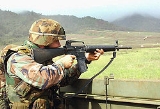
Area X [Area X-Ray as it's known locally] and its environs constitute the bulk of the training areas on Schofield Barracks. Large open areas allow for air assault operations to take off and land. Covered concrete pads can provide shelter for units training in the area who do not wish to deal with sleeping in the field. The range control office as well as numerous semi-automated and other firing ranges are contained within this area as well.East Range Training Area
The MOUT site, Land Navigation Course and designated training areas are laid out in this area to the west of the Main Post and the Enlisted Housing area. Typically, the bulk of the EIBExpert Infantryman Badge
The Expert Infantryman Badge, or EIB, is a military badge of the United States Army. Although similar in name and appearance to the Combat Infantryman Badge , it is a completely different award: while the CIB is awarded for participation in ground combat, the EIB is presented for completion of a...
train up and testing are done in this area.
Kolekole Pass
Kolekole road, which passes through the Enlisted Housing Area and West Post Training Area leads up to a saddle named Kolekole pass which constitutes allows vehicle traffic to flow between Schofield Barracks and Lualualei Naval Magazine as well as being an intermediate destination for Physical Training runs by Soldiers stationed on Schofield Barracks.25th Infantry Division Memorial
The 25th Infantry Division Memorial consists of four statues, representing the division's soldiers who served in World War II, Korea, Vietnam, and the War on Terrorism (Afghanistan and Iraq). The first statue was unveiled in June 2005.Cultural references
Schofield Barracks was the principal setting for the novel From Here to EternityFrom Here to Eternity (novel)
From Here to Eternity is the debut novel by James Jones, winner of the National Book Award for fiction in 1952. It was ranked 62 on Modern Library's list of the 100 Best Novels. It is loosely based on Jones' experiences in the pre-World War II Hawaiian Division's 27th Infantry and the unit in which...
by James Jones
James Jones (author)
James Jones was an American author known for his explorations of World War II and its aftermath.-Life and work:...
.
It and the surrounding area was also used for CBS's Tour of Duty (TV series)
Tour of Duty (TV series)
Tour of Duty is an American drama television series on CBS. It ran for three seasons from September 1987 to April 1990 as 58 one–hour episodes. The show was created by Steve Duncan and L. Travis Clark, and produced by Zev Braun....
.