
Sarufutsu, Hokkaido
Encyclopedia
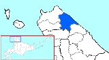
is a village
located in Sōya District
, Sōya
, Hokkaidō, Japan
.
As of December 31, 2007, the village has an estimated population
of 2,884 and a density
of 4.91 persons per km². The total area is 590.00 km².
to the east where, during the winter, there is drift ice
. 80% of the village's total area is covered by forests.
Villages of Japan
A is a local administrative unit in Japan.It is a local public body along with , , and . Geographically, a village's extent is contained within a prefecture....
located in Sōya District
Soya District, Hokkaido
is a district located in Sōya Subprefecture, Hokkaidō, Japan.As of 2004, the district has an estimated population of 2,925 and a density of 4.96 persons per km². The total area is 590.00 km².-Towns and villages:*Sarufutsu...
, Sōya
Soya Subprefecture
is a subprefecture of Hokkaidō, Japan. Its population is estimated to be 77,500 as of July 31, 2004 and its area is 4,050.84 km². It is the northernmost subprefecture of Japan.Wakkanai Airport is located in Wakkanai...
, Hokkaidō, Japan
Japan
Japan is an island nation in East Asia. Located in the Pacific Ocean, it lies to the east of the Sea of Japan, China, North Korea, South Korea and Russia, stretching from the Sea of Okhotsk in the north to the East China Sea and Taiwan in the south...
.
As of December 31, 2007, the village has an estimated population
Population
A population is all the organisms that both belong to the same group or species and live in the same geographical area. The area that is used to define a sexual population is such that inter-breeding is possible between any pair within the area and more probable than cross-breeding with individuals...
of 2,884 and a density
Population density
Population density is a measurement of population per unit area or unit volume. It is frequently applied to living organisms, and particularly to humans...
of 4.91 persons per km². The total area is 590.00 km².
Geography
Sarufutsu is the northernmost village in Japan and is the largest village in Hokkaidō in area. Located on the Tonbetsu Plain, it faces the Sea of OkhotskSea of Okhotsk
The Sea of Okhotsk is a marginal sea of the western Pacific Ocean, lying between the Kamchatka Peninsula on the east, the Kuril Islands on the southeast, the island of Hokkaidō to the far south, the island of Sakhalin along the west, and a long stretch of eastern Siberian coast along the west and...
to the east where, during the winter, there is drift ice
Drift ice
Drift ice is ice that floats on the surface of the water in cold regions, as opposed to fast ice, which is attached to a shore. Usually drift ice is carried along by winds and sea currents, hence its name, "drift ice"....
. 80% of the village's total area is covered by forests.
- Mountains: Mount Horoshiri
- Rivers: Sarufutsu River
- Lakes: Poro Swamp, Kamuito Swamp, Mokeuni Swamp
Settlements in Sarufutsu
- Ashino
- Asajino
- Chiraibetsu
- Hamaonishibetsu
- Hamasarufutsu
- Onishibetsu (Town Hall is located here)
Neighbouring municipalities
- HokkaidōHokkaido, formerly known as Ezo, Yezo, Yeso, or Yesso, is Japan's second largest island; it is also the largest and northernmost of Japan's 47 prefectural-level subdivisions. The Tsugaru Strait separates Hokkaido from Honshu, although the two islands are connected by the underwater railway Seikan Tunnel...
- WakkanaiWakkanai, Hokkaidois a city located in Sōya, Hokkaidō. It is the capital of Sōya Subprefecture and the northernmost city in Japan. It contains Japan's northernmost point, Cape Soya, from which the Russian island of Sakhalin can be seen....
- ToyotomiToyotomi, Hokkaidois a town located in Teshio District, Sōya, Hokkaidō, Japan.As of 2008, the town has an estimated population of 4,663 and a density of 9.46 persons per km². The total area is 520.67 km².-External links:* in Japanese...
- HamatonbestuHamatonbetsu, Hokkaidois a town located in Esashi District, Sōya, Hokkaidō, Japan.As of 2008, the town has an estimated population of 4,452 and a density of 11.55 persons per km²...
- HoronobeHoronobe, Hokkaidois a town located in Teshio District, Rumoi, Hokkaidō, Japan. There is a JR train station, Horonobe Station which connects Horonobe-town with other cities in Hokkaido....
- Wakkanai
Economy
Sarufutsu is famous for its large and particularly excellent scallops, amongst other seafood. Likewise, a relatively large part of the village is utilised for dairy farming. Lastly, Sarufutsu has a fledgling tourist industry, as it is a highlight for bikers in the summer, who stop overnight at one of the biker camps.Education
- Primary Schools
- Onishibestu Elementary School
- Hamaonishibestu Elementary School
- Hamasarufutsu Elementary School
- Asajino Elementary School
- Ashino Elementary School
- Junior High Schools
- Takushin Junior High School