

Santa María de Guía de Gran Canaria
Encyclopedia
| Municipality of Santa María de Guía de Gran Canaria | |
| Map | |
|---|---|
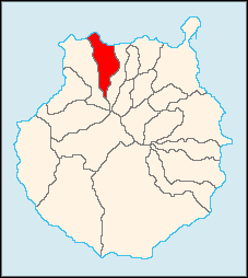 |
|
| Statistics | |
| Autonomous region: | Canary Islands Canary Islands The Canary Islands , also known as the Canaries , is a Spanish archipelago located just off the northwest coast of mainland Africa, 100 km west of the border between Morocco and the Western Sahara. The Canaries are a Spanish autonomous community and an outermost region of the European Union... |
| Province: | Las Palmas Las Palmas (province) The Province of Las Palmas is a province of Spain, consisting of the eastern part of the autonomous community of the Canary Islands.-Composition:... |
| Island: | Gran Canaria Gran Canaria Gran Canaria is the second most populous island of the Canary Islands, with a population of 838,397 which constitutes approximately 40% of the population of the archipelago... |
| Area Area Area is a quantity that expresses the extent of a two-dimensional surface or shape in the plane. Area can be understood as the amount of material with a given thickness that would be necessary to fashion a model of the shape, or the amount of paint necessary to cover the surface with a single coat... : |
42.59 km² some reads 42/37 km² |
| Population Population A population is all the organisms that both belong to the same group or species and live in the same geographical area. The area that is used to define a sexual population is such that inter-breeding is possible between any pair within the area and more probable than cross-breeding with individuals... : |
14,107 (2004) |
| Population density Population density Population density is a measurement of population per unit area or unit volume. It is frequently applied to living organisms, and particularly to humans... : |
332.95/km² |
| Elevation Elevation The elevation of a geographic location is its height above a fixed reference point, most commonly a reference geoid, a mathematical model of the Earth's sea level as an equipotential gravitational surface .... : Lowest: Centre: Highest: |
Atlantic Ocean Atlantic Ocean The Atlantic Ocean is the second-largest of the world's oceanic divisions. With a total area of about , it covers approximately 20% of the Earth's surface and about 26% of its water surface area... 180 m eastern part |
| Location Geographic coordinate system A geographic coordinate system is a coordinate system that enables every location on the Earth to be specified by a set of numbers. The coordinates are often chosen such that one of the numbers represent vertical position, and two or three of the numbers represent horizontal position... : |
28.133/28°8' N lat. 15.5833/15°35' W long. |
| Municipal code: | E-35023 |
| Car designation: | GC until 2001 |
Santa María de Guía de Gran Canaria is a municipality in Las Palmas
Las Palmas (province)
The Province of Las Palmas is a province of Spain, consisting of the eastern part of the autonomous community of the Canary Islands.-Composition:...
province of the Canary Islands
Canary Islands
The Canary Islands , also known as the Canaries , is a Spanish archipelago located just off the northwest coast of mainland Africa, 100 km west of the border between Morocco and the Western Sahara. The Canaries are a Spanish autonomous community and an outermost region of the European Union...
. It is located on the north side of Grand Canary island.
Santa María's area is 42.59 km², its population of about 14,107 inhabitants (ISTAC, 2003) and its density is 332.95/km². Its maximum elevation is 180 metres.
Santa Maria is situated in a valley setting. The valley dominates the north, the mountains cover the southern part, farmlands are within the valley, forests dominate the valleys, within streams and the south. The Atlantic Ocean
Atlantic Ocean
The Atlantic Ocean is the second-largest of the world's oceanic divisions. With a total area of about , it covers approximately 20% of the Earth's surface and about 26% of its water surface area...
lies to the west and to the north. Santa Maria is located west of Las Palmas de Gran Canaria
Las Palmas de Gran Canaria
Las Palmas de Gran Canaria commonly known as Las Palmas is the political capital, jointly with Santa Cruz, the most populous city in the Autonomous Community of the Canary Islands and the ninth largest city in Spain, with a population of 383,308 in 2010. Nearly half of the people of the island...
and the GC2
GC2 (Gran Canaria)
The GC-2 North Highway in Gran Canaria . Connects Las Palmas de Gran Canaria with the north little port and village of Agaete...
, north of Puerto Rico and west of Arucas
Arucas, Las Palmas
Arucas is a Canary Islands municipality in the province of Las Palmas. It is situated in the north of Gran Canaria. Arucas is a suburb of Las Palmas city....
and is linked with a major highway to Las Palmas de Gran Canaria and Arucas. The main industry are agriculture, commerce and tourism.
Geography and Information
- Location:
- Latitude: 28.133 (28°8') N
- Longitude: 15.5833 (15°35') W
- Altitude:
- Lowest: Atlantic Ocean
- Centre: 180 m
- Highest: eastern part
- Name of inhabitants: -
- Postal code: -
Historical population
| Year | Population | Density |
|---|---|---|
| 1991 | 12,383 | - |
| 1996 | 13,117 | - |
| 2001 | 13,893 | 323.09/km² |
| 2002 | 14,171 | - |
| 2003 | 14,255 | 334.7/km² |
| 2004 | 14,107 | 332.95/km² |
Other
Santa Maria has schools, lyceums, gymnasia, churches, a post office and squares (plazas).External links
- http://www.mancomunidaddelnorte.org/guia.htm
- Map and aerial photos
- Street map: Street map from Mapquest, MapPoint, Google or Yahoo! Maps
- Satellite images: Google or Microsoft Virtual Earth - image now available
- Coordinates: 28°8′0"N 15°35′0"W
See also
- Gran CanariaGran CanariaGran Canaria is the second most populous island of the Canary Islands, with a population of 838,397 which constitutes approximately 40% of the population of the archipelago...
(Grand Canary) - List of municipalities in Las Palmas
- Canary IslandsCanary IslandsThe Canary Islands , also known as the Canaries , is a Spanish archipelago located just off the northwest coast of mainland Africa, 100 km west of the border between Morocco and the Western Sahara. The Canaries are a Spanish autonomous community and an outermost region of the European Union...
| North: Atlantic Ocean Atlantic Ocean The Atlantic Ocean is the second-largest of the world's oceanic divisions. With a total area of about , it covers approximately 20% of the Earth's surface and about 26% of its water surface area... |
||
| West: Gáldar Gáldar, Las Palmas Gáldar's area is 61.59 km² with a population of about 22,763 and its density is 369.59/km².Gáldar is situated in the mountains and are surrounded by valleys. Farmlands are within the coastline while the mountains lies to the southeast, the Atlantic Ocean lies to the west and to the north. A... |
Santa Maria de Guía de Gran Canaria | East: Moya Moya, Las Palmas Moya is a municipality of Las Palmas province, on the Canary Islands. It is in the northern part of the Grand Canary island or Gran Canaria.Moya's area is 31.87 km² with a population of about 8,307 and its density is 250.63/km².... |
| South: Gáldar |