
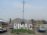
Rímac District
Encyclopedia

Lima Province
Lima Province is located in the central coast of Peru and is the only province in the country not belonging to any of the twenty-five regions. Its capital is Lima, which is also the nation's capital....
, Peru
Peru
Peru , officially the Republic of Peru , is a country in western South America. It is bordered on the north by Ecuador and Colombia, on the east by Brazil, on the southeast by Bolivia, on the south by Chile, and on the west by the Pacific Ocean....
. It lies directly to the north of downtown Lima
Lima District
Lima is a district of the Lima Province in Peru. It is not where the inner city zone of Lima, the country's capital city, is located, San Isidro District being such area in Lima....
, to which it is connected by six bridges over the Rímac River
Rímac River
The Rímac River is located in western Peru and is the most important source of potable water for the Lima and Callao Metropolitan Area.The river is part of the Pacific watershed and has a length of 160 km...
. The district also borders the Independencia
Independencia District, Lima
Independencia is a district of the Lima Province in Peru. It is part of city of Lima.Officially established as a district on March 16, 1964, the current mayor of Independencia is Lovell Yomond Vargas. The district's postal code is 28....
, San Martín de Porres, and San Juan de Lurigancho districts. Vestiges of Lima's colonial heyday remain today in an area of the Rímac district known as the Historic centre of Lima
Historic centre of Lima
Located principally in the city centre or Cercado de Lima and Rímac areas, the Historic Centre of Lima is among the most important tourist destinations in Peru.-Foundation:...
, which was declared a UNESCO World Heritage Site in 1988.
Downtown Rímac District has, like its southern counterpart, its eastern and western sides divided by Jirón Trujillo, which connects to Lima District's Jirón de la Unión
Jiron de la Union
The Jiron de la Union, or the Jiron of the Union, is a pedestrian street located in the Historic Centre of Lima, part of the capital of Peru. For many years it was one of the most important boulevards of the city, often described as the most aristocratic, where many of the most affluent citizens of...
through the Puente de Piedra, the oldest bridge in the whole city. Rímac's East side features the Plaza de Acho, the most famous bullfighting
Bullfighting
Bullfighting is a traditional spectacle of Spain, Portugal, southern France and some Latin American countries , in which one or more bulls are baited in a bullring for sport and entertainment...
arena in South America
South America
South America is a continent situated in the Western Hemisphere, mostly in the Southern Hemisphere, with a relatively small portion in the Northern Hemisphere. The continent is also considered a subcontinent of the Americas. It is bordered on the west by the Pacific Ocean and on the north and east...
and one of the most well-known in the world.
Looking directly from Puente Ricardo Palma on downtown Lima district's East side can be seen a large building with the logo of Cristal beer, one of two famous Peruvian brands. This was the main brewery until the Backus
Backus and Johnston
Backus and Johnston is the largest brewery in Peru, part of Grupo Empresarial Bavaria, which itself is part of the international SABMiller group. Its main brewery is located in the Ate District of Lima...
company moved operations to Ate
Ate District
Ate, also known as Ate-Vitarte, is a district of the Lima Province in Peru. Located in the eastern part of the province, it is one of the districts that comprise the city of Lima.-Geography:The district has a total land area of 77.72 km²...
in the 1990s.
North of the plant goes the Alameda de los Descalzos, a short boulevard
Boulevard
A Boulevard is type of road, usually a wide, multi-lane arterial thoroughfare, divided with a median down the centre, and roadways along each side designed as slow travel and parking lanes and for bicycle and pedestrian usage, often with an above-average quality of landscaping and scenery...
with a large planted median leading into the Convento de los Descalzos (Discalced Monks convent). Built in the 18th century by the Spanish
Spain
Spain , officially the Kingdom of Spain languages]] under the European Charter for Regional or Minority Languages. In each of these, Spain's official name is as follows:;;;;;;), is a country and member state of the European Union located in southwestern Europe on the Iberian Peninsula...
colonial government, it is one of the best features in this lower-middle-class district.
Northern Rímac, or Amancaes, once romanticized in ballads as "La Flor de Amancaes", a hilly prairie, is now overrun with pueblos jóvenes
Pueblos jóvenes
Pueblos jóvenes is the nickname given to the vast shanty towns that surround Lima and other cities of Peru. Many of these towns have developed into significant districts in Lima such as Villa El Salvador and Comas.- Population :...
(shanty towns). The Cerro San Cristóbal, which is the highest point in the Lima Province, is located in the district.
Boundaries
- North: IndependenciaIndependencia District, LimaIndependencia is a district of the Lima Province in Peru. It is part of city of Lima.Officially established as a district on March 16, 1964, the current mayor of Independencia is Lovell Yomond Vargas. The district's postal code is 28....
- East: San Juan de Lurigancho
- South: Downtown LimaLima DistrictLima is a district of the Lima Province in Peru. It is not where the inner city zone of Lima, the country's capital city, is located, San Isidro District being such area in Lima....
- West: San Martín de Porres
Urban areas
As of 1993, Rímac is divided into the following urban areas:- Caqueta
- Centro Rimac
- Alameda de los Descalzos
- Cerro Palomares
- Ciudad y Campo
- El Bosque
- El Manzano
- Huerta Guinea
- La Florida
- La Huerta
- Las Totoritas
- Leoncio Prado
- Perricholi
- Rimac
- Santa Candelaria
- Santa Rosa
- Ventura Rossi
- Villacampa
External links
www.munirimac.gob.pe Official website1.40 Gigapixel Image of Lima