
.gif)
Route 3 (New Jersey)
Encyclopedia
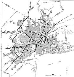
Route 3 is a state highway
in the northern part of New Jersey
in the United States
. The route runs 10.84 mi (17.45 km) from U.S. Route 46
in Clifton
, Passaic County
to U.S. Route 1/9
in North Bergen
, Hudson County
. Route 3 is sometimes called the Secaucus Bypass within Secaucus
. The route is a divided highway
for its entire length, with most of the highway to freeway standard except the westernmost part, which contains a few businesses. Route 3 intersects many major roads, including the Garden State Parkway
and Route 21 in Clifton, the western spur of the New Jersey Turnpike
(Interstate 95
) in East Rutherford
, the mainline New Jersey Turnpike in Secaucus, and Route 495 in North Bergen. It serves as a commuting route for northern New Jersey to the Lincoln Tunnel
into New York City
by way of Route 495. Route 3 also provides access to the Meadowlands Sports Complex
in East Rutherford. The road was the inspiration for a story in The New Yorker
in 2004 by Ian Frazier
.
Route 3 was originally established in 1927 to run from the New York
border on the west shore of Greenwood Lake
to Secaucus. In 1929, the western terminus was cut back to Paterson
when the alignment west of there was planned to become part of Route S4B. Route 3 originally followed present-day Route 20 through Paterson and ran along local streets to East Rutherford, where it followed present-day Route 120
and the Paterson Plank Road
to Secaucus. It was extended east to the Lincoln Tunnel in 1939. The freeway section of Route 3 between U.S. Route 46 in Clifton and East Rutherford was completed in the 1940s as Route S3 as well as the Secaucus Bypass, which was designated a bypass of Route 3. Route 3 was moved to the Route S3 freeway and the Secaucus Bypass in 1953 and was truncated to U.S. Route 1/9 in North Bergen in 1958 when the Lincoln Tunnel approach was designated as Interstate 495. The Route 3 freeway has seen many improvements over the years such as widening and interchange reconstructions and is projected to see more improvements such as the replacement of the bridge over the Passaic River
.
and County Route 621 (Valley Road) as a six-lane divided highway
with a Jersey barrier
that is not up to freeway standards as it contains a few businesses, with right-in/right-out
access. The route comes to an interchange with County Route 623 (Grove Street) and interchanges with County Route 509
(Broad Street). Route 3 comes to the Garden State Parkway
, where it interchanges with the southbound lanes and then the northbound lanes. All interchange movements are present between Route 3 and the Garden State Parkway except from the southbound Garden State Parkway to westbound Route 3 and from eastbound Route 3 to the northbound Garden State Parkway.
Past the Garden State Parkway, Route 3 eventually turns into a six-lane freeway that is not designed to Interstate Highway standards
. It interchanges with County Route 622 (Bloomfield Avenue) and then intersects County Route 603 (Passaic Avenue), which heads south into Nutley
to become Route 7. The next interchange is for County Route 601 (Main Avenue). Past that interchange, Route 3 comes to an interchange with Route 21 and soon passes over the route.
 Route 3 crosses the Passaic River
on a drawbridge
into Rutherford
, Bergen County
. Just after crossing the river, the route interchanges with County Route 507
(Riverside Avenue). The freeway continues through a residential area and comes to an exit that provides access to southbound Route 17. Past this interchange, Route 3 is closely paralleled by Route 17 to the south until Route 3 interchanges with Route 17, at which Route 17 continues to the north of Route 3.
The route widens to eight lanes and enters the New Jersey Meadowlands
, crossing into East Rutherford
and then passing over the Berrys Creek
. Route 3 passes to the south of the Meadowlands Sports Complex
and has access to Route 120
, MetLife Stadium, and the Meadowlands Racetrack
in the eastbound direction and to MetLife Stadium and the Meadowlands Racetrack in the westbound direction. The route narrows back to six lanes and comes to a ramp which provides access to the western spur of the New Jersey Turnpike
(Interstate 95
). Route 3 interchanges with Route 120 and the carriageway
s separate. The route passes under the western spur of the New Jersey Turnpike and becomes eight lanes again.
into Secaucus
, Hudson County
. It interchanges with the Meadowlands Parkway and continues southeast into a residential area with the carriageways joining back together. At the interchange with County Route 681 (Paterson Plank Road
), Route 3 widens into a local-express lane
configuration with three express lanes and local lanes each in the eastbound direction and two express lanes and three local lanes in the westbound direction. The route passes by the Mill Creek Mall
and crosses under the mainline of the New Jersey Turnpike
(Interstate 95
). Route 3 comes to an eastbound exit and entrance with Harmon Meadow Boulevard and features a cloverleaf interchange
with Paterson Plank Road. The route crosses the Penhorn Creek into North Bergen
. In North Bergen, the route comes to a truck-restricted eastbound ramp for eastbound Route 495. Route 3 then interchanges with Route 495, which provides access to the New Jersey Turnpike and the Lincoln Tunnel
. Past this interchange, the local-express lane configuration ends and Route 3 heads southeast as a four-lane highway. The route meets a westbound exit and entrance for the Lincoln Tunnel Park & Ride and comes to its terminus at a traffic light with U.S. Route 1/9
south, with no direct access to U.S. Route 1/9 north.
 Route 3 was legislated by the 1927 New Jersey state highway renumbering
to run from the New York
border on the west shore of Greenwood Lake
to Route 1 (now U.S. Route 1/9
) in Secaucus
. In 1929, the route west of Paterson was designated to become part of Route S4B, a spur of Route 4, and Route 3 was modified to end at Route S4B north of Paterson. Route S4B was never built west of Paterson while the portion that was built became Route 208 in 1953.
Following the 1929 amendments, Route 3 ran from Paterson
along today's Route 20, through Clifton
, Passaic
, Wallington
, Carlstadt
, and East Rutherford along local streets, and finally down Paterson Plank Road
(part of which is today's Route 120
) to Secaucus. In 1939, Route 3 was extended east along present-day Route 495 to the Lincoln Tunnel
into Manhattan
, New York City
.
The section of what is now Route 3 from U.S. Route 46
in Clifton to Route 120 in East Rutherford
was planned to be built as a freeway in the mid 1930s designated as Route S3, a spur of Route 3. Construction started in 1940, but it was interrupted by World War II
. It would resume, with the first section of freeway opening between Route 17 to Route 3 (now Route 120) in 1942. The freeway was completed by 1949, including a bypass of Secaucus that was designated as a bypass of Route 3. The freeway had cost a total of $10 million to build and cut commuting times between Northern New Jersey and Manhattan. Before the freeway was completed, Route S3 was designated to follow Allwood Road between Hepburn Road and Bloomfield Avenue in Clifton; the road was later returned to Passaic County and is currently County Route 602. In 1942, a spur of Route S3 in Clifton was commissioned; this became Route S3 Spur in 1948 and Route 161 in 1953.
In the 1953 New Jersey state highway renumbering
, Route 3 was realigned to follow the entire length of the Route S3 freeway. In addition, Route 3 in Secaucus was shifted off the Paterson Plank Road to the newly built Secaucus Bypass. The original alignment of Route 3 became Route 153. Only the section west of Paterson Plank Road was state-maintained after the renumbering, and the entire route was eliminated by the 1990s. In the mid-1950s, Route 3 was planned as one of the original routes of the Interstate Highway System
; however, the New Jersey State Highway Department had deemed it too expensive to bring it up to Interstate Highway standards
and Interstate 280
was favored instead. In 1958, the Lincoln Tunnel approach was designated as Interstate 495 and Route 3 was truncated back to U.S. Route 1/9 in North Bergen
.
Many improvements have occurred to the Route 3 freeway. The entire freeway was widened from four to six lanes in the 1960s. In the 1970s, the interchanges with Route 17, the New Jersey Turnpike
western spur, and Route 120 were improved with the construction of the Meadowlands Sports Complex
in the area. The bridge over the Berrys Creek
, originally built in 1948, was reconstructed in 1995 and Route 3 was widened to eight lanes in the area near the bridge. In 2003, the interchange with Route 495 and the intersection with U.S. Route 1/9 was improved at a cost of $16 million.
was completed in May 2009 at a cost of $38.1 million, a flyover from southbound Route 120 to eastbound Route 3 is planned to be completed in early 2010 at a cost of $13 million, and improvements to the New Jersey Turnpike
interchange are planned to be completed in the later part of 2010 at a cost of $49 million. There are also plans to rebuild Route 3 in the vicinity of the Passaic River
crossing between Main Avenue in Clifton
and Route 17 in Rutherford
. In mid August 2007, the NJDOT announced that it would replace the bridge deck on the Route 3 drawbridge
over the Passaic River with a fixed span. This project took place during late 2007 at a cost of $3.7 million. The Passaic River bridge is to be completely replaced in 2010. In addition to the replacement of the Passaic River bridge, many other bridges along Route 3 will be replaced and the road will be reconstructed to modern standards with noise walls installed. The entire project is projected to be complete in 2014.
in 2004 by Ian Frazier
. In this story, Frazier describes a bus journey along the route, mentioning scenes along the road such as traffic congestion, the Meadowlands Sports Complex
, and the Tick Tock Diner off Route 3 in Clifton
. He also described a walking journey he once took into New York City
along Route 3, encountering heavy, noisy traffic speeding by and debris along the side of the road
.
In a Saturday Night Live
sketch featuring Horatio Sanz
and Derek Jeter
, the fictional business "Derek Jeter's Taco Hole" is on Route 3 in Nutley, NJ between Kinko's and "El Duque's Shoe Repair".
!County
!Location
!Mile
!Destinations
!Notes
|-
|rowspan=10|Passaic
|rowspan=10|Clifton
|rowspan=2|0.00
|
|Western terminus; westbound exit and eastbound entrance
|-
|
|Westbound exit and eastbound entrance
|-
|0.51
|
|
|-
|1.26
|
|
|-
|1.44
|
|
|-
|1.53
|
|Westbound exit and eastbound entrance
|-
|2.64
|
|
|-
|3.41
|
|
|-
|3.82
|
|
|-
|4.70
|
|
|-
|rowspan=7|Bergen
|rowspan=3|Rutherford
|5.01
|
|Access to CR 30 from eastbound only
|-
|5.67
|
|Access to CR 30 from westbound only
|-
|6.36-
6.39
|
|
|-
|rowspan=4|East Rutherford
|7.21
|, Meadowlands Sports Complex
|Eastbound exit
|-
|7.27
|Meadowlands Sports Complex
- Racetrack
, Stadium
|Westbound exit and entrance
|-
|7.58
| Western Spur
|Exit 16W of NJTP
|-
|7.96
|
|Westbound exit and entrance, eastbound entrance
|-
|rowspan=9|Hudson
|rowspan=4|Secaucus
|8.60
|Meadowlands Parkway
|
|-
|9.12
|
|Access to I-95/NJTP southbound from eastbound Route 3 local lanes
|-
|9.89
|Harmon Meadow Boulevard
|Access to westbound exit is from NJ 495 only
|-
|10.04
|
|Access to westbound exit is from NJ 495 only
|-
|rowspan=5|North Bergen
|10.33
|
|Eastbound exit, no trucks
|-
|10.46
| Eastern Spur
|Exits 16E & 17 of NJTP
|-
|10.50
|
|No eastbound entrance or westbound exit (NJ 3 becomes NJ 495 after US 1/9 exit; leading to the Lincoln Tunnel to New York City)
|-
|10.70
| Park & Ride
|Westbound exit and entrance
|-
|10.84
|
|Eastern terminus; Eastbound exit and westbound entrance
State highway
State highway, state road or state route can refer to one of three related concepts, two of them related to a state or provincial government in a country that is divided into states or provinces :#A...
in the northern part of New Jersey
New Jersey
New Jersey is a state in the Northeastern and Middle Atlantic regions of the United States. , its population was 8,791,894. It is bordered on the north and east by the state of New York, on the southeast and south by the Atlantic Ocean, on the west by Pennsylvania and on the southwest by Delaware...
in the United States
United States
The United States of America is a federal constitutional republic comprising fifty states and a federal district...
. The route runs 10.84 mi (17.45 km) from U.S. Route 46
U.S. Route 46
U.S. Route 46 is an east–west U.S. Highway, running for , completely within the state of New Jersey. The west end is at an interchange with Interstate 80 and Route 94 in Columbia, Warren County on the Delaware River...
in Clifton
Clifton, New Jersey
Clifton is a city in Passaic County, New Jersey, United States. As of the 2010 United States Census, the city had a total population of 84,136. The 2010 population represented an increase of 5,464 residents from its population of 78,672 in the 2000 Census, making it the state's 11th largest...
, Passaic County
Passaic County, New Jersey
Passaic County is a county located in the U.S. state of New Jersey. As of the 2010 Census, the population was 501,226. Its county seat is Paterson...
to U.S. Route 1/9
U.S. Route 1/9
U.S. Route 9 is a U.S. highway in the northeast United States, running from Laurel, Delaware north to the Canadian border near Champlain, New York...
in North Bergen
North Bergen, New Jersey
North Bergen is a township in Hudson County, New Jersey, United States. As of the United States 2010 Census, the township had a total population of 60,773. Originally founded in 1843, the town was much diminished in territory by a series of secessions. Situated on the Hudson Palisades, it is one...
, Hudson County
Hudson County, New Jersey
Hudson County is the smallest county in New Jersey and one of the most densely populated in United States. It takes its name from the Hudson River, which creates part of its eastern border. Part of the New York metropolitan area, its county seat and largest city is Jersey City.- Municipalities...
. Route 3 is sometimes called the Secaucus Bypass within Secaucus
Secaucus, New Jersey
Secaucus is a town in Hudson County, New Jersey. As of the 2010 United States Census, the town population was 16,264. Located within the New Jersey Meadowlands, it is the most suburban of the county's municipalities, though large parts of the town are dedicated to light manufacturing, retail, and...
. The route is a divided highway
Divided Highway
Divided Highway is a compilation album by American rock band The Doobie Brothers, released in 2003. . All tracks are taken from the albums Cycles and Brotherhood .-Track listing:...
for its entire length, with most of the highway to freeway standard except the westernmost part, which contains a few businesses. Route 3 intersects many major roads, including the Garden State Parkway
Garden State Parkway
The Garden State Parkway is a 172.4-mile limited-access toll parkway that stretches the length of New Jersey from the New York line at Montvale, New Jersey, to Cape May at New Jersey's southernmost tip. Its name refers to New Jersey's nickname, the "Garden State." Most New Jersey residents refer...
and Route 21 in Clifton, the western spur of the New Jersey Turnpike
New Jersey Turnpike
The New Jersey Turnpike is a toll road in New Jersey, maintained by the New Jersey Turnpike Authority. According to the International Bridge, Tunnel and Turnpike Association, the Turnpike is the nation's sixth-busiest toll road and is among one of the most heavily traveled highways in the United...
(Interstate 95
Interstate 95 in New Jersey
Interstate 95 is a major Interstate Highway that traverses the full extent of the East Coast of the United States, from Florida to Maine...
) in East Rutherford
East Rutherford, New Jersey
East Rutherford is a borough in Bergen County, New Jersey. As of the 2010 United States Census, the borough population was 8,913. It is an inner-ring suburb of New York City, located west of Midtown Manhattan....
, the mainline New Jersey Turnpike in Secaucus, and Route 495 in North Bergen. It serves as a commuting route for northern New Jersey to the Lincoln Tunnel
Lincoln Tunnel
The Lincoln Tunnel is a long tunnel under the Hudson River, connecting Weehawken, New Jersey and the borough of Manhattan in New York City.-History:...
into New York City
New York City
New York is the most populous city in the United States and the center of the New York Metropolitan Area, one of the most populous metropolitan areas in the world. New York exerts a significant impact upon global commerce, finance, media, art, fashion, research, technology, education, and...
by way of Route 495. Route 3 also provides access to the Meadowlands Sports Complex
Meadowlands Sports Complex
The MetLife Sports Complex is a sports and entertainment facility located in East Rutherford, Bergen County, New Jersey, United States, owned and operated by the New Jersey Sports and Exposition Authority...
in East Rutherford. The road was the inspiration for a story in The New Yorker
The New Yorker
The New Yorker is an American magazine of reportage, commentary, criticism, essays, fiction, satire, cartoons and poetry published by Condé Nast...
in 2004 by Ian Frazier
Ian Frazier
Ian Frazier is an American writer and humorist. He is best known for his 1989 non-fiction history Great Plains, his acclaimed 2010 best-selling opus Travels in Siberia, and as a writer and humorist for The New Yorker....
.
Route 3 was originally established in 1927 to run from the New York
New York
New York is a state in the Northeastern region of the United States. It is the nation's third most populous state. New York is bordered by New Jersey and Pennsylvania to the south, and by Connecticut, Massachusetts and Vermont to the east...
border on the west shore of Greenwood Lake
Greenwood Lake
Greenwood Lake is an interstate lake approximately seven miles long, straddling the border of New Jersey and New York. It is located in West Milford, New Jersey and Greenwood Lake, New York ....
to Secaucus. In 1929, the western terminus was cut back to Paterson
Paterson, New Jersey
Paterson is a city serving as the county seat of Passaic County, New Jersey, United States. As of the 2010 United States Census, its population was 146,199, rendering it New Jersey's third largest city and one of the largest cities in the New York City Metropolitan Area, despite a decrease of 3,023...
when the alignment west of there was planned to become part of Route S4B. Route 3 originally followed present-day Route 20 through Paterson and ran along local streets to East Rutherford, where it followed present-day Route 120
New Jersey Route 120
Route 120 is a state highway located in Bergen County, New Jersey, United States. It extends from an interchange with Route 3 in East Rutherford to another interchange with Route 17 in Carlstadt, where it continues to the west as County Route 120. NJ 120 serves the Meadowlands Sports Complex,...
and the Paterson Plank Road
Paterson Plank Road
Paterson Plank Road is a road that runs through Passaic, Bergen and Hudson Counties in northeastern New Jersey originally lain in the colonial era. The route, connecting the city Paterson and the Hudson River waterfront, still exists...
to Secaucus. It was extended east to the Lincoln Tunnel in 1939. The freeway section of Route 3 between U.S. Route 46 in Clifton and East Rutherford was completed in the 1940s as Route S3 as well as the Secaucus Bypass, which was designated a bypass of Route 3. Route 3 was moved to the Route S3 freeway and the Secaucus Bypass in 1953 and was truncated to U.S. Route 1/9 in North Bergen in 1958 when the Lincoln Tunnel approach was designated as Interstate 495. The Route 3 freeway has seen many improvements over the years such as widening and interchange reconstructions and is projected to see more improvements such as the replacement of the bridge over the Passaic River
Passaic River
The Passaic River is a mature surface river, approximately 80 mi long, in northern New Jersey in the United States. The river in its upper course flows in a highly circuitous route, meandering through the swamp lowlands between the ridge hills of rural and suburban northern New Jersey,...
.
Passaic County
Route 3 heads to the southeast from an interchange with U.S. Route 46U.S. Route 46
U.S. Route 46 is an east–west U.S. Highway, running for , completely within the state of New Jersey. The west end is at an interchange with Interstate 80 and Route 94 in Columbia, Warren County on the Delaware River...
and County Route 621 (Valley Road) as a six-lane divided highway
Divided Highway
Divided Highway is a compilation album by American rock band The Doobie Brothers, released in 2003. . All tracks are taken from the albums Cycles and Brotherhood .-Track listing:...
with a Jersey barrier
Jersey barrier
A Jersey barrier or Jersey wall is a modular concrete barrier employed to separate lanes of traffic. It is designed to both minimize vehicle damage in cases of incidental contact while still preventing crossover in the case of head-on accidents....
that is not up to freeway standards as it contains a few businesses, with right-in/right-out
Right-in/right-out
Right-in/right-out and left-in/left-out refer to a type of road intersection where turning movements of vehicles are restricted. A RIRO permits only right turns and a LILO permits only left turns. RIRO is usual where vehicles drive on the right, and LILO is usual where vehicles drive on the left...
access. The route comes to an interchange with County Route 623 (Grove Street) and interchanges with County Route 509
County Route 509 (New Jersey)
County Route 509 is a county highway in the U.S. state of New Jersey. The highway extends 25.78 miles from North Avenue in Westfield to Straight Street in Paterson....
(Broad Street). Route 3 comes to the Garden State Parkway
Garden State Parkway
The Garden State Parkway is a 172.4-mile limited-access toll parkway that stretches the length of New Jersey from the New York line at Montvale, New Jersey, to Cape May at New Jersey's southernmost tip. Its name refers to New Jersey's nickname, the "Garden State." Most New Jersey residents refer...
, where it interchanges with the southbound lanes and then the northbound lanes. All interchange movements are present between Route 3 and the Garden State Parkway except from the southbound Garden State Parkway to westbound Route 3 and from eastbound Route 3 to the northbound Garden State Parkway.
Past the Garden State Parkway, Route 3 eventually turns into a six-lane freeway that is not designed to Interstate Highway standards
Interstate Highway standards
Standards for Interstate Highways in the United States are defined by the American Association of State Highway and Transportation Officials in the publication A Policy on Design Standards - Interstate System...
. It interchanges with County Route 622 (Bloomfield Avenue) and then intersects County Route 603 (Passaic Avenue), which heads south into Nutley
Nutley, New Jersey
2010 Census Data:*TOTAL: 28,370 or 100%*White: 23,405 *African American: 628 *Asian: 2,824 *American Indian and Alaska Native: 36 *Native Hawaiian and Pacific Islander: 4...
to become Route 7. The next interchange is for County Route 601 (Main Avenue). Past that interchange, Route 3 comes to an interchange with Route 21 and soon passes over the route.
Bergen County
Passaic River
The Passaic River is a mature surface river, approximately 80 mi long, in northern New Jersey in the United States. The river in its upper course flows in a highly circuitous route, meandering through the swamp lowlands between the ridge hills of rural and suburban northern New Jersey,...
on a drawbridge
Drawbridge
A drawbridge is a type of movable bridge typically associated with the entrance of a castle surrounded by a moat. The term is often used to describe all different types of movable bridges, like bascule bridges and lift bridges.-Castle drawbridges:...
into Rutherford
Rutherford, New Jersey
Rutherford is a borough in Bergen County, New Jersey, United States. As of the 2010 United States Census, the borough population was 18,061. It is an inner-ring suburb of New York City, located west of Midtown Manhattan....
, Bergen County
Bergen County, New Jersey
Bergen County is the most populous county of the state of New Jersey, United States. As of the 2010 United States Census, its population was 905,116. The county is part of the New York City Metropolitan Area. Its county seat is Hackensack...
. Just after crossing the river, the route interchanges with County Route 507
County Route 507 (New Jersey)
County Route 507 is a county highway in the U.S. state of New Jersey. The highway extends from Harrison Avenue on the Kearny-Harrison town line to the New York state line in Mahwah. Between Ho-Ho-Kus and Mahwah, this highway is known as Franklin Turnpike...
(Riverside Avenue). The freeway continues through a residential area and comes to an exit that provides access to southbound Route 17. Past this interchange, Route 3 is closely paralleled by Route 17 to the south until Route 3 interchanges with Route 17, at which Route 17 continues to the north of Route 3.
The route widens to eight lanes and enters the New Jersey Meadowlands
New Jersey Meadowlands
New Jersey Meadowlands, also known as the Hackensack Meadowlands after the primary river flowing through it, is a general name for the large ecosystem of wetlands in northeast New Jersey in the United States. The Meadowlands are known for being the site of large landfills and decades of...
, crossing into East Rutherford
East Rutherford, New Jersey
East Rutherford is a borough in Bergen County, New Jersey. As of the 2010 United States Census, the borough population was 8,913. It is an inner-ring suburb of New York City, located west of Midtown Manhattan....
and then passing over the Berrys Creek
Berrys Creek
Berrys Creek is a tributary of the Hackensack River in the New Jersey Meadowlands in Bergen County, New Jersey.-Geography:...
. Route 3 passes to the south of the Meadowlands Sports Complex
Meadowlands Sports Complex
The MetLife Sports Complex is a sports and entertainment facility located in East Rutherford, Bergen County, New Jersey, United States, owned and operated by the New Jersey Sports and Exposition Authority...
and has access to Route 120
New Jersey Route 120
Route 120 is a state highway located in Bergen County, New Jersey, United States. It extends from an interchange with Route 3 in East Rutherford to another interchange with Route 17 in Carlstadt, where it continues to the west as County Route 120. NJ 120 serves the Meadowlands Sports Complex,...
, MetLife Stadium, and the Meadowlands Racetrack
Meadowlands Racetrack
The Meadowlands Racetrack is a horse racing track at the MetLife Sports Complex in East Rutherford, New Jersey, United States.The track hosts both thoroughbred racing and harness racing...
in the eastbound direction and to MetLife Stadium and the Meadowlands Racetrack in the westbound direction. The route narrows back to six lanes and comes to a ramp which provides access to the western spur of the New Jersey Turnpike
New Jersey Turnpike
The New Jersey Turnpike is a toll road in New Jersey, maintained by the New Jersey Turnpike Authority. According to the International Bridge, Tunnel and Turnpike Association, the Turnpike is the nation's sixth-busiest toll road and is among one of the most heavily traveled highways in the United...
(Interstate 95
Interstate 95 in New Jersey
Interstate 95 is a major Interstate Highway that traverses the full extent of the East Coast of the United States, from Florida to Maine...
). Route 3 interchanges with Route 120 and the carriageway
Carriageway
A carriageway consists of a width of road on which a vehicle is not restricted by any physical barriers or separation to move laterally...
s separate. The route passes under the western spur of the New Jersey Turnpike and becomes eight lanes again.
Hudson County
Route 3 crosses the Hackensack RiverHackensack River
The Hackensack River is a river, approximately 45 miles long, in the U.S. states of New York and New Jersey, emptying into Newark Bay, a back chamber of New York Harbor. The watershed of the river includes part of the suburban area outside New York City just west of the lower Hudson River,...
into Secaucus
Secaucus, New Jersey
Secaucus is a town in Hudson County, New Jersey. As of the 2010 United States Census, the town population was 16,264. Located within the New Jersey Meadowlands, it is the most suburban of the county's municipalities, though large parts of the town are dedicated to light manufacturing, retail, and...
, Hudson County
Hudson County, New Jersey
Hudson County is the smallest county in New Jersey and one of the most densely populated in United States. It takes its name from the Hudson River, which creates part of its eastern border. Part of the New York metropolitan area, its county seat and largest city is Jersey City.- Municipalities...
. It interchanges with the Meadowlands Parkway and continues southeast into a residential area with the carriageways joining back together. At the interchange with County Route 681 (Paterson Plank Road
Paterson Plank Road
Paterson Plank Road is a road that runs through Passaic, Bergen and Hudson Counties in northeastern New Jersey originally lain in the colonial era. The route, connecting the city Paterson and the Hudson River waterfront, still exists...
), Route 3 widens into a local-express lane
Local-express lanes
A Local-express lane system is an arrangement of roadways within a major highway providing one of more roadways for express lanes with a limited number of entrances and exits and also separate roadways for local or collector lanes which provide access to all interchanges...
configuration with three express lanes and local lanes each in the eastbound direction and two express lanes and three local lanes in the westbound direction. The route passes by the Mill Creek Mall
Mill Creek Mall
The Mall at Mill Creek, or Mill Creek Mall, is a one-story regional shopping mall located in Secaucus, New Jersey in the New Jersey Meadowlands. It is situated in the Harmon Meadow Plaza complex, approximately six miles from New York City, and is owned by Hartz Mountain Industries...
and crosses under the mainline of the New Jersey Turnpike
New Jersey Turnpike
The New Jersey Turnpike is a toll road in New Jersey, maintained by the New Jersey Turnpike Authority. According to the International Bridge, Tunnel and Turnpike Association, the Turnpike is the nation's sixth-busiest toll road and is among one of the most heavily traveled highways in the United...
(Interstate 95
Interstate 95 in New Jersey
Interstate 95 is a major Interstate Highway that traverses the full extent of the East Coast of the United States, from Florida to Maine...
). Route 3 comes to an eastbound exit and entrance with Harmon Meadow Boulevard and features a cloverleaf interchange
Cloverleaf interchange
A cloverleaf interchange is a two-level interchange in which left turns, reverse direction in left-driving regions, are handled by ramp roads...
with Paterson Plank Road. The route crosses the Penhorn Creek into North Bergen
North Bergen, New Jersey
North Bergen is a township in Hudson County, New Jersey, United States. As of the United States 2010 Census, the township had a total population of 60,773. Originally founded in 1843, the town was much diminished in territory by a series of secessions. Situated on the Hudson Palisades, it is one...
. In North Bergen, the route comes to a truck-restricted eastbound ramp for eastbound Route 495. Route 3 then interchanges with Route 495, which provides access to the New Jersey Turnpike and the Lincoln Tunnel
Lincoln Tunnel
The Lincoln Tunnel is a long tunnel under the Hudson River, connecting Weehawken, New Jersey and the borough of Manhattan in New York City.-History:...
. Past this interchange, the local-express lane configuration ends and Route 3 heads southeast as a four-lane highway. The route meets a westbound exit and entrance for the Lincoln Tunnel Park & Ride and comes to its terminus at a traffic light with U.S. Route 1/9
U.S. Route 1/9
U.S. Route 9 is a U.S. highway in the northeast United States, running from Laurel, Delaware north to the Canadian border near Champlain, New York...
south, with no direct access to U.S. Route 1/9 north.
History
1927 New Jersey state highway renumbering
In 1927, New Jersey's state highways were renumbered. The old system, which had been defined in sequence by the legislature, was growing badly, as several routes shared the same number, and many unnumbered state highways had been defined...
to run from the New York
New York
New York is a state in the Northeastern region of the United States. It is the nation's third most populous state. New York is bordered by New Jersey and Pennsylvania to the south, and by Connecticut, Massachusetts and Vermont to the east...
border on the west shore of Greenwood Lake
Greenwood Lake
Greenwood Lake is an interstate lake approximately seven miles long, straddling the border of New Jersey and New York. It is located in West Milford, New Jersey and Greenwood Lake, New York ....
to Route 1 (now U.S. Route 1/9
U.S. Route 1/9
U.S. Route 9 is a U.S. highway in the northeast United States, running from Laurel, Delaware north to the Canadian border near Champlain, New York...
) in Secaucus
Secaucus, New Jersey
Secaucus is a town in Hudson County, New Jersey. As of the 2010 United States Census, the town population was 16,264. Located within the New Jersey Meadowlands, it is the most suburban of the county's municipalities, though large parts of the town are dedicated to light manufacturing, retail, and...
. In 1929, the route west of Paterson was designated to become part of Route S4B, a spur of Route 4, and Route 3 was modified to end at Route S4B north of Paterson. Route S4B was never built west of Paterson while the portion that was built became Route 208 in 1953.
Following the 1929 amendments, Route 3 ran from Paterson
Paterson, New Jersey
Paterson is a city serving as the county seat of Passaic County, New Jersey, United States. As of the 2010 United States Census, its population was 146,199, rendering it New Jersey's third largest city and one of the largest cities in the New York City Metropolitan Area, despite a decrease of 3,023...
along today's Route 20, through Clifton
Clifton, New Jersey
Clifton is a city in Passaic County, New Jersey, United States. As of the 2010 United States Census, the city had a total population of 84,136. The 2010 population represented an increase of 5,464 residents from its population of 78,672 in the 2000 Census, making it the state's 11th largest...
, Passaic
Passaic, New Jersey
Passaic is a city in Passaic County, New Jersey, United States. As of the 2010 United States Census, the city had a total population of 69,781, maintaining its status as the 15th largest municipality in New Jersey with an increase of 1,920 residents from the 2000 Census population of 67,861...
, Wallington
Wallington, New Jersey
Wallington is a borough in Bergen County, New Jersey, United States. As of the 2010 United States Census, the borough population was 11,335.Wallington was created as a borough on January 2, 1895 , at the height of the "Boroughitis" fever then sweeping through Bergen County...
, Carlstadt
Carlstadt, New Jersey
Carlstadt is a borough in Bergen County, New Jersey, United States. As of the 2010 United States Census, the borough population was 6,127.Carlstadt was originally formed as a village by an Act of the New Jersey Legislature on March 12, 1860, within Lodi Township. It was named after Dr...
, and East Rutherford along local streets, and finally down Paterson Plank Road
Paterson Plank Road
Paterson Plank Road is a road that runs through Passaic, Bergen and Hudson Counties in northeastern New Jersey originally lain in the colonial era. The route, connecting the city Paterson and the Hudson River waterfront, still exists...
(part of which is today's Route 120
New Jersey Route 120
Route 120 is a state highway located in Bergen County, New Jersey, United States. It extends from an interchange with Route 3 in East Rutherford to another interchange with Route 17 in Carlstadt, where it continues to the west as County Route 120. NJ 120 serves the Meadowlands Sports Complex,...
) to Secaucus. In 1939, Route 3 was extended east along present-day Route 495 to the Lincoln Tunnel
Lincoln Tunnel
The Lincoln Tunnel is a long tunnel under the Hudson River, connecting Weehawken, New Jersey and the borough of Manhattan in New York City.-History:...
into Manhattan
Manhattan
Manhattan is the oldest and the most densely populated of the five boroughs of New York City. Located primarily on the island of Manhattan at the mouth of the Hudson River, the boundaries of the borough are identical to those of New York County, an original county of the state of New York...
, New York City
New York City
New York is the most populous city in the United States and the center of the New York Metropolitan Area, one of the most populous metropolitan areas in the world. New York exerts a significant impact upon global commerce, finance, media, art, fashion, research, technology, education, and...
.
The section of what is now Route 3 from U.S. Route 46
U.S. Route 46
U.S. Route 46 is an east–west U.S. Highway, running for , completely within the state of New Jersey. The west end is at an interchange with Interstate 80 and Route 94 in Columbia, Warren County on the Delaware River...
in Clifton to Route 120 in East Rutherford
East Rutherford, New Jersey
East Rutherford is a borough in Bergen County, New Jersey. As of the 2010 United States Census, the borough population was 8,913. It is an inner-ring suburb of New York City, located west of Midtown Manhattan....
was planned to be built as a freeway in the mid 1930s designated as Route S3, a spur of Route 3. Construction started in 1940, but it was interrupted by World War II
World War II
World War II, or the Second World War , was a global conflict lasting from 1939 to 1945, involving most of the world's nations—including all of the great powers—eventually forming two opposing military alliances: the Allies and the Axis...
. It would resume, with the first section of freeway opening between Route 17 to Route 3 (now Route 120) in 1942. The freeway was completed by 1949, including a bypass of Secaucus that was designated as a bypass of Route 3. The freeway had cost a total of $10 million to build and cut commuting times between Northern New Jersey and Manhattan. Before the freeway was completed, Route S3 was designated to follow Allwood Road between Hepburn Road and Bloomfield Avenue in Clifton; the road was later returned to Passaic County and is currently County Route 602. In 1942, a spur of Route S3 in Clifton was commissioned; this became Route S3 Spur in 1948 and Route 161 in 1953.
In the 1953 New Jersey state highway renumbering
1953 New Jersey state highway renumbering
On January 1, 1953, the New Jersey Department of Transportation renumbered many of the State Routes. A few rules were followed in deciding what to renumber:...
, Route 3 was realigned to follow the entire length of the Route S3 freeway. In addition, Route 3 in Secaucus was shifted off the Paterson Plank Road to the newly built Secaucus Bypass. The original alignment of Route 3 became Route 153. Only the section west of Paterson Plank Road was state-maintained after the renumbering, and the entire route was eliminated by the 1990s. In the mid-1950s, Route 3 was planned as one of the original routes of the Interstate Highway System
Interstate Highway System
The Dwight D. Eisenhower National System of Interstate and Defense Highways, , is a network of limited-access roads including freeways, highways, and expressways forming part of the National Highway System of the United States of America...
; however, the New Jersey State Highway Department had deemed it too expensive to bring it up to Interstate Highway standards
Interstate Highway standards
Standards for Interstate Highways in the United States are defined by the American Association of State Highway and Transportation Officials in the publication A Policy on Design Standards - Interstate System...
and Interstate 280
Interstate 280 (New Jersey)
Interstate 280 is a Interstate Highway in the U.S. state of New Jersey. It provides a spur from I-80 in Parsippany-Troy Hills, Morris County to Newark, and I-95 Interstate 280 (abbreviated I-280) is a Interstate Highway in the U.S. state of New Jersey. It provides a spur from I-80 in...
was favored instead. In 1958, the Lincoln Tunnel approach was designated as Interstate 495 and Route 3 was truncated back to U.S. Route 1/9 in North Bergen
North Bergen, New Jersey
North Bergen is a township in Hudson County, New Jersey, United States. As of the United States 2010 Census, the township had a total population of 60,773. Originally founded in 1843, the town was much diminished in territory by a series of secessions. Situated on the Hudson Palisades, it is one...
.
Many improvements have occurred to the Route 3 freeway. The entire freeway was widened from four to six lanes in the 1960s. In the 1970s, the interchanges with Route 17, the New Jersey Turnpike
New Jersey Turnpike
The New Jersey Turnpike is a toll road in New Jersey, maintained by the New Jersey Turnpike Authority. According to the International Bridge, Tunnel and Turnpike Association, the Turnpike is the nation's sixth-busiest toll road and is among one of the most heavily traveled highways in the United...
western spur, and Route 120 were improved with the construction of the Meadowlands Sports Complex
Meadowlands Sports Complex
The MetLife Sports Complex is a sports and entertainment facility located in East Rutherford, Bergen County, New Jersey, United States, owned and operated by the New Jersey Sports and Exposition Authority...
in the area. The bridge over the Berrys Creek
Berrys Creek
Berrys Creek is a tributary of the Hackensack River in the New Jersey Meadowlands in Bergen County, New Jersey.-Geography:...
, originally built in 1948, was reconstructed in 1995 and Route 3 was widened to eight lanes in the area near the bridge. In 2003, the interchange with Route 495 and the intersection with U.S. Route 1/9 was improved at a cost of $16 million.
Future developments
The NJDOT is planning to rebuild the interchange at U.S. Route 46 and Valley Road in Clifton. This project will reconfigure ramps, bring bridges up to standard, and will provide for three-lane connections between Route 3 and U.S. Route 46. It was announced in 2003 and is projected to cost $200 million. Plans are also in place to improve Route 3 near the Meadowlands Sports Complex with the construction of American Dream Meadowlands. An overpass between eastbound Route 3 and northbound Route 120New Jersey Route 120
Route 120 is a state highway located in Bergen County, New Jersey, United States. It extends from an interchange with Route 3 in East Rutherford to another interchange with Route 17 in Carlstadt, where it continues to the west as County Route 120. NJ 120 serves the Meadowlands Sports Complex,...
was completed in May 2009 at a cost of $38.1 million, a flyover from southbound Route 120 to eastbound Route 3 is planned to be completed in early 2010 at a cost of $13 million, and improvements to the New Jersey Turnpike
New Jersey Turnpike
The New Jersey Turnpike is a toll road in New Jersey, maintained by the New Jersey Turnpike Authority. According to the International Bridge, Tunnel and Turnpike Association, the Turnpike is the nation's sixth-busiest toll road and is among one of the most heavily traveled highways in the United...
interchange are planned to be completed in the later part of 2010 at a cost of $49 million. There are also plans to rebuild Route 3 in the vicinity of the Passaic River
Passaic River
The Passaic River is a mature surface river, approximately 80 mi long, in northern New Jersey in the United States. The river in its upper course flows in a highly circuitous route, meandering through the swamp lowlands between the ridge hills of rural and suburban northern New Jersey,...
crossing between Main Avenue in Clifton
Clifton, New Jersey
Clifton is a city in Passaic County, New Jersey, United States. As of the 2010 United States Census, the city had a total population of 84,136. The 2010 population represented an increase of 5,464 residents from its population of 78,672 in the 2000 Census, making it the state's 11th largest...
and Route 17 in Rutherford
Rutherford, New Jersey
Rutherford is a borough in Bergen County, New Jersey, United States. As of the 2010 United States Census, the borough population was 18,061. It is an inner-ring suburb of New York City, located west of Midtown Manhattan....
. In mid August 2007, the NJDOT announced that it would replace the bridge deck on the Route 3 drawbridge
Drawbridge
A drawbridge is a type of movable bridge typically associated with the entrance of a castle surrounded by a moat. The term is often used to describe all different types of movable bridges, like bascule bridges and lift bridges.-Castle drawbridges:...
over the Passaic River with a fixed span. This project took place during late 2007 at a cost of $3.7 million. The Passaic River bridge is to be completely replaced in 2010. In addition to the replacement of the Passaic River bridge, many other bridges along Route 3 will be replaced and the road will be reconstructed to modern standards with noise walls installed. The entire project is projected to be complete in 2014.
In popular culture
Route 3 was the inspiration for a story in The New YorkerThe New Yorker
The New Yorker is an American magazine of reportage, commentary, criticism, essays, fiction, satire, cartoons and poetry published by Condé Nast...
in 2004 by Ian Frazier
Ian Frazier
Ian Frazier is an American writer and humorist. He is best known for his 1989 non-fiction history Great Plains, his acclaimed 2010 best-selling opus Travels in Siberia, and as a writer and humorist for The New Yorker....
. In this story, Frazier describes a bus journey along the route, mentioning scenes along the road such as traffic congestion, the Meadowlands Sports Complex
Meadowlands Sports Complex
The MetLife Sports Complex is a sports and entertainment facility located in East Rutherford, Bergen County, New Jersey, United States, owned and operated by the New Jersey Sports and Exposition Authority...
, and the Tick Tock Diner off Route 3 in Clifton
Clifton, New Jersey
Clifton is a city in Passaic County, New Jersey, United States. As of the 2010 United States Census, the city had a total population of 84,136. The 2010 population represented an increase of 5,464 residents from its population of 78,672 in the 2000 Census, making it the state's 11th largest...
. He also described a walking journey he once took into New York City
New York City
New York is the most populous city in the United States and the center of the New York Metropolitan Area, one of the most populous metropolitan areas in the world. New York exerts a significant impact upon global commerce, finance, media, art, fashion, research, technology, education, and...
along Route 3, encountering heavy, noisy traffic speeding by and debris along the side of the road
Road debris
Road debris, a form of road hazard, is debris on or off a road. Road debris includes substances, materials, and objects that are foreign to the normal roadway environment...
.
In a Saturday Night Live
Saturday Night Live
Saturday Night Live is a live American late-night television sketch comedy and variety show developed by Lorne Michaels and Dick Ebersol. The show premiered on NBC on October 11, 1975, under the original title of NBC's Saturday Night.The show's sketches often parody contemporary American culture...
sketch featuring Horatio Sanz
Horatio Sanz
Horatio Sanz is a Chilean-born American actor and comedian best known as a cast member on Saturday Night Live from 1998-2006. Sanz most recently starred alongside his former SNL castmate Chris Parnell in the Comedy Central series Big Lake.-Early life:Sanz, the youngest of three sons, was born in...
and Derek Jeter
Derek Jeter
Derek Sanderson Jeter is an American baseball shortstop who has played 17 years in Major League Baseball for the New York Yankees. A twelve-time All-Star and five-time World Series champion, Jeter's clubhouse presence, on-field leadership, hitting ability, and baserunning have made him a central...
, the fictional business "Derek Jeter's Taco Hole" is on Route 3 in Nutley, NJ between Kinko's and "El Duque's Shoe Repair".
Exit list
{|class=wikitable!County
!Location
!Mile
!Destinations
!Notes
|-
|rowspan=10|Passaic
|rowspan=10|Clifton
|rowspan=2|0.00
|
|Western terminus; westbound exit and eastbound entrance
|-
|
|Westbound exit and eastbound entrance
|-
|0.51
|
|
|-
|1.26
|
|
|-
|1.44
|
|
|-
|1.53
|
|Westbound exit and eastbound entrance
|-
|2.64
|
|
|-
|3.41
|
|
|-
|3.82
|
|
|-
|4.70
|
|
|-
|rowspan=7|Bergen
|rowspan=3|Rutherford
|5.01
|
|Access to CR 30 from eastbound only
|-
|5.67
|
|Access to CR 30 from westbound only
|-
|6.36-
6.39
|
|
|-
|rowspan=4|East Rutherford
|7.21
|, Meadowlands Sports Complex
Meadowlands Sports Complex
The MetLife Sports Complex is a sports and entertainment facility located in East Rutherford, Bergen County, New Jersey, United States, owned and operated by the New Jersey Sports and Exposition Authority...
|Eastbound exit
|-
|7.27
|Meadowlands Sports Complex
Meadowlands Sports Complex
The MetLife Sports Complex is a sports and entertainment facility located in East Rutherford, Bergen County, New Jersey, United States, owned and operated by the New Jersey Sports and Exposition Authority...
- Racetrack
Meadowlands Racetrack
The Meadowlands Racetrack is a horse racing track at the MetLife Sports Complex in East Rutherford, New Jersey, United States.The track hosts both thoroughbred racing and harness racing...
, Stadium
|Westbound exit and entrance
|-
|7.58
| Western Spur
|Exit 16W of NJTP
|-
|7.96
|
|Westbound exit and entrance, eastbound entrance
|-
|rowspan=9|Hudson
|rowspan=4|Secaucus
|8.60
|Meadowlands Parkway
|
|-
|9.12
|
|Access to I-95/NJTP southbound from eastbound Route 3 local lanes
|-
|9.89
|Harmon Meadow Boulevard
|Access to westbound exit is from NJ 495 only
|-
|10.04
|
|Access to westbound exit is from NJ 495 only
|-
|rowspan=5|North Bergen
|10.33
|
|Eastbound exit, no trucks
|-
|10.46
| Eastern Spur
|Exits 16E & 17 of NJTP
|-
|10.50
|
|No eastbound entrance or westbound exit (NJ 3 becomes NJ 495 after US 1/9 exit; leading to the Lincoln Tunnel to New York City)
|-
|10.70
| Park & Ride
|Westbound exit and entrance
|-
|10.84
|
|Eastern terminus; Eastbound exit and westbound entrance
External links
- An enlarged view of road jurisdiction at the confluence of NJ 3 and NJ 46 in Clifton
- An enlarged view of road jurisdiction at the confluence of NJ 3 and NJ 17 in Rutherford
- An enlarged view of road jurisdiction at the confluence of NJ 3, NJ 120 and I 95 in East Rutherford
- An enlarged view of road jurisdiction at the confluence of NJ 3, NJ 495, I 95 / NJ Turnpike, US 1 in Secaucus and North Bergen
- New Jersey Roads: Route 3
- Police Scanner Frequencies for Route 3
- Speed Limits for State Roads