
Rolde
Encyclopedia
Rolde is a town in the Dutch
province of Drenthe
. It is a part of the municipality of Aa en Hunze
, and lies about 6 km east of Assen
.
Rolde was a separate municipality until 1998, when it became a part of Aa en Hunze.
In 2001, the town of Rolde had 3558 inhabitants. The built-up area of the town was 1.4 km², and contained 1585 residences.
The statistical area "Rolde", which also can include the surrounding countryside, has a population of around 4160.
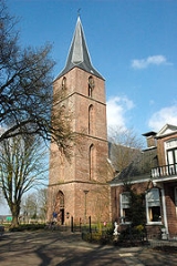
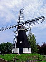
Although facilities are limited, Rolde possesses a ten pin bowling alley. There are also two hunebeds on a site east of the church. The windmill
has been restored to working order.
Netherlands
The Netherlands is a constituent country of the Kingdom of the Netherlands, located mainly in North-West Europe and with several islands in the Caribbean. Mainland Netherlands borders the North Sea to the north and west, Belgium to the south, and Germany to the east, and shares maritime borders...
province of Drenthe
Drenthe
Drenthe is a province of the Netherlands, located in the north-east of the country. The capital city is Assen. It is bordered by Overijssel to the south, Friesland to the west, Groningen to the north, and Germany to the east.-History:Drenthe, unlike many other parts of the Netherlands, has been a...
. It is a part of the municipality of Aa en Hunze
Aa en Hunze
Aa en Hunze is a municipality in the northeastern Netherlands.The names 'Aa' and 'Hunze' refer to two small rivers through the municipality.-Population centres:*Achter 't Hout*Amen *Anderen*Anloo*Annen...
, and lies about 6 km east of Assen
Assen
Assen is a municipality and a city in the north eastern Netherlands, capital of the province of Drenthe. It received city rights in 1809. Assen's main claim to fame is the TT Circuit Assen the motorcycle racing circuit, where on the last Saturday in June the Dutch TT is run...
.
Rolde was a separate municipality until 1998, when it became a part of Aa en Hunze.
In 2001, the town of Rolde had 3558 inhabitants. The built-up area of the town was 1.4 km², and contained 1585 residences.
The statistical area "Rolde", which also can include the surrounding countryside, has a population of around 4160.
Although facilities are limited, Rolde possesses a ten pin bowling alley. There are also two hunebeds on a site east of the church. The windmill
Windmill
A windmill is a machine which converts the energy of wind into rotational energy by means of vanes called sails or blades. Originally windmills were developed for milling grain for food production. In the course of history the windmill was adapted to many other industrial uses. An important...
has been restored to working order.