

Roads and Maritime Services
Encyclopedia
Roads and Maritime Services is an agency of the New South Wales Government responsible for building and maintaining road infrastructure and managing the day-to-day compliance and safety for roads and waterways.
The Agency was created on 1 November 2011 from a merger of the Roads and Traffic Authority
and NSW Maritime
. Planning responsibilities were transferred to Transport for New South Wales
, which was created on the same day.
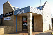
, and employs 6,900 staff in more than 180 offices throughout NSW, including 129 Motor Registries Offices.
 Roads and Maritime Services is responsible for the registration of vehicles (including the issuing of registration plates
) and the issuing of Drivers licences in New South Wales, including testing and administering of licences. Additionally, RMS produces photo cards for identification of non-drivers and issues photographic firearms licence
s for the New South Wales Police
Firearms Registry, security licences also for the New South Wales Police
, Commercial Agents & Private Inquiry Agents cards and Mobility Parking Permits.
In 1999 the NSW Transport Management Centre (TMC) established Traffic Commander and Traffic Emergency Patrol (TEP) services throughout the Greater Urban Area of Sydney to provide 24-hour 365 day a year coverage to "Manage the traffic arrangements around an incident scene and return the road to normal operating conditions with the utmost urgency."
Traffic Commanders take command of traffic management arrangements at an incident (such as a motor vehicle collision) and liaise with other response agencies such as the Police, and assist in clearing the road and minimising the effects and disruption to traffic. Traffic Emergency Patrols vans patrol major road routes and respond to unplanned incidents with the aim of returning the road to normal operating conditions as soon as possible. Both Traffic Commanders and TEP units carry a wide array of traffic management devices such as traffic cones, barrier boards and road signage. Both also are permitted to use and display red and blue emergency lighting and are designated as 'emergency vehicles'.
 As part of its duty to provide major road infrastructure, RMS is responsible for the provision of several car ferries. These ferries are all toll-free, and include:
The Agency was created on 1 November 2011 from a merger of the Roads and Traffic Authority
Roads and Traffic Authority
The Roads and Traffic Authority is a former New South Wales government agency that was responsible for major road infrastructure, licensing of drivers, and registration of motor vehicles. The RTA directly managed State roads and provided funding to local councils for regional and local roads...
and NSW Maritime
NSW Maritime
NSW Maritime was an agency in the Government of New South Wales, Australia. NSW Maritime was the State Government Authority responsible for marine safety, regulation of commercial and recreational boating and oversight of port operations...
. Planning responsibilities were transferred to Transport for New South Wales
Transport for New South Wales
Transport for New South Wales is an agency of the Government of New South Wales created on 1 November 2011 to manage the transport services in state of New South Wales, Australia....
, which was created on the same day.
Functions
Roads and Maritime Services manages 4,787 bridges and 17623 km (10,950.5 mi) of state roads and highways, including 3105 km (1,929.4 mi) of national highwaysNational Highway (Australia)
thumb|right|150px|The National Highway Shield in NSW, QLD, WA, NT & TAS.The National Highway is a system of roads connecting all the States and Territories of Australia, and is the major network of highways connecting Australia's largest and most important cities.The National Highway was...
, and employs 6,900 staff in more than 180 offices throughout NSW, including 129 Motor Registries Offices.
Vehicle registration
Vehicle registration plate
A vehicle registration plate is a metal or plastic plate attached to a motor vehicle or trailer for official identification purposes. The registration identifier is a numeric or alphanumeric code that uniquely identifies the vehicle within the issuing region's database...
) and the issuing of Drivers licences in New South Wales, including testing and administering of licences. Additionally, RMS produces photo cards for identification of non-drivers and issues photographic firearms licence
Firearms licence
A firearms licence is a licence or permit issued by some Governments of a country , that allows the licensee to buy, own, possess, and use firearms, often subject to a number of conditions or restrictions, especially with regards to storage requirements or the completion of a firearms...
s for the New South Wales Police
New South Wales Police
The New South Wales Police Force is the primary law enforcement agency in the State of New South Wales, Australia. It is an agency of the Government of New South Wales within the New South Wales Ministry for Police...
Firearms Registry, security licences also for the New South Wales Police
New South Wales Police
The New South Wales Police Force is the primary law enforcement agency in the State of New South Wales, Australia. It is an agency of the Government of New South Wales within the New South Wales Ministry for Police...
, Commercial Agents & Private Inquiry Agents cards and Mobility Parking Permits.
Major incident response
Within NSW, the Transport Management Centre is responsible for managing special events and unplanned incidents and disseminating information to motorists. It is the central point for identifying and directing the response to incidents such as crashes, breakdowns and spills. It passes on information to the public through the media, the RMS call centre and variable message signs along routes.In 1999 the NSW Transport Management Centre (TMC) established Traffic Commander and Traffic Emergency Patrol (TEP) services throughout the Greater Urban Area of Sydney to provide 24-hour 365 day a year coverage to "Manage the traffic arrangements around an incident scene and return the road to normal operating conditions with the utmost urgency."
Traffic Commanders take command of traffic management arrangements at an incident (such as a motor vehicle collision) and liaise with other response agencies such as the Police, and assist in clearing the road and minimising the effects and disruption to traffic. Traffic Emergency Patrols vans patrol major road routes and respond to unplanned incidents with the aim of returning the road to normal operating conditions as soon as possible. Both Traffic Commanders and TEP units carry a wide array of traffic management devices such as traffic cones, barrier boards and road signage. Both also are permitted to use and display red and blue emergency lighting and are designated as 'emergency vehicles'.
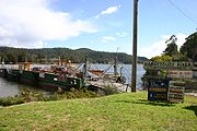
Car ferry services
- Berowra Waters FerryBerowra Waters FerryThe Berowra Waters Ferry is a cable ferry across the Berowra Creek, a tributary of the Hawkesbury River, in New South Wales, Australia. The ferry operates from the community of Berowra Waters on the west bank of the creek, to a landing on the east bank, thus connecting with the road to Berowra...
, across Berowra Waters - Lawrence FerryLawrence FerryThe Lawrence Ferry is a cable ferry across the Clarence River in New South Wales, Australia. The ferry operates between the town of Lawrence and Woodford Island, and forms part of the route east from Lawrence to the coast...
, across the Clarence RiverClarence River (New South Wales)The Clarence River is situated in northeastern New South Wales, Australia. The river originates on the watershed that marks the Queensland border. After flowing south and northeast for 394 km it then empties into the Pacific Ocean at Iluka/Yamba. On its journey it passes through the towns of... - Mortlake FerryMortlake FerryThe Mortlake Ferry, also known as the Putney Punt, is a cable ferry that runs across the Parramatta River in Sydney, connecting Hilly Street in Mortlake and Pellisier Road in Putney.- History and heritage :...
, across the Parramatta RiverParramatta RiverThe Parramatta River is a waterway in Sydney, New South Wales, Australia. The Parramatta River is the main tributary of Sydney Harbour, a branch of Port Jackson, along with the smaller Lane Cove and Duck Rivers....
in SydneySydneySydney is the most populous city in Australia and the state capital of New South Wales. Sydney is located on Australia's south-east coast of the Tasman Sea. As of June 2010, the greater metropolitan area had an approximate population of 4.6 million people... - Sackville FerrySackville FerryThe Sackville Ferry is a cable ferry across the Hawkesbury River in New South Wales, Australia. The ferry connects the communities of Sackville, on the north/west bank of the river, and Sackville North, on the south/east bank...
, across the Hawkesbury RiverHawkesbury RiverThe Hawkesbury River, also known as Deerubbun, is one of the major rivers of the coastal region of New South Wales, Australia. The Hawkesbury River and its tributaries virtually encircle the metropolitan region of Sydney.-Geography:-Course:...
near the village of SackvilleSackville, New South WalesSackville is a suburb of Sydney, in the state of New South Wales, Australia. It is located in the City of Hawkesbury and in the census of 2001 had a population of 410.... - Speewa FerrySpeewa FerryThe Speewa Ferry is a cable ferry across the Murray River on the border between the Australian states of New South Wales and Victoria. The ferry is located in the community of Speewa, Victoria, approximately north of Swan Hill, off the road between Swan Hill and Nyah.The ferry is controlled by New...
, across the Murray RiverMurray RiverThe Murray River is Australia's longest river. At in length, the Murray rises in the Australian Alps, draining the western side of Australia's highest mountains and, for most of its length, meanders across Australia's inland plains, forming the border between New South Wales and Victoria as it...
between New South Wales and VictoriaVictoria (Australia)Victoria is the second most populous state in Australia. Geographically the smallest mainland state, Victoria is bordered by New South Wales, South Australia, and Tasmania on Boundary Islet to the north, west and south respectively.... - Ulmarra FerryUlmarra FerryThe Ulmarra Ferry is a cable ferry across the Clarence River in New South Wales, Australia. The ferry operates between the town of Ulmarra and Southgate....
, across the Clarence River - Webbs Creek FerryWebbs Creek FerryWebbs Creek Ferry is a cable ferry across the Hawkesbury River in New South Wales, Australia. The ferry operates from the community of Wisemans Ferry, to a point up-stream of the Hawkesbury River's confluence with the Macdonald River, thus connecting with the St Albans Road that follows the west...
, across the Hawkesbury River in the village of Wisemans FerryWisemans Ferry, New South WalesWisemans Ferry is a town north of Sydney, in the state of New South Wales, Australia. Wisemans Ferry is located 75 kilometres north-west of the Sydney central business district in the local government areas of Hornsby Shire, The Hills Shire, City of Hawkesbury and City of Gosford.The town is a... - Wisemans FerryWisemans FerryWisemans Ferry is a cable ferry across the Hawkesbury River in New South Wales, Australia. The ferry operates from the eponymous community of Wisemans Ferry on the south bank, to a point on the north bank downstream of the Hawkesbury River's confluence with the Macdonald River, connecting with the...
, across the Hawkesbury River in the village of Wisemans Ferry - Wymah FerryWymah FerryThe Wymah Ferry is a cable ferry across the upper reach of Lake Hume, on the Murray River and on the border between the Australian states of New South Wales and Victoria...
, across the Murray River between New South Wales and Victoria
Lighthouses
RMS is responsible for light operation in the following 13 lighthouses:- Point Danger Lighthouse
- Fingal Head LightFingal Head LightFingal Head Light is an active lighthouse located at Fingal Head, New South Wales, Australia, a headland about south of Point Danger, which marks the Queensland border.-History:...
- Ballina Head Light
- Evans Head Light
- Tacking Point LighthouseTacking Point LighthouseTacking Point Lighthouse is Australia's third oldest lighthouse. It was built on a rocky headland about 8 kilometres south of Port Macquarie in 1879 by Shepard and Mortley, to a design by the New South Wales government's architect of the time, James Barnet...
- Crowdy Head LightCrowdy Head LightCrowdy Head Light is an active lighthouse located at Crowdy Head, a headland between Forster and Port Macquarie, New South Wales, Australia. It is registered with the Register of the National Estate.-History:...
- Point Stephens LightPoint Stephens LightPoint Stephens Light is an active lighthouse located on Point Stephens, a point on an unnamed headland at the east of Fingal Bay, south of the entrance of Port Stephens, New South Wales, Australia. It serves in assisting vessels entering Port Stephens. It is considered an endangered lighthouse due...
- Norah Head LightNorah Head LightNorah Head Light is an active lighthouse located at Norah Head, a headland on the Central Coast, New South Wales, Australia, close to Toukley. It is the last lighthouse of the James Barnet style to be built, and the last staffed lighthouse constructed in New South Wales.Officially displayed for the...
- Barrenjoey Head Lighthouse
- Kiama LightKiama LightKiama Light, also known as Kiama Harbour Light, is an active lighthouse in Kiama, New South Wales, Australia. The lighthouse is located close to the Kiama Blowhole on Blowhole Point, south of Kiama Harbour.-History:...
- Warden Head LightWarden Head LightWarden Head Light, also known as Ulladulla Lighthouse, is an active lighthouse on Warden Head, a headland south of Ulladulla, New South Wales, Australia, guarding the entrance to the Port of Ulladulla. It is one of only two wrought iron lighthouses in New South Wales, the other being its sibling,...
- Brush IslandBrush IslandBrush Island is an island nature reserve lying off the south coast of New South Wales, Australia. It lies about 2 km south-east of the coastal village of Bawley Point. It has an unmanned lighthouse. The island was made a nature reserve in 1963 and is important for breeding seabirds...
Light - Burrewarra Point LightBurrewarra Point LightBurrewarra Point Light is an active lighthouse located at Burrewarra Point, New South Wales, Australia, which is north of Broulee and to the south of Batemans Bay....
Key building projects
Key road building projects that Roads and Maritime Services are undertaking either directly, through contractors or via public/private partnerships, include:- On-going completion of a minimum four-lane arterial type road, with traffic signals at upgraded intersections from WoodfordWoodford, New South WalesWoodford is a village in the Blue Mountains in New South Wales, Australia, approximately 90 kilometres west of Sydney. Its elevation is above sea level. It is situated on the Great Western Highway and has a railway station on the Main Western railway line served by CityRail's Blue Mountains...
to Wentworth FallsWentworth Falls, New South WalesWentworth Falls is a town in the Blue Mountains, New South Wales located 100 kilometres west of Sydney, and about 8 kilometres east of Katoomba, Australia on the Great Western Highway, with a Wentworth Falls railway station on the Main Western line. The town is situated at an elevation of...
on the Great Western HighwayGreat Western HighwayThe Great Western Highway is a highway in New South Wales, Australia. It runs 210 km from Sydney to Bathurst.Starting as Broadway at the intersection of City Road near the fringe of the Sydney CBD, and becoming Parramatta Road to Parramatta itself, the Great Western Highway heads due west from...
. - On-going completion of the upgrading of the remaining two-lane sections of the Hume HighwayHume HighwayThe Hume Highway/Hume Freeway is one of Australia's major inter-city highways, running for 880 km between Sydney and Melbourne. It is part of the Auslink National Network and is a vital link for road freight to transport goods to and from the two cities as well as serving Albury-Wodonga and...
to dual carriagewayDual carriagewayA dual carriageway is a class of highway with two carriageways for traffic travelling in opposite directions separated by a central reservation...
(four-lane) standard, by 2012. - On-going completion of a four-lane dual carriageway of the Princes HighwayPrinces HighwayThe Princes Highway extends from Sydney to Port Augusta via the coast through the states of New South Wales, Victoria and South Australia, a distance of 1941 km or 1898 km via the former alignments of the highway ....
from the Jervis BayJervis BayJervis Bay is a large bay bounded by the state of New South Wales, the Jervis Bay Territory, and a detached enclave of the Australian Capital Territory. HMAS Creswell is located between Jervis Bay Village and Greenpatch in the Jervis Bay Territory.-History:...
turnoff to link up with the Sydney Orbital Network near MascotMascot, New South WalesMascot is a suburb in south-eastern Sydney, in the state of New South Wales, Australia. Mascot is located 7 kilometres south of the Sydney central business district and is the administrative centre of the City of Botany Bay...
, by 2014. - On-going completion of the upgrading of the Pacific HighwayPacific Highway (Australia)The Pacific Highway is a major transport route along part of the east coast of Australia and is part of Australia's national route 1.It is 960 km long and links Sydney, the capital of New South Wales, to Brisbane, the capital of Queensland, along the coast, via Gosford, Newcastle, Taree, Port...
to continuous dual carriageway (minimum four-lane) standard between the Sydney Newcastle Freeway and the Queensland border, by 2016.
General
- Great Western Highway
- Sydney to Melbourne strategy
- Hume Highway duplication package
- Coolac Bypass
- Pacific Highway
- Princes Highway strategy.