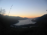
Riñihue Lake
Encyclopedia
The Riñihue Lake is a lake
of glacial
origin in eastern Valdivia Province
, southern Chile
. It is surrounded by several mountains. The eastern side receives the waters of the Panguipulli Lake
, by the Enco River
its main contributor. It is the last of the Seven Lakes chain. In the west is it cut into two arms by the Tralcán
Mount, and on the east side lies the Mocho-Choshuenco
volcano. By the south the lake is bounded by the Cerros de Quimán
mountains.
During the Great Chilean Earthquake
a landslide near the Tralcan
Mount dam
med the Riñihue Lake. As the water levels of Riñihue rose more than 20 meters, the dam was in danger of breaking and flooding everything downstream, including the city of Valdivia. There were plans for evacuating the city, and many people left the city. All this ended when a large team of workers was able to open a channel for drainage in the landslide. Then the water levels of the lake sunk slowly to its normal levels. There is evidence that a similar landslide and earthquake happened in 1575.
Lake
A lake is a body of relatively still fresh or salt water of considerable size, localized in a basin, that is surrounded by land. Lakes are inland and not part of the ocean and therefore are distinct from lagoons, and are larger and deeper than ponds. Lakes can be contrasted with rivers or streams,...
of glacial
Glacier
A glacier is a large persistent body of ice that forms where the accumulation of snow exceeds its ablation over many years, often centuries. At least 0.1 km² in area and 50 m thick, but often much larger, a glacier slowly deforms and flows due to stresses induced by its weight...
origin in eastern Valdivia Province
Valdivia Province
Valdivia Province is one of two provinces of the southern Chilean region of Los Ríos . The provincial capital is Valdivia. Located in the province are two important rivers, the Calle-Calle / Valdivia River and the Cruces River.It is part of Northern Patagonia and its wild virgin forest embrace the...
, southern Chile
Chile
Chile ,officially the Republic of Chile , is a country in South America occupying a long, narrow coastal strip between the Andes mountains to the east and the Pacific Ocean to the west. It borders Peru to the north, Bolivia to the northeast, Argentina to the east, and the Drake Passage in the far...
. It is surrounded by several mountains. The eastern side receives the waters of the Panguipulli Lake
Panguipulli Lake
The Panguipulli Lake is one of the "Seven Lakes" in Panguipulli municipality, southern Chile. The lake is of glacial origin and it is enclosed by mountain ranges of the Andes, on all sides except the west, where the town of Panguipulli lies in the Chilean Central Valley. The lake is drained by the...
, by the Enco River
Enco River
Enco River is a river in Panguipulli commune in southern Chile. By flowing from Panguipulli Lake to Riñihue Lake Enco River carries the water of the six upper lakes of the Seven Lakes area into Riñihue, the last lake in the chain...
its main contributor. It is the last of the Seven Lakes chain. In the west is it cut into two arms by the Tralcán
Tralcan
Tralcán is a triangular shaped mount near Riñihue Lake, Chile. It is located south of the outflow dividing western Riñihue in two arms. Despite been sacred for the huilliches for centuries, the mount became famous when several landslides near Tralcan dammed the Riñihue Lake, after the Great...
Mount, and on the east side lies the Mocho-Choshuenco
Mocho-Choshuenco
Mocho-Choshuenco is a glacier covered compound stratovolcano in the Andes of Los Ríos Region, Chile. It is made of the twin volcanoes Choshuenco in the northwest and the Mocho in the southeast...
volcano. By the south the lake is bounded by the Cerros de Quimán
Cerros de Quimán
Cerros de Quimán is a forest-covered mountain group between Riñihue Lake and Ranco Lake in Chile. The mountain group runs east-west from Cordillera Negra and Mocho-Choshuenco Volcano in the east and forms part of the border between Futrono and Los Lagos municipalities of Los Ríos Region....
mountains.
The Riñihuazo
The Riñihue lake became famous after an event known as the "Riñihuazo", which threatened to destroy several towns, villages and cities in southern Chile.During the Great Chilean Earthquake
Great Chilean Earthquake
The 1960 Valdivia earthquake or Great Chilean Earthquake of Sunday, 22 May 1960 is to date the most powerful earthquake ever recorded on Earth, rating 9.5 on the moment magnitude scale...
a landslide near the Tralcan
Tralcan
Tralcán is a triangular shaped mount near Riñihue Lake, Chile. It is located south of the outflow dividing western Riñihue in two arms. Despite been sacred for the huilliches for centuries, the mount became famous when several landslides near Tralcan dammed the Riñihue Lake, after the Great...
Mount dam
Dam
A dam is a barrier that impounds water or underground streams. Dams generally serve the primary purpose of retaining water, while other structures such as floodgates or levees are used to manage or prevent water flow into specific land regions. Hydropower and pumped-storage hydroelectricity are...
med the Riñihue Lake. As the water levels of Riñihue rose more than 20 meters, the dam was in danger of breaking and flooding everything downstream, including the city of Valdivia. There were plans for evacuating the city, and many people left the city. All this ended when a large team of workers was able to open a channel for drainage in the landslide. Then the water levels of the lake sunk slowly to its normal levels. There is evidence that a similar landslide and earthquake happened in 1575.

