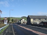
Rhydypennau, Ceredigion
Encyclopedia
Rhydypennau is a hamlet
in the Genau'r-glyn district of Ceredigion
, Wales
, approximately 4½ miles (7 km) north-east of Aberystwyth
. Along with the village of Pen-y-garn
, Rhydypennau is now often considered to be part of the neighbouring village of Bow Street
. All three places stretch in a long narrow strip along the main Aberystwyth to Machynlleth road (A487
).
), Pen-y-garn and Bow Street, Tom Macdonald (1900-80) recalls that the local pronunciation of Rhydypennau was actually ‘Rhypenne’.
copper thin-butted flat axe was found to the north-east of Rhydypennau Bridge. The axe has one smooth face, which is slightly hammered along its edges, whilst the other is irregular and shows traces of tooling.
and Borth
. As well as a few houses, there is the Rhyd-y-Pennau Inn, Rhydypennau Garage, the Pennau craft centre, and Rhydypennau Farm.
The old Rhydypennau School (which has recently closed) overlooks the hamlet, whilst the present Rhydypennau school, Ysgol Rhydypennau, is actually located in Pen-y-garn. Bow Street Football Club
's ground, Cae Piod, is also at Rhydypennau.
Hamlet (place)
A hamlet is usually a rural settlement which is too small to be considered a village, though sometimes the word is used for a different sort of community. Historically, when a hamlet became large enough to justify building a church, it was then classified as a village...
in the Genau'r-glyn district of Ceredigion
Ceredigion
Ceredigion is a county and former kingdom in mid-west Wales. As Cardiganshire , it was created in 1282, and was reconstituted as a county under that name in 1996, reverting to Ceredigion a day later...
, Wales
Wales
Wales is a country that is part of the United Kingdom and the island of Great Britain, bordered by England to its east and the Atlantic Ocean and Irish Sea to its west. It has a population of three million, and a total area of 20,779 km²...
, approximately 4½ miles (7 km) north-east of Aberystwyth
Aberystwyth
Aberystwyth is a historic market town, administrative centre and holiday resort within Ceredigion, Wales. Often colloquially known as Aber, it is located at the confluence of the rivers Ystwyth and Rheidol....
. Along with the village of Pen-y-garn
Pen-y-garn, Ceredigion
Pen-y-garn is a small village in the Tirymynach district of Ceredigion, Wales, approximately 4 miles north-east of Aberystwyth. Along with the hamlet of Rhydypennau, Pen-y-garn is now often considered to be part of the neighbouring larger village of Bow Street. All three places stretch in a long...
, Rhydypennau is now often considered to be part of the neighbouring village of Bow Street
Bow Street, Ceredigion
Bow Street is a large village in the Tirymynach district of Ceredigion, Wales, approximately north-east of Aberystwyth. As well as Bow Street itself, it is now often considered to include the neighbouring smaller village of Pen-y-garn and the hamlet of Rhydypennau...
. All three places stretch in a long narrow strip along the main Aberystwyth to Machynlleth road (A487
A487 road
The A487 is a trunk road in Wales, running up the western side of the country from Haverfordwest in the south to Bangor in the north.It starts at Merlin's Bridge near Haverfordwest, from where it travels north west to St David's, then switches back north east through Fishguard, Cardigan, Aberaeron,...
).
Toponymy
In his memoirs about growing up in Llanfihangel Geneu’r Glyn (LlandreLlandre
Llandre, or Llanfihangel Genau'r Glyn, is a village in Ceredigion, Wales. It lies 5 miles north of Aberystwyth in the north-west of the county, on the road from Rhydypennau to Borth...
), Pen-y-garn and Bow Street, Tom Macdonald (1900-80) recalls that the local pronunciation of Rhydypennau was actually ‘Rhypenne’.
Archaeology
An early Bronze-ageBronze Age
The Bronze Age is a period characterized by the use of copper and its alloy bronze as the chief hard materials in the manufacture of some implements and weapons. Chronologically, it stands between the Stone Age and Iron Age...
copper thin-butted flat axe was found to the north-east of Rhydypennau Bridge. The axe has one smooth face, which is slightly hammered along its edges, whilst the other is irregular and shows traces of tooling.
Services
Rhydypennau is centred around the junction of the A487 with the road towards LlandreLlandre
Llandre, or Llanfihangel Genau'r Glyn, is a village in Ceredigion, Wales. It lies 5 miles north of Aberystwyth in the north-west of the county, on the road from Rhydypennau to Borth...
and Borth
Borth
Borth ) is a coastal village 7 miles north of Aberystwyth in the county of Ceredigion, Mid Wales. The population was 1,523 in 2001.-Features and history:Borth has a sandy beach and is a popular holiday seaside resort...
. As well as a few houses, there is the Rhyd-y-Pennau Inn, Rhydypennau Garage, the Pennau craft centre, and Rhydypennau Farm.
The old Rhydypennau School (which has recently closed) overlooks the hamlet, whilst the present Rhydypennau school, Ysgol Rhydypennau, is actually located in Pen-y-garn. Bow Street Football Club
Bow Street F.C.
Bow Street F.C. are based at Rhydypennau near Bow Street in Ceredigion, Wales, about 4½ miles north-east of Aberystwyth, and are currently playing in the Mid Wales Football League...
's ground, Cae Piod, is also at Rhydypennau.

